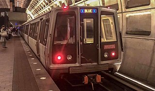
The Blue Line is a rapid transit line of the Washington Metro system, consisting of 28 stations in Fairfax County, Alexandria and Arlington, Virginia; Washington, D.C.; and Prince George's County, Maryland, United States. The Blue Line runs from Franconia–Springfield to Downtown Largo. The line shares track with the Orange Line for 13 stations, the Silver Line for 18, and the Yellow Line for 7. Only 3 stations are exclusive to the Blue Line.

The Orange Line is a rapid transit line of the Washington Metro system, consisting of 26 stations in Fairfax County and Arlington, Virginia; the District of Columbia; and Prince George's County, Maryland, United States. The Orange Line runs from Vienna in Virginia to New Carrollton in Maryland. Half of the line's stations are shared with the Blue Line and over two thirds are shared with the Silver Line. Orange Line service began on November 20, 1978.

The Green Line is a rapid transit line of the Washington Metro system, consisting of 21 stations in Washington, D.C., and Prince George's County, Maryland, United States. The Green Line runs from Branch Avenue, to Greenbelt, connecting the southeast suburbs to the northeast suburbs through downtown Washington, DC.

The Yellow Line is a rapid transit line of the Washington Metro system that runs between Huntington in Virginia and Mount Vernon Square in Washington, D.C. It consists of 13 stations in Fairfax County, the city of Alexandria, and Arlington County in Virginia, as well as Washington, D.C. It is the shortest line in the system, and since its truncation to Mount Vernon Square, it is the only line that does not enter Maryland.

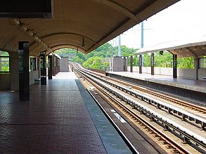
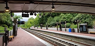
Grosvenor–Strathmore station is a rapid transit station on the Red Line of the Washington Metro in North Bethesda, Maryland. Grosvenor–Strathmore is the last above-ground station for Glenmont-bound Red Line trains until NoMa-Gallaudet U; south of the station, trains cross over the Capital Beltway before descending underground. It is one of a number of stations on the Rockville Pike corridor in Montgomery County.
King Street–Old Town station is a Washington Metro station in Alexandria, Virginia, United States. The station opened on December 17, 1983, and is operated by the Washington Metropolitan Area Transit Authority (WMATA). Providing service for both the Blue and Yellow Lines, this is the southernmost transfer station for the Blue and Yellow lines, as the two lines diverge just south of the station. During inclement weather, Crystal City is commonly used as an unofficial transfer point, being the southernmost underground station common to both lines. King Street was originally served only by the Yellow Line, until the Blue Line was extended from National Airport to Van Dorn Street in 1991.

Huntington station is an island-platformed Washington Metro station in the Huntington area of Fairfax County, Virginia, United States. The station was opened on December 17, 1983, and is operated by the Washington Metropolitan Area Transit Authority (WMATA). Serving as the southern terminus for the Yellow Line, the station is built into a hillside; the south mezzanine, along with escalator access, is accessible via an incline elevator.

Braddock Road station is an island-platformed Washington Metro station in Alexandria, Virginia, United States. The station was opened on December 17, 1983, and is operated by the Washington Metropolitan Area Transit Authority (WMATA). Providing service for both the Blue and Yellow Lines, the station is located at Braddock Road and West Street.

Ronald Reagan Washington National Airport station is a Washington Metro station in Arlington, Virginia on the Blue and Yellow Lines. The station platform is elevated and covered and is the last above-ground station on the Yellow Line in Virginia, heading into Washington, D.C. It is one of only two stations in the system to have three tracks. The station is located across Smith Boulevard from Terminal 2 at Ronald Reagan Washington National Airport; the mezzanine is directly connected to Level 2 of the terminal by two pedestrian bridges. Airport shuttle buses or a walkway connect the station and Terminal 1. The airport's Abingdon Plantation historical site is near the station.
Arlington Cemetery station is a side platformed Washington Metro station in Arlington, Virginia, United States. The station was opened on July 1, 1977, and is operated by the Washington Metropolitan Area Transit Authority (WMATA). The station provides service for only the Blue Line, and is located at the entrance to Arlington National Cemetery, underneath Memorial Drive. There is no public parking near the station except at the cemetery, which is reserved for cemetery visitors. It is the only station that closes earlier than the rest of the system, closing at 7 PM from October to March, and 10 PM from April to September.

Archives station is a Washington Metro station in Washington, D.C., on the Green and Yellow Lines.

Mount Vernon Square station is a Washington Metro station in Washington, D.C., on the Green and Yellow Lines. It is the northeastern terminus of the Yellow Line.

Minnesota Avenue station is an island-platformed Washington Metro station in the Central Northeast/Mahaning Heights neighborhood of Northeast Washington, D.C., United States. The station was opened on November 20, 1978, and is operated by the Washington Metropolitan Area Transit Authority (WMATA).

Deanwood station is an island-platformed Washington Metro station in the Deanwood neighborhood of Northeast Washington, D.C., United States. The station was opened on November 20, 1978, and is operated by the Washington Metropolitan Area Transit Authority (WMATA). Providing service for only the Orange Line, the station is the final station in the District of Columbia going east. The station is located at Minnesota Avenue and 48th Street Northeast.

Cheverly station is a side-platformed Washington Metro station in Prince George's County, Maryland, United States. The station was opened on November 20, 1978, and is operated by the Washington Metropolitan Area Transit Authority (WMATA). Providing service for the Orange Line, the station is the first station going east in Maryland on the Orange Line. The station is in the residential area of Cheverly at Columbia Park Road near U.S. Route 50. It is a commuter station with 530 parking spaces. In 2021, Cheverly had the lowest average weekday ridership of any Metro station. When Phase 2 of the Silver Line was released in 2022, this was no longer the case as Loudoun Gateway had an even lower average weekday ridership.
Landover station is an island-platformed Washington Metro station in Landover, Maryland, United States. The station was opened on November 20, 1978, and is operated by the Washington Metropolitan Area Transit Authority (WMATA). Providing service for the Orange Line, the station is in a residential area of Landover at Pennsy Drive near Landover Road. It is primarily a commuter station, with parking for over 1,800 cars, but it also served the now-demolished Capital Centre, the former home of the Washington Bullets and Washington Capitals.

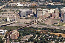
New Carrollton station is a joint Washington Metro, MARC, and Amtrak station just outside the city limits of New Carrollton, Prince George's County, Maryland located at the eastern end of the Metro's Orange Line. The station will also serve as the eastern terminus of the Purple Line, currently under construction, and is adjacent to the Capital Beltway.

Greenbelt station is a Washington Metro and MARC station in Prince George's County, Maryland. The station is the northeastern terminus of the Green Line of the Washington Metro. MARC commuter rail trains on the Camden Line also stop at Greenbelt on a set of tracks parallel to the Metro tracks.
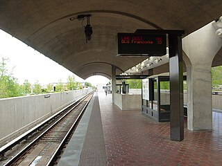
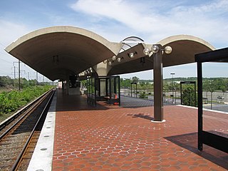
Van Dorn Street station is a Washington Metro station straddling the boundary between Fairfax County and the independent city of Alexandria in Virginia, United States. The station’s island platform lies in unincorporated Rose Hill in Fairfax County, while the station’s entrance and parking facilities are in Alexandria. The station was opened on June 15, 1991, and is operated by the Washington Metropolitan Area Transit Authority (WMATA). Providing service for only the Blue Line, the station is located at South Van Dorn Street and Eisenhower Avenue, next to the Capital Beltway. From 1991 to 1997 it was the southwestern terminus of the Blue Line.