Buckland, Surrey

Last updated

Buckland
Village and civil parish
Buckland Nr. Reigate, A. R. Quinton.jpg
A view in the village, c.1920
Surrey UK location map.svg
Red pog.svg
Buckland
Location within Surrey
Area5.51 km2 (2.13 sq mi)
Population562 (Civil Parish 2011) [1]
  Density 102/km2 (260/sq mi)
OS grid reference TQ2251
Civil parish
  • Buckland
District
Shire county
Region
Country England
Sovereign state United Kingdom
Post town Betchworth
Postcode district RH3
Dialling code 01737
Police Surrey
Fire Surrey
Ambulance South East Coast
UK Parliament
List of places
UK
England
Surrey
51°14′38″N0°15′18″W / 51.244°N 0.255°W / 51.244; -0.255

Buckland is a village and civil parish in the Mole Valley district of Surrey, England, between Dorking and Reigate, its nearest towns. The civil parish is bordered by the North Downs escarpment in the north. The area contains a number of sand pits.

Contents

Geography

Buckland is in the Mole Valley district of Surrey, 2 mi (3.2 km) east of Reigate and 4 mi (6.4 km) west of Dorking. The village is at the northern edge of the Weald, at the foot of the North Downs.

The south of the civil parish, which includes the village centre, is on the strata of the Lower Greensand Group. Sand is quarried from the Folkestone Beds and silver sand occurs in seams between Buckland and Reigate. [2] :76,179 The Gault clay forms a 0.5 mi-wide (0.80 km) band, running from east to west, to the north of the village centre. Fossils of Serpula antiquata , Neohibolites listeri and Euhoplites species have been found in this stratum. [2] :82 Hearthstone was quarried from the Upper Greensand at the base of the North Downs until the early 20th century. [2] :87 This layer contains fossils of bivalve species, including several from the genus Pecten . [2] :119

History

The earliest surviving record of Buckland is the Domesday Book of 1086, in which it appears as Bochelant. The settlement is recorded as Boclande in 1225, Boclond in 1225, Bukelonde in 1293 and Bukkelond in 1448. [3] The name is generally agreed to mean "land held by book or charter". [4]

Iron Age British Qc quarter stater(obv) (FindID 132130).jpg
Iron Age British Qc quarter stater(rev) (FindID 132130).jpg
The front (left) and back faces of a gold, Iron Age quarter stater coin, found in Buckland in 1995 and dated to c.60 – c.20 BCE [5]

The earliest evidence of human activity in the village is a flint axe fragment from the Neolithic. [6] A side-looped spearhead from the Middle Bronze Age, dated to c.1400 – c.1200 BCE, was found by workmen in 1907. [7]

In 1086, the manor was held by John, a lesser tenant of Richard of Tonbridge. Buckland had a church, watermill and thirty-five heads of household. Of these, seventeen farmed the land owned by the feudal lord, and ten were serfs. [8] [9]

Buckland Mill Buckland mill.jpg
Buckland Mill

The village church of St Mary the Virgin was built in 1380. It is a Grade II listed building. [10] The church was rebuilt in 1859-60, under the supervision of the architect, Henry Woodyer. A new, wider chancel arch was constructed and a new organ chamber and vestry added on the north side. [11] Some of the timbers removed during Woodyer's work, may have been reused in the construction of Buckland Windmill, also Grade II listed, and now a tourist focal point. [12]

The barn on The Green dates from the early 17th century. The timber-framed structure, which was restored in the 20th century, has a tower at the south end, topped by a weathervane. [13] The barn was used as a temporary church during the Woodyer reconstruction work and was converted to a private house in the early 1980s. [14]

The first school in Buckland, a National school, was founded in 1822. Its replacement, designed by Woodyer, opened in 1862. It closed in 1981 and the building is now a private house. [11]

Buckland War Memorial, on the village green, was erected in 1920 and was unveiled in July of that year by Percival Marling VC. Designed by Ebbutt and Sons of Croydon, it is constructed in rough Cornish granite in the form of a wheel-head cross. [15] [16]

Local legend

Buckland is also the location of the source of the Shag Brook, a tributary of the River Mole. Local legend says the brook was the home of a monstrous horse (in some versions a gorilla), called the "Buckland Shag". This beast would drag travellers from the nearby coaching road and devour them on the Shag Stone, a large boulder in the brook with a blood red vein of iron ore running through it. [17] The monster was exorcised by the local parson, Willoughby Bertie, and the stone was removed from the brook c.1757. [18]

The legend of the Buckland Shag was revived in 1986 by a local morris side, The Buckland Shag Morris Men. [19]

Amenities

Buckland has a village store and a pub, The Pheasant, on the Reigate Road.

Transport

The A25 runs east–west through the parish. The nearest railway station is Betchworth on the North Downs Line, 1 mile (1.6 km) WNW of the village centre.

Governance

Surrey County Council, elected every four years, has one representative from Buckland for Dorking Rural. Two councillors sit on the Mole Valley District Council.

Demography and housing

2011 Census Homes
Output areaDetachedSemi-detachedTerracedFlats and apartmentsCaravans/temporary/mobile homesshared between households [1]
(Civil Parish)11876132540

The average level of accommodation in the region composed of detached houses was 28%, the average that was apartments was 22.6%.

2011 Census Key Statistics
Output areaPopulationHouseholds% Owned outright% Owned with a loanhectares [1]
(Civil Parish)56223639.8%30.5%551

The proportion of households in the civil parish who owned their home outright compares to the regional average of 35.1%. The proportion who owned their home with a loan compares to the regional average of 32.5%. The remaining % is made up of rented dwellings (plus a negligible % of households living rent-free).

Related Research Articles

<span class="mw-page-title-main">Dorking</span> Market town in Surrey, England

Dorking is a market town in Surrey in South East England, about 21 mi (34 km) south of London. It is in Mole Valley District and the council headquarters are to the east of the centre. The High Street runs roughly east–west, parallel to the Pipp Brook and along the northern face of an outcrop of Lower Greensand. The town is surrounded on three sides by the Surrey Hills Area of Outstanding Natural Beauty and is close to Box Hill and Leith Hill.

<span class="mw-page-title-main">Reigate and Banstead</span> Place in England

<span class="mw-page-title-main">Reigate</span> Town in Surrey, England

Reigate is a town in Surrey, England, around 19 mi (31 km) south of central London. The settlement is recorded in Domesday Book in 1086 as Cherchefelle and first appears with its modern name in the 1190s. The earliest archaeological evidence for human activity is from the Paleolithic and Neolithic, and during the Roman period, tile-making took place to the north east of the modern centre.

<span class="mw-page-title-main">Redhill, Surrey</span> Town in Surrey, England

Redhill is a town in the borough of Reigate and Banstead within the county of Surrey, England. The town, which adjoins the town of Reigate to the west, is due south of Croydon in Greater London, and is part of the London commuter belt. The town is also the post town, entertainment and commercial area of three adjoining communities : Merstham, Earlswood and Whitebushes, as well as of two small rural villages to the east in the Tandridge District, Bletchingley and Nutfield.

<span class="mw-page-title-main">A25 road</span> Road in southern England

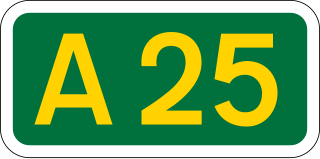
The A25 road is an east–west main road in the South-East of England. Its carries traffic east from Guildford, Surrey, eastward through Surrey and into mid-west Kent, to the town of Sevenoaks, and then on to Wrotham Heath where it connects with the A20.

<span class="mw-page-title-main">Brockham</span> Human settlement in England

Brockham is a village and civil parish in the Mole Valley district of Surrey, England. It is approximately 1.5 miles (2.4 km) east of Dorking and 4 miles (6.4 km) west of Reigate. The village lies south of Box Hill, with the River Mole flowing west through the village. At the 2011 census, it had a population of 2,868.

<span class="mw-page-title-main">Westcott, Surrey</span> Human settlement in England

Westcott is a semi-rural English village and former civil parish 1.5 miles (2.4 km) west of the centre of Dorking on the A25 between the North Downs and Greensand Ridge, making it one of the 'Vale of Holmesdale' villages and is in Surrey in the direction of Guildford. It is served by a local bus service and is 1 mile (1.6 km) from Dorking West railway station on the North Downs Line.

<span class="mw-page-title-main">Abinger</span> Civil parish in Mole Valley, Surrey, England

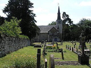
Abinger is a large, well-wooded and mostly rural civil parish that lies between the settlements of Dorking, Shere and Ewhurst in the district of Mole Valley, Surrey, England.

<span class="mw-page-title-main">Betchworth</span> Human settlement in England

Betchworth is a village and civil parish in the Mole Valley district of Surrey, England. The village centre is on the north bank of the River Mole and south of the A25 road, almost 3 miles (4.8 km) east of Dorking and 3 miles (4.8 km) west of Reigate. London is 19.5 miles (31.4 km) north of the village.

<span class="mw-page-title-main">Headley, Surrey</span> Human settlement in England

Headley is a village and civil parish in the North Downs in Surrey, England. The nearest settlements are, to the west, Mickleham and Leatherhead; to the north, Ashtead and Langley Vale; to the east, Walton-on-the-Hill; and to the south, Box Hill. It is just outside the M25 motorway encircling London.

<span class="mw-page-title-main">Leigh, Surrey</span> Human settlement in England

Leigh is a village and civil parish in Surrey, between Reigate, Dorking and Charlwood in the east of Mole Valley district. The village centre is suburban and its remainder is agricultural, interspersed by four satellite clustered localities: Dawesgreen, Bunce Common, Shellwood Cross and Nalderswood which benefit from the amenities of the village and a minority of the remainder is woodland.

<span class="mw-page-title-main">Capel, Surrey</span> Human settlement in England

Capel is a village and civil parish in southern Surrey, England. It is equidistant between Dorking and Horsham – about 5 miles (8.0 km) away. Around Capel, to the west, skirts the A24 road. Capel is approximately 2.5 miles (4.0 km) north of the West Sussex border, 26 miles (42 km) south of London and 12 miles (19 km) southeast of Guildford and is in the Mole Valley district. The village is in the north of a landscape called the Weald, meaning forest, which forms a significant minority of the land today, particularly towards the Greensand Ridge.

<span class="mw-page-title-main">Wotton, Surrey</span> Human settlement in England

Wotton is a well-wooded parish with one main settlement, a small village mostly south of the A25 between Guildford in the west and Dorking in the east. The nearest village with a small number of shops is Westcott. Wotton lies in a narrow valley, collecting the headwaters of the Tilling Bourne which then has its first combined flow in the Vale of Holmesdale. The parish is long north to south, reaching to the North Downs escarpment in the north to the escarpment of the Greensand Ridge at Leith Hill in the south.

<span class="mw-page-title-main">Vale of Holmesdale</span>

Holmesdale, also known as the Vale of Holmesdale, is a valley in South-East England that falls between the hill ranges of the North Downs and the Greensand Ridge of the Weald, in the counties of Kent and Surrey. It stretches from Folkestone on the Kent coast, through Ashford, Harrietsham, Maidstone, Riverhead/Sevenoaks, Westerham, Oxted, Godstone, Redhill, Reigate, Dorking, Gomshall, and Guildford – west of which it is also called by the local name of "Puttenham Vale" – as it continues through the village of Puttenham, to the market town of Farnham.

<span class="mw-page-title-main">Gatton, Surrey</span> Human settlement in England

Gatton is a former village in the Borough of Reigate and Banstead, Surrey, England. It survives as a sparsely populated, predominantly rural locality, which includes Gatton Park, no more than 12 houses, and two farms on the slopes of the North Downs near Reigate.

<span class="mw-page-title-main">Pixham</span> Human settlement in England

Pixham is a chapelry within the parish of Dorking, Surrey on the near side of the confluence of the River Mole and the Pipp Brook to its town, Dorking, which is centred 1 km (0.6 mi) southwest. The town as a whole, uniquely in Surrey, has three railway stations; Pixham adjoins or is the location of two of the three; and is near the junction of the A24 and A25 main roads.

<span class="mw-page-title-main">Pipp Brook</span> River in Surrey, England

The Pipp Brook is a left-bank tributary of the River Mole, Surrey, England. It rises at two main springs north of Leith Hill on the Greensand Ridge, then descends steeply in a northward direction, before flowing eastwards along the Vale of Holmesdale. It runs to the north of Dorking High Street, before discharging into the Mole at Pixham.

<span class="mw-page-title-main">St Martin's Church, Dorking</span> Church in Surrey, United Kingdom

St Martin's Church is an Anglican parish church in Dorking, Surrey. It is a Grade II* listed building and surviving parts of the structure date back to the Middle Ages. It in the archdeaconry of Dorking, in the Diocese of Guildford. The church is the main Anglican parish church in Dorking and was refurbished to the designs of Henry Woodyer.

<span class="mw-page-title-main">Reigate Stone</span> Form of sandstone used for building

Reigate Stone is a freestone that was mined from the Upper Greensand in north east Surrey. It was used in building work throughout the middle ages and early modern period. It is sometimes classified as a calcareous sandstone, although very little of the silica content is in the form of detrital sand grains. In addition to silicon dioxide, the stone also includes clay, fine-grained calcite, mica flakes and glauconite.

References

  1. 1 2 3 Key Statistics; Quick Statistics: Population Density Archived 11 February 2003 at the Wayback Machine United Kingdom Census 2011 Office for National Statistics Retrieved 21 November 2013
  2. 1 2 3 4 Dines, H.G.; Edmunds, F.H.; Chatwin, C.P.; Stubblefield, C.J. (1933). The geology of the country around Reigate and Dorking : Explanation of one-inch geological sheet 286, new series. London: British Geological Survey. Archived from the original on 2 January 2021. Retrieved 25 July 2020.
  3. Gover, J.E.B; Mawer, A.; Stenton, F.M. (1969). The place-names of Surrey. Cambridge: Cambridge University Press. p. 285.
  4. Smith, Gavin (2005). Surrey Place-names. Heart of Albion. p. 14. ISBN   978-1-87-288384-7.
  5. Williams, David W. (24 February 2011) [10 May 2006]. "Finds record for: SUR-1FEC04". The Portable Antiquities Scheme. Archived from the original on 24 September 2023. Retrieved 18 September 2023.
  6. Williams, David W. (1984). "Neolithic Axe from Buckland" (PDF). Surrey Archaeological Collections. 74: 209. Archived (PDF) from the original on 24 September 2023. Retrieved 23 September 2023.
  7. Williams, David W. (1999). "A Middle Bronze Age side-looped spearhead from Buckland" (PDF). Surrey Archaeological Collections. 86: 201–202. doi:10.5284/1069256. Archived (PDF) from the original on 24 September 2023. Retrieved 23 September 2023.
  8. Powell-Smith, A. (2011). "Buckland". Open Domesday. Archived from the original on 13 June 2023. Retrieved 23 September 2023.
  9. "Surrey Domesday Book". Archived from the original on 15 July 2007.
  10. Historic England (11 November 1966). "Church of St Mary the Virgin (Grade II) (1378123)". National Heritage List for England.
  11. 1 2 Elliott, John; Pritchard, John, eds. (2001). Henry Woodyer, Gentleman Architect. Reading: University of Reading. pp. 213–214. ISBN   978-0-70-491331-8.
  12. Historic England (12 June 1997). "Windmill (in grounds of Yewdells} (Grade II) (1271903)". National Heritage List for England.
  13. Historic England. "Street Farm Barn, The towered barn (Grade II) (1190790)". National Heritage List for England.
  14. Williams, Ian (2009). Dorking and the Mole Valley: Past and Present. Stroud: History Press Limited. p. 64. ISBN   978-0-75-094582-0.
  15. "Buckland War Memorial". Surrey Mirror and County Post. No. 2214. 9 July 1920. p. 6.
  16. Historic England. "Buckland War Memorial (Grade II) (1437406)". National Heritage List for England.
  17. Dyer, F. Thiselton (2008). Strange Pages from Family Papers. London: Echo library. p. 344. ISBN   9781406827040.
  18. Ferns, Duncan C. (1999). Buckland 1000-2000: A Village History of Buckland, Surrey. D.C. Ferns. ISBN   0-9535919-0-5.
  19. "There's nothing floral about these dancers". Dorking Advertiser. No. 5243. 14 March 1991. p. 20.