Little Bookham

Last updated

Little Bookham
Cottages in Little Bookham Street.JPG
Cottages and Ye Olde Windsor Castle Pub, Little Bookham Street
Surrey UK location map.svg
Red pog.svg
Little Bookham
Location within Surrey
Population11,375 (2011 Census. Bookham North and South Wards, covering Great and Little Bookham
OS grid reference TQ1254
District
Shire county
Region
Country England
Sovereign state United Kingdom
Post town Leatherhead
Postcode district KT23
Dialling code 01372
Police Surrey
Fire Surrey
Ambulance South East Coast
UK Parliament
List of places
UK
England
Surrey
51°16′49″N0°23′23″W / 51.280370°N 0.389741°W / 51.280370; -0.389741

Little Bookham is a village in the Mole Valley district, in Surrey, England between Great Bookham and Effingham. It is home to several listed historical buildings, included in a large conservation area, along with Ye Olde Windsor Castle public house, Manor House School, and All Saints' Church. The village is centred immediately north of the North Downs and is contiguous with Great Bookham, the two divisions of Bookham having been made in the early medieval period.

Contents

History

View south on Little Bookham Street View South on Little Bookham Street.JPG
View south on Little Bookham Street

It is difficult to conjecture when the parish of Little Bookham was formed. The first documentary evidence can be found after the conversion of England to Christianity in the 7th century. The Venerable Bede states that Erconwald, who became Bishop of London in 674, founded the Benedictine Abbey of St. Peter of Chertsey in 666, and Frithuwald, who was sub-king or regent of Surrey, joined in the grant endowing the abbey with certain lands. [1]

Frithuwald, however, seems to have been the subject at that time of Ecgberht, King of Kent, and the charter is stated to have been confirmed by Wulfhere, King of Mercia, to whom the overlordship of Surrey must have been passed before his death in 675. It has been stated that the monastery was first built under King Egbert. [1]

According to a charter C.675, the original of which is lost but which exists in a later form, there was granted to the Abbey twenty dwellings at Bocham cum Effingham. This was confirmed by four Saxon kings; Offa, "King of the Mercians and of the nations roundabout" in 787; Æthelstan who was "King and ruler of the whole island of Britain" in 933 confirmed the privileges to the monastery; King Edgar, "Emperor of all Britain" in 967 confirmed "twelve mansiones" in Bocham, and King Edward the Confessor, "King of the English" in 1062 confirmed twenty mansae at Bocham cum Effingham, Driteham and Pechingeorde. Driteham and Pechingeorde are both referred to in the Domesday Book and appear to have been absorbed into the manors of Effingham and Effingham East Court. [1]

Little Bookham lay within the Anglo-Saxon administrative district of Effingham half hundred. [1]

Little Bookham appears in the Domesday Book of 1086 as Bocheham. It was held by Halsard from William de Braiose. Its Domesday Assets were: 2 hides; 2 ploughs, 4 acres (16,000 m2) of meadow, herbage and pannage worth 11 hogs. It rendered (in total): £3. [2]

Parts of the present parish of Effingham, however, lying to the east of Effingham Common Road at one time belonged to the parish of Little Bookham. The charters of Frithwald, Offa, Edgar and Edward the Confessor are all believed to be substantially fabricated, but probably embodied authentic material or recorded an earlier genuine transaction. These charters were probably written at a later date than stated in order to confirm a position which was thought to have existed at that earlier date. The Charter of Æthelstan is believed to be complete fabrication. [1]

It seems probable, as the number of cottages in Bocham cum Effingham remained constant, that the later charters must have been copies of earlier charters which were not revised to accord with the actual number of cottages at any one time. [1]

In 1951 the civil parish had a population of 650. [3] On 1 April 1974 the parish was abolished. [4]

The Old Rectory

Old Rectory in 2001 when derelict The Old Rectory in Little Bookham before partial demolition 2001.jpg
Old Rectory in 2001 when derelict

The King and Queen of Yugoslavia were evacuated to the Old Rectory in Little Bookham during the Second World War, now partly redeveloped into six houses.

Domesday Book record

All Saints' Church All Saints Church, Manor House Lane, Little Bookham (May 2014) (1).JPG
All Saints' Church

The Domesday Book of 1086, which was a survey for taxation purposes, makes the first known distinction between the parishes of Great and Little Bookham, if it is assumed that there was no separate parish at the time of the charter of Edward the Confessor in 1062. As the Domesday Book makes no reference to there being a church in Little Bookham, then the church must have been built sometime subsequent to that date and that the parish of Little Bookham is likely a slice cut from the parish of Bookham. By way of confirmation of this supposition that there is no distinction between the two parishes, as recently as 1824, lay documents relate to land transactions, in which land was described as being "in Great Bookham in the parish of Bookham".

The Domesday survey refers to the manor of Little Bookham being held by Halsard of William de Braose, Lord of Bramber, and the manor appears to have remained in the Halsard or Hansard family until about 1291. It would seem, therefore, that Little Bookham Parish Church was built by the Hansard family about 1100 and probably at first was a manorial chapel. It is dedicated to All Saints and is a Grade II* listed building. [5]

Roads in Little Bookham

Lower Road, Water Lane, Manor House Lane, Guildford Road, Woodlands Road, Links Way, Chalkpit Lane, Rectory Lane, Little Bookham Street, Long Meadow, Bennetts Farm Place, Heatherside Close, Fox Lane, Longheath Drive, Burnhams Road, Edgeley, Atwood, Maddox Park, Maddox Lane, Little Acre. [6]

Petition to create Little Bookham postal locality

Queen's Diamond Jubilee village sign Great and Little Bookham Jubilee village sign.jpg
Queen's Diamond Jubilee village sign

Royal Mail do not recognise prefixes 'Great' or 'Little' in its published data cross referencing the optional locality line(s) with numerical subdistricts (inward codes) of postcodes, meaning that residents' addresses are incomplete when the information is computer-generated or looked up using postcodes alone.

Royal Mail are willing to update their records to add the specific localities to its data if Mole Valley D.C. and MP, Paul Beresford, need to give permission for this.

The Council have asked residents to sign a petition to show that they support this update, before they decide whether to give their permission. The petition reached sufficient initial support to be hosted at the local authority website. [7] The problem can be overcome manually by broader postcode to traditional/main locality search boxes online. [8]

As of April 2020, Royal Mail now recognises both Little Bookham and Great Bookham as separate localities by their postcodes.

See also

Related Research Articles

<span class="mw-page-title-main">Effingham, Surrey</span> Human settlement in England

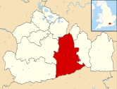
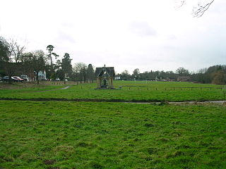
Effingham is a small English village in the Borough of Guildford in Surrey, reaching from the gently sloping northern plain to the crest of the North Downs and with a medieval parish church. The village has been chosen as the home of notable figures, such as Sir Barnes Wallis who was buried here and Toni Mascolo. The M25 motorway is 4 miles (6.4 km) north-west of the middle of the village, which consists of new build homes and green space in the Metropolitan Green Belt.

William de Braose, First Lord of Bramber was previously lord of Briouze, Normandy. He was granted lands in England by William the Conqueror soon after he and his followers had invaded and controlled Saxon England.

<span class="mw-page-title-main">Fetcham</span> Human settlement in England

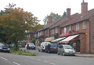
Fetcham is a suburban village in the Mole Valley district, in Surrey, England west of the town of Leatherhead, on the other side of the River Mole and has a mill pond, springs and an associated nature reserve. The housing, as with adjacent Great Bookham, sits on the lower slopes of the North Downs north of Polesden Lacey (NT). Fetcham Grove has Leatherhead and the village's main leisure centre and football club, between the two settlements. Fetcham has two short parades of shops and services, several sports teams and parks and a small number of large pubs and food premises.

<span class="mw-page-title-main">Great Bookham</span> Village in England

Great Bookham is a village in the Mole Valley district, in Surrey, England, one of six semi-urban spring line settlements between the towns of Leatherhead and Guildford. With the narrow strip parish of Little Bookham, it forms part of the Saxon settlement of Bocham. The Bookhams are surrounded by common land, and Bookham railway station in Church Road, Great Bookham, serves both settlements.

<span class="mw-page-title-main">East Horsley</span> Village in Surrey, England

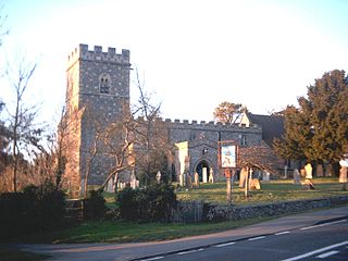
East Horsley is a village and civil parish in Surrey, England, 21 miles southwest of London, on the A246 between Leatherhead and Guildford. Horsley and Effingham Junction railway stations are on the New Guildford line to London Waterloo. The two-halves of ancient Horsley are similar in having substantial woodland and some chalky lower slopes, in the south, of the North Downs.

<span class="mw-page-title-main">Great and Little Kimble cum Marsh</span> Human settlement in England

Great and Little Kimble cum Marsh is a civil parish in central Buckinghamshire, England. It is located 5 miles (8 km) to the south of Aylesbury. The civil parish altogether holds the ancient ecclesiastical villages of Great Kimble, Little Kimble, Kimblewick and Marsh, and an area within Great Kimble called Smokey Row. The two separate parishes with the same name were amalgamated in 1885, but kept their separate churches, St Nicholas for Great Kimble on one part of the hillside and All Saints for Little Kimble on other side at the foot of the hill.

<span class="mw-page-title-main">Little Missenden</span> Human settlement in England

Little Missenden is a village and civil parish on the River Misbourne in Buckinghamshire, England. It is in the Chiltern Hills, about 3 miles (5 km) southeast of Great Missenden and 3 miles (5 km) west of Amersham. The village lies on the River Misbourne in the Misbourne valley.

<span class="mw-page-title-main">Brightwell-cum-Sotwell</span> Human settlement in England

Brightwell-cum-Sotwell is a twin-village and civil parish in the Upper Thames Valley in South Oxfordshire. It lies between Didcot to the west and the historic market town of Wallingford to the east. In 1974 it was transferred from Berkshire to the county of Oxfordshire, and from Wallingford Rural District to the district of South Oxfordshire.

<span class="mw-page-title-main">Chobham</span> Human settlement in England

Chobham is a village and civil parish in the Borough of Surrey Heath in Surrey, England.

<span class="mw-page-title-main">Claygate</span> Human settlement in England

Claygate is an affluent suburban village in Surrey, England, 14 miles southwest of central London. It is the only civil parish in the borough of Elmbridge. Adjoining Esher and Hinchley Wood to the west and north respectively, and bordered by green belt land to the south and east, Claygate lies within the Greater London Built-up Area.

<span class="mw-page-title-main">Chalgrave</span> Human settlement in England

Chalgrave is a civil parish in the Central Bedfordshire district of Bedfordshire, England. The hamlets of Tebworth and Wingfield are in the west of the parish, with the church and manor in the east. Nearby places are Toddington, Chalton, Houghton Regis, and Hockliffe. Before 1929, the parish also included part of the village of Hockliffe.

<span class="mw-page-title-main">Artington</span> Human settlement in England

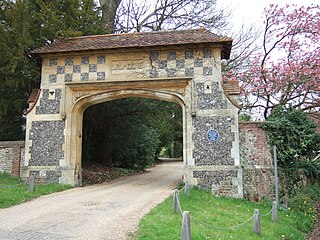
Artington is a village and civil parish in the borough of Guildford, Surrey, England. It covers the area from the southern edge of the built-up centre of Guildford and steep Guildown, the start of the Hog's Back and part of the North Downs AONB, to New Pond Farm by Godalming and the edge of Peasmarsh. It contains Loseley Park, a country estate with dairy, and the hamlet of Littleton.

<span class="mw-page-title-main">Ash, Surrey</span> Village in England

Ash is a village and civil parish in the far west of the borough of Guildford, Surrey. Ash is on the eastern side of the River Blackwater, with a station on the Reading-Guildford-Gatwick line, and direct roads to Aldershot, Farnham and Guildford. The 2011 census counted the residents of the main ward of Ash, which excludes Ash Vale, as 6,120. It is within the Blackwater Valley and adjoins the riverside in the east of that large town; Ash has a small museum in the local cemetery chapel, a large secondary school and a library.

<span class="mw-page-title-main">Westhumble</span> Village in Surrey, England

Westhumble is a village in south east England, approximately 2 km (1.2 mi) north of Dorking, Surrey. The village is not part of a civil parish, however the majority of the settlement is in the ecclesiastical Parish of Mickleham.

<span class="mw-page-title-main">Kingswood, Surrey</span> Human settlement in England

Kingswood or Kingswood with Burgh Heath is a residential area on the North Downs in the borough of Reigate and Banstead in Surrey, England. Part of the London commuter belt, Kingswood is just to the east of the A217 separating it from Tadworth and has a railway station. Burgh Heath in its north is combined with it to form a ward. Reigate is 3.6 miles (5.8 km) south of its centre and London is 15.5 miles (24.9 km) to the north northeast. Kingswood with Burgh Heath had a population of 6,891 in 2011.

<span class="mw-page-title-main">Wanborough, Surrey</span> Human settlement in England

Wanborough is a rural village and civil parish in Surrey approximately 4 miles (6 km) west of Guildford on the northern slopes of the Hog's Back. Wanborough lies between Puttenham and Normandy. Wanborough village grew around and to service Wanborough Manor which is on the site of ancient springs.

<span class="mw-page-title-main">Ockley</span> Human settlement in England

Ockley is a rural village in Surrey. It lies astride the A29, the modern road using the alignment of Stane Street (Chichester). The A29 diverges from the A24 from London about 2.5 miles northeast and takes the alignment of Stane Street a mile north of the village. It has a medieval parish church, see list of places of worship in Mole Valley.

<span class="mw-page-title-main">Effingham Hundred</span>

Effingham Hundred or the Hundred of Effingham was a hundred but often treated as a half-hundred with that of Copthorne and was the smallest in Surrey, England.

<span class="mw-page-title-main">Pixham</span> Human settlement in England

Pixham is a chapelry within the parish of Dorking, Surrey on the near side of the confluence of the River Mole and the Pipp Brook to its town, Dorking, which is centred 1 km (0.6 mi) southwest. The town as a whole, uniquely in Surrey, has three railway stations; Pixham adjoins or is the location of two of the three; and is near the junction of the A24 and A25 main roads.

References

  1. 1 2 3 4 5 6 Parishes: Little Bookham at the Wayback Machine (archived 8 March 2018)
  2. Domesday Book for Surrey Archived 2007-10-30 at the Wayback Machine
  3. "Population statistics Little Bookham AP/CP through time". A Vision of Britain through Time . Retrieved 27 April 2024.
  4. "Surrey Mid-Eastern Registration District". UKBMD. Retrieved 27 April 2024.
  5. Historic England. "Church of All Saints (1028606)". National Heritage List for England . Retrieved 2 November 2014.
  6. Church information and parish map Archived 8 March 2018 at the Wayback Machine The Church of England. For evidence the ecclesiastical parish emulates the civil parish and historic areas lost/gained (minor changes) see Vision of Britain, cited above.
  7. "Home | Mole Valley District Council". Archived from the original on 22 January 2021. Retrieved 23 January 2021.
  8. "A vision of Britain through time | Your national on-line library for local history". Archived from the original on 23 April 2007. Retrieved 23 January 2021.

Commons-logo.svg Media related to Little Bookham at Wikimedia Commons