Mickleham, Surrey

Last updated

Mickleham
St Michaels Mickleham.jpg
St Michael's church
Surrey UK location map.svg
Red pog.svg
Mickleham
Location within Surrey
Area7.31 km2 (2.82 sq mi)
Population585 (Civil Parish 2011) [1]
  Density 80/km2 (210/sq mi)
OS grid reference TQ171534
Civil parish
  • Mickleham
District
Shire county
Region
Country England
Sovereign state United Kingdom
Post town Dorking
Postcode district RH5
Dialling code 01372 or 01306
Police Surrey
Fire Surrey
Ambulance South East Coast
UK Parliament
List of places
UK
England
Surrey
51°16′05″N0°19′16″W / 51.268°N 0.321°W / 51.268; -0.321

Mickleham is a village in south east England, between the towns of Dorking and Leatherhead in Surrey. The civil parish covers 7.31 square kilometres (1,810 acres) and includes the hamlet of Fredley. [2] The larger ecclesiastical parish includes the majority of the neighbouring village of Westhumble, [3] from which Mickleham is separated by the River Mole.

Contents

History

Mickleham lies near to the old Roman road known as Stane Street, which ran from London to Chichester. Then, acquiring its Old English based name, the small settlement lay within the Copthorne hundred the initial purposes of which were those of the feudal system — use for meetings of the wealthy and powerful for strategic purposes in Anglo-Saxon England and later becoming an area of land assessment for taxation.

Mickleham appears in the Domesday Book of 1086 as Michelham and Micleham. It was partly held by Nigel from the Bishop of Bayeux and partly by Oswald from (under) Richard de Tonbridge. Its domesday assets were: 7 hides; 1 church, 7 ploughs, 3 acres (12,000 m2) of meadow, woodland worth 4 hogs. It rendered £10 per year to its overlords. [4]

Nearby Mickleham Down was the venue for a single wicket cricket match in June 1730. The game was between two teams of three and played for a stake of £50. The teams, Surrey and Sussex, were described in a contemporary newspaper report as "esteemed the best in the respective counties" but it does not name the players. [5] This is the first and only reference to Mickleham in association with cricket of a senior level.

Mickleham is mentioned in Jane Austen's novel Emma (1815).

The philosopher and amateur botanist John Stuart Mill protested against the building of a railway though the "beautiful valley of Mickleham" in 1836. [6] The village has featured prominently in cycling, following the loops of Box Hill adopted by various versions of the London-Surrey Cycle Classic which has acquired a federation of European cycling points status as an annual event, since its use in the 2012 Summer Olympics.

Amenities

Places of worship

St Michael's Church and lychgate, viewed from the south west. Lychgate, Mickleham - geograph.org.uk - 251173.jpg
St Michael's Church and lychgate, viewed from the south west.

The main place of worship is St. Michael's Church, surrounded by St. Michael's Churchyard. The church (in full the "Parish Church of St. Michael and All Angels in Mickleham") has a Norman west tower and a Norman chancel arch, raised in the 1871 restoration by Ewan Christian, who added neo-Norman aisles and east end. The Norbury chapel on the north side is late Perpendicular, with chequerboard flint and clunch walling. [7] The majority of the stained glass windows are by Clayton and Bell with others by Percy Bacon Bros, Morris & Sons and a modern window by Alfred Fisher (2015). [8]

Community facilities and commerce

The village has two pubs (The Running Horses and The King William IV), a village shop (Rose's Stores) and an Italian Restaurant (Frascati).

The Mickleham Village Hall is on Dell Close and is available for hire.

Schools

Box Hill School - Dalewood House in Mickleham village, now a boarding school. It follows Kurt Hahn's educational principles. Box Hill School - geograph.org.uk - 1393906.jpg
Box Hill School - Dalewood House in Mickleham village, now a boarding school. It follows Kurt Hahn's educational principles.

In the village are Box Hill School, an independent secondary school, located close to the village shop, St Michael's Infant C of E (Aided) School and St Michael's Community Nursery.

Transport

Roads

The A24 bypasses Mickleham with a dual-carriageway bypass.

Railway

Box Hill & Westhumble station, located across the A24, and towards Westhumble, provides a link to London and Horsham. [3]

Buses

The 465 bus route runs every hour or half-hour (except nights) between Kingston upon Thames and Dorking, via Mickleham village. [3]

Localities

Fredley

The hamlet and former manor of Fredley is approximately 300m south of the centre of Mickleham. Juniper Hall, run by the Field Studies Council is located there.

James Clavell, the Australian novelist and screenwriter, lived at Fredley Manor between 1970 and 1990. [9]

Mickleham Downs

The hillside to the east of the village, known as Mickleham Downs, was donated to the National Trust in January 1939 by Lord Beaverbrook, the proprietor of the Daily Express newspaper, who had recently purchased the Cherkley Court estate. [10] [11]

Norbury Park

Across the Mole and the A24 is Norbury Park. In this is the 'Druids Grove' which is an area of mature Yew trees.

The Burford Bridge and the zig-zag road

Here is the hotel that was frequented by Lord Nelson, 150m north of which starts the Zig-Zag road, one of the two local roads for motor vehicles climbing Box Hill.

Landmarks

The surrounding area contains many Sites of Special Scientific Interest (SSSI) including the Mickleham Downs and panoramic beauty spot of Box Hill.

The River Mole flows nearby. As its name suggests, the river in places goes underground due to the chalk bed being dissolved, forming swallow holes (sinkholes). Ian Middleton tells of his father, sometime in the 1950s, the village police officer P.C. Middleton, looking past his bathroom mirror one morning whilst shaving to see a mature oak tree disappear into the ground. [12] It turned out that the river flowing underground had been gradually wearing away the supporting ground under the tree, forming a giant such hole which had collapsed. [13] The subsequent pit was not filled in until about 1968 approx when it was still 30 ft deep and 30 ft across.

Notable residents

Demography and housing

2011 Census Homes
Output areaDetachedSemi-detachedTerracedFlats and apartmentsCaravans/temporary/mobile homesshared between households [1]
(Civil Parish)7451153500

The average level of accommodation in the region composed of detached houses was 28%, the average that was apartments was 22.6%.

2011 Census Key Statistics
Output areaPopulationHouseholds% Owned outright% Owned with a loanhectares [1]
(Civil Parish)58517527.4%24.6%731

The proportion of households in the civil parish who owned their home outright compares to the regional average of 35.1%. The proportion who owned their home with a loan compares to the regional average of 32.5%. The remaining % is made up of rented dwellings (plus a negligible % of households living rent-free).

See also

Related Research Articles

<span class="mw-page-title-main">Effingham, Surrey</span> Human settlement in England

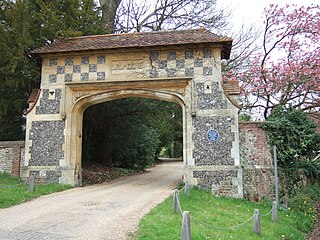
Effingham is a small English village in the Borough of Guildford in Surrey, reaching from the gently sloping northern plain to the crest of the North Downs and with a medieval parish church. The village has been chosen as the home of notable figures, such as Sir Barnes Wallis who was buried here and Toni Mascolo. The M25 motorway is 4 miles (6.4 km) north-west of the middle of the village, which consists of new build homes and green space in the Metropolitan Green Belt.

<span class="mw-page-title-main">River Mole</span> Tributary of the River Thames in southern England

The River Mole is a tributary of the River Thames in southern England. It rises in West Sussex near Gatwick Airport and flows northwest through Surrey for 80 km to the Thames at Hampton Court Palace. The river gives its name to the Surrey district of Mole Valley.

<span class="mw-page-title-main">Box Hill, Surrey</span> Hill in Surrey, England

Box Hill is a summit of the North Downs in Surrey, approximately 31 km (19 mi) south-west of London. The hill gets its name from the ancient box woodland found on the steepest west-facing chalk slopes overlooking the River Mole. The western part of the hill is owned and managed by the National Trust, whilst the village of Box Hill lies on higher ground to the east. The highest point is Betchworth Clump at 224 m (735 ft) above OD, although the Salomons Memorial overlooking the town of Dorking is the most popular viewpoint.

<span class="mw-page-title-main">Walton-on-the-Hill</span> Human settlement in England

Walton-on-the-Hill, Surrey, is a village in England midway between the market towns of Reigate and Epsom. The village is a dispersed cluster on the North Downs centred less than one mile inside of the M25 motorway. The village hosts the Walton Heath Golf Club, whose former members include King Edward VIII, Winston Churchill and David Lloyd George.

<span class="mw-page-title-main">Limpsfield</span> Human settlement in England

Limpsfield is a village and civil parish in Surrey, England, at the foot of the North Downs close to Oxted railway station and the A25. The composer Frederick Delius and orchestral conductor Sir Thomas Beecham are buried in the village churchyard and there are 89 listed buildings.

<span class="mw-page-title-main">Abinger</span> Civil parish in Mole Valley, Surrey, England

Abinger is a large, well-wooded and mostly rural civil parish that lies between the settlements of Dorking, Shere and Ewhurst in the district of Mole Valley, Surrey, England.

<span class="mw-page-title-main">Betchworth</span> Human settlement in England

Betchworth is a village and civil parish in the Mole Valley district of Surrey, England. The village centre is on the north bank of the River Mole and south of the A25 road, almost 3 miles (4.8 km) east of Dorking and 3 miles (4.8 km) west of Reigate. London is 19.5 miles (31.4 km) north of the village.

<span class="mw-page-title-main">Westhumble</span> Village in Surrey, England

Westhumble is a village in south east England, approximately 2 km (1.2 mi) north of Dorking, Surrey. The village is not part of a civil parish, however the majority of the settlement is in the ecclesiastical Parish of Mickleham.

<span class="mw-page-title-main">Bocketts Farm</span>

Bocketts Farm in Surrey, England is a visitor attraction farm set in the countryside on the slopes of the North Downs 1.6 miles (2.6 km) due south of Leatherhead.

<span class="mw-page-title-main">Headley, Surrey</span> Human settlement in England

Headley is a village and civil parish in the North Downs in Surrey, England. The nearest settlements are, to the west, Mickleham and Leatherhead; to the north, Ashtead and Langley Vale; to the east, Walton-on-the-Hill; and to the south, Box Hill. It is just outside the M25 motorway encircling London.

<span class="mw-page-title-main">Box Hill & Westhumble railway station</span> Railway station in Surrey, England

Box Hill & Westhumble is a railway station in the village of Westhumble in Surrey, England, approximately 2 miles (3.2 km) north of Dorking town centre. Box Hill is located approximately 12 mile (800 m) to the east. It is 21 miles 14 chains (34.1 km) down the line from London Waterloo. Train services are operated by Southern who manage the station, and South Western Railway.

<span class="mw-page-title-main">Tandridge</span> Human settlement in England

Tandridge is a village and civil parish in the Tandridge District, in the county of Surrey, England. Its nucleus is on a rise of the Greensand Ridge between Oxted and Godstone. It includes, towards its middle one named sub-locality (hamlet), Crowhurst Lane End. In 2011 the parish had a population of 663 and the district had a population of 82,998.

<span class="mw-page-title-main">Norbury Park</span>

Norbury Park is a swathe of mixed wooded and agricultural land associated with its Georgian manor house near Leatherhead and Dorking, Surrey, which appears in the Domesday Book of 1086. It occupies mostly prominent land reaching into a bend in the Mole in the parish of Mickleham.

<span class="mw-page-title-main">Juniper Hall</span> Countrey house in Surrey, England

Juniper Hall FSC Field Centre is an 18th-century country house, leased from the National Trust, on the east slopes of Mickleham in the deep Mole Gap of the North Downs in Surrey, England. The varying contours of the slopes provide habitats and environments for study including unimproved chalk grassland, coppiced woodlands, heathland and freshwater.

<span class="mw-page-title-main">St Helen's Church, Hangleton</span> Church

St Helen's Church, an Anglican church in the Hangleton area of Hove, is the oldest surviving building in the English city of Brighton and Hove. It is the ancient parish church of Hangleton, an isolated South Downs village that was abandoned by the Middle Ages and was open farmland until the Interwar Period, when extensive residential development took place.

<span class="mw-page-title-main">St. Michael's Churchyard, Mickleham</span> Graveyard in Surrey, England

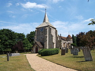
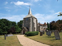
St. Michael's Churchyard is the church and graveyard located in Mickleham, Surrey, England, belonging to the Church of England parish of Mickleham.

<span class="mw-page-title-main">Doddiscombsleigh</span> Village in Devon, England

Doddiscombsleigh is a small settlement in Devon, England. It is 5 miles (8 km) southwest of the city of Exeter and one mile East of the River Teign and the Teign Valley. Along with a few other places in Devon, it is one of the longest place names in England with 16 letters.

<span class="mw-page-title-main">Pixham</span> Human settlement in England

Pixham is a chapelry within the parish of Dorking, Surrey on the near side of the confluence of the River Mole and the Pipp Brook to its town, Dorking, which is centred 1 km (0.6 mi) southwest. The town as a whole, uniquely in Surrey, has three railway stations; Pixham adjoins or is the location of two of the three; and is near the junction of the A24 and A25 main roads.

Leopold Salomons was a city financier and company director active in the City of London in the late nineteenth and early twentieth centuries. Salomons was born into a British Jewish family, but it has been suggested that he later converted to Christianity. Today he is primarily remembered for his purchase of Box Hill in 1914 to protect it from development.

<span class="mw-page-title-main">Thames Down Link</span>

The Thames Down Link is a 24 km (15 mi) official walking route linking the Thames Path and the North Downs Way. It starts in the town centre of Kingston upon Thames and finishes at Box Hill & Westhumble railway station.

References

  1. 1 2 3 Key Statistics; Quick Statistics: Population Density Archived 11 February 2003 at the Wayback Machine United Kingdom Census 2011 Office for National Statistics Retrieved 21 November 2013
  2. Surrey Council census Archived 28 September 2007 at the Wayback Machine
  3. 1 2 3 "Home". Mickleham Parish Council. Archived from the original on 16 October 2020. Retrieved 14 October 2020.
  4. Surrey Domesday Book Archived 15 July 2007 at the Wayback Machine
  5. Buckley, G. B. (1935). Fresh Light on 18th Century Cricket. Birmingham: Cotterell. p. 4.
  6. Dictionary of National Biography. Vol XIII, 1903, Smith and Elder. Leslie Stephen
  7. Ian Nairn and Nikolaus Pevsner, The Buildings of England – Surrey, 1962
  8. "Stained Glass Windows at St. Michael". Church Stained Glass Windows. Archived from the original on 23 January 2021. Retrieved 21 March 2019.
  9. Churchill, Penny (9 March 2017). "For Your Eyes Only: The Surrey manor where James Clavell hosted 007 (and JR Ewing)". Country Life. Farnborough, Hampshire. Archived from the original on 30 September 2020. Retrieved 21 September 2020.
  10. "Mickleham Downs". The Times. No. 48196. London. 6 January 1939. p. 12.
  11. "Mickleham Downs: Gift To The National Trust". The Times. No. 48196. London. 6 January 1939. p. 16.
  12. "Oak tree disappears". Surrey Advertiser and County Times. Vol. CXLII, no. 10259. 10 February 1940. p. 5.
  13. "The strange secret of the River Mole". Surrey Mirror and County Post. No. 4581. 10 July 1964. p. 21.
  14. "Historic Sites and Monuments Board of Canada – Former Prime Ministers and Their Grave Sites – The Right Honourable Richard Bedford Bennett". Parks Canada. Government of Canada. 20 December 2010. Archived from the original on 22 October 2013. Retrieved 27 February 2014.
  15. Lynch, Andrew (20 January 2013). "Leading edge: Sir Stuart Etherington". The Sunday Times. No. 9828. p. 4. Archived from the original on 12 October 2013. Retrieved 6 February 2016.
  16. Knapman, D. – Conversation Sharp – The Biography of a London Gentleman, Richard Sharp (1759–1835), in Letters, Prose and Verse. Chapter 9 (2004).
  17. Boase, George Clement; William Prideaux Courtney (1878). Bibliotheca Cornubiensis: A Catalogue of the Writings, Both Manuscript and Printed, of Cornishmen, and of Works Relating to the County of Cornwall, with Biographical Memoranda and Copious Literary References. Vol. 2 (Digitized 5 Sep 2007 ed.). Longmans, Green, Reader and Dyer. p. 895.