
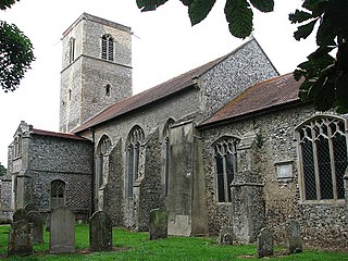
Blakeney is a coastal village and civil parish in the English county of Norfolk. Blakeney lies within the Norfolk Coast AONB and the North Norfolk Heritage Coast. The North Norfolk Coastal Path travels along its quayside. The village is 21.1 mi (34 km) north west of Norwich, 4.6 mi (7.4 km) NNW of the larger settlement of Holt, 11.5 mi (18.5 km) west of Cromer and 112 mi (180 km) NNE of London.

Cley next the Sea is a village and civil parish on the River Glaven in English county of Norfolk, 4 mi (6 km) north-west of Holt and east of Blakeney. The main A149 coast road runs through the centre of the village, causing congestion in the summer months due to the tight, narrow streets. It lies within the Norfolk Coast AONB and the North Norfolk Heritage Coast.

East Ruston is a village and a civil parish in the English county of Norfolk. The village is located 4.1 miles (6.6 km) south-east of North Walsham and 14 miles (23 km) north-east of Norwich.

Denver is a village and civil parish in the English county of Norfolk. The village is situated on the River Great Ouse, approximately 1 mile (1.6 km) south of the small town of Downham Market, 14 miles (23 km) south of the larger town of King's Lynn, and 37 miles (60 km) west of the city of Norwich.

Buxton is a village in the parish of Buxton with Lamas, in the Broadland district of the county of Norfolk, England. It is located between Norwich and Aylsham, and is separated from Lamas by the River Bure. In 2021, it had a population of 1,295.

East Harling is a village in the civil parish of Harling, in the Breckland district, in the county of Norfolk, England. It is the principal settlement in the parish of Harling, and is located 13 kilometres (8.1 mi) east of Thetford and 40 kilometres (25 mi) south-west of the city of Norwich on the banks of the River Thet.
Aldeby is a village and civil parish in the English county of Norfolk. It is bounded to the south by the River Waveney, on the other side of which is Suffolk. The village is about five miles (8 km) by road from Beccles.

Alpington is a village and civil parish in the English county of Norfolk. It is situated about six miles (10 km) south-east of Norwich and is closely associated with Yelverton just to the north.

Brooke is a village and civil parish in the South Norfolk district of Norfolk, England, about 7 miles south of Norwich and roughly equidistant from Norwich and Bungay.

Erpingham is a village and civil parish in the English county of Norfolk. The village is located 3.1 miles (5.0 km) north of Aylsham and 15 miles (24 km) north of Norwich, along the Scarrow Beck. In 1935, Erpingham parish was merged with Calthorpe to form the parish of Erpingham with Calthorpe.

Repps with Bastwick is a civil parish in the English county of Norfolk. It comprises the adjacent villages of Bastwick and Repps, which are situated some 16 km (9.9 mi) north-west of the town of Great Yarmouth and 22 km (14 mi) north-east of the city of Norwich. The parish borders the River Thurne and Bastwick is at the south end of the bridge which carries the A149 road over that river to the village of Potter Heigham.

Croxton is a village and civil parish in the English county of Norfolk, within the district of Breckland. Croxton is located 2.2 miles north of Thetford and 26 miles south-east of Norwich.

Briston is a village, civil parish and electoral ward in the English county of Norfolk that contains the hamlet of Briston Common. The village is 11 miles (18 km) east north east of the town of Fakenham, 13.3 miles (21.4 km) west south west of Cromer, 20.3 miles (32.7 km) north north west of the city of Norwich, and 125 miles (201 km) north north east of London. The village is situated on the route of the B1354 that runs between the A148 at Thursford and the B1149 at Saxthorpe.
Colby is a village and a civil parish in the English county of Norfolk. The village is 8.6 miles (13.8 km) south of Cromer, 16.8 miles (27.0 km) north-north-west of Norwich, 5.2 miles (8.4 km) west-north-west of North Walsham and 131 miles (211 km) north-east of London.
Corpusty is a village and former civil parish, now in the parish of Corpusty and Saxthorpe, in the North Norfolk district, in the county of Norfolk, England, situated on the River Bure. Corpusty is about sixteen miles from Norwich and six miles (10 km) from Holt.

Earsham is a village and civil parish in the English county of Norfolk. Earsham is located 1.7 kilometres (1.1 mi) west of its postal town of Bungay and 21 kilometres (13 mi) south-east of Norwich. The village is located close to the border between Norfolk and Suffolk, and the River Waveney.

East Rudham is a village and civil parish in the English county of Norfolk. The village is located 14 miles (23 km) north-east of King's Lynn and 28 miles (45 km) north-west of Norwich.

Felthorpe is a village and civil parish in the English county of Norfolk. The village is located 11 miles (18 km) east of Dereham and 7.1 miles (11.4 km) north-west of Norwich.
Crostwick is a village in the English county of Norfolk. The village is part of the civil parish of Horstead with Stanninghall. Crostwick is located 2.6 miles from Wroxham and 5.2 miles from Norwich.

Bradfield is a village and former civil parish, now in the parish of Swafield, in the North Norfolk district, in the county of Norfolk, England. The village is 7.6 miles (12.2 km) south south east of Cromer, 18.1 miles (29.1 km) north north east of Norwich and 135 miles (217 km) north east of London. The village lies 3.1 miles (5.0 km) north north west of the town of North Walsham. In 1931 the parish had a population of 136.


