
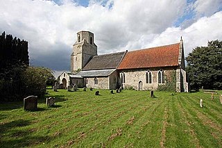
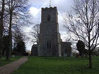
Reedham is a village and civil parish in the English county of Norfolk and within The Broads. It is on the north bank of the River Yare, some 12 miles (19 km) east of the city of Norwich, 7.5 mi (12.1 km) south-west of the town of Great Yarmouth and the same distance north-west of the Suffolk town of Lowestoft.

Snettisham is a village and civil parish in the English county of Norfolk. It is located near the west coast of Norfolk, some 5 miles (8.0 km) south of the seaside resort of Hunstanton, 9 miles (14 km) north of the town of King's Lynn and 45 miles (72 km) northwest of the city of Norwich.
Scoulton is a small village and civil parish in the county of Norfolk, England, situated 16 miles (26 km) west of the city of Norwich and 21 miles (34 km) north-north-east of Thetford.

Northwold is a village and civil parish in the English county of Norfolk. It covers an area of 19.72 km2 (7.61 sq mi) and had a population of 1,070 in 448 households at the 2001 census, increasing to 1,085 at the 2011 Census. For the purposes of local government, it falls within the district of King's Lynn and West Norfolk. The civil parish also includes the hamlets of Whittington and Little London.
Quidenham is a small rural village and civil parish in the English county of Norfolk. It covers an area of 22.51 km2 (8.69 sq mi) and had a population of 576 in 183 households at the 2001 census, falling to a population of 560 living in 189 households at the 2011 Census. For the purposes of local government, it falls within the district of Breckland.

Barton Bendish is a village and a civil parish in the English county of Norfolk. The village is 7.6 miles (12.2 km) east of Downham Market, 38.6 miles (62.1 km) west of Norwich and 14.4 miles (23.2 km) south of the town of Kings Lynn.The nearest railway station is at Downham Market for the Fen Line which runs between Cambridge and King’s Lynn. The civil parish has an area of 15.92 km² and in the 2011 census had a population of 210 in 96 households. For the purposes of local government, the parish falls within the district of King's Lynn and West Norfolk.
Belton with Browston is a civil parish in the English county of Norfolk. Historically part of Suffolk, the parish consists of the villages of Belton and Browston Green, and is situated some 5 miles (8 km) south-west of the town of Great Yarmouth and 6¼ miles (10 km) north-west of the Suffolk town of Lowestoft.
Saham Toney is a village and a civil parish in the English county of Norfolk. The village is 14.5 miles (23.3 km) North of Thetford, 27.3 miles (43.9 km) west of Norwich and 101 miles (163 km) north-east of London. The village lies 13.1 miles (21.1 km) west of the town of Attleborough. The nearest railway station is at Attleborough for the Breckland Line which runs between Cambridge and Norwich. The nearest airport is Norwich International Airport. The civil parish has an area of 16.51 km2 (6.37 sq mi) and in 2001 had a population of 1565 in 680 households, reducing to 1,507 in 679 households at the 2011 Census. For the purposes of local government, the parish falls within the district of Breckland.

Wretham is a civil parish in the Breckland district of Norfolk, England. The parish includes the village of East Wretham, which is about 6 miles (10 km) northeast of Thetford and 25 miles (40 km) southwest of Norwich. It also includes the villages of Illington and Stonebridge. The parish has an area of 32.25 km2 (12.45 sq mi). The 2011 Census recorded a parish population of 374 people in 141 households.
Winfarthing is a village and civil parish in the English county of Norfolk. It is located 6 km north of the town of Diss, 20 km east of the town of Thetford, and 30 km south of the city of Norwich.

Tottington is a deserted village and civil parish in the English county of Norfolk. It is situated some 6.2 miles (10.0 km) north of the town of Thetford and 25 miles (40 km) south-west of the city of Norwich. Any population at the 2011 Census was included in the civil parish of Thompson.

Stanford Training Area (STANTA), originally known as Stanford Battle Area, is a British Army training area situated in the English county of Norfolk. The area is approximately 30,000 acres (120 km2) in size; it is some 7 miles (11 km) north of the town of Thetford and 25 miles (40 km) south-west of the city of Norwich. The site is run by the Operational Training and Advisory Group (OPTAG).
Stanford is a deserted village and civil parish in the English county of Norfolk. It is situated some 7+1⁄2 miles (12 km) north of the town of Thetford and 25 miles (40 km) southwest of the city of Norwich.

Mundford is a village and civil parish in the English county of Norfolk. It is situated at the intersection of two major routes, the A134 Colchester to King's Lynn road and the A1065 Mildenhall to Fakenham road, about 8 miles (13 km) north west of Thetford. The village is 35 miles (56 km) from the city of Norwich and 88 miles (142 km) from London.

Methwold is a civil parish in the English county of Norfolk, on the edge of the Norfolk Fens and Breckland. With an area of 49.12 km2 (18.97 sq mi) it is the second largest parish in Norfolk. It had a population of 1,476 in 591 households at the 2001 census, increasing to 1,502 at the 2011 Census. For the purposes of local government, it falls within the district of King's Lynn and West Norfolk.

Croxton is a village and civil parish in the English county of Norfolk, north of Thetford. It covers an area of 18.96 km2 (7.32 sq mi) and had a population of 416 in 176 households at the 2001 census, including Stanford and increasing to a population of 445 in 187 households at the 2011 Census. For the purposes of local government, it falls within the district of Breckland.
Langford is a village and former civil parish within the English county of Norfolk. The village is in the Norfolk battle training area of the Ministry of Defence which is an area with restricted entry. Langford is about nine miles south of the town of Swaffham.

Little Thetford is a small village in the civil parish of Thetford, 3 miles (5 km) south of Ely in Cambridgeshire, England, about 76 miles (122 km) by road from London. The village is built on a boulder clay island surrounded by flat fenland countryside, typical of settlements in this part of the East of England. During the Mesolithic era, the fenland basin was mostly dry and forested, although subject to salt and fresh water incursions. The marshes and meres of this fenland may therefore have been difficult to occupy, other than seasonally, but there is evidence of human settlement on the island since the late Neolithic Age; a Bronze Age causeway linked the village with the nearby Barway, to the south-east. An investigation, prior to a 1995 development in the village, discovered a farm and large tile-kiln of Romano-British origin; further investigations uncovered an earlier settlement of the Pre-Roman Iron Age. The Roman road Akeman Street passed through the north-west corner of the parish, and the lost 7th century Anglo-Saxon village of Cratendune may be nearby.

Carbrooke is a village and civil parish in the Breckland district of mid-Norfolk, East Anglia, England in the United Kingdom. It is 3 miles (4.8 km) from the centre of Watton, 8 miles (13 km) from Dereham and 17 miles (27 km) from its postal town of Thetford. It has an area of 12.66 km2 (4.89 sq mi) with an estimated population of 1,310 in 2007. The measured population at the Census 2011 was 2,076.
Lynford is a village and civil parish in the Breckland District of Norfolk. The parish covers an area of 24.72 km2 (9.54 sq mi), and the 2001 Census recorded a population of 157 in 81 households. Lynford lies 4 miles (6.4 km) north east of Brandon and between Mundford, 2 miles (3.2 km) to the north west, and Thetford, 6.5 miles (10.5 km) to the south east, on the A134. It lies deep within Breckland forestry land between the Stanford Battle Area and Thetford Forest.
