
Clinton County is a county located in the U.S. state of Ohio. As of the 2020 census, the population was 42,018. Its county seat and largest city is Wilmington. The county is named for former U.S. Vice President George Clinton. Clinton County comprises the Wilmington, Ohio Micropolitan Statistical Area, which is also included in the Cincinnati-Wilmington-Maysville, OH-KY-IN Combined Statistical Area.

Warren County is a county located in the southwestern part of the U.S. state of Ohio. As of the 2020 census, the population was 242,337. Its county seat is Lebanon and largest city is Mason. The county is one of Ohio's most affluent, with the highest median income of the state's 88 counties. The county was established on May 1, 1803, from Hamilton County; it is named for Dr. Joseph Warren, a hero of the Revolution who sent Paul Revere and the overlooked William Dawes on their famous rides and who died at the Battle of Bunker Hill. Warren County is part of the Cincinnati, OH-KY-IN Metropolitan Statistical Area.

Hamilton County is located in the southwestern corner of the U.S. state of Ohio. As of the 2020 census, the population was 830,639, making it the third-most populous county in Ohio. The county seat and largest city is Cincinnati. The county is named for the first Secretary of the Treasury, Alexander Hamilton. Hamilton County is part of the Cincinnati-Middletown, OH-KY-IN Metropolitan Statistical Area.

Randolph County is a county located in the central section of U.S. state of Indiana, on its eastern border with Ohio. As of 2020, the population was 24,502. The county seat is Winchester.

Ohio County is a county located in southeastern Indiana. With a 2020 population of 5,940, and an area of just 87 square miles, Ohio County is the smallest county in Indiana by area and the least populous. The county seat and only incorporated municipality is Rising Sun. The county was officially established in 1844 and was one of the last Indiana counties to be created. Ohio County borders the state of Kentucky across the Ohio River for which it was named. It is part of the Cincinnati, OH-KY-IN Metropolitan Statistical Area. The county is divided into four townships which provide local services. Three state roads pass through or into the county.

Jay County is a county in the U.S. state of Indiana. As of 2020, the population was 20,478. The county seat is Portland.

Greene County is a county in the U.S. state of Indiana. As of 2020, the population was 30,803. The county seat is Bloomfield. The county was determined by the US Census Bureau to include the mean center of U.S. population in 1930.
Lawrenceburg is a city and the county seat of Dearborn County, Indiana, United States. The population was 5,129 at the 2020 census. It is the largest city in Dearborn County. Lawrenceburg is in southeast Indiana, on the Ohio River west of Cincinnati.

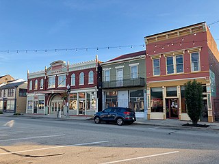
Connersville is a city in Fayette County, east central Indiana, United States, 66 miles (106 km) east by southeast of Indianapolis. The population was 13,481 at the 2010 census. The city is the county seat of and the largest and only incorporated town in Fayette County. The city is in the center of a large rural area of east central Indiana; the nearest significant city is Richmond, 26 miles (42 km) to the northeast by road. Connersville is home to the county's only high school. The local economy relies on manufacturing, retail, and healthcare to sustain itself. However, there has been a consistent decline in both employment and population since the 1960s, placing it among the least affluent areas in the state, as indicated by measures such as median household income and other economic indicators.

Bloomfield is a town within Richland Township and the county seat of Greene County, Indiana, United States. The population was 2,405 at the 2010 census.

Hanover is a town in Hanover Township, Jefferson County, southeast Indiana, along the Ohio River. The population was 3,546 at the 2010 census. Hanover is the home of Hanover College, a small Presbyterian liberal arts college. The tallest waterfall in Indiana, Fremont Falls, is located in Hanover.

Union City is a city in Wayne Township, Randolph County, Indiana, United States. As of the 2020 census, the city had a population of 3,454.

Xenia is a city in and the county seat of Greene County, Ohio, United States. Located in southwestern Ohio, it is 15 miles (24 km) east of Dayton and is part of the Dayton metropolitan area as well as the Miami Valley region. As of the 2020 census, the city had a population of 25,441. The city's name comes from the Greek word Xenia (ξενία), which means "hospitality".

Franklin is a city in Warren County, Ohio, United States, along the Great Miami River. The population was 11,690 at the 2020 census. The city lies about 15 miles (24 km) southwest of Dayton and 33.5 miles (53.9 km) northeast of Cincinnati. Ohio State Routes 73, 123 and 741 pass through Franklin, while Interstate 75 passes on the east side of the city.

Loveland is a city in Hamilton, Clermont, and Warren counties in the southwestern part of the U.S. state of Ohio. The population was 13,307 at the 2020 census. Considered part of the Cincinnati metropolitan area, Loveland is located near exit 52 off Interstate 275, about 15 miles (24 km) northeast of the Cincinnati city limits. It borders Symmes, Miami and Hamilton townships and straddles the Little Miami River. Once a busy railroad town, Loveland is now a major stop along the Little Miami Scenic Trail.

Anderson Township is a township located southeastern Hamilton County along the Ohio and Little Miami Rivers, approximately 13 miles southeast of downtown Cincinnati. The population was 44,088 at the 2020 census.
Green Township is one of the twelve townships of Hamilton County, Ohio, United States. It is a suburb of the neighboring city of Cincinnati. With a population of 60,424 at the 2020 census, Green Township is the most populous township in Hamilton County, and the second most populous township in Ohio. It was founded in 1809.

The Northwest Territory, also known as the Old Northwest and formally known as the Territory Northwest of the River Ohio, was formed from unorganized western territory of the United States after the American Revolution. Established in 1787 by the Congress of the Confederation through the Northwest Ordinance, it was the nation's first post-colonial organized incorporated territory.

Scotland is an unincorporated community and census-designated place (CDP) in Taylor Township, Greene County, Indiana, United States. As of the 2010 census it had a population of 134.

Cincinnati is a city in and the county seat of Hamilton County, Ohio, United States. Settled in 1788, the city is located in the northern side of the confluence of the Licking and Ohio rivers, the latter of which marks the state line with Kentucky. The population of Cincinnati was 309,317 in 2020, making it the third-most populous city in Ohio after Columbus and Cleveland, and 65th in the United States. The city is the economic and cultural hub of the Cincinnati metropolitan area, Ohio's most populous metro area and the nation's 30th-largest with over 2.265 million residents.


