The Red Line is a light rail line in Dallas, Texas operated by the Dallas Area Rapid Transit system. It began operations in June 1996, and is one of two inaugural light rail lines in the DART Light Rail system alongside the Blue Line.

Cityplace/Uptown station is a DART Light Rail station located in Dallas, Texas. It is located beneath North Central Expressway at Haskell Avenue in the Cityplace district. As the first infill DART station, it opened on December 18, 2000, as the first public subway station in Texas.

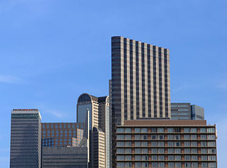
The Cityplace Tower is a 42-story building located at 2711 North Haskell Avenue, at North Central Expressway, in the Cityplace district of Uptown Dallas, Texas (USA). The building is 560 feet (171 m) tall and has 1,400,000 square feet (130,000 m2) of office space. It is also the tallest building in Dallas outside of Downtown.

Oak Lawn is a neighborhood in Dallas, Texas, defined in Dallas City Ordinance 21859 as Planned Development District No. 193, the Oak Lawn Special Purpose District. The unofficial boundaries are Turtle Creek Boulevard, Central Expressway, the City of Highland Park, Inwood Road, and Harry Hines Boulevard. It is over 12 square miles (31 km2) in area. Officially it is bounded by the City of Highland Park, the North Central Expressway, Stemmons Freeway, Woodall Rodgers Freeway, and other roads. The district is within the boundary defined by the City of Dallas law, excluding any existing planned development districts within.
The Main Street District of downtown Dallas, Texas runs along Main Street and is bounded by Elm Street one block north, Commerce St. one block south, N. Lamar St. to the west, and US 75/I-45 (I-345) elevated highway to the east. The district is the spine of downtown Dallas, and connects many of the adjoining business and entertainment districts. It does not include Dealey Plaza or the John Fitzgerald Kennedy Memorial which are a few blocks west in the West End Historic District.

The Cedars is a district in Dallas, Texas (U.S.). It is adjacent to and south of downtown and Interstate 30, east of Austin Street, north of Corinth Street, and west of the 75 & 345 Overpasses just east of South Good Latimer Expy.

The Arts District is a performing and visual arts district in downtown Dallas, Texas.
Vickery Place is a historic neighborhood in East Dallas, Texas, bounded on the north by Goodwin Avenue, on the west by North Central Expressway and Henderson, on the south by Belmont, and on the east by Greenville Avenue. Although Vickery Place is considered by some to be part of the M Streets area, it is strictly speaking not as it is south of the Greenland Hills subdivision. Vickery Place has seen much improvement and property value growth over the past several years due to its close proximity to Downtown Dallas and Uptown, and its location bordering the vibrant Lower Greenville Avenue and Knox-Henderson entertainment and shopping districts.
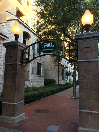
State Thomas is a Dallas Landmark District in the Uptown area of Dallas, Texas (USA). It borders downtown to the south at Woodall Rodgers Freeway, Bryan Place to the east at US 75, and LoMac to the north and west.

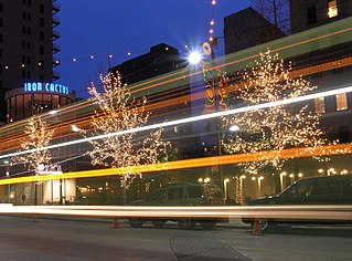
The M-Line Trolley is a heritage streetcar line in the Uptown neighborhood of Dallas, Texas. The trolley line, which has been in service since 1989, is notable for its use of restored historic streetcar vehicles, as opposed to modern replicas.
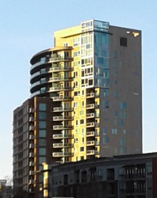
The Mondrian, designed by famed Dallas architect Thomas Brink, is a 20-story high-rise located at 3000 Blackburn Street in the Cityplace neighborhood of Oak Lawn, Dallas, Texas, United States. Construction started on the structure in 2003 and the building was completed in 2005,
Central Expressway is a north–south highway in the Dallas-Fort Worth Metroplex in Texas (USA) and surrounding areas. The best-known section is the North Central Expressway, a name for a freeway section of U.S. Highway 75 between downtown Dallas and Van Alstyne, Texas. The southern terminus is south of the Woodall Rodgers Freeway at exit 284C of "hidden" Interstate 345. From there, Central Expressway becomes the South Central Expressway, the northernmost portion of which was renamed César Chávez Boulevard on April 9, 2010.

Bryan Place is a neighborhood in Old East Dallas, Texas (USA). It is east of the Arts District of downtown and the State Thomas neighborhood, north of Deep Ellum, south of Cityplace and west of Munger Place. Its boundaries are generally considered to be US-75 North Central Expressway on the west, Ross Avenue on the (north)west, N. Washington Street on the (north)east, and Live Oak Avenue on the (south)east.
The City Center District is an area in north-central downtown Dallas, Texas (USA). It lies south of the Arts District, north of the Main Street District, northwest of Deep Ellum, southwest of Bryan Place and east of the West End Historic District. The district contains a large concentration of downtown commercial space which prior to 1950 had been concentrated along Main Street. The district also contains remnants of Theatre Row, the historical entertainment area along Elm Street which contained theatres such as the Majestic Theatre.
The West Village District is a walkable urban village in the Uptown area of Dallas, Texas. West Village is located at the northern edge of Uptown along McKinney Avenue and is bordered by Lemmon Avenue, Cole Avenue, Haskell Drive and Central Expressway.
This article is about transportation systems in and around Dallas, Texas (USA).

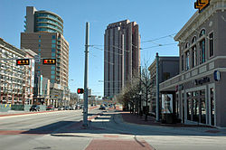
Uptown is a PID and a dense neighborhood in Dallas, Texas. Uptown is north of and adjacent to downtown Dallas, and is bordered by US 75 on the east, N Haskell Avenue on the northeast, the Katy Trail on the northwest, Bookhout Street and Cedar Springs Road on the west, N Akard Street on the southwest and Spur 366 on the south.

Downtown Dallas is the central business district (CBD) of Dallas, Texas, United States, located in the geographic center of the city. It is the second-largest business district in the state of Texas. The area termed "Downtown" has traditionally been defined as bounded by the downtown freeway loop, bounded on the east by I-345 (although known and signed as the northern terminus of I-45 and the southern terminus of US 75, on the west by I-35E, on the south by I-30, and on the north by Woodall Rodgers Freeway.
Belmont Park is a neighborhood in Old East Dallas, Texas (USA). The neighborhood is located near the area now known as Cityplace, and also near Uptown; it is 2 miles from the center of Downtown Dallas. The boundaries of the neighborhood are North Carroll Avenue, Coles Manor Place, Kirby Street, and Weldon Street.