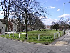
Norton, also known as Norton-on-Tees, is a market town in the Borough of Stockton-on-Tees, in County Durham, England. The suburbs of Roseworth and Ragworth are notable areas of the town. Billingham Beck is to the east of the town, the beck flows to the south-east. The town also contains the areas of Wolviston and Wynyard which are to the north of the town and are wards of the town. The town had a population of 20,829 in the 2011 Census.

Carlton is a village in the Metropolitan Borough of Barnsley in South Yorkshire, England. It is situated between the villages of Athersley and Royston. The village is split in two with one half in the Monk Bretton ward and the rest in the Royston ward of the Barnsley MBC. It was built up on coking and coal mining industries and now has one of the largest industrial estates within the surrounding area. In the industrial estate lies a glass recycling plant, called Rexam. To its east stands the Mr Kipling cake factory, owned by Premier Foods. Until 1974 it was in the West Riding of Yorkshire.

Craghead is a village and former civil parish, now in the parish of Stanley, in the County Durham district, in the ceremonial county of Durham, England. It is a mining village. It is located at the bottom of the valley to the south of Stanley, on the main road between Stanley and Durham, and not far from the village of Edmondsley. In 1931 the parish had a population of 4973. from 1869 Craghead was a civil parish in its own right, on 1 April 1937 the parish was abolished and merged with Stanley and Lanchester.
Blackwell is a suburb in the borough of Darlington and the ceremonial county of Durham, England. It is situated towards the edge of the West End of Darlington, beside the River Tees. Blackwell consists of large 1930s style semi-detached and detached houses, and private, newly built homes. Blackwell Grange is an 18th-century country house converted into a hotel.

Egglescliffe is a village and civil parish in County Durham, England. Administratively it is located in the borough of Stockton-on-Tees.
Mainsforth is a small village and former civil parish, now in the parish of Bishop Middleham, in the County Durham district, in the ceremonial county of Durham, England. It is to the east of Ferryhill. The earliest settlement in Mainsforth may have been on Marble. It has been suggested, without great historical foundation, that this was a Danish settlement. In 1961 the parish had a population of 229.

School Aycliffe is a village and former civil parish, now in the parish of Great Aycliffe, in the County Durham district, in the ceremonial county of Durham, England. It is a short distance west of Newton Aycliffe, and east of Heighington. Its name derives from a Viking called Scula, who owned land in that part of South Durham.
Mordon is a village and civil parish in County Durham, England. It is situated a few miles to the north-east of Newton Aycliffe. The population recorded by the 2011 census for the parish was 260.
Coundon Grange is a village in the civil parish of Dene Valley, in County Durham, England. It is situated to the east of Bishop Auckland. In the 2001 census Coundon Grange had a population of 235.

Haughton-le-Skerne is a village in the borough of Darlington in the ceremonial county of Durham, England. It is situated in the north east of Darlington. The village lies to the west of the River Skerne. At the centre of the village green, is the main road towards Darlington town centre going across the river, south of the church. There used to be a linen mill on the riverbank on the east side of the village. Part of the mill leat can still be seen today.

Headlam is a village in the borough of Darlington and the ceremonial county of County Durham, England. It lies to the west of Darlington. The population taken at the 2011 Census was less than 100. Details are included in the parish of Ingleton. The hamlet has 14 stone houses plus 17th-century Headlam Hall, now a country house hotel. The village is set around a village green with a medieval cattle-pound and an old stone packhorse bridge across the beck. Headlam is classed as Lower Teesdale and has views to the south as far as Richmond and to the Cleveland Hills in the east.
Faverdale is a suburb of Darlington in County Durham, England. It is situated in the north west of Darlington, north of Cockerton. The area was rural until the 20th century, a large wagon works was established in the 1920s, with housing development starting at the same time. The wagon works closed in the 1960s and further industrial and commercial development took place expanding from the brownfield site. As of 2012 the area has a mixture of industrial, residential and rural land use.
Middlestone is a village and former civil parish in the County Durham district, in the ceremonial county of Durham, England. It is situated to the south of Spennymoor, near Kirk Merrington. In the 2001 census Middlestone had a population of 67.
Redworth is a village and former civil parish, now in the parish of Heighington in the borough of Darlington and the ceremonial county of Durham, England. It is west of Newton Aycliffe, between Darlington and Shildon. It had 190 residents at the time of the census in 2001. The name Redworth originates from the words Reed Worth, as the area was a large marsh. Redworth is home to Barcelo Redworth Hall, a 4 star hotel, which has been visited by many famous figures, including the England football team. Redworth Wood is filled with protected trees, and even a Stone Age fort, which has been pictured in the Northern Echo.

Mickley is a cluster of villages in the civil parish of Prudhoe in Northumberland, England. It lies south of the River Tyne and is accessible via the A695. The electoral ward of Mickley comprises the hamlets of Mickley Square, West Mickley, High Mickley, plus Cherryburn and Eltringham Farm. The population is a little under one thousand. In 1951 the parish had a population of 1862.

Kilton is a village in the civil parish of Lockwood, in the borough of Redcar and Cleveland, in the ceremonial county of North Yorkshire, England.
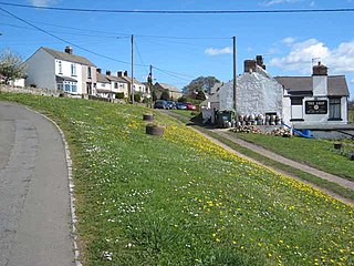
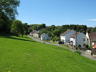
Westerton is a village and former civil parish in the County Durham district, in the ceremonial county of Durham, England. In the 2001 census Westerton had a population of 44. It is situated between Bishop Auckland and Spennymoor. It sits on top of a hill which is one of the highest points in County Durham, and is the location of an observatory built for Thomas Wright, who was the first person to suggest that the Milky Way consisted of a flattened disk of stars. The observatory is known today as "Wright's Folly".

Hepburn is a hamlet and former civil parish, now in the parish of Chillingham in the county of Northumberland, England. In 1951 the parish had a population of 43.

Harton is a suburban area of South Shields, South Tyneside, Tyne and Wear, England. It was historically a village, however as the urban area grew it merged with its adjacent villages to become part of the town. Some of the original village buildings are still intact today, such as St Peter's Church. Until 1974 it was in County Durham.

Morton Palms is a civil parish in the Darlington district, in the ceremonial county of Durham, England. In 2001 the parish had a population of 32. The parish borders Barmpton, Great Burdon, Hurworth, Middleton St. George, Neasham and Sadberge.