Cockeysville is a census-designated place (CDP) in Baltimore County, Maryland, United States. The population was 20,776 at the 2010 census.

The Washington Monument is an obelisk on the National Mall in Washington, D.C., built to commemorate George Washington, a Founding Father of the United States, victorious commander-in-chief of the Continental Army from 1775 to 1783 in the American Revolutionary War, and the first President of the United States from 1789 to 1797. Standing east of the Reflecting Pool and the Lincoln Memorial, the monument is made of bluestone gneiss for the foundation and of granite for the construction. The outside facing consists, due to the interrupted building process, of three different kinds of white marble: in the lower third, marble from Baltimore County, Maryland, followed by a narrow zone of marble from Sheffield, Berkshire County, Massachusetts, and, in the upper part, the so-called Cockeysville Marble. Both "Maryland Marbles" came from the "lost” Irish Quarry Town of "New Texas". It is both the world's tallest predominantly stone structure and the world's tallest obelisk, standing 554 feet 7+11⁄32 inches (169.046 m) tall, according to U.S. National Geodetic Survey measurements in 2013–2014. It is the tallest monumental column in the world if all are measured above their pedestrian entrances. It was the world's tallest structure between 1884 and 1889, after which it was overtaken by the Eiffel Tower, in Paris. Previously, the tallest structure was the Cologne Cathedral.

The Patapsco River mainstem is a 39-mile (63 km) river in central Maryland that flows into the Chesapeake Bay. The river's tidal portion forms the harbor for the city of Baltimore. With its South Branch, the Patapsco forms the northern border of Howard County, Maryland. The name "Patapsco" is derived from the Algonquian pota-psk-ut, which translates to "backwater" or "tide covered with froth."

Maryland Route 45 is a state highway in the U.S. state of Maryland. Known for most of its length as York Road, the state highway runs 30.06 miles (48.38 km) from U.S. Route 1 /US 40 Truck in Baltimore north to the Pennsylvania state line in Maryland Line, where the highway continues as State Route 3001. MD 45 is the primary highway between Downtown Baltimore and Towson, the county seat of Baltimore County. North of Interstate 695 (I-695), the state highway parallels I-83 and serves the suburban communities of Lutherville, Timonium, Cockeysville, and Hunt Valley. MD 45 also connects the northern Baltimore County communities of Hereford and Parkton. The state highway is maintained by the Maryland State Highway Administration in Baltimore County and by the Baltimore City Department of Transportation in the city, where the highway also follows Greenmount Avenue.

Maryland Route 99 is a state highway in the U.S. state of Maryland. Known as Old Frederick Road, the state highway runs 7.57 miles (12.18 km) from MD 32 near West Friendship east to U.S. Route 29 in Ellicott City. MD 99 parallels the north side of Interstate 70 (I-70) through a rural and suburban area in northeastern Howard County. MD 99, which follows the original 18th-century road west from Baltimore, was constructed as part of three state highways: MD 99, the original MD 100, and MD 105. All three highways were constructed between the early 1920s and early 1930s. MD 99 originally turned south along St. Johns Lane to US 40 and MD 144; in 1956, the state highway was rerouted along part of MD 100 and all of MD 105 to downtown Ellicott City. MD 99's eastern terminus was rolled back to US 29 in two steps in the late 1970s and late 1980s.

Maryland Route 145 is a state highway in the U.S. state of Maryland. The state highway runs 10.34 miles (16.64 km) from MD 45 in Cockeysville east to MD 165 near Baldwin. MD 145 connects the north-central and eastern portions of Baltimore County via Jacksonville. The first section of the highway was built from Loch Raven Reservoir to Jacksonville in the early 1910s. The remainder of MD 145 east to Baldwin was completed in the mid-1920s. The state highway was extended west to Cockeysville in the early 1980s in a maintenance swap. When MD 145's bridge over Loch Raven Reservoir was replaced in 2000, the old bridge from 1922 was preserved.

Marriottsville is an unincorporated community in Howard, Carroll and Baltimore counties, Maryland, United States. Marriottsville is located along Marriottsville Road near the Carroll County line, 10.3 miles (16.6 km) north-northwest of Columbia.
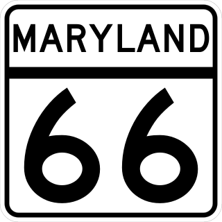
Maryland Route 66 is a state highway in the U.S. state of Maryland. Known for most of its length as Mapleville Road, the state highway runs 12.84 miles (20.66 km) from U.S. Route 40 Alternate in Boonsboro north to MD 64 near Smithsburg. MD 66 parallels the western flank of South Mountain in eastern Washington County, connecting Boonsboro and Smithsburg with Interstate 70 (I-70) and US 40. MD 66 was constructed in the late 1920s and early 1930s from Boonsboro to Cavetown. The state highway was extended north through Smithsburg after MD 64 bypassed the town in the late 1950s.

Tennessee marble is a type of crystalline limestone found only in East Tennessee, in the southeastern United States. Long esteemed by architects and builders for its pinkish-gray color and the ease with which it is polished, the stone has been used in the construction of numerous notable buildings and monuments throughout the United States and Canada, including the National Gallery of Art, National Air and Space Museum, and United States Capitol in Washington, D.C., the Minnesota State Capitol Grand Central Terminal in New York, and Union Station in Toronto. Tennessee marble achieved such popularity in the late-19th century that Knoxville, the stone's primary finishing and distribution center, became known as "The Marble City."

Johnsville is an unincorporated community in Frederick County, Maryland, United States. It is located approximately halfway between Libertytown and Union Bridge along Maryland Route 75. The Kitterman-Buckey Farm was listed on the National Register of Historic Places in 2005.

Sylacauga marble, also commonly known as Alabama marble, is a marble that is found in a belt running through Talladega County, Alabama. It is prized for its pure white color and its crystalline structure. The stone is named after the town of Sylacauga, Alabama, which is sometimes called "the Marble City". Sylacauga marble has been called the "world's whitest". Discovered in 1814, it has been mined for over 160 years, and is used for building, sculpture, and industry. The Alabama Legislature passed Act 755 on September 12, 1969, which made this marble the state's official rock.

Beaver Dam is a flooded marble quarry in Cockeysville, Maryland that has been used as a swimming location since the 1930s. Currently, a 30-acre swim club is located there with two swimming pools, a volleyball court, picnic tables and grills, a creek, and snack house. The 40 foot deep freshwater quarry has floating platforms, two rolling logs, diving and jumping platforms, and a rope swing.

Quarry Lake is a manmade lake in the Pikesville area of Baltimore County, Maryland. Originally a marble quarry, it is now one of the deepest lakes in the state. The lake is surrounded by Quarry Lake at Greenspring, a mixed residential development and commercial development that includes single-family homes, condominiums, shops, and office buildings.

Treasure Mountain, elevation 13,535 ft (4,125 m), is a summit in the Elk Mountains of western Colorado. The mountain is in the Raggeds Wilderness southeast of Marble. The massif has been the site of marble mining and a legend of lost French gold.
The Guilford Quartz Monzonite is a Silurian or Ordovician quartz monzonite pluton in Howard County, Maryland. It is described as a biotite-muscovite-quartz monzonite which occurs as discontinuous lenticular bodies which intrude mainly through the Wissahickon Formation (gneiss).

The Woodstock Quartz Monzonite is a Silurian or Ordovician quartz monzonite pluton in Baltimore County, Maryland. It is described as a massive biotite-quartz monzonite which intrudes through the Baltimore Gneiss at a single locality surrounding the town of Granite, Maryland.

The Ellicott City Granodiorite is a Silurian or Ordovician granitic pluton in Howard and Baltimore Counties, Maryland. It is described as a biotite granodiorite along the margin of the intrusion which grades into a quartz monzonite in its core. It intrudes through the Wissahickon Formation and the Baltimore Gabbro Complex.

The Baltimore Gneiss is a Precambrian geological formation in the Piedmont region of Maryland, Pennsylvania, and Delaware.