Newport is a city and county borough in Wales, situated on the River Usk close to its confluence with the Severn Estuary, 12 mi (19 km) northeast of Cardiff. The population grew considerably between the 2011 and the 2021 census, rising from 145,700 to 159,587, the largest growth of any unitary authority in Wales. Newport is the third-largest principal authority with city status in Wales, and sixth most populous overall. Newport became a unitary authority in 1996 and forms part of the Cardiff-Newport metropolitan area, also known as the Cardiff Capital Region.
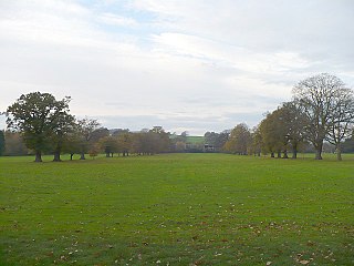
Tredegar Park is a 90-acre (36 ha) country park situated in the Coedkernew area of Newport, Wales. It lies close to junction 28 of the M4 motorway connecting London and West Wales.
Stow Hill is a community civil parish and coterminous electoral district (ward) of the City of Newport, South Wales.

Merry Hill is a suburb of Wolverhampton, West Midlands and a ward of Wolverhampton City Council. It is situated in the south-west of the city, bordering South Staffordshire and the Tettenhall Wightwick, Park, Graiseley and Penn wards. It forms part of the Wolverhampton South West constituency.

Park Village is an inner city area of Wolverhampton, West Midlands, England. It is situated in the north-east of the city on the A460 Cannock Road, which at that point is the border between the city council's Bushbury South and Low Hill and Heath Town wards.
Maesglas or Maes-glas is a neighbourhood in the south west of the city of Newport, South Wales. In the 16th century it was recorded as Greenfield but the Welsh language name Maesglas has remained the more widely used, among English speakers.
Marshfield is a village and community of Newport, Wales. It sits approximately 5 miles southwest of Newport, and 7 miles northeast of Cardiff. The area is governed by Newport City Council. The community includes Castleton. Its population in 2011 was 3,054.

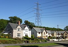
Duffryn is a large housing estate in the southwest of the city of Newport, south Wales comprising a large portion of the Tredegar Park electoral district (ward). Built on land belonging to Tredegar House, it was completed in 1978 and at the time won several awards for its design. The layout of the estate, as viewed from above, is that of large terraces undulating around a central wooded area. Originally a council estate, Duffryn is now a mix of private ownership and Newport City Homes RSL properties.

Castleton is a hamlet in the city of Newport, South Wales.

The A606 is an A road in England that starts in West Bridgford, on the outskirts of Nottingham, and heads southeastwards through Leicestershire and the towns of Melton Mowbray and Oakham, terminating at Stamford, Lincolnshire on the former Great North Road.

Dorstone is a village within the Golden Valley, Herefordshire, England. There is a church and public house with restaurant. The Golden Valley area offers hillwalking and horseback riding countryside and is noted for its scenery. It is within the catchment area of Fairfield secondary school.

Brynglas is an area of the city of Newport, South Wales, United Kingdom.
Tredegar Park is a community of the city of Newport. It is named after the nearby park, although the community covers a much smaller area.
Newport West railway station is a proposed station to serve the western suburbs of the city of Newport, Wales.
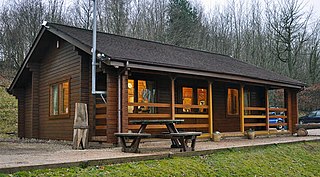
Treetops Sporting Ground is a sporting clay pigeon shooting ground located in Coedkernew, Newport, South Wales. It has facilities for air rifle owners. The grounds contain a large area set aside for paintballing, and is a venue for team building activities and birthday parties.

Gwern-y-steeple is a hamlet in the Vale of Glamorgan, Wales. It lies north of the A48 road and north-west St. Nicholas on the road south-west of Peterston-Super-Ely. Cottrell Park Golf Club lies to the south. Gwern-y-steeple is part of the village of Peterston-Super-Ely and lies within the catchment area of both Peterson-Super-Ely Church in Wales Primary School and Pendoylan Primary School. The local member of Parliament is Conservative Alun Cairns and is part of the Vale of Glamorgan county council. The local county councillor is Rhodri Traherne.

Cobridge is an area of Stoke-on-Trent, in the City of Stoke-on-Trent district, in the county of Staffordshire, England. Cobridge was marked on the 1775 Yates map as 'Cow Bridge' and was recorded in Ward records (1843) as Cobridge Gate.

St John the Evangelist, Knotty Ash, is a church in the Knotty Ash area of Liverpool, Merseyside, England. It is on Thomas Lane and was built 1834–6.
Tredegar Park and Marshfield is an electoral ward for Newport City Council in south Wales. It was created in 2022 by combining the former wards of Tredegar Park and Marshfield. It is represented by three city councillors.