Crystal River is a city in Citrus County, Florida, United States. The population was 3,396 in the 2020 census, up from 3,108 at the 2010 census. It is part of the Homosassa Springs, Florida Metropolitan Statistical Area. The city was incorporated in 1903 and is the self-professed "Home of the Manatee". Crystal River Preserve State Park is located nearby, and Crystal River Archaeological State Park is located in the city's northwest side.

Franklin County is a county along the Gulf of Mexico in the panhandle of the U.S. state of Florida. As of the 2020 census, the population was 12,451, making it the third-least populous county in Florida. The county seat is Apalachicola.

Gadsden County is a county located in the panhandle of the U.S. state of Florida. As of the 2020 census, the population was 43,826. Its county seat is Quincy. Gadsden County is included in the Tallahassee, FL Metropolitan Statistical Area. Gadsden County is the only majority African-American county in Florida.

Jefferson County is a county located in the Big Bend region in the northern part of the U.S. state of Florida. As of the 2020 census, the population was 14,510. Its county seat is Monticello.

Leon County is a county in the Panhandle of the U.S. state of Florida. It was named after the Spanish explorer Juan Ponce de León. As of the 2020 census, the population was 292,198.

Liberty County is a county located in the state of Florida. As of the 2020 census, the population was 7,974, making it the least populous county in Florida. Its county seat is Bristol. Liberty County is the only dry county in Florida. Lafayette County prohibits bars, but not retail sale of beer.

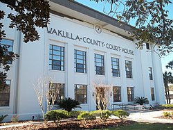
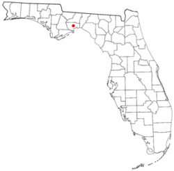
Wakulla County is a county located in the Big Bend region in the northern portion of the U.S. state of Florida. As of the 2020 census, the population was 33,764. Its county seat is Crawfordville.

Havana is a town in Gadsden County, Florida, United States, and a suburb of Tallahassee. The population was 1,753 at the 2020 census, almost even from 1,754 at the 2010 census. It is part of the Tallahassee, Florida Metropolitan Statistical Area. The town was named after Havana, Cuba, located about 530 miles (850 km) to the south.

Midway is a city in Gadsden County, Florida, United States. It is part of the Tallahassee, Florida Metropolitan Statistical Area. According to the 2020 census, the population was 3,537, up from 3,004 at the 2010 census.

Cottondale is a city in Jackson County, Florida, United States. It is part of the Florida Panhandle and North Florida. The population was 848 at the 2020 census, down from 933 at the 2010 census.

Palm Beach Shores is a town in Palm Beach County, Florida, United States. The town is part of the Miami metropolitan area of South Florida. The population was 1,330 at the 2020 US census.

Pierson is a town in Volusia County, Florida, United States. The town is part of the Deltona–Daytona Beach–Ormond Beach, Florida Metropolitan Statistical Area. The population was 1,542 as of the 2020 census.

Sopchoppy is a city in Wakulla County, Florida, United States. The City of Sopchoppy is located on the Florida Panhandle in North Florida, with Ochlockonee River State Park located nearby. It is part of the Tallahassee, Florida Metropolitan Statistical Area. The population was 426 at the 2020 census, down from 457 at the 2010 census.

St. Marks is a city in Wakulla County, Florida, United States. It is part of the Tallahassee, Florida Metropolitan Statistical Area. St. Marks is located on the Florida Panhandle in North Florida, along the Gulf of Mexico. The population at the 2020 census was 274, down from 293 at the 2010 census.

Mauston is a city in and the county seat of Juneau County, Wisconsin, United States. The population was 4,347 as of the 2020 census. It is approximately 70 miles northwest from the state capital, Madison.

State Road 61 is located in the Big Bend area of Florida, running through the state capital of Florida, Tallahassee. Throughout most of its length, SR 61 is the unsigned state route assigned to U.S. Route 319. It starts at US 98 In Saint Teresa, meets up with US 98 again in Crawfordville, then separates from US 319 And Goes Back To US 319. It Then Enters Leon County And The City Of Tallahassee. Then, Goes On Paul Rusell Road. Then Goes North On Monroe Sreet. Eventually, At The Southern Terminus Of Thomasville Road, It Goes North To Thomasville Road. It Then Meets Up With US 319 Again, The Eastern Terminus Of Capital Circle. It intersects Bannerman Road/Bradfordville Road. It Then Intersects CR 12. It ends at US 319 And SR 35 At Georgia State Line.

Panacea is an unincorporated community and census-designated place (CDP) in Wakulla County, Florida, United States. The population was 735 at the 2020 census, down from 816 at the 2010 census. It is part of the Tallahassee, Florida Metropolitan Statistical Area. The mule drawn and wooden railed Panacea Team brought tourists from Sopchoppy. It is home to Gulf Specimen Marine Lab and its nature center.

The Tallahassee Metropolitan Area is the metropolitan area centered on Tallahassee, the capital of the U.S. state of Florida, located in Leon County the center of North Florida in the Florida panhandle.

Wakulla High School is the only public four year high school located in Wakulla County, Florida, United States. It is part of the Wakulla County Public Schools network. The Florida Department of Education has labeled Wakulla High School as a "School of Excellence" in their school accountability reports for the years 2020 and 2021.
Lincoln is a town in Penobscot County, Maine, United States. The town's population was 4,853 at the 2020 United States Census. A statue honoring Medal of Honor recipient Gary Gordon was installed in Lincoln, in 2021. The 10-foot (3.0 m) bronze sculpture faces Gordon's grave at Park Street Cemetery.