U.S. Route 9 (US 9) is a north–south United States Numbered Highway in the states of Delaware, New Jersey, and New York in the Northeastern United States. It is one of only two U.S. Highways with a ferry connection ; the other is US 10. US 9 is signed east–west in Delaware and north–south on the rest of its route. The southern terminus of the route is in Laurel, Delaware, at an intersection with US 13, while the highway's northern terminus is at a junction with Interstate 87 (I-87) in Champlain, New York, where the old roadway continues north as the unsigned New York State Route 971B (NY 971B), which ends in a cul-de-sac just short of the Canadian border.

Lewes is an incorporated city on the Delaware Bay in eastern Sussex County, Delaware, United States. According to the 2020 census, its population was 3,303. Along with neighboring Rehoboth Beach, Lewes is one of the principal cities of Delaware's rapidly growing Cape Region. The city lies within the Salisbury, Maryland–Delaware Metropolitan Statistical Area. Lewes proudly claims to be "The First Town in The First State."

The Cape May–Lewes Ferry is a ferry system in the United States that traverses a 17-mile (27 km) crossing of the Delaware Bay connecting North Cape May, New Jersey with Lewes, Delaware. The ferry constitutes a portion of U.S. Route 9 and is the final crossing of the Delaware River-Delaware Bay waterway before it meets the Atlantic Ocean.

The Delaware Valley, sometimes referred to as Greater Philadelphia or the Philadelphia metropolitan area, is a metropolitan region in the Northeast on the East Coast of the United States that centers on Philadelphia and spans four U.S. states: southeastern Pennsylvania, southern New Jersey, northern Delaware, and the northern Eastern Shore of Maryland. As of the 2020 census, the core metropolitan statistical area of the Delaware Valley had a total population of 6.288 million residents, making it the nation's seventh-largest, the continent's eighth-largest, and the world's 35th-largest metropolitan area. The combined statistical area of the Delaware Valley is even larger with a total population of 7.366 million.

The Delaware River Port Authority (DRPA), officially the Delaware River Port Authority of Pennsylvania and New Jersey, is a bi-state agency instrumentality created by a congressionally approved interstate compact between the state governments of Pennsylvania and New Jersey. The authority is principally charged to maintain and develop transportation links between the two states with four bridges and a mass transit rail line across the Delaware River. Though the DRPA has "port" in its name, it does not own or operate any ports.

The Delaware Memorial Bridge is a dual-span suspension bridge crossing the Delaware River. The toll bridges carry Interstate 295 and U.S. Route 40 and is also the link between Delaware and New Jersey. The bridge was designed by the firm known today as HNTB with consulting help from engineer Othmar Ammann, whose other designs include the Walt Whitman Bridge and the Verrazzano-Narrows Bridge. It is also one of only two crossings of the Delaware River with both U.S. Highway and Interstate Highway designations, the other being the Benjamin Franklin Bridge.

The Little Creek-Cape Charles Ferry was a passenger ferry service operating across the mouth of the Chesapeake Bay from the 1930s until 1964. Known also as the Princess Anne-Kiptopeke Beach Ferry or Little Creek-Kiptopeke Beach Ferry, the service connected Virginia Beach, Virginia with Cape Charles on the Eastern Shore of Virginia. Departures from and arrivals to Cape Charles were matched with times of Pennsylvania Railroad passenger trains such as the Del-Mar-Va Express and the Cavalier that operated the length of the Delmarva Peninsula.

Wilmington Airport is an airport located in unincorporated New Castle County, Delaware, near Wilmington, Delaware. Owned by New Castle County and operated under a lease agreement with the Delaware River and Bay Authority, it is five miles (8 km) south of Wilmington and about 30 miles (50 km) from Philadelphia. It is included in the Federal Aviation Administration (FAA) National Plan of Integrated Airport Systems for 2017–2021, in which it is categorized as a non-hub primary commercial service facility.
Ocean Highway was a designation established early in the 20th century for a combination of roadways and water-crossings for motor vehicles which would generally traverse as close as possible to the Atlantic Ocean along the East Coast of the United States from Jacksonville, Florida to North Brunswick, New Jersey. The Ocean Highway concept predated the creation of the Interstate Highway System beginning in the 1950s, and in many states the highways and byways of coastal routes from Florida to North Brunswick still carry the name.

Delaware Route 9 (DE 9) is a 57.83-mile (93.07 km) state highway that runs from DE 1 near Dover Air Force Base in Kent County north to DE 2 in the city of Wilmington in New Castle County. DE 9 is a designated scenic highway known as the Delaware Bayshore Byway south of New Castle, running through mostly rural areas to the west of the Delaware Bay and the Delaware River as a two-lane undivided road. Between New Castle and Wilmington, DE 9 is a four-lane road that runs through urban and suburban areas. DE 9 passes through several cities and towns including Little Creek, Leipsic, Port Penn, Delaware City, and New Castle. DE 9 has an auxiliary route, DE 9A, that provides access to the Port of Wilmington. In addition, it has a truck route, DE 9 Truck, located to the south of New Castle.

Millville Executive Airport is in Millville, in Cumberland County, New Jersey. The airport, 4 miles (6.4 km) southwest of the Millville city center, is owned by the Delaware River and Bay Authority (DRBA) and the City of Millville.

Delaware Route 9A (DE 9A) is a two- to four-lane road in Wilmington, Delaware that serves as the primary access route to the Port of Wilmington as well as provide access to Interstate 495 (I-495). The official designation of the route runs 0.78 miles (1.26 km) along Terminal Avenue between DE 9 and the Port of Wilmington, interchanging with I-495. Signage has the route continuing north along Christiana Avenue to an intersection with U.S. Route 13 (US 13) and DE 9 for a total length of 2.0 mi (3.2 km). Christiana Avenue originally became a state highway in the 1920s, serving as part of US 40 that connected to a ferry across the Delaware River to Penns Grove, New Jersey. US 40 was removed from this road in the 1930s and it later became part of DE 48, which was subsequently removed in the 1950s following the discontinuance of the ferry. DE 9A was designated by 1971.

The Queen Anne’s Railroad was a railroad that ran between Love Point, Maryland, and Lewes, Delaware, with connections to Baltimore via ferry across the Chesapeake Bay. The Queen Anne's Railroad company was formed in Maryland in 1894, and received legislative authorization from Delaware in February 1895. The railroad's original western terminus was in Queenstown, Maryland, and was moved via a 13-mile (21 km) extension to Love Point in 1902, which shortened the ferry trip to Baltimore.
U.S. Route 9 (US 9) is a United States Numbered Highway in the Northeastern U.S., running from Laurel, Delaware, north to Champlain, New York. In Delaware, the route runs a southwest–northeast path through Sussex County. Even though US 9 is signed north–south for the remainder of its route, the segment in Delaware is signed east–west. The highway runs from its western terminus at US 13 in Laurel northeast to the Cape May–Lewes Ferry terminal in Lewes, where the ferry carries the route across the Delaware Bay to North Cape May, New Jersey. US 9 passes through rural areas and serves the communities of Laurel, Georgetown, and Lewes. US 9 intersects Delaware Route 20 (DE 20) in Hardscrabble, US 113 and DE 18/DE 404 in Georgetown, DE 30 in Gravel Hill, DE 5 in Harbeson, and DE 1 at the Five Points intersection in Nassau. US 9 runs concurrent with DE 404 between Georgetown and Five Points and with DE 1 between Five Points and Carpenters Corner.

U.S. Route 40 (US 40) is a US highway running from Silver Summit, Utah, east to Atlantic City, New Jersey. In the US state of Delaware, it serves as a major east–west highway in northern New Castle County, just south of Wilmington. It runs from the Maryland state line west of Glasgow east to the Delaware Memorial Bridge over the Delaware River to New Jersey, at which point it is concurrent with Interstate 295 (I-295). Along the way, US 40 passes through suburban areas in Glasgow and Bear before running concurrent with US 13 and I-295 around New Castle. US 40 is a multilane divided highway the entire length across Delaware, with the section concurrent with I-295 a freeway.
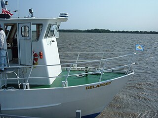
The Forts Ferry Crossing is a ferry system on the Delaware River that serves Forts DuPont and Delaware in Delaware and Fort Mott in Pennsville Township, New Jersey. It is operated by the Delaware River and Bay Authority (DRBA). The ferry operates on weekends from the last weekend in April until the last weekend in September and Wednesday to Sunday between June and Labor Day.

Transportation in New Jersey utilizes a combination of road, rail, air, and water modes. New Jersey is situated between Philadelphia and New York City, two major metropolitan centers of the Boston-Washington megalopolis, making it a regional corridor for transportation. As a result, New Jersey's freeways carry high volumes of interstate traffic and products. The main thoroughfare for long distance travel is the New Jersey Turnpike, the nation's fifth-busiest toll road. The Garden State Parkway connects the state's densely populated north to its southern shore region. New Jersey has the 4th smallest area of U.S. states, but its population density of 1,196 persons per sq. mi causes congestion to be a major issue for motorists.
A total of at least three special routes of U.S. Route 9 (US 9) exist and at least seven have been deleted.

The Port of Salem is a shallow-draft port in the vicinity of the Salem River Cut-Off on the Salem River in Salem, New Jersey in the United States about 2 miles (3.2 km) east of the Delaware River and about 54 miles (87 km) from the Atlantic Ocean. It was re-designated a port of entry in 1984 and became a foreign trade zone (FTZ) in 1987. Transloading operations include the handling of a variety of bulk cargo, notably of construction aggregate, break bulk cargo, and containers for clothing, fishing apparel, agricultural produce, and other consumer goods, and has at times involved lighterage. It is operated under the auspices of the South Jersey Port Corporation. The port is envisioned as being a component of the supply chain for the development of windpower in the Atlantic Ocean off the coast of New Jersey.