Delaware Water Gap

Last updated
Delaware Water Gap
Delaware Water Gap.jpg
Delaware Water Gap seen from the Appalachian Trail at Mount Minsi in Pennsylvania with I-80 on the left
Elevation 335 ft (102 m) [1]
Traversed byI-80.svg I-80, PA-611.svg PA 611, Delaware–Lackawanna Railroad
Location New Jersey and Pennsylvania, U.S.
Range Blue Mountains/Kittatinny Ridge
Coordinates 40°58′3.7″N75°7′11.6″W / 40.967694°N 75.119889°W / 40.967694; -75.119889
Topo map Portland, Stroudsburg

Delaware Water Gap is a water gap on the border of the U.S. states of New Jersey and Pennsylvania where the Delaware River cuts through a large ridge of the Appalachian Mountains. [2]

Contents

The gap makes up the southern portion of the Delaware Water Gap National Recreation Area, which is used primarily for recreational purposes, such as canoeing, fishing, hiking, and rock climbing. Though the US National Park Service manages the National Recreation Area, portions of the water gap are also patrolled by New Jersey Division of Parks and Forestry.

The park does not charge an entrance fee but does have expanded amenity fees, including vehicle season and daily passes, bicycles amenity fees, and charges for beach use. Most of the park is open 24-hours a day, with most day-use areas within the park open sunrise to sunset (such as trailhead parking lots, Millbrook Village, and all picnic areas). [3]

Geology

Worthington State Forest seen from a campsite WorthingtonStateForest.jpg
Worthington State Forest seen from a campsite
The Delaware Water Gap with the Pennsylvania town of the same name visible in the lower left next to the I-80 crossing. Del Water Gap.jpg
The Delaware Water Gap with the Pennsylvania town of the same name visible in the lower left next to the I-80 crossing.

A water gap is a geological feature where a river cuts through a mountain ridge. The Delaware Water Gap formed 500 million years ago [4] when quartz pebbles from mountains in the area were deposited in a shallow sea. The Martinsburg Shale on the eastern side of what was to be Kittatinny Mountain was uplifted 450 million years ago when a chain of volcanic islands collided with proto-North America. These islands slid over the North American plate, and deposited rock on top of the plate, forming the Highlands and Kittatinny Valley.

About 400 million years ago, a small continent collided with proto-North America. The heat from the pressure melted the quartzite, which allowed it to bend the quartz pebbles. This layer was then uplifted and cracked over thousands of years. During this period, the Delaware River slowly cut its path down through the shattered and cracked quartzite. If the quartzite had not been cracked, the river would not have been able to cut its path through the mountain to form the gap. [5]

Millions of years of rain, ice, snow, and wind erosion shaped the area. The Wisconsin glaciation, which occurred between 21,000 BCE and 13,000 BCE, covered the entire Kittatinny Ridge and ended near Belvidere. When the glaciers retreated, the existing gap assumed its present form. [6]

The mountain is composed of Silurian shawangunk conglomerate. This is gray quartzite, which makes the mountain highly resistant to weathering. The Silurian High Fall formation of sandstone is on the western side of the gap near the base. The eastern side of the gap has Ordovician Martinsburg shale. Sedimentary rock is along the river. The Bloomsburg Red Beds, a red shale, are at the gap under Dunnfield Creek.

The Delaware Water Gap is nearly 1,300 feet (400 m) wide at river level and about 1 mile (1.6 km) wide from the top of Mt. Tammany to the top of Mt. Minsi. It is more than 1,200 feet (370 m) from mountaintop to the river surface. [7] The river through the gap is 290 feet (88 m) above sea level.

The ridge of the Appalachians that the Delaware River crosses is called the Blue Mountains in Pennsylvania and the Kittatinny Ridge in Warren County, New Jersey. This is the first major ridge of the Appalachian mountains. New Jersey's mountain is Mount Tammany, named after the Lenni-Lenape Chief Tamanend. The Pennsylvania mountain is Mount Minsi, named after the Native American tribe of the area. The summit of Tammany is 1,540 ft (470 m) above sea level.

Flora and fauna

Delaware Water Gap seen from the Delaware River Viaduct in Knowlton Township, New Jersey in June 2021 2021-06-16 09 10 03 View of the Delaware Water Gap from the Delaware River Viaduct over the Delaware River on the border of Knowlton Township, Warren County, New Jersey and Upper Mount Bethel Township, Northampton County, Pennsylvania.jpg
Delaware Water Gap seen from the Delaware River Viaduct in Knowlton Township, New Jersey in June 2021

In 1739, America's first botanist, John Bartram of Philadelphia, followed the course of the Delaware River in his search for American trees, evergreens and shrubs to supply new species that were formerly unknown to British naturalists. These gardeners waited months for shipments of saplings, seeds, and pinecones to be sent by sea that were then introduced into English gardens. Using Native American trails, Bartram rode on horseback through the Water Gap, which allowed entry to the lands beyond. [8]

A northern deciduous forest cloaks the slopes of the Delaware Water Gap. Hardwood species comprising the forest include various oaks, hickories, maples, ash, elm, cherry, walnut, birch, sycamore, and beech. Coniferous species include Eastern White Pine, Pitch Pine, Eastern Red Cedar, and Eastern Hemlock.

Black bear, white-tailed deer, gray squirrels, red squirrels, raccoons, gray fox, fisher, and chipmunks are some of the forest species of the area. Hunting of deer, turkey, and small game is permitted, following NJ Fish & Wildlife regulations, but is not permitted at any of the campsites. [9]

Shad migrate up the river through the gap in the spring. Other fish include bass, trout, carp, and walleye. Dunnfield Creek has been designated a "Wild Trout Stream" because of its natural brook trout fishery. [10]

Timber rattlesnakes and copperheads also inhabit the rocky areas of the mountain. Salamanders are found in the moist areas of the forest. Eastern prickly pear cactus also grows on the mountain near the red dot trail on the south eastern facing slope halfway up the mountain.

Transportation

Delaware Water Gap as seen from Knowlton Township, New Jersey in Warren County Delaware Water Gap from I 80.jpg
Delaware Water Gap as seen from Knowlton Township, New Jersey in Warren County

Steep rock walls prohibited foot travel through the gap until a road was built on the Pennsylvania side of the river in 1793. In 1830, a road was built on the New Jersey side through the gap and north toward Pahaquarry. Interstate 80 passes through the gap on the New Jersey side as of the early 1970s via the Delaware Water Gap Toll Bridge, and occupies the former right-of-way of the New York, Susquehanna and Western Railway.

The Pennsylvania portion of the New Jersey Cut-Off mainline of the Delaware, Lackawanna and Western Railroad comes into Slateford, Pennsylvania. The Pennsylvania Northeast Regional Railroad Authority owns the trackage in the Water Gap area. Delaware-Lackawanna Railroad operates the lines that run through the gap. Pennsylvania Route 611 occupies the right-of-way of a former trolley line.

Martz Trailways has a bus station within the municipal boundaries of Delaware Water Gap. There are also numerous jitneys that stop there on their route between New York City and towns further areas such as Hazleton, Wilkes-Barre, and Scranton.

Tocks Island and the National Park Service

In 1962, the Congress authorized the building of a dam across the Delaware River at Tocks Island, upstream of the water gap. Meant to control hurricane-related flooding, it was never built. The land for the proposed reservoir, which had already been purchased, was used to create the Delaware Water Gap National Recreation Area in 1965. [11]

There are two visitor centers, one in New Jersey near the Delaware River bridge and the other in Dingman's Ferry, Pennsylvania. Headquarters is located on River Road in Pennsylvania. The New Jersey side of the gap is also protected within Worthington State Forest, a forest wholly contained within the recreation area.

Hiking trails

TrailLength (one-way)Elevation ChangeDifficulty Blaze
Mt. Tammany1.2 miles (1.9 km)1,201 feet (366 m)Difficult Red 
Pahaquarry1.7 miles (2.7 km)1,201 feet (366 m)Difficult Blue 
Dunnfield Creek3.5 miles (5.6 km)966 feet (294 m)Moderate Green 

Mount Tammany Trail

One of two trails leading up 1,200 vertical feet to the summit of Mt. Tammany. Once completed, one can see views of Mt. Minsi in Pennsylvania on the other side of the gap. [12]

Pahaquarry Trail

The second trail to the top of Mt. Tammany. The most challenging hike in the park is to combine the Red Dot and Blue Blaze trails into a 3 mi (4.8 km) loop. Park Services suggest ascending the Red Dot and descending the Blue Blaze, and the Blue trail is less steep. [13]

Dunnfield Creek Trail

Dunnfield Creek Trail departs from the Appalachian Trail above the Delaware River, follows the creek for two-thirds of its length with numerous stream crossings. The trail then climbs a ravine to rejoin the Appalachian Trail at Sunfish Pond. [14] [15] [16]

Appalachian Trail

The trails at Mt. Tammany near Kittatinny Point, NJ Mt. Tammany Trail Map.webp
The trails at Mt. Tammany near Kittatinny Point, NJ

Running from Springer Mountain, Georgia to Mt. Katahdin in Baxter State Park, Maine, the Appalachian Trail enters the Delaware Water Gap at the Delaware River on the Route 80 Bridge. It goes to Sunfish Pond, and continues northeast to Stokes State Forest. The trail crosses Route 206 and continues along the ridgeline of the Kittatinny Mountains to High Point State Park, eventually entering New York. Of the 2,174 miles (3,499 km) of trail, 28 miles (45 km) are within the Delaware Water Gap National Recreation Area. [17]

Additional trails also traverse through the area.

Rock climbing

The gap is a popular place to rock-climb in New Jersey. The climbs are 150 to 300 ft (46 to 91 m). Most climbing is done on the New Jersey side due to easier access. There are about one hundred climbs on the New Jersey side. Climbs range from 5.1 to 5.14 on the Yosemite Decimal System scale. Climbers follow the gray dot trail along Route 80, then pass the large rock face, then go up the path to the route they choose.

Beginning in 2010, the Pennsylvania side has been periodically closed to climbing during the nesting season for the endangered peregrine falcons. [18] [19] [20]

Boy Scout camps

The Easton Area Council of the Boy Scouts of America operated Weygadt Scout Reservation at the base of Mount Tammany from 1931 until 1968. [21] The Reservation was originally home to two Scout camps—the Easton Council's Camp Weygadt on the southern part of the reservation and the Minsi Trails Council's Camp Minsi on the northern section of the reservation. [21] [22] In the later part of the 1930s, the Bethlehem Council moved their camp to the Poconos, and the entire reservation in the Water Gap became Camp Weygadt. Camp Minsi is now located in Pocono Summit, Pennsylvania, on the shores of Stillwater Lake.

Pahaquarra Boy Scout Camp was located on the New Jersey side of the Delaware Water Gap on Old Mine Road at the abandoned Pahaquarry Copper Mine. The camp served Boy Scouts from the George Washington Council. Just north of this camp was Camp Cowaw Boy Scout Camp which served Raritan Council Boy Scouts.

See also

Related Research Articles

<span class="mw-page-title-main">Tocks Island Dam controversy</span>

A 1950s proposal to construct a dam near Tocks Island across the Delaware River was met with considerable controversy and protest. Tocks Island is located in the Delaware River a short distance north from the Delaware Water Gap. In order to control damaging flooding and provide clean water to supply New York City and Philadelphia, the U.S. Army Corps of Engineers proposed building a dam. When completed, the Tocks Island Dam would have created a 37-mile (60-km) long lake between Pennsylvania and New Jersey, with depths of up to 140 feet. This lake and the land surrounding were to be organized as the Tocks Island National Recreation Area. Although the dam was never built, 72,000 acres (291 km²) of land were acquired by condemnation and eminent domain. This incited environmental protesters and embittered local residents displaced by the project's preparations when their property was condemned. After the Tocks Island Dam project was withdrawn, the lands acquired were transferred to the oversight of the National Park Service which reorganized them to establish the Delaware Water Gap National Recreation Area.

<span class="mw-page-title-main">Worthington State Forest</span> State forest in New Jersey

Worthington State Forest is a state forest located in Warren County, New Jersey within the Delaware Water Gap National Recreation Area, just north of the water gap in the Skylands Region of the state. It covers an area of 6,660 acres (27.0 km2) and stretches for more than 7 miles (11 km) along the Kittatinny Ridge near Columbia.

<span class="mw-page-title-main">Kittatinny Mountain</span> Ridge in northwestern New Jersey

Kittatinny Mountain is a long ridge traversing primarily across Sussex County in northwestern New Jersey, running in a northeast-southwest axis, a continuation across the Delaware Water Gap of Pennsylvania's Blue Mountain. It is the first major ridge in the far northeastern extension of the Ridge and Valley province of the Appalachian Mountains, and reaches its highest elevation, 1,803 feet, at High Point in Montague Township. Kittatinny Mountain forms the eastern side of Wallpack Valley; the western side comprises the Wallpack Ridge (highest elevation: 928 feet above sea level.

<span class="mw-page-title-main">Mount Tammany</span> Mountain in New Jersey, United States

Mount Tammany is the southernmost peak of the Kittatinny Mountains, in Knowlton Township, Warren County, New Jersey, United States. It is 1,526 feet (465 m) tall, and forms the east side of the Delaware Water Gap. Across the Gap is Mount Minsi, on the Pennsylvania side of the river. The mountain is named after the Lenni Lenape chief Tamanend. It lies along the Appalachian Trail in Worthington State Forest. The summit can be hiked by the Mount Tammany Trail ascending the western slopes. The trailhead is accessible from Interstate 80.

<span class="mw-page-title-main">Blue Mountain (Pennsylvania)</span> Ridge in Pennsylvania, United States

Blue Mountain, Blue Mountain Ridge, or the Blue Mountains of Pennsylvania is a ridge of the Appalachian Mountains in eastern Pennsylvania. Forming the southern and eastern edge of the Ridge-and-Valley Appalachians physiographic province in Pennsylvania, Blue Mountain extends 150 miles (240 km) from the Delaware Water Gap on the New Jersey border in the east to Big Gap in Franklin County in south-central Pennsylvania at its southwestern end.

<span class="mw-page-title-main">Delaware Water Gap National Recreation Area</span> Protected area

Delaware Water Gap National Recreation Area is a 70,000-acre (28,000 ha) national recreation area administered by the National Park Service in northwest New Jersey and northeast Pennsylvania. It is centered around a 40-mile (64 km) stretch of the Delaware River designated the Middle Delaware National Scenic River. At the area's southern end lays the Delaware Water Gap, a dramatic mountain pass where the river cuts between Blue Mountain and Kittatinny Mountain.

Old Mine Road is a road in New Jersey and New York said to be one of the oldest continuously used roads in the United States of America. At a length of 104 miles (167 km), it stretches from the Delaware Water Gap National Recreation Area to the vicinity of Kingston, New York.

<span class="mw-page-title-main">Skylands Region</span> Region of New Jersey, US

The Skylands Region is a region of New Jersey located in the northern and central parts of the state. It is one of six tourism regions established by the New Jersey State Department of Tourism; the others are Gateway Region, Greater Atlantic City Region, the Southern Shore Region, the Delaware River Region, and the Shore Region.

<span class="mw-page-title-main">Stokes State Forest</span>

Stokes State Forest is a state park located in Sandyston, Montague and Frankford in Sussex County, New Jersey, United States. Stokes comprises 16,447 acres (66.56 km2) of mountainous woods in the Kittatinny Mountains, extending from the southern boundary of High Point State Park southwestward to the eastern boundary of the Delaware Water Gap National Recreation Area. The park is operated and maintained by the New Jersey Division of Parks and Forestry.

The Appalachian National Scenic Trail spans 14 U.S. states over its roughly 2,200 miles (3,500 km): Georgia, North Carolina, Tennessee, Virginia, West Virginia, Maryland, Pennsylvania, New Jersey, New York, Connecticut, Massachusetts, Vermont, New Hampshire, and Maine. The southern end is at Springer Mountain, Georgia, and it follows the ridgeline of the Appalachian Mountains, crossing many of its highest peaks and running almost continuously through wilderness before reaching the northern end at Mount Katahdin, Maine.

<span class="mw-page-title-main">Shawangunk Formation</span> Bedrock unit in eastern Pennsylvania, New Jersey, and New York

The Silurian Shawangunk Formation is a mapped bedrock unit in eastern Pennsylvania, New Jersey, and New York. It is named for the Shawangunk Ridge for which it is the dominant rock type. The division of the Shawangunk between the Tuscarora Formation and Clinton Group has not been conclusively determined. The shift of nomenclature currently has the divide between Hawk Mountain and Lehigh Gap.

<span class="mw-page-title-main">Kittatinny Valley</span>

The Kittatinny Valley is a section of the Great Appalachian Valley in Sussex and Warren counties in northwestern New Jersey that is bounded on the northwest by Kittatinny Mountain, and in the southeast by the New Jersey Highlands region. The valley is roughly 40 miles (64 km) long, with a breadth of 10 to 13 miles.

<span class="mw-page-title-main">Pahaquarry Copper Mine</span> United States historic place

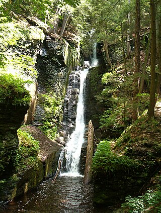
The Pahaquarry Copper Mine is an abandoned copper mine located on the west side of Kittatinny Mountain presently in Hardwick Township in Warren County, New Jersey in the United States. Active mining was attempted for brief periods during the mid-eighteenth, mid-nineteenth, and early twentieth centuries but was never successful despite developments in mining technology and improving mineral extraction methods. Such ventures were not profitable as the ore extracted proved to be of too low a concentration of copper. This site incorporates the mining ruins, hiking trails, and nearby waterfalls, and is located within the Delaware Water Gap National Recreation Area and administered by the National Park Service. It was added to the National Register of Historic Places in 1980 as a contributing property to the Old Mine Road Historic District.

<span class="mw-page-title-main">Minisink</span>

The Minisink or Minisink Valley is a loosely defined geographic region of the Upper Delaware River valley in northwestern New Jersey, northeastern Pennsylvania and New York.

Rattlesnake Mountain is a peak of the Kittatinny Mountains in Sussex County, New Jersey, United States. The mountain stands 1,489 feet (454 m) high. It lies along the Appalachian Trail in the Delaware Water Gap National Recreation Area. Located near the junction of Mullins Rd. (unmarked) and the trail. Rattlesnakes like any of the rocky areas of the Kittatinny Ridge, for sunning themselves.

Paradise Mountain, or Mount Paradise is a peak of the Kittatinny Mountains in Sussex County, New Jersey, United States. The mountain is 1,606 feet (490 m) tall. It lies along the Appalachian Trail in the Delaware Water Gap National Recreation Area.

Bird Mountain is a peak of the Kittatinny Mountains in Sussex County, New Jersey, United States. The mountain is 1,500 feet (457 m) tall. It lies near the Appalachian Trail in the Delaware Water Gap National Recreation Area, and overlooks Quick's Pond to the east.

Catfish Mountain is a peak of the Kittatinny Mountains in Warren County, New Jersey, United States. The mountain stands 1,560 feet (475 m) in height. It lies along the Appalachian Trail in the Delaware Water Gap National Recreation Area. Catfish Pond is to the southwest; it is drained by Yards Creek, which flows through Catfish Pond Gap.

<span class="mw-page-title-main">Mount Tammany Fire Road</span> Road on Kittatinny Mountain, New Jersey, U.S.

The Mount Tammany Fire Road is an unpaved 4.5-mile (7.2 km) road on the eastern ridgeline of Kittatinny Mountain from Upper Yards Creek Reservoir to Mount Tammany, the 1,527-foot (465 m) prominence on the New Jersey side of the Delaware Water Gap. The fire road, located within Worthington State Forest, is maintained as a firebreak and access road for wildfire suppression efforts by the New Jersey Forest Fire Service. There are three helispots along the fire road used by the Forest Fire Service.

References

  1. "Delaware Water Gap". Geographic Names Information System . United States Geological Survey. Archived from the original on 2022-01-28. Retrieved 2008-08-29.
  2. "NPS Geodiversity Atlas—Delaware Water Gap National Recreation Area, New Jersey and Pennsylvania (U.S. National Park Service)". www.nps.gov. Archived from the original on 2022-06-21. Retrieved 2022-06-21.
  3. Bushkill, Mailing Address: Delaware Water Gap National Recreation Area P. O. Box 2; Us, PA 18324 Phone: 570 426-2452 Contact. "Basic Information - Delaware Water Gap National Recreation Area (U.S. National Park Service)". www.nps.gov. Archived from the original on 2022-06-19. Retrieved 2022-06-21.{{cite web}}: CS1 maint: numeric names: authors list (link)
  4. "Delaware Water Gap". Appalachian Trail Conservancy |. 2019-06-28. Archived from the original on 2022-06-24. Retrieved 2022-06-21.
  5. "Delaware water Gap National Recreation Area, The geology of the Delaware Water Gap" (PDF). Archived (PDF) from the original on 2020-10-21. Retrieved 2020-04-29.
  6. "Wisconsin Glacial Stage | Time, Map, & Facts | Britannica". www.britannica.com. Archived from the original on 2022-06-21. Retrieved 2022-06-21.
  7. Guide to the Gap (nps.gov)
  8. The Brother Gardeners: Botany, Empire and the birth of an obsession, by Andrea Wulf. Publisher Alfred A. Knopf New York 2009. Pg 77
  9. "NJDEP | Worthington State Forest | New Jersey State Park Service". nj.gov. Archived from the original on 2022-06-21. Retrieved 2022-06-21.
  10. "NJDEP | Worthington State Forest | New Jersey State Park Service". nj.gov. Archived from the original on 2022-06-21. Retrieved 2022-06-21.
  11. Bushkill, Mailing Address: Delaware Water Gap National Recreation Area P. O. Box 2; Us, PA 18324 Phone: 570 426-2452 Contact. "History & Culture - Delaware Water Gap National Recreation Area (U.S. National Park Service)". www.nps.gov. Retrieved 2024-01-11.{{cite web}}: CS1 maint: numeric names: authors list (link)
  12. Bushkill, Mailing Address: Delaware Water Gap National Recreation Area P. O. Box 2; Us, PA 18324 Phone: 570 426-2452 Contact. "Mt. Tammany Trail (Red Dot) - Delaware Water Gap National Recreation Area (U.S. National Park Service)". www.nps.gov. Archived from the original on 2022-06-21. Retrieved 2022-06-21.{{cite web}}: CS1 maint: numeric names: authors list (link)
  13. Bushkill, Mailing Address: Delaware Water Gap National Recreation Area P. O. Box 2; Us, PA 18324 Phone: 570 426-2452 Contact. "Pahaquarry Trail (Blue Blaze) - Delaware Water Gap National Recreation Area (U.S. National Park Service)". www.nps.gov. Archived from the original on 2022-06-21. Retrieved 2022-06-21.{{cite web}}: CS1 maint: numeric names: authors list (link)
  14. "NJDEP | Worthington State Forest | New Jersey State Park Service". nj.gov. Archived from the original on 2022-06-21. Retrieved 2022-06-21.
  15. "Dunnfield Creek Natural Area - Kids Outdoors". kids.outdoors.org. Archived from the original on 2021-10-22. Retrieved 2022-06-21.
  16. Bushkill, Mailing Address: Delaware Water Gap National Recreation Area P. O. Box 2; Us, PA 18324 Phone: 570 426-2452 Contact. "Dunnfield Creek Trail - Delaware Water Gap National Recreation Area (U.S. National Park Service)". www.nps.gov. Archived from the original on 2022-06-21. Retrieved 2022-06-21.{{cite web}}: CS1 maint: numeric names: authors list (link)
  17. Bushkill, Mailing Address: Delaware Water Gap National Recreation Area P. O. Box 2; Us, PA 18324 Phone: 570 426-2452 Contact. "Appalachian National Scenic Trail - Delaware Water Gap National Recreation Area (U.S. National Park Service)". www.nps.gov. Archived from the original on 2022-06-21. Retrieved 2022-06-21.{{cite web}}: CS1 maint: numeric names: authors list (link)
  18. Staff Writer. "Rare falcons nest in Delaware Water Gap". New Jersey Herald. Archived from the original on 2023-03-28. Retrieved 2023-03-28.
  19. "Falcons close popular hiking, climbing trail in Pennsylvania". NORTHEAST EXPLORER. 2016-01-28. Archived from the original on 2023-03-28. Retrieved 2023-03-28.
  20. "Area Off Limits for Falcons in the Poconos". wnep.com. February 26, 2018. Archived from the original on 2023-03-28. Retrieved 2023-03-28.
  21. 1 2 "NPS.GOV - History of the Delaware Watergap" (PDF). Archived (PDF) from the original on 2010-09-28. Retrieved 2010-06-01.
  22. "Camp Weygadt History Website". Archived from the original on 2011-01-08. Retrieved 2010-06-01.