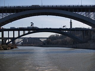
The Harlem River is an 8-mile (13 km) tidal strait in New York, United States, flowing between the Hudson River and the East River and separating the island of Manhattan from the Bronx on the New York mainland.

Forsyth Street runs from Houston Street south to Henry Street in the New York City borough of Manhattan. The street was named in 1817 for Lt. Colonel Benjamin Forsyth.
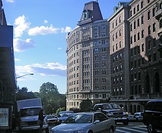
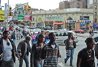
125th Street, co-named Martin Luther King Jr. Boulevard, is a two-way street that runs east–west in the New York City borough of Manhattan, from First Avenue on the east to Marginal Street, a service road for the Henry Hudson Parkway along the Hudson River in the west. It is often considered to be the "Main Street" of Harlem.

Manhattan Valley is a neighborhood in the northern part of Upper West Side in Manhattan, New York City. It is bounded by West 110th Street to the north, Central Park West to the east, West 96th Street to the south, and Broadway to the west.

Third Avenue is a north-south thoroughfare on the East Side of the New York City borough of Manhattan, as well as in the center portion of the Bronx. Its southern end is at Astor Place and St. Mark's Place. It transitions into Cooper Square, and further south, the Bowery, Chatham Square, and Park Row. The Manhattan side ends at East 128th Street. Third Avenue is two-way from Cooper Square to 24th Street, but carries only northbound (uptown) traffic while in Manhattan above 24th Street; in the Bronx, it is again two-way. However, the Third Avenue Bridge carries vehicular traffic in the opposite direction, allowing only southbound vehicular traffic, rendering the avenue essentially non-continuous to motor vehicles between the boroughs.
110th Street is a street in the New York City borough of Manhattan. It is commonly known as the boundary between Harlem and Central Park, along which it is known as Central Park North. In the west, between Central Park West/Frederick Douglass Boulevard and Riverside Drive, it is co-signed as Cathedral Parkway.
Vanderbilt Avenue is the name of three thoroughfares in the New York City boroughs of Brooklyn, Manhattan, and Staten Island. They were named after Cornelius Vanderbilt (1794–1877), the builder of Grand Central Terminal in Midtown Manhattan.
Fordham Road is a major thoroughfare in the Bronx, New York City, that runs west-east from the Harlem River to Bronx Park. Fordham Road houses the borough's largest and most diverse shopping district. It geographically separates the geopolitical North Bronx from the South Bronx.

The Manhattan Waterfront Greenway is a waterfront greenway for walking or cycling, 32 miles (51 km) long, around the island of Manhattan, in New York City. The largest portions are operated by the New York City Department of Parks and Recreation. It is separated from motor traffic, and many sections also separate pedestrians from cyclists. There are three principal parts — the East, Harlem and Hudson River Greenways.

Dyckman Street, occasionally called West 200th Street, is a street in the Inwood neighborhood of Manhattan, New York City. It is commonly considered to be a crosstown street because it runs from the Hudson River to the Harlem River and intersects Broadway. However, in its true geographical orientation, Dyckman Street runs roughly from north-northwest to south-southeast, and the majority of the street that lies southeast of Broadway runs closer to a north-south direction than east-west.
The West Side of Manhattan refers to the side of Manhattan Island that abuts the Hudson River and faces the U.S. state of New Jersey. The West Side is home to several famed New York City locations, including Fifth Avenue, Central Park, and lower Broadway. The major neighborhoods on the West Side are Inwood, Hudson Heights, Washington Heights, West Harlem, Morningside Heights, Manhattan Valley, Upper West Side, Hell's Kitchen, Chelsea, West Village, SoHo, and Tribeca. The 8th Avenue and West Side subway lines connect all parts of the West Side.

The New York, Westchester and Boston Railway Company, was an electric commuter railroad in the Bronx and Westchester County, New York from 1912 to 1937. It ran from the southernmost part of the South Bronx, near the Harlem River, to Mount Vernon with branches north to White Plains and east to Port Chester. From 1906, construction and operation was under the control of the New York, New Haven & Hartford Railroad (NH) until its bankruptcy in 1935.

155th Street is a crosstown street separating the Harlem and Washington Heights neighborhoods, in the New York City borough of Manhattan. It is the northernmost of the 155 crosstown streets mapped out in the Commissioner's Plan of 1811 that established the numbered street grid in Manhattan. The street consists of a "high portion" which is a major artery through the area, as well as a lesser-used "low portion".

The 178th and 179th Street Tunnels are two disused vehicular tunnels in Upper Manhattan in New York City. Originally conceived and constructed under the auspices of Robert Moses, the twin tunnels have been superseded by the Trans-Manhattan Expressway in Washington Heights, which itself runs through a cut with high-rise apartments built over it in places.

The East River Greenway is an approximately 9.44-mile-long (15.19 km) foreshoreway for walking or cycling on the east side of the island of Manhattan on the East River. It is part of the Manhattan Waterfront Greenway. The largest portions are operated by the New York City Department of Parks and Recreation. It is separated from motor traffic, and many sections also separate pedestrians from cyclists. The greenway is parallel to the Franklin D. Roosevelt East River Drive for a majority of its length.

Midtown South is a macro-neighborhood of the borough of Manhattan in New York City, generally characterized as constituting the southern portion of Midtown Manhattan. Midtown Manhattan hosts over 700,000 daily employees as a busy hub for workers, residents, and tourists. The Empire State Building, the Flatiron Building, Pennsylvania Station, Madison Square Garden, the Macy's Herald Square flagship store, Koreatown, and NYU Langone Medical Center are all located in Midtown South.