Ettrick, Virginia

Last updated

Ettrick, Virginia
CDP
Ettrick and VSU.jpg
Ettick historic marker and steps to VSU, viewed from Campbell's Bridge over the Appomattox River
VAMap-doton-Ettrick.PNG
Location of Ettrick, Virginia
Coordinates: 37°14′34″N77°25′32″W / 37.24278°N 77.42556°W / 37.24278; -77.42556
CountryUnited States
State Virginia
County Chesterfield
Area
  Total3.0 sq mi (7.8 km2)
  Land2.9 sq mi (7.6 km2)
  Water0.08 sq mi (0.2 km2)
Elevation
105 ft (32 m)
Population
 (2020)
  Total7,241
  Density2,400/sq mi (930/km2)
Time zone UTC−5 (Eastern (EST))
  Summer (DST) UTC−4 (EDT)
FIPS code 51-26128 [1]
GNIS feature ID1496888 [2]

Ettrick is a census-designated place (CDP) in Chesterfield County, Virginia, United States. Per the 2020 census, the population was 7,241. [3] The town is home to Virginia State University and the Petersburg Amtrak train station.

Contents

Most of Ettrick has a Petersburg mailing address, ZIP code 23803, although the community is not part of the city of Petersburg.

History

'On Ettricks' Appomatox River, by Frances Benjamin Johnston, 1933 On Ettricks Island, Petersburg, Dinwiddie County, Virginia. Street.jpg
'On Ettricks' Appomatox River, by Frances Benjamin Johnston, 1933

Ettrick was named around 1765 by the foreign merchant Neil Buchanan, who dubbed the eventual village Ettrick Banks for its similarities to his native Ettrick area of Selkirk, Scotland. [4]

Capt. Christopher Newport led expeditions in this area. Near Petersburg, which developed as an industrial city, Ettrick also developed industry. It had cotton mills, as it was on the Fall Line and could use water power.

During the American Civil War, the Confederate Army established a large hospital here. In the late nineteenth century, the biracial state legislature established the first state-supported black college, founded here in 1882 as Virginia Normal and Collegiate Institute (now Virginia State University). John Mercer Langston, who founded the Law School at Howard University, was its first president. He was elected as a US Congressman from Virginia from here. [4] Vawter Hall and Old President's House was listed on the National Register of Historic Places in 1980. [5]

One of the longstanding landmarks is Campbell's Bridge, first built around 1810. It has been reconstructed several times and is the only direct thoroughfare from the village across the river into Petersburg.

Ettrick today

Currently there is an active Historical Society, gathering for many annual events including a "Burns Night", which celebrates the life's works of the Scottish poet Robert Burns. The evening includes a traditional dinner of haggis. Heritage Day is observed every second Saturday in April, complete with pipe and drums, food, clans, and Native American, Civil War, and pirate re-enactors.

Geography

Ettrick is located at 37°14′34″N77°25′32″W / 37.24278°N 77.42556°W / 37.24278; -77.42556 (37.242750, −77.425418). [6]

According to the United States Census Bureau, the CDP has a total area of 3.0 square miles (7.8 km2), of which 2.9 square miles (7.6 km2) is land and 0.08 square miles (0.2 km2), or 2.48%, is water.

Demographics

Historical population
CensusPop.Note
1980 4,890
1990 5,2908.2%
2000 5,6276.4%
2010 6,68218.7%
2020 7,2418.4%
U.S. Decennial Census [7]
2010 [8] 2020 [9]

2020 census

Ettrick CDP, Virginia – Racial and ethnic composition
Note: the US Census treats Hispanic/Latino as an ethnic category. This table excludes Latinos from the racial categories and assigns them to a separate category. Hispanics/Latinos may be of any race.
Race / Ethnicity (NH = Non-Hispanic)Pop 2010 [8] Pop 2020 [9] % 2010% 2020
White alone (NH)1,1151,57216.69%21.71%
Black or African American alone (NH)5,1604,95777.22%68.46%
Native American or Alaska Native alone (NH)16190.24%0.26%
Asian alone (NH)21890.31%1.23%
Pacific Islander alone (NH)020.00%0.03%
Some Other Race alone (NH)13310.19%0.43%
Mixed Race or Multi-Racial (NH)1642992.45%4.13%
Hispanic or Latino (any race)1932722.89%3.76%
Total6,6827,241100.00%100.00%

2000 Census

As of the census [1] of 2000, there were 5,627 people, 1,517 households, and 989 families residing in the CDP. The population density was 1,884.0 people per square mile (726.6/km2). There were 1,673 housing units at an average density of 560.1/sq mi (216.0/km2). The racial makeup of the CDP was 21.49% White, 75.14% African American, 0.32% Native American, 0.52% Asian, 0.09% Pacific Islander, 1.00% from other races, and 1.46% from two or more races. Hispanic or Latino of any race were 2.22% of the population.

There were 1,517 households, out of which 32.3% had children under the age of 18 living with them, 38.4% were married couples living together, 20.9% had a female householder with no husband present, and 34.8% were non-families. 26.0% of all households were made up of individuals, and 8.8% had someone living alone who was 65 years of age or older. The average household size was 2.51 and the average family size was 3.03.

In the CDP, the population was spread out, with 17.6% under the age of 18, 40.1% from 18 to 24, 20.6% from 25 to 44, 13.0% from 45 to 64, and 8.7% who were 65 years of age or older. The median age was 22 years. For every 100 females, there were 78.6 males. For every 100 females age 18 and over, there were 74.2 males.

The median income for a household in the CDP was $38,470, and the median income for a family was $43,357. Males had a median income of $33,241 versus $28,134 for females. The per capita income for the CDP was $13,251. About 6.7% of families and 11.2% of the population were below the poverty line, including 8.2% of those under age 18 and 6.8% of those age 65 or over.

Notable people

Related Research Articles

<span class="mw-page-title-main">Progress Village, Florida</span> Census-designated place in Florida, United States

Progress Village is a census-designated place (CDP) in Hillsborough County, Florida, United States. Per the 2020 census, the population was 11,188.

<span class="mw-page-title-main">University, Hillsborough County, Florida</span> Census-designated place in Florida, United States

University is an unincorporated census-designated place in Hillsborough County, Florida, United States. The population was 41,163 at the 2010 census, up from 30,736 at the 2000 census. The University of South Florida is located just southeast of the community, within the Tampa city limits. The community is also known as "University West", mainly due to its location in relation to the university. The community is often notoriously referred to by locals as "Suitcase City" due to the high rate of transients.

<span class="mw-page-title-main">Villages of Oriole, Florida</span> Unincorporated place in Florida, United States

Villages of Oriole was a former census-designated place (CDP) and current unincorporated place in Palm Beach County, Florida, United States. The population was 4,758 at the 2000 census.

<span class="mw-page-title-main">Langston, Oklahoma</span> Town in Oklahoma, United States

Langston is a town in Logan County, Oklahoma, United States, and is part of the Oklahoma City Metropolitan Statistical Area. The population was 1,619 as of the 2020 United States census. Langston is home to Langston University, the only historically black college in Oklahoma.

<span class="mw-page-title-main">Dooms, Virginia</span> CDP in Virginia, United States

Dooms is a census-designated place (CDP) in Augusta County, Virginia, United States. The population was 1,327 at the 2010 census. It is part of the Staunton–Waynesboro Micropolitan Statistical Area.

<span class="mw-page-title-main">Jolivue, Virginia</span> Census-designated place in Virginia, United States

Jolivue is a census-designated place (CDP) in Augusta County, Virginia, United States. The population was 1,129 at the 2010 census. It is part of the Staunton–Waynesboro Micropolitan Statistical Area.

<span class="mw-page-title-main">Verona, Virginia</span> CDP in Virginia, United States

Verona is a census-designated place (CDP) in Augusta County, Virginia, United States. The population was 4,239 at the 2010 census. It is part of the Staunton–Waynesboro Micropolitan Statistical Area.

<span class="mw-page-title-main">Bellwood, Virginia</span> CDP in Virginia, United States

Bellwood is a census-designated place (CDP) in Chesterfield County, Virginia, United States. The population was 6,352 at the 2010 census. The community takes its name from Bellwood, one of the James River Plantations.

<span class="mw-page-title-main">Bensley, Virginia</span> CDP in Virginia, United States

Bensley is a census-designated place (CDP) in Chesterfield County, Virginia, United States. It is an inner suburb of Richmond, Virginia. The population was 5,819 at the 2010 census. Bensley Community building is inside of Bensley park. The community building is outside of Bensley, setting in walking distance of the CDP. The community is an old village with no active government. The community is over 100 years old. A new police substation in the village is next to the old Bensley Bermuda Rescue Squad, near DuPont Spruance.

<span class="mw-page-title-main">Chester, Virginia</span> CDP in Virginia, United States

Chester is a census-designated place (CDP) in Chesterfield County, Virginia, United States. Per the 2020 census, the population was 23,414.

<span class="mw-page-title-main">Chesterfield Court House, Virginia</span> Unincorporated community in Virginia, United States

Chesterfield Court House is an unincorporated community and census-designated place that is the county seat of Chesterfield County, Virginia, United States. It was a census-designated place (CDP) at the 2020 census. It was not delineated as a CDP for the 2010 census. The Chesterfield County Courthouse and Courthouse Square are listed in the National Register of Historic Places. The area is also home of the Chesterfield County Government Complex.

<span class="mw-page-title-main">Matoaca, Virginia</span> CDP in Virginia, United States

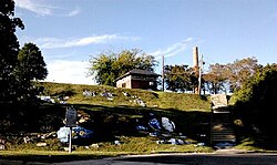
Matoaca is a census-designated place (CDP) in Chesterfield County, Virginia, United States. The population was 2,403 at the 2010 census. It is named after the Pamunkey princess Matoaka who was better known by her nickname "Pocahontas". It was near the site of an Appomattoc village Matoka or Matoks, which was reputedly her girlhood home, and the palace town of the weroansqua Oppussoquionuske.

<span class="mw-page-title-main">Chamberlayne, Virginia</span> Census-designated place in Virginia

Chamberlayne is a census-designated place (CDP) in Henrico County, Virginia, United States. The population was 5,581 at the 2020 census.

<span class="mw-page-title-main">East Highland Park, Virginia</span> Census-designated place in Virginia

East Highland Park is a census-designated place (CDP) in Henrico County, Virginia, in the United States. The population was 15,131 at the 2020 census.

<span class="mw-page-title-main">Montrose, Virginia</span> Census-designated place in Virginia

Montrose is a census-designated place (CDP) in Henrico County, Virginia, United States. The population was 7,909 at the 2020 census.

<span class="mw-page-title-main">Laurel Park, Virginia</span> CDP in Virginia, United States

Laurel Park is a census-designated place (CDP) in Henry County, Virginia, United States. The population was 675 at the 2010 census. It is part of the Martinsville Micropolitan Statistical Area.

Sandy Level is a census-designated place (CDP) in Henry County, Virginia, United States. The population was 484 at the 2010 census, which was a significant decrease from the 689 reported in 2000. It is part of the Martinsville Micropolitan Statistical Area.

<span class="mw-page-title-main">Marietta-Alderwood, Washington</span> Place in Washington, United States

Marietta-Alderwood is a census-designated place (CDP) in Whatcom County, Washington, United States. The population was 3,906 at the 2010 census. Parts of Marietta-Alderwood were annexed into Bellingham in 2019, while the rest remains an unincorporated area.

<span class="mw-page-title-main">Dranesville, Virginia</span> Census-designated place in Virginia, United States

Dranesville is a census-designated place (CDP) in Fairfax County, Virginia, United States. Dranesville is located on the Leesburg Pike at its intersection with Georgetown Pike. The U.S. Census Bureau defines Dranesville as a census-designated place (CDP) with a population of 11,921 as of 2010. At the 2020 Census the population was 11,785.

<span class="mw-page-title-main">Oljato–Monument Valley, Utah</span> CDP in Utah, United States

Oljato-Monument Valley is a census-designated place (CDP) in San Juan County, Utah, United States. The population was 864 at the 2000 census.

References

  1. 1 2 "U.S. Census website". United States Census Bureau . Retrieved January 31, 2008.
  2. "US Board on Geographic Names". United States Geological Survey. October 25, 2007. Retrieved January 31, 2008.
  3. "Ettrick CDP, Virginia". United States Census Bureau . Retrieved December 25, 2022.
  4. 1 2 Jeffrey M. O'Dell, History of Chesterfield County
  5. "National Register Information System". National Register of Historic Places . National Park Service. July 9, 2010.
  6. "US Gazetteer files: 2010, 2000, and 1990". United States Census Bureau. February 12, 2011. Retrieved April 23, 2011.
  7. "Decennial Census by Decade". US Census Bureau.
  8. 1 2 "P2 Hispanic or Latino, and Not Hispanic or Latino by Race – 2010: DEC Redistricting Data (PL 94-171) - Ettrick CDP, Virginia". United States Census Bureau .
  9. 1 2 "P2 Hispanic or Latino, and Not Hispanic or Latino by Race – 2020: DEC Redistricting Data (PL 94-171) - Ettrick CDP, Virginia". United States Census Bureau .
  10. "James Farrior". databaseFootball.com. Archived from the original on October 19, 2012. Retrieved March 25, 2013.
  11. "Rudi Johnson". databaseFootball.com. Archived from the original on May 21, 2013. Retrieved March 25, 2013.
  12. "LANGSTON, John Mercer | US House of Representatives: History, Art & Archives". history.house.gov. Retrieved December 12, 2019.
  13. "Lennie Pond". www.legendsofnascar.com. Retrieved December 12, 2019.