Flora of Door County, Wisconsin

Last updated
Select plants, fungi, and algae found in the county
Balsam-Fir-needles (top) (6255945534).gif
White-Spruce-needles (top).gif
Tamarack Larix laricina Washington Island Wisconsin.jpg
Thuja occidentalis foliage Wisconsin.jpg
Common-Juniper-3.png
Creeping juniper Juniperus horizontalis Washington Island Wisconsin.jpg
Staghorn-Sumac-leaves.gif
Red-Osier-Dogwood-berries.gif
Bunchberry dogwood Cornus canadensis Newport State Park Wisconsin.jpg
Velvet-Leaf-Blueberry.gif
Primula mistassinica.jpg
Wild sarsaparilla Aralia nudicaulis Newport State Park Wisconsin.jpg
Bluebead Clintonia borealis Newport State Park Door County Wisconsin.jpg
Wood Lily (Lilium philadelphicum) (40298058244).jpg
Large-flowered Bellwort Uvularia grandifloria Ellison Bluff Wisconsin.jpg
Smooth Solomons seal Polygonatum biflorum Rock Island State Park Wisconsin.jpg
Canada Mayflower Maianthemum canadense Ellison Bluff Wisconsin.jpg
Starry False Solomons Seal Maianthemum stellatum Europe Bay Woods Wisconsin.jpg
European lily of the valley Convallaria majalis Baileys Harbor Wisconsin.jpg
White trillium Trillium grandiflorum Ellison Bluff Wisconsin.jpg
Yellow Ladys-Slipper Cypripedium parviflorum Ellison Bluff Wisconsin.jpg
Common reed Phragmites australis North Bay Door County Wisconsin.jpg
Close up of Northern Wild Comfrey Cynoglossum boreale Ellison Bluff Wisconsin.jpg
Stickywilly Galium aparine White Cliff Fen and Forest Door County Wisconsin.jpg
Woodland Forget-Me-Nots Myosotis sylvatica Peninsula State Park Wisconsin.jpg
American Starflower Lysimachia borealis Newport State Park Wisconsin.jpg
Lesser fringed gentian Gentianopsis procera Moonlight Bay Bedrock Beach Door County Wisconsin.jpg
Nodding ladys tresses Spiranthes cernua Moonlight Bay Bedrock Beach Door County Wisconsin.jpg
Woodland strawberry Fragaria vesca Washington Island Wisconsin.jpg
Wild Strawberry Whitefish Dunes State Park Wisconsin.jpg
Indian strawberry Duchesnea indica Moonlight Bay Bedrock Beach Door County Wisconsin.jpg
Mitchella repens partridgeberry Liberty Grove Door County Wisconsin.jpg
Multiflora rose Rosa multiflora Moonlight Bay Bedrock Beach Door County Wisconsin.jpg
Silverweed cinquefoil Moonlight Bay Bedrock Beach Door County Wisconsin.jpg
Yellow-Avens-flower.gif
White-Avens-flower-2.gif
Yellow marsh marigold Caltha palustris Baileys Harbor Door County Wisconsin.jpg
Red columbine Aquilegia canadensis Ellison Bluff Wisconsin.jpg
White-Baneberry.gif
Fringed Milkwort Polygala paucifolia Peninsula State Park Wisconsin.jpg
American Speedwell Veronica americana Moonlight Bay Bedrock Beach Wisconsin.jpg
Bellflower (6255462197).gif
Marsh bellflower Campanula aparinoides Ellison Bluff Liberty Grove Door County Wisconsin.jpg
Great blue lobelia Lobelia siphilitica Washington Island Wisconsin.jpg
Maidenstears campion Silene vulgaris Liberty Grove Door County Wisconsin.jpg
Silene latifolia bladder campion Door County Wisconsin.jpg
Water smartweed Persicaria amphibia syn Polygonum amphibium Washington Island Wisconsin.jpg
Common-St.png
Kalm's St. Johns wort Hypericum kalmianum Moonlight Bay Bedrock Beach Door County Wisconsin.jpg
Common-Milkweed-flowers (6255449025).gif
Alpine Cancer Root-1.jpg
Mentha canadensis.jpg
Heal-All.gif
Dwarf Lake Iris (Iris lacustris) (4719635645).jpg
Canada violet Viola canadensis Kangaroo Lake Wisconsin.jpg
Hookedspur violet Viola adunca Moonlight Bay Bedrock Beach Door County Wisconsin.jpg
Viola nephrophylla (4711056912).jpg
Downy yellow violet Viola pubescens Ellison Bluff Wisconsin.jpg
Viola rostrata longspur violet Town of Liberty Grove Door County Wisconsin.jpg
Oxeye-Daisy.gif
Tall-Wild-Lettuce-leaf.gif
Common sowthistle Sonchus oleraceus Mink River Estuary Door County Wisconsin.jpg
Cichorium intybus common chicory Door County Wisconsin.jpg
Spotted knapweed Centaurea stoebe Washington Island Wisconsin.jpg
Daisy-Fleabane.png
Eastern daisy fleabane Erigeron annuus White Cliff Fen and Forest Door County Wisconsin.jpg
Riddell s goldenrod Solidago riddellii Rock Island State Park Wisconsin.jpg
Jack-go-to-bed-at-noon goatsbeard Tragopogon pratensis Gibraltar Door County Wisconsin.jpg
Smooth blue aster Symphyotrichum laeve Washington Island Wisconsin.jpg
European swamp thistle Cirsium palustre Moonlight Bay Bedrock Beach Baileys Harbor Wisconsin.jpg
Bull thistle Cirsium vulgare Fish Creek Door County Wisconsin.jpg
Orange-Hawkweed.gif
Blackeyed Susan Rudbeckia hirta Washington Island Wisconsin.jpg
Spotted Joe Pye weed Eutrochium maculatum Baileys Harbor Wisconsin.jpg
Yarrow.gif
Pussytoes (Antennaria neglecta).jpg
Western pearly everlasting Anaphalis margaritacea Rock Island State Park Wisconsin.jpg
Common Burdock.png
Lyrate Rock Cress Arabidopsis lyrata Europe Bay Woods Wisconsin.jpg
Spreadingpod rockcress Arabis xdivaricarpa Peninsula State Park Wisconsin.jpg
Common evening primrose Oenothera biennis Moonlight Bay Bedrock Beach Door County Wisconsin.jpg
Bastard toadflax Comandra umbellata Washington Island Wisconsin.jpg
Cream pea Lathyrus ochroleucus Bayshore Blufflands Door County Wisconsin.jpg
Carolina vetch Vicia caroliniana Bayshore Blufflands Door County Wisconsin.jpg
Herb Robert Geranium robertianum Potawatomi State Park Wisconsin.jpg
Robert geranium Geranium robertianum Moonlight Bay Bedrock Beach Door County Wisconsin.jpg
Smallflower false foxglove Agalinis paupercula Washington Island Wisconsin.jpg
Wood Betony Pedicularis canadensis Ellison Bluff Wisconsin.jpg
Scarlet Indian paintbrush Castilleja coccinea Baileys Harbor Wisconsin.jpg
Hooded coralroot Corallorhiza striata Baileys Harbor Wisconsin.jpg
Lobelia kalmii Sister Bay Wisconsin.jpg
Sanicula marilandica Gardner Wisconsin.jpg
Cornus racemosa Union Wisconsin.jpg
Berteroa incana Union Wisconsin.jpg
Acer spicatum.jpg
Aralia racemosa Sister Bay.jpg
Cirsium pitcheri Door County Wisconsin.jpg
Sambucus racemosa red elderberry Baileys Harbor Wisconsin.jpg
Ranunculus bulbosus St. Anthonys turnip Egg Harbor Wisconsin.jpg
Rosa blanda Little Sturgeon Wisconsin.jpg
Crataegus punctata Washington Island Wisconsin.jpg
Shepherdia canadensis Potawatomi State Park Wisconsin.jpg
Sedum acre Nasewaupee Wisconsin.jpg
Arceuthobium pusillum Baileys Harbor Wisconsin.jpg
Calamagrostis canadensis Peninsula State Park Wisconsin.jpg
Festuca trachyphylla Ephraim Wisconsin.jpg
Poa compressa Hotz Memorial Town Park Wisconsin.jpg
Poa saltuensis oldpasture bluegrass Sevastopol Door County Wisconsin.jpg
Elymus lanceolatus subsp psammophilus Clay Banks Wisconsin.jpg
Schizachne purpurascens Cave Point Spring Wisconsin.jpg
Carex castanea Mud Lake Wisconsin.jpg
Carex communis Peninsula State Park Wisconsin.jpg
Carex deweyana Peninsula State Park Wisconsin.jpg
Carex eburnea Potawatomi State Park Wisconsin.jpg
Carex hystericina Peninsula State Park Wisconsin.jpg
Carex intumescens greater bladder sedge Sevastopol Door County Wisconsin.jpg
Triglochin maritima Arbter Lake Sevastopol Wisconsin.jpg
Equisetum arvense Door County Wisconsin.jpg
Equisetum variegatum Baileys Harbor Wisconsin.jpg
Equisetum hyemale Sevastopol Wisconsin.jpg
Equisetum x ferrissii Door County Wisconsin.jpg
Equisetum scirpoides Jacksonport Wisconsin.jpg
Gfp-wisconsin-newport-state-park-little-pine-trees.jpg
Selaginella selaginoides club spikemoss Ridges Baileys Harbor Wisconsin.jpg
Selaginella eclipes hidden spikemoss Ridges Baileys Harbor Wisconsin.jpg
Maidenhair-Ferns.gif
Eastern marsh fern Thelypteris palustris Vicinity of Ephraim Door County Wisconsin.jpg
Botrychium multifidum Garrett Bay Wisconsin.jpg
Botrypus virginianus rattlesnake fern Garrett Bay Town of Liberty Grove Door County Wisconsin.jpg
Gymnocarpium robertianum North Bay Wisconsin.jpg
Sulphur Polypore.gif
Pholiota aurivella mushroom at campground in Door County, Wisconsin - Flickr - Jay Sturner.jpg
Cantharellus minor, Small Chanterelle, Potawatomi State Park, Door County, Wisconsin.jpg
Cladonia pyxidata 54677046.jpg
Lecanora thysanophora 48813450.jpg
Dermatocarpon miniatum 6428178.jpg
Boreal oakmoss Evernia mesomorpha Ridges Baileys Harbor Door County Wisconsin.jpg
Chara contraria Europe Lake Wisconsin.jpg

The flora of Door County, Wisconsin comprise a variety of plant species. Geobotanically, Door County belongs to the North American Atlantic Region.

Contents

Plant species lists

As of 2019, 1201 species and hybrids of vascular plants have been identified in the county, [1] including the yellow lady's-slipper Cypripedium parviflorum , the official county flower. [2] 255 unique taxa of mosses, liverworts, and hornworts [3] have been identified in Door County.

Islands

In 2001, species lists were compiled for the county's islands. Snake Island had 156 species, Cana Island had 111, Hat Island 22, Chambers Island 398, Adventure Island 58, Little Strawberry Island 44, Jack Island 28, Horseshoe Island 49, Sister Island 6, Spider Island 42, Plum Island 259, Detroit Island 25, Pilot Island 40, Washington Island 626, Hog Island 34, Rock Island 333, and Gravel and Fish islands were devoid of plant life. [4] In particular, Washington Island is one of only two places in Wisconsin where the fern Asplenium viride (green spleenwort) is found. [5]

Lakes

In 2006, 60 species of aquatic plants or macrophytic algae were found in Clark Lake and nearby upstream, including spotted pondweed, Potamogeton pulcher, which is endangered in Wisconsin. [6] [7] In 2017, 9 species of aquatic plants were found in the Forestville Millpond, also called the Forestville Dam or Forestville Flowage. [8]

Rare plants

Along with nearby Marinette and Delta (see Garden Peninsula) counties, Door County is home to endemic plants and disjunct populations, [9] such as those protected at Plum Island, Coffee Swamp, Cave Point County Park, the adjacent Whitefish Dunes State Park, and The Ridges Sanctuary. The Grand Traverse islands have some of Wisconsin's richest rare plant reserves. [10]

Invasive species

In 2019, 25 miles of roadsides were surveyed for invasive species, [11] and in 2020, 62 miles of streams were surveyed for invasive species. [12] A county-wide electronic map of Japanese knotweed, Phragmites , teasel, and wild parsnip infested locations is updated annually. [13] Locations of other problem species have also been documented. [14]

Plant communities unique to the area

The county is home to a variety of plant communities, including some unique to the area. Boreal rich fen is called "rich" because the dolomite makes the soil more fertile. [15] Calcicole plants growing in these fens depend on minerals which the dolomite contributes to the soil. [16] The southernmost boreal forests in the state are on the eastern side of the peninsula. [17] In white cedar variant forests, white cedar coexists with hardwoods and balsam fir in upland stands that ordinarily would not support cedar. This forest cover is likely due to the alkaline soil and mostly grows on the Niagara Escarpment along the Green Bay side of the peninsula or near the Lake Michigan shoreline. A combination of high humidity, high levels of calcium and magnesium carbonates from the dolomite, and weathered, nutrient poor soils are thought to limit microbial activity. As a result, a layer of humus builds up from organic matter falling to the ground. [18] The escarpment also features the dry cliff natural community [19] and is home to two rare species of whitlow grass. [20] [21] Other uncommon communities are alvar and the similar Great Lakes alkaline rockshore, [22] [23] also home to rare plants. [9]

Vegetation along the Green Bay and Lake Michigan shores

Plants in Newport State Park recolonizing the drawdown zone in August 2013 during a period of low lake levels. Plants present in the background include Anthriscus sylvestris (Queen Anne's lace), goldenrod, Cirsium arvense (Canada thistle), and Phalaris arundinacea (reed canary grass). The foreground includes the woody plants Thuja occidentalis (white cedar), and Cornus sericea (red-osier dogwood). Gfp-wisconsin-newport-state-park-lakeview.jpg
Plants in Newport State Park recolonizing the drawdown zone in August 2013 during a period of low lake levels. Plants present in the background include Anthriscus sylvestris (Queen Anne's lace), goldenrod, Cirsium arvense (Canada thistle), and Phalaris arundinacea (reed canary grass). The foreground includes the woody plants Thuja occidentalis (white cedar), and Cornus sericea (red-osier dogwood).

Yearly fluctuations in lake levels alternately kill off vegetation during periods of high water and promote succession during times of low water. Even during times of high water when low-lying plants are inundated, the populations may persist uphill by clonal expansion and spreading their seeds. Lake Michigan has more diverse shoreline vegetation than Lake Ontario, which has a more stable water level due to human intervention. Without the changing lake levels the shoreline would be dominated by woody plants or highly competitive and even invasive water-loving species such as cattails, reed canary grass, or purple loosestrife. Wet meadows like this one thrive when flooding does not occur often enough to allow emergent vegetation to prevail but is still too frequent to allow the establishment of trees and shrubs. [24]

Out of 268 miles (431 km) miles of county shoreline along Lake Michigan and Green Bay surveyed in 2012, 167.5 miles (269.6 km) was vegetated with of high density shrubs and trees. There was also 3.1 miles (5.0 km) of low density shrubs and trees, 29.3 miles (47.2 km) of moderate density shrubs and trees, 32.6 miles (52.5 km) of unmaintained herbaceous vegetation, 31.8 miles (51.2 km) of manicured lawns, and 3.7 miles (6.0 km) with no vegetation. [25]

Individual trees

Some trees have attracted attention:

Macrofungi species lists

As of 2019, 243 species of mushrooms and other macrofungi have been identified north of the canal, [36] with 326 species for the county as a whole, including those found in lichens. [37] Several of the more uncommon lichens found in the county are Cetraria arenaria, which grows on the ground, [38] and Anaptychia crinalis, which grows on tree bark. [39]

Hybrid yeast

In 2009, a unique hybrid of Saccharomyces cerevisiae yeast was found on fallen cherries near Fish Creek. This strain of S. cerevisiae descended from both oak-tree and vineyard lineages. [40]

Spongy moth fungus

In 1910, Entomophaga maimaiga from Japan was released in Boston in order to infect spongy moths and control their population. [41] In 1996, it was discovered that E. maimaiga had naturally spread to southern Door County. This was the first time it had been detected in the state. [42]

See also

Further reading

Related Research Articles

<span class="mw-page-title-main">Lake Michigan</span> One of the Great Lakes of North America

Lake Michigan is one of the five Great Lakes of North America. It is the second-largest of the Great Lakes by volume and the third-largest by surface area, after Lake Superior and Lake Huron. To the east, its basin is conjoined with that of Lake Huron through the 3+12-mile (5.6-kilometer) wide, 295-foot deep Straits of Mackinac, giving it the same surface elevation as its easterly counterpart; geologically, the two bodies are a single lake that is, by area, the largest freshwater lake in the world.

<span class="mw-page-title-main">Kewaunee County, Wisconsin</span> County in Wisconsin, United States

Kewaunee County is a county located in the U.S. state of Wisconsin. As of the 2020 census, the population was 20,563. Its county seat is Kewaunee. The county was created in 1852 and organized in 1859. Its Menominee name is Kewāneh, an archaic name for a species of duck. Kewaunee County is part of the Green Bay, WI Metropolitan Statistical Area as well as the Green Bay-Shawano, WI Combined Statistical Area.

<span class="mw-page-title-main">Door County, Wisconsin</span> County in Wisconsin, United States

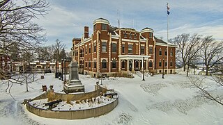
Door County is the easternmost county in the U.S. state of Wisconsin. As of the 2020 census, the population was 30,066. Its county seat is Sturgeon Bay. It is named after the strait between the Door Peninsula and Washington Island. The dangerous passage, known as Death's Door, contains shipwrecks and was known to Native Americans and early French explorers. The county was created in 1851 and organized in 1861. Nicknamed the "Cape Cod of the Midwest," Door County is a popular Upper Midwest vacation destination.

<span class="mw-page-title-main">Indiana Dunes National Park</span> United States National Park in Indiana

Indiana Dunes National Park is a United States national park located in northwestern Indiana managed by the National Park Service. It was authorized by Congress in 1966 as the Indiana Dunes National Lakeshore and was redesignated as the nation's 61st national park on February 15, 2019. The park runs for about 20 miles (32 km) along the southern shore of Lake Michigan and covers 15,349 acres (6,212 ha). Along the lakefront, the eastern area is roughly the lake shore south to U.S. 12 or U.S. 20 between Michigan City, Indiana, on the east and the Cleveland-Cliffs steel plant on the west. This area's conservation scheme is enhanced by the older Indiana Dunes State Park. To the west of the steel plant lies West Beach and a small extension south of the steel mill continues west along Salt Creek to Indiana 249. The western area is roughly the shoreline south to U.S. 12 between the Burns Ditch west to Broadway in downtown Gary, Indiana. In addition, there are several outlying areas, including Pinhook Bog, in LaPorte County to the east; the Heron Rookery in Porter County, the center of the park; and the Hoosier Prairie State Nature Preserve and the Hobart Prairie Grove, both in Lake County, the western end of the park.

Lake Koshkonong is a reservoir in southern Wisconsin, which was transformed from its original marshland by the construction of the Indianford Dam in 1932. The lake lies along the Rock River, with the river acting as both the primary inflow and the primary outflow for the lake. Lake Koshkonong begins 5.5 mi (8.9 km) downriver from Fort Atkinson, with the large majority of the lake located in southwestern Jefferson County. Small portions of the lake extend into southeastern Dane and northern Rock counties.

<span class="mw-page-title-main">Driftless Area</span> Geological region in the Midwestern US

The Driftless Area, also known as Bluff Country and the Paleozoic Plateau, is a topographical and cultural region in the Midwestern United States that comprises southwestern Wisconsin, southeastern Minnesota, northeastern Iowa, and the extreme northwestern corner of Illinois. The Driftless Area is a USDA Level III Ecoregion: Ecoregion 52. The Driftless Area takes up a large portion of the Upper Midwest forest–savanna transition. The Blufflands refers to the eastern section of the Driftless area in Minnesota, due to the steep bluffs and cliffs around the river valleys. The western half is known as the Rochester Plateau, which is flatter than the Blufflands. The Coulee Region refers to the southwestern part of the Driftless Area in Wisconsin. It is named for its numerous ravines.

<span class="mw-page-title-main">Indiana Dunes State Park</span> State park in Indiana, United States

Indiana Dunes State Park is an Indiana State Park located in Porter County, Indiana, United States, 47 miles (75.6 km) east of Chicago. The park is bounded by Lake Michigan to the northwest and is surrounded by as well as within the authorized boundaries of Indiana Dunes National Park, a unit of the National Park Service; the NPS owns the water from the ordinary high water mark to 300 feet (91 m) offshore. The 1,530-acre (619.2 ha) Dunes Nature Preserve makes up the bulk of eastern part of the park, and includes most of the park's hiking trails and dune landscape. This was one of the first places Richard Lieber considered when establishing the Indiana State Park system. Like all Indiana state parks, there is a fee for entrance. Indiana Dunes State Park was established in 1925 and designated a National Natural Landmark in 1974.

<span class="mw-page-title-main">Chambers Island</span> Island in Green Bay, Lake Michigan, U.S.

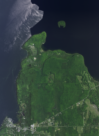
Chambers Island, named in honor of Col. Talbot Chambers, is a 2,834 acre island in Green Bay, about 7 miles (11 km) off the coast of the Door Peninsula, near Gibraltar, Wisconsin. It is part of the Town of Gibraltar in Door County.

<span class="mw-page-title-main">Ahnapee River</span> River in Wisconsin, United States

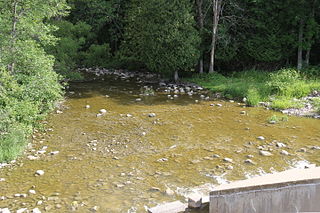
The Ahnapee River is a 14.7-mile-long (23.7 km) river on the Door Peninsula in eastern Wisconsin in the United States. It rises in Door County, Wisconsin, and flows through Kewaunee County into Lake Michigan at the city of Algoma. Its name has been ascribed as coming from the Ojibwe word aanapii meaning "when?".

<span class="mw-page-title-main">Wisconsin Highway 42</span> Highway in Wisconsin

State Trunk Highway 42 is a state highway in the U.S. state of Wisconsin. It runs for 135 miles (217 km) north–south in northeast Wisconsin from Sheboygan to the ferry dock in Northport. Much of the highway is part of the Lake Michigan Circle Tour from the eastern junction with U.S. Highway 10 (US 10) in Manitowoc to its junction with WIS 57 in Sister Bay. WIS 42 parallels I-43 from Sheboygan to Manitowoc, and parallels WIS 57 throughout much of the route, particularly from Manitowoc to Sturgeon Bay, meeting the northern terminus of WIS 57 in Sister Bay.

<span class="mw-page-title-main">Rock Island (Wisconsin)</span>

Rock Island is a mostly wooded island off the tip of Wisconsin's Door Peninsula at the mouth of Green Bay, in Door County, Wisconsin. The 974.87-acre (394.5 ha) island is approximately 1.6 miles (2.6 km) long and 1.1 miles (1.8 km) wide. It rises to 65 meters above Lake Michigan, making it the highest in elevation out of all the Potawatomi Islands. It is almost entirely owned by the Wisconsin Department of Natural Resources, which maintains Rock Island State Park. It is the northernmost part of the town of Washington.

<span class="mw-page-title-main">Sandy Island Beach State Park</span> New York State park

Sandy Island Beach State Park is a New York State park on the eastern shore of Lake Ontario. Its highlight is a 1,500-foot (460 m) natural sandy beach. The park is near the southern end of a notable 17-mile (27 km) length of sandy shoreline, coastal dunes, and wetlands ; a 1959 study noted that "The eastern end of Lake Ontario contains not only the finest beaches on the entire lake but also the finest wildlife habitat."

<span class="mw-page-title-main">Peninsula State Park</span> State park in Door County, Wisconsin

Peninsula State Park is a 3,776-acre (1,528 ha) Wisconsin state park with eight miles (13 km) of Green Bay shoreline in Door County. Peninsula is the third largest state park in Wisconsin and is visited by an estimated one million visitors annually.

<span class="mw-page-title-main">Whitefish Dunes State Park</span> State park in Wisconsin, United States

Whitefish Dunes State Park is a 867-acre (351 ha) state park of Wisconsin on the eastern shore of the Door Peninsula. This day-use park preserves the most substantial sand dunes on the western shore of Lake Michigan. The remains of eight successive prehistoric Native American villages are on the National Register of Historic Places as Whitefish Dunes-Bay View Site. Cave Point County Park is an enclave inside the state park, allowing visitors free foot access to the state park by the shoreline trail connecting the parks.

<span class="mw-page-title-main">Geography of Wisconsin</span> Physical features of the state in the Midwestern United States

Wisconsin, a state in the Midwestern United States, has a vast and diverse geography famous for its landforms created by glaciers during the Wisconsin glaciation 17,000 years ago. The state can be generally divided into five geographic regions—Lake Superior Lowland, Northern Highland, Central Plain, Eastern Ridges & Lowlands, and Western Upland. The southwestern part of the state, which was not covered by glaciers during the most recent ice age, is known as the Driftless Area. The Wisconsin glaciation formed the Wisconsin Dells, Devil's Lake, and the Baraboo Range. A number of areas are protected in the state, including Devil's Lake State Park, the Apostle Islands National Lakeshore, and the Chequamegon–Nicolet National Forest.

<span class="mw-page-title-main">Beech–maple forest</span> Closed canopy hardwood forest

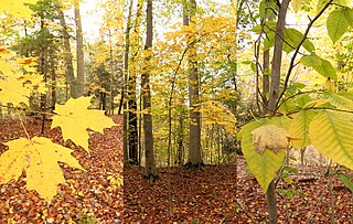
A beech–maple forest or a maple beech forest is a climax mesic closed canopy hardwood forest. It is primarily composed of American beech and sugar maple trees which co-dominate the forest and which are the pinnacle of plant succession in their range. A form of this forest was the most common forest type in the Northeastern United States when it was settled by Europeans and remains widespread but scattered today.

<span class="mw-page-title-main">Castle Rock Lake</span> Lake in Adams and Juneau counties, Wisconsin, United States

Castle Rock Lake is an artificial lake on the Wisconsin River. It is located in central Wisconsin in Adams County and Juneau County. The lake has an inflow from Petenwell Lake, Yellow River, Big Roche a Cri., and Klien Creek. It has a surface area of 16,640 acres (67.3 km2) and its depth varies from 8–20 ft (2.4–6.1 m) in most places, with area in the old river beds reaching as deep as 35 ft (11 m).

<span class="mw-page-title-main">Trout Lake (Wisconsin)</span> Lake in Wisconsin, USA

Trout Lake is in Vilas County, Wisconsin, near the towns of Boulder Junction and Arbor Vitae, Wisconsin. With a surface area of 6.208 sq mi (16.079 km2) and a volume of 0.058 cu mi (0.240 km3), Trout Lake is one of the largest lakes in Vilas County. It has 16.1 mi (25.9 km) of shoreline, a large portion of which is undeveloped. There are also seven islands within the lake: Miller Island, Zimmerman Island, Haunted Island, Easter Island, Fisk Island, Chocolate Drop Island, and an unnamed island. It is a dimictic oligotrophic lake that supports a large number of sport fish, which has made it a popular angling destination.

<span class="mw-page-title-main">Climate of Door County, Wisconsin</span>

The climate of Door County, Wisconsin is tempered by Green Bay and Lake Michigan. There are fewer extremely cold days and fewer hot days than in areas of Wisconsin directly to the west. Lake waters delay the coming of spring as well as extend mild temperatures in the fall. Annual precipitation is slightly lower than elsewhere in northern Wisconsin. The county features a humid continental climate with warm summers and cold snowy winters.

<span class="mw-page-title-main">Economy of Door County, Wisconsin</span>

The economy of Door County is similar to that of Bayfield, Iron, Oneida, Sawyer, and Vilas counties. These six northern Wisconsin counties have been categorized as having "forestry-related tourism"-based economies.

References

  1. Wisflora Species list
  2. Green Fund: Friends and Donors, archived October 2, 2011.
  3. Mycology Collections Portal. "Consortium of North American Bryophyte Herbaria". (CNABH). Retrieved 24 January 2019.
  4. Flora and vegetation of the Grand Traverse Islands (Lake Michigan), Wisconsin and Michigan by Judziewicz, EJ., The Michigan Botanist, Vol. 40. 2001, p. 85
  5. Conservation Assessment for Green Spleenwort (Asplenium trichomanes-ramosum) L by the USDA Forest Service, Eastern Region, March 2002, subsection "Habitat and Ecology, p. 9
  6. Darrin Hoverson and Nancy Turyk (November 2006). "2006 Summary and Comparisons of Clark Lake - Door County Aquatic Macrophyte Community Surveys" (PDF). University of Wisconsin, Stevens Point Center for Watershed Science and Education. Retrieved January 22, 2019.
  7. Potamogeton pulcher Tuck. spotted pondweed, USDA PLANTS database, Accessed December 13, 2019
  8. Door County Soil and Water Conservation Department (June 2018). "Table 7-2. Plant Species, p. 41 (page 46 of the pdf)". Final Report for Comprehensive Lake Management Planning Grant Project #LPL162317 Forestville Millpond. Retrieved January 22, 2019.
  9. 1 2 Emmet Judziewicz and David Kopitzke (September 1999). "Wisconsin's Lake Michigan Islands Plant Survey-II" (PDF). Wisconsin Department of Natural Resources, Bureau of Endangered Resources. Retrieved January 23, 2019.
  10. A Guide to Significant Wildlife Habitat and Natural Areas Of Door County, Wisconsin, March, 2003, by the Wisconsin Department of Natural Resources Sturgeon Bay Service Center, p. 128, p. 52, p. 23, p. 127 and pp. 52, 83, 85, and 99 (note: pagination in the pdf is one page past the numerical pagination)
  11. County of Door 2019 Annual Reports, page 70
  12. County of Door 2020 Annual Reports, page 73
  13. Web-Map of Door County, Wisconsin ... For All Seasons!, Door County Land Information Office, Accessed September 7th, 2019
  14. Priority Invasive Species Lists in Wisconsin, electronic map
  15. Boreal rich fen, Detailed Community Description from Ecological Landscapes of Wisconsin General natural community overview, Wisconsin DNR, accessed September 9th, 2019
  16. Biodiversity Investment Areas: Coastal Wetland Ecosystems by Patricia Chow-Fraser and Dennis A. Albert, State of the Lakes Ecosystem Conference 1998, July 1999, Table 5.6 Lake Michigan shoreline reaches and their characteristic wetlands, p. 46 (p. 51 of the pdf)
  17. Boreal forest, Detailed Community Description from Ecological Landscapes of Wisconsin General natural community overview, Wisconsin DNR, accessed January 20, 2020.
  18. The Origins and Properties of Alkaline Raw Humus by Harry Merrill Galloway, MS thesis, UW-Wisconsin, 1938
  19. Dry cliff, Detailed Community Description from Ecological Landscapes of Wisconsin General natural community overview, Wisconsin DNR, accessed September 10th, 2019
  20. Hoary Whitlow-grass (Draba cana), Wisconsin DNR, accessed September 10th, 2019
  21. Rock Whitlow-grass (Draba arabisans), Wisconsin DNR, accessed September 10th, 2019
  22. Alvar, Detailed Community Description from Ecological Landscapes of Wisconsin General natural community overview, Wisconsin DNR, accessed September 9th, 2019.
  23. Great Lakes alkaline rockshore, Detailed Community Description from Ecological Landscapes of Wisconsin General natural community overview, Wisconsin DNR, accessed September 9th, 2019
  24. p. 828 of Hydrogeomorphic Factors and Ecosystem Responses in Coastal Wetlands of the Great Lakes by Janet R. Keough, Todd A. Thompson, Glenn R. Guntenspergen, and Douglas A. Wilcox, December 1999, Environmental Science and Ecology Faculty Publications Vol. 51
  25. STARR Partners (February 2013). "Appendix F, Kewaunee, Door, and Brown County" (PDF). Discovery Report. Federal Emergency Management Agency Region V. p. 19 (pdf page 27).
  26. Door County Comprehensive Forest Plan, completed about 2008, see also for reference the map of all Door county woodlands
  27. Door County Coastal Byway Interpretive Master Plan Archived 2021-10-16 at the Wayback Machine by Schmeeckle Reserve Interpreters, p. 25, (p. 30 of the pdf), 2014
  28. Chapter 15, Northern Lake Michigan Coastal Ecological Landscape. from The ecological landscapes of Wisconsin: An assessment of ecological resources and a guide to planning sustainable management. Madison: Wisconsin Department of Natural Resources, 2015. PUB-SS-1131Q 2015, p. Q-23 (p. 33 of the pdf)
  29. Growing Fruit in the Upper Midwest by Don Gordon, University of Minnesota Press: Minneapolis, 1991, p. 47
  30. History of the Department of Horticulture, Chronology of the Department’s Research Highlights and Growth, University of Wisconsin Madison, 2014, p. 16
  31. Detroit island's birch survived the centuries by Roy Lukes, Door County Advocate, March 4th, 1971
  32. Wisconsin's Champion Trees: A Tree Hunter's Guide by R. Bruce Allison, 2005, Wisconsin Book Pub.
  33. 1 2 3 4 5 Champion Trees of Door County by Roy and Charlotte Lukes, November 21, 2013, doorcountypulse.com
  34. 400-Year Pine on Island; Towering Elm, Egg Harbor, Door County Advocate, Volume 86, Number 22, page 1
  35. Giant Egg Harbor Elm Can lay Claim to Championship, Door County Advocate, Volume 91, Number 47, July 24, 1952, page 1 and Reign of Jorns Elm Ended by Madison Conservationist, Door County Advocate, Volume 91, Number 53, September 18, 1952, page 2
  36. Charlotte Lukes. "Biodiversity of Macrofungi in Northern Door County, WI". UWGB Cofrin Center for Biodiversity. Archived from the original on January 23, 2019. Retrieved January 22, 2019.
  37. Mycology Collections Portal. "Search for Door, Wisconsin". Mycoportal. Retrieved January 24, 2019.
  38. Lichens: Alluring but Little-Known Plants by Roy and Charlotte Lukes, Peninsula Pulse, November 21st, 2011
  39. Hanging Fringed Lichen (Anaptychia crinalis), Wisconsin DNR, accessed September 10th, 2019
  40. Clowers, K. J.; Will, J. L.; Gasch, A. P. (2015). "A unique ecological niche fosters hybridization of oak-tree and vineyard isolates of Saccharomyces cerevisiae". Molecular Ecology. 24 (23): 5886–5898. Bibcode:2015MolEc..24.5886C. doi:10.1111/mec.13439. PMC   4824287 . PMID   26518477.
  41. The Gypsy Moth Fungus Entomophaga maimaiga in North America by Richard C. Reardon and Ann E. Hajek, US Forest Service, Forest Health Technology Enterprise Team, June, 1998, page 19 (page 23 of the pdf)
  42. Inoculative Releases and Natural Spread of the Fungal Pathogen Entomophaga maimaiga (Entomophthorales: Entomophthoraceae) into U.S. Populations of Gypsy Moth, Lymantria dispar (Lepidoptera: Erebidae), by Ann E. Hajek, Andrea L. Diss-Torrance, Nathan W. Siegert, and Andrew M. Liebhold, Environmental Entomology, June 15, 2021, pages 5–6 doi : 10.1093/ee/nvab068