Fort Osage Township, Jackson County, Missouri

Last updated

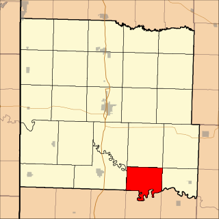
Fort Osage Township is an inactive township in Jackson County, in the U.S. state of Missouri. [1]

A civil township is a widely used unit of local government in the United States that is subordinate to a county. The term town is used in New England, New York, and Wisconsin to refer to the equivalent of the civil township in these states. Specific responsibilities and the degree of autonomy vary based on each state. Civil townships are distinct from survey townships, but in states that have both, the boundaries often coincide and may completely geographically subdivide a county. The U.S. Census Bureau classifies civil townships as minor civil divisions. Currently, there are 20 states with civil townships.

Jackson County, Missouri County in the United States

Jackson County is a county located in the western portion of the U.S. state of Missouri. As of the 2010 census, the population was 674,158. making it the second-most populous county in the state. Although Independence retains its status as the original county seat, Kansas City serves as a second county seat and the center of county government. The county was organized December 15, 1826, and named for President Andrew Jackson. Jackson County is the central county of the Kansas City metropolitan area.

U.S. state constituent political entity of the United States

In the United States, a state is a constituent political entity, of which there are currently 50. Bound together in a political union, each state holds governmental jurisdiction over a separate and defined geographic territory and shares its sovereignty with the federal government. Due to this shared sovereignty, Americans are citizens both of the federal republic and of the state in which they reside. State citizenship and residency are flexible, and no government approval is required to move between states, except for persons restricted by certain types of court orders. Four states use the term commonwealth rather than state in their full official names.

Fort Osage Township was established in 1827, taking its name from Fort Osage. [2]

Fort Osage a trading post system for the Osage Nation in the early 19th century near Sibley, Missouri

Fort Osage was an early 19th-century factory trading post system run by the United States Government, on the American frontier being located in present-day Sibley, Missouri. The Treaty of Fort Clark was signed with certain members of the Osage Nation in 1808 calling for the creation of Fort Osage. It was one of three forts established by the U.S. Army to establish control over the newly acquired Louisiana Purchase territories. Fort Madison in SE Iowa was built to control trade and pacify Native Americans in the Upper Mississippi River region. Fort Belle Fontaine near St. Louis controlled the mouth of the Missouri. The fort ceased operations in the 1820s as the Osage in subsequent treaties ceded the rest of their land in Missouri. A replica of the fort was rebuilt on the site between 1948 and 1961. The Fort Osage school district, which serves northeast Independence and the surrounding area, was named after it.

Related Research Articles

Fishing River river in the United States of America

The Fishing River is a 39.0-mile-long (62.8 km) tributary of the Missouri River in western Missouri in the United States. It rises in the northeastern extremity of Kansas City in Clay County and flows generally eastward and southeastward through Clay and southeastern Ray counties, past the town of Mosby. It joins the Missouri River about 3 miles (5 km) south of the town of Orrick.

Jackson Township, Callaway County, Missouri Township in Missouri, United States

Jackson Township is one of eighteen townships in Callaway County, Missouri, USA. As of the 2010 census, its population was 2,150.

Lone Oak Township, Bates County, Missouri Township in Missouri, United States

Lone Oak Township is one of twenty-four townships in Bates County, Missouri, USA. As of the 2000 census, its population was 293.

Prairie Township, Bates County, Missouri Township in Missouri, United States

Prairie Township is one of twenty-four townships in Bates County, Missouri, USA. As of the 2000 census, its population was 153.

The Fort Osage R-1 School District is a public school district located in Jackson County, Missouri, in the Kansas City metropolitan area. The district headquarters is in an unincorporated area adjacent to the City of Independence. The district serves a section of northern Independence.

Jackson Township is an inactive township in Clinton County, in the U.S. state of Missouri.

Osage Township is an inactive township in Crawford County, in the U.S. state of Missouri.

Osage Township is an inactive township in Dent County, in the U.S. state of Missouri.

Osage Township is a township in Henry County, in the U.S. state of Missouri.

Lewis Township is an inactive township in Holt County, in the U.S. state of Missouri.

Blue Township is an inactive township in Jackson County, in the U.S. state of Missouri.

Brooking Township is an inactive township in Jackson County, in the U.S. state of Missouri.

Prairie Township is an inactive township in Jackson County, in the U.S. state of Missouri.

Sni-A-Bar Township is an inactive township in Jackson County, in the U.S. state of Missouri.

Van Buren Township is an inactive township in Jackson County, in the U.S. state of Missouri.

Washington Township is an inactive township in Jackson County, in the U.S. state of Missouri.

Osage Township is an inactive township in Laclede County, in the U.S. state of Missouri.

Linn Township is an inactive township in Moniteau County, in the U.S. state of Missouri.

Jackson Township is an inactive township in Osage County, in the U.S. state of Missouri.

Osage Township is a township in Vernon County, in the U.S. state of Missouri.

References

  1. U.S. Geological Survey Geographic Names Information System: Fort Osage Township, Jackson County, Missouri
  2. "Jackson County Place Names, 1928–1945 (archived)". The State Historical Society of Missouri. Archived from the original on 24 June 2016. Retrieved 16 October 2016.

Coordinates: 39°08′35″N94°12′31″W / 39.1431°N 94.2086°W / 39.1431; -94.2086

Geographic coordinate system Coordinate system

A geographic coordinate system is a coordinate system that enables every location on Earth to be specified by a set of numbers, letters or symbols. The coordinates are often chosen such that one of the numbers represents a vertical position and two or three of the numbers represent a horizontal position; alternatively, a geographic position may be expressed in a combined three-dimensional Cartesian vector. A common choice of coordinates is latitude, longitude and elevation. To specify a location on a plane requires a map projection.