Sibley, Missouri

Last updated
Sibley, Missouri
Jackson County Missouri Incorporated and Unincorporated areas Sibley Highlighted.svg
Location of Sibley, Missouri
Coordinates: 39°10′49″N94°11′45″W / 39.18028°N 94.19583°W / 39.18028; -94.19583 Coordinates: 39°10′49″N94°11′45″W / 39.18028°N 94.19583°W / 39.18028; -94.19583
Country United States
State Missouri
County Jackson
Area
[1]
  Total1.04 sq mi (2.70 km2)
  Land1.04 sq mi (2.70 km2)
  Water0.00 sq mi (0.00 km2)
Elevation
807 ft (246 m)
Population
 (2020)
  Total314
  Density301.05/sq mi (116.22/km2)
Time zone UTC-6 (Central (CST))
  Summer (DST) UTC-5 (CDT)
ZIP code
64088
Area code 816
FIPS code 29-67718 [2]
GNIS feature ID0735854 [3]

Sibley is a village in Jackson County, Missouri, United States. The population was 314 at the 2020 census. It is known as the home of Fort Osage National Historic Landmark. It is part of the Kansas City metropolitan area.

Contents

History

Sibley was platted in 1836. [4] The village was named for George C. Sibley, the first Indian agent and postmaster of Fort Osage. [5] A post office called Sibley has been in operation since 1842. [6]

Geography

Sibley is located at 39°10′49″N94°11′45″W / 39.18028°N 94.19583°W / 39.18028; -94.19583 (39.180338, -94.195940). [7]

According to the United States Census Bureau, the village has a total area of 1.04 square miles (2.69 km2), all land. [8]

Demographics

Historical population
CensusPop.Note
1960 177
1970 27957.6%
1980 38236.9%
1990 367−3.9%
2000 347−5.4%
2010 3572.9%
2020 314−12.0%
U.S. Decennial Census [9]
Fort Osage from the west. The "factory" trading post is on the left. Fort-osage.jpg
Fort Osage from the west. The "factory" trading post is on the left.

2010 census

As of the census [10] of 2010, there were 357 people, 129 households, and 98 families living in the village. The population density was 343.3 inhabitants per square mile (132.5/km2). There were 141 housing units at an average density of 135.6 per square mile (52.4/km2). The racial makeup of the village was 96.4% White, 0.8% Native American, and 2.8% from two or more races. Hispanic or Latino of any race were 3.9% of the population.

There were 129 households, of which 37.2% had children under the age of 18 living with them, 61.2% were married couples living together, 8.5% had a female householder with no husband present, 6.2% had a male householder with no wife present, and 24.0% were non-families. 19.4% of all households were made up of individuals, and 10.1% had someone living alone who was 65 years of age or older. The average household size was 2.77 and the average family size was 3.14.

The median age in the village was 40.1 years. 24.4% of residents were under the age of 18; 9.8% were between the ages of 18 and 24; 23.1% were from 25 to 44; 25.5% were from 45 to 64; and 17.4% were 65 years of age or older. The gender makeup of the village was 49.6% male and 50.4% female.

2000 census

As of the census [2] of 2000, there were 347 people, 128 households, and 94 families living in the village. The population density was 332.9 inhabitants per square mile (128.5/km2). There were 133 housing units at an average density of 127.6 per square mile (49.3/km2). The racial makeup of the village was 95.97% White, 1.44% African American, 1.15% Native American, 0.29% Asian, 0.86% from other races, and 0.29% from two or more races. Hispanic or Latino of any race were 3.17% of the population.

There were 128 households, out of which 37.5% had children under the age of 18 living with them, 70.3% were married couples living together, 2.3% had a female householder with no husband present, and 25.8% were non-families. 20.3% of all households were made up of individuals, and 9.4% had someone living alone who was 65 years of age or older. The average household size was 2.71 and the average family size was 3.18.

In the village, the population was spread out, with 25.9% under the age of 18, 8.4% from 18 to 24, 28.8% from 25 to 44, 23.9% from 45 to 64, and 13.0% who were 65 years of age or older. The median age was 37 years. For every 100 females, there were 112.9 males. For every 100 females age 18 and over, there were 97.7 males.

The median income for a household in the village was $45,000, and the median income for a family was $50,417. Males had a median income of $40,313 versus $28,125 for females. The per capita income for the village was $17,100. About 2.1% of families and 5.4% of the population were below the poverty line, including 2.2% of those under age 18 and 16.7% of those age 65 or over.

Related Research Articles

<span class="mw-page-title-main">Gaylord, Minnesota</span> City in Minnesota, United States

Gaylord is a city and the county seat of Sibley County, Minnesota, United States, along the shore of Titlow Lake. It is approximately 65 miles (105 km) west-southwest of Minneapolis-St. Paul. The population was 2,305 at the 2010 census.

<span class="mw-page-title-main">Winthrop, Minnesota</span> City in Minnesota, United States

Winthrop is a city in Sibley County, Minnesota, United States. The population was 1,399 at the 2010 census.

<span class="mw-page-title-main">Merwin, Missouri</span> Village in Missouri, United States

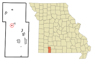
Merwin is a village in Bates County, Missouri, and is part of the Kansas City metropolitan area within the United States. The population was 69 at the 2020 census.

<span class="mw-page-title-main">Passaic, Missouri</span> Town in Missouri, United States

Passaic is a town in Bates County, Missouri, and is part of the Kansas City metropolitan area within the United States.

<span class="mw-page-title-main">St. Cloud, Missouri</span> Village in Missouri, United States

St. Cloud is a village in northeast Crawford County, Missouri, United States. The population was 41 at the 2010 census.

<span class="mw-page-title-main">River Bend, Missouri</span> Village in Missouri, United States

River Bend is a village in Jackson County, Missouri, United States. The population was 3 at the 2020 census. It is the only part of Jackson County that lies north of the Missouri River. In 1951, the Missouri River was relocated to a new channel, creating River Bend,. The county line still follows the original riverbed. It is part of the Kansas City metropolitan area. The mayor is Alex Dockler.

<span class="mw-page-title-main">Airport Drive, Missouri</span> Village in Missouri, United States

Airport Drive is a village in Jasper County, Missouri, United States. The population was 766 at the 2020 census. It is part of the Joplin, Missouri Metropolitan Statistical Area. The community is still commonly referred to as "Stone's Corner," as the intersection of Route 43 and Route 171 is known.

<span class="mw-page-title-main">Brooklyn Heights, Missouri</span> Village in Missouri, United States

Brooklyn Heights is a village in Jasper County, Missouri, United States. The population was 101 at the 2020 census. It is part of the Joplin, Missouri Metropolitan Statistical Area.

<span class="mw-page-title-main">Shoal Creek Estates, Missouri</span> Village in Missouri, United States

Shoal Creek Estates is a village in Newton County, Missouri, United States. The population was 76 at the 2010 census. It is part of the Joplin, Missouri Metropolitan Statistical Area.

<span class="mw-page-title-main">Flemington, Missouri</span> Village in Missouri, United States

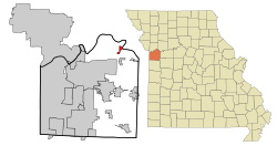
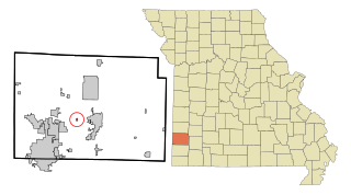
Flemington is a village in Polk County, Missouri, United States. The population was 148 at the 2010 census. It is part of the Springfield, Missouri Metropolitan Statistical Area.

<span class="mw-page-title-main">Bellerive Acres, Missouri</span> City in Missouri, United States

Bellerive Acres is a northern suburban village in St. Louis County, Missouri, United States. The population was 188 at the 2010 census. In April, 2015, the residents voted to change the village of Bellerive to a fourth class city named Bellerive Acres.

<span class="mw-page-title-main">Grantwood Village, Missouri</span> Town in Missouri, United States

Grantwood Village is a town in St. Louis County, Missouri, United States. The population was 863 at the 2010 census.

<span class="mw-page-title-main">Hillsdale, Missouri</span> Village in Missouri, United States

Hillsdale is a village in St. Louis County, Missouri, United States. The population was 1,478 at the 2010 census.

<span class="mw-page-title-main">Marlborough, Missouri</span> Village in Missouri, United States

Marlborough is a village in St. Louis County, Missouri, United States. The population was 2,179 at the 2010 census.

<span class="mw-page-title-main">Velda Village Hills, Missouri</span> Village in Missouri, United States

Velda Village Hills is a village in northeastern St. Louis County, Missouri, United States. The population was 1,055 at the 2010 census.

<span class="mw-page-title-main">Penermon, Missouri</span> Village in Missouri, United States

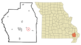
Penermon is a village in Stoddard County, Missouri, United States. The population was 64 at the 2010 census.

<span class="mw-page-title-main">McCord Bend, Missouri</span> Village in Missouri, United States

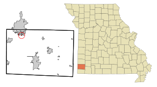
McCord Bend is a village in Stone County, Missouri, United States. The population was 212 at the 2020 census. It is part of the Branson, Missouri Micropolitan Statistical Area.

<span class="mw-page-title-main">Merriam Woods, Missouri</span> City in Missouri, United States

Merriam Woods is a city in Taney County, Missouri, United States. The population was 2,006 at the 2020 census. It is part of the Branson, Missouri Micropolitan Statistical Area.

<span class="mw-page-title-main">Ritchey, Missouri</span> Town in Missouri, United States

Ritchey is a village in Newton County, Missouri, United States. The population was 82 at the 2010 census. It is part of the Joplin, Missouri Metropolitan Statistical Area.

<span class="mw-page-title-main">Saginaw, Missouri</span> Village in Missouri, United States

Saginaw is a village in Newton County, Missouri, United States. The population was 297 at the 2010 census. It is part of the Joplin, Missouri Metropolitan Statistical Area.

References

  1. "ArcGIS REST Services Directory". United States Census Bureau. Retrieved August 28, 2022.
  2. 1 2 "U.S. Census website". United States Census Bureau . Retrieved 2008-01-31.
  3. "US Board on Geographic Names". United States Geological Survey. 2007-10-25. Retrieved 2008-01-31.
  4. Eaton, David Wolfe (1916). How Missouri Counties, Towns and Streams Were Named. The State Historical Society of Missouri. pp.  178.
  5. "Jackson County Place Names, 1928–1945 (archived)". The State Historical Society of Missouri. Archived from the original on 24 June 2016. Retrieved 16 October 2016.{{cite web}}: CS1 maint: bot: original URL status unknown (link)
  6. "Post Offices". Jim Forte Postal History. Retrieved 16 October 2016.
  7. "US Gazetteer files: 2010, 2000, and 1990". United States Census Bureau. 2011-02-12. Retrieved 2011-04-23.
  8. "US Gazetteer files 2010". United States Census Bureau. Archived from the original on January 12, 2012. Retrieved 2012-07-08.
  9. "Census of Population and Housing". Census.gov. Retrieved June 4, 2015.
  10. "U.S. Census website". United States Census Bureau . Retrieved 2012-07-08.