Foster Township, Big Stone County, Minnesota

Last updated

Foster Township
USA Minnesota location map.svg
Red pog.svg
Foster Township
Location within the state of Minnesota
Usa edcp location map.svg
Red pog.svg
Foster Township
Foster Township (the United States)
Coordinates: 45°27′54″N96°40′13″W / 45.46500°N 96.67028°W / 45.46500; -96.67028
Country United States
State Minnesota
County Big Stone
Area
  Total33.2 sq mi (86.0 km2)
  Land30.1 sq mi (77.8 km2)
  Water3.1 sq mi (8.1 km2)
Elevation
1,102 ft (336 m)
Population
 (2000)
  Total123
  Density4.1/sq mi (1.6/km2)
Time zone UTC-6 (Central (CST))
  Summer (DST) UTC-5 (CDT)
FIPS code 27-22058 [1]
GNIS feature ID0664205 [2]

Foster Township is a township in Big Stone County, Minnesota, United States. The population was estimated at 110 in the 2020 census. [3] Situated in the southwest region of the county, the township has a western boundary with South Dakota. Big Stone Lake and the Little Minnesota River drain it.

Contents

Geography

According to the United States Census Bureau, the township has a total area of 33.2 square miles (86 km2), of which 30.1 square miles (78 km2) is land and 3.1 square miles (8.0 km2) (9.43%) is water.

Unincorporated towns

(This list is based on USGS data and may include former settlements.)

Major highway

Lakes

Adjacent townships

Cemeteries

The township contains two cemeteries, Holden and Lakeside.

Demographics

At the 2000 census, [1] there were 123 people, 57 households and 42 families residing in the township. The population density was 4.1 per square mile (1.6/km2). There were 169 housing units at an average density of 5.6/sq mi (2.2/km2). The racial makeup of the township was 98.37% White and 1.63% Asian.

There were 57 households, of which 15.8% had children under the age of 18 living with them, 70.2% were married couples living together, and 26.3% were non-families. 24.6% of all households were made up of individuals, and 7.0% had someone living alone who was 65 years of age or older. The average household size was 2.16, and the average family size was 2.50.

15.4% of the population were under the age of 18, 5.7% from 18 to 24, 15.4% from 25 to 44, 40.7% from 45 to 64, and 22.8% were 65 years of age or older. The median age was 52 years. For every 100 females, there were 141.2 males. For every 100 females age 18 and over, there were 126.1 males.

The median household income was $31,875 and the median family income was $41,250. Males had a median income of $22,500 and females $22,083. The per capita income was $16,178. There were 17.5% of families and 18.4% of the population living below the poverty line, including 19.0% of those under eighteen and none of those over 64.

Related Research Articles

<span class="mw-page-title-main">Traverse County, Minnesota</span> County in Minnesota, United States

Traverse County is a county in the U.S. state of Minnesota. As of the 2020 census, the population was 3,360, making it the least-populous county in Minnesota. Its county seat is Wheaton. The county was founded in 1862 and organized in 1881.

Alaska Township is a township in Beltrami County, Minnesota, United States. The population was 197 as of the 2000 census. Alaska Township was named by settlers who had recently returned from a trip to Alaska.

Quiring Township is a township in Beltrami County, Minnesota, United States. The population was 85 as of the 2000 census.

Shotley Township is a township in Beltrami County, Minnesota, United States. The population was 54 as of the 2000 census. Shotley Township took its name from Shotley Brook.

<span class="mw-page-title-main">Artichoke Township, Big Stone County, Minnesota</span> Township in Minnesota, United States

Artichoke Township is a township in Big Stone County, Minnesota, United States. The population was 84 as of the 2000 census. Artichoke is also the name of an unincorporated hamlet within Artichoke Township.

Graceville Township is a township in Big Stone County, Minnesota, United States. The population was 205 as of the 2000 census. Graceville Township took its name from the city of Graceville, which was named for Thomas Langdon Grace, second Roman Catholic Bishop of Saint Paul, Minnesota.

Malta Township is a township in Big Stone County, Minnesota, United States. The population was 90 at the 2000 census.

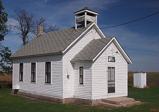
Ortonville Township is a township in Big Stone County, Minnesota, United States. The population was 2,011 as of the 2010 census.

Prior Township is a township in Big Stone County, Minnesota, United States. The population was 223 as of the 2000 census.

Judson Township is a township in Blue Earth County, Minnesota, United States. The population was 591 as of the 2000 census.

Pleasant Mound Township is a township in Blue Earth County, Minnesota, United States. The population was 235 as of the 2000 census.

Straight River Township is a township in Hubbard County, Minnesota, United States. The population was 662 at the 2000 census.

<span class="mw-page-title-main">Lancaster, Minnesota</span> City in Minnesota, United States

Lancaster is a city in Kittson County, Minnesota, United States. As of the 2020 census, the city population was 364.

Verdi Township is a township in Lincoln County, Minnesota, United States. The population was 240 at the 2000 census.

Camp Township is a township in Renville County, Minnesota, United States. The population was 207 at the time of the 2000 census. Camp Township was organized in 1867.

Big Stone Township is a township in Big Stone County, Minnesota, United States. The population was 253 at the 2000 census.

Myhre Township is a township in Lake of the Woods County, Minnesota, United States. The population was 213 at the 2000 census.

<span class="mw-page-title-main">Strandquist, Minnesota</span> City in Minnesota, United States

Strandquist is a city in Lincoln Township of Marshall County, Minnesota, United States. The population was 70 at the 2020 census.

Gheen is an unorganized territory in Saint Louis County, Minnesota, United States. The population was 25 at the 2000 census.

McKinley is an unorganized territory in Kittson County, Minnesota, United States. The population was 42 at the 2000 census.

References

  1. 1 2 "U.S. Census website". United States Census Bureau . Retrieved January 31, 2008.
  2. "US Board on Geographic Names". United States Geological Survey. October 25, 2007. Retrieved January 31, 2008.
  3. "U.S. Census website" . Retrieved December 30, 2008.