
Gaston County is a county in the U.S. state of North Carolina. As of the 2020 census, the population was 227,943. The county seat is Gastonia. Dallas served as the original county seat from 1846 until 1911.

Gastonia is the most populous city in and county seat of Gaston County, North Carolina, United States. It is the second-largest satellite city of the Charlotte area, behind Concord. The population was 80,411 in the 2020 census, up from 71,741 in 2010. Gastonia is the 13th-most populous city in North Carolina. It is part of the Charlotte-Concord-Gastonia, NC-SC Metropolitan Statistical Area, which is part of the Charlotte-Concord, NC-SC Combined Statistical Area.

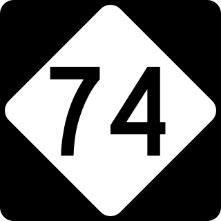
U.S. Route 74 (US 74) is an east–west United States highway that runs for 515 miles (829 km) from Chattanooga, Tennessee to Wrightsville Beach, North Carolina. Primarily in North Carolina, it serves as an important highway from the mountains to the sea, connecting the cities of Asheville, Charlotte and Wilmington. It is known as Andrew Jackson Highway throughout most of North Carolina.

U.S. Route 321 (US 321) is a spur of U.S. Route 21. It runs for 516.9 miles (831.9 km) from Hardeeville, South Carolina to Lenoir City, Tennessee; with both serving as southern termini. It reaches its northernmost point at Elizabethton, Tennessee, just northeast of Johnson City. Because of its unusual "north–south–north" routing, U.S. Route 321 intersects both Interstate 40 and U.S. Route 70 three separate times. The highway serves different roles in each state: An alternate route to interstates in South Carolina, a major highway in North Carolina, and a scenic route in Tennessee.

Interstate 485 (I-485) is a 66.68-mile-long (107.31 km) auxiliary Interstate Highway encircling Charlotte, North Carolina. As a complete loop, it is primarily signed with "inner" and "outer" designations, though at some major interchanges, supplemental signage reflects the local compass orientation of the road. The entire route lies within Mecklenburg County.

Interstate 540 (I-540) and North Carolina Highway 540 (NC 540) are part of a partially completed beltway around the city of Raleigh in the US state of North Carolina, forming the Raleigh Outer Loop. When complete, the route will completely encircle the city, meeting its parent route of I-40 in two locations.

South Carolina Highway 31 (SC 31), also known as the Carolina Bays Parkway, is a 28.097-mile (45.218 km) six-lane, limited-access highway that parallels the Intracoastal Waterway around Myrtle Beach. The first phase opened on December 17, 2002, completing a 22-mile (35 km) link between U.S. Route 501 (US 501) and SC 9. The second phase opened in March 2005, running from US 501 southwest to S.C. Highway 544. The third phase opened on November 7, 2019, extending to SC 707. While usually referred to only as the Carolina Bays Parkway, the highway is also dedicated the John B. Singleton Parkway in memory of John B. Singleton, a former Myrtle Beach City Council member and police commissioner.
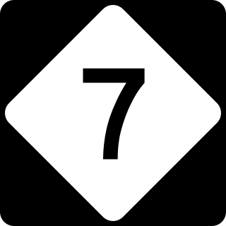
North Carolina Highway 7 (NC 7) is a primary state highway in the U.S. state of North Carolina. Entirely within Gaston County, it connects the towns of Lowell, McAdenville, and Belmont with the city of Gastonia.

Route 4 is an 18.6-mile (29.9 km) partial ring road located in Charlotte, North Carolina. Beginning and ending at Interstate 85 (I-85), it loops south around Uptown Charlotte along state-maintained secondary roads, connecting the Charlotte Douglas International Airport and several city neighborhoods including Madison Park, Myers Park, Windsor Park and Sugar Creek. The route is posted by the Charlotte Department of Transportation (CDOT), using a modified pentagonal county road shield, with a green background and the city's crown logo above the number. The loop has a radius of about 4 miles (6.4 km), hence the number.
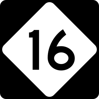
North Carolina Highway 16 (NC 16) is a 143.8-mile primary state highway in the U.S. state of North Carolina. Traveling in a north–south direction, it connects the cities and towns of Charlotte, Newton, Conover, Taylorsville, Wilkesboro and Jefferson, linking the Charlotte metropolitan area with the mountainous High Country. NC 16 is part of a three-state route 16 that connects the Charlotte region with northwestern West Virginia.
The Winston-Salem Northern Beltway is a partially completed freeway loop around the city of Winston-Salem in North Carolina. The western section has been designated as North Carolina Highway 452 (NC 452), which will become I-274 when completed, and the eastern section of the beltway will be designated as North Carolina Highway 74 (NC 74), which will become part of I-74 when completed. The entire route is in Forsyth County.
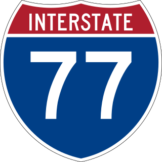
Interstate 77 (I-77) is a part of the Interstate Highway System that runs from Columbia, South Carolina, to Cleveland, Ohio. In North Carolina, I-77 enters the state at Charlotte, from South Carolina. Crossing the Piedmont, it connects with Statesville before continuing north into Virginia. The landscapes traversed by I-77 is a contrast of urban and rural foothills, with views of the Blue Ridge Mountains seen from a distance on its most northern section. The Interstate extends for 105.7 miles (170.1 km) and has one auxiliary route.
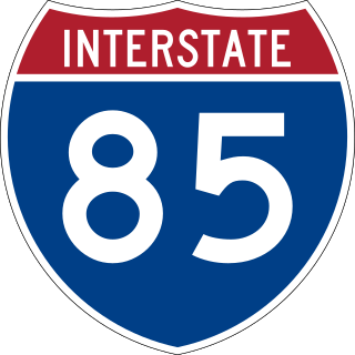
Interstate 85 (I-85) is an Interstate Highway that runs from Montgomery, Alabama, to Petersburg, Virginia. In North Carolina, I-85 travels 231.23 miles (372.13 km) from the South Carolina state line near Grover to the Virginia state line near Wise. Despite being signed north–south, I-85 physically travels in a southwest–northeast direction across the state. The major landscapes traversed by I-85 include urban and rural pockets of the Piedmont region, with views of Kings Pinnacle seen from its southernmost stretch. The Interstate Highway connects the three most populous metropolitan areas of North Carolina: the Charlotte metropolitan area, Piedmont Triad, and Research Triangle, as well as nine of the 20 largest municipalities in the state. Outside of North Carolina, I-85 connects the state with Richmond, Virginia, to the north and Upstate South Carolina and Atlanta, Georgia, to the south. I-85 parallels several US Highways including US Highway 29 (US 29) between South Carolina and Greensboro, US 70 between Greensboro and Durham, US 15 between Durham and Oxford, and US 1 between Henderson and Virginia.
The North Carolina Turnpike Authority was created in 2002 to speed the implementation of needed transportation improvements by funding some projects with tolls. Governed by a nine-member authority board, it is located within the Department of Transportation and under the direct supervision of the Secretary of Transportation. The authority has the power to study, plan, develop and undertake preliminary design work on up to eleven turnpike projects. At the conclusion of these actives, the authority is authorized to design, establish, purchase, construct, operate and maintain toll highways and bridges. The authority is also authorized to designate one or more lanes of any highway, or portion thereof, into a high-occupancy toll lanes or other type of managed lanes; provided that such designation does not reduce the number of existing non-toll general purpose lanes.

U.S. Route 421 (US 421) is part of the United States Numbered Highway System that runs from Fort Fisher, North Carolina to Michigan City, Indiana. In the U.S. state of North Carolina, US 421 travels 328 miles (528 km) from its southern terminus at Fort Fisher to the Tennessee state line near the community of Zionville, North Carolina. US 421 traverses the state from east to west travelling from the coastal plains to Appalachian Mountains. It provides an important connection between the cities of Wilmington, Sanford, Greensboro, Winston-Salem, and Boone. Despite being signed as north–south, much of the routing of US 421 in North Carolina runs in an east–west direction, particularly between Greensboro and the Tennessee state line. Portions of US 421 have been upgraded to freeway standards including the majority of its routing between Sanford and North Wilkesboro.
The Triangle Expressway (TriEx) is the first modern toll road built in North Carolina, and one of the first toll roads in the United States built to use only electronic toll collection instead of toll booths. The overall freeway consists of two segments called the Triangle Parkway and the Western Wake Freeway. The six-lane Triangle Parkway extends Interstate 885 (I-885) 3.5 miles (5.6 km) via North Carolina Highway 885 (NC 885) in Durham County to meet North Carolina Highway 540 (NC 540) in Morrisville in Wake County. The Western Wake Freeway extends the total Triangle Expressway to 17.5 miles (28.2 km) long, extending NC 540 where it continues along to Holly Springs.

The Charlotte metropolitan area, sometimes referred to as Metrolina, is a metropolitan area of the U.S. states of North and South Carolina, containing the city of Charlotte. The metropolitan area also includes the cities of Gastonia, Concord, Huntersville, and Rock Hill as well as the large suburban area in the counties surrounding Mecklenburg County, which is at the center of the metro area. Located in the Piedmont, it is the largest metropolitan area in the Carolinas, and the fourth largest in the Southeastern United States. The Charlotte metropolitan area is one of the fastest growing metropolitan areas in the United States.
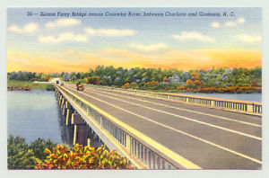
The Sloans Ferry Bridge is a four-lane automobile bridge spanning the Catawba River/Lake Wylie between Belmont, in Gaston County, and Charlotte, in Mecklenburg County. The bridge carries US 29/US 74 and is utilized mostly by local traffic.

North Carolina Highway 192 (NC 192) is a proposed east-west primary state highway designation in the U.S. state of North Carolina. It will serve as the designation of an existing 2.6-mile (4.2 km) segment of freeway between Interstate 40 (I-40) Winston-Salem and the Winston-Salem Northern Beltway near Union Cross, currently designated I-74 and formerly U.S. Route 311 (US 311). NC 192 will be designated when the final section of the Winston-Salem Northern Beltway opens sometime in 2026, at which point I-74 will be rerouted onto that road. The highway is completed but not yet signed.
The Monroe Expressway, designated U.S. Route 74 Bypass, is a 18.68-mile (30.06 km) controlled-access toll road in Union County in the U.S. state of North Carolina, the first to be completed in the Charlotte area. It serves as a bypass of the communities of Indian Trail, Monroe, and Wingate for U.S. Route 74 (US 74), running generally parallel to the route.
