
Ballston is a neighborhood in Arlington County, Virginia. Located at the western end of the Rosslyn-Ballston corridor, Ballston is a major transportation hub, and boasts one of the nation's highest concentrations of scientific research agencies, including the Office of Naval Research, the Virginia Tech Advanced Research Institute, and the Air Force Office of Scientific Research.

Clarendon is an urbanized, upper-class neighborhood in Arlington County, Virginia, located between the Rosslyn area and the Ballston area. It was named after Edward Hyde, 1st Earl of Clarendon, a leading statesman and historian of the English Civil War. The main thoroughfares are Wilson Boulevard and Clarendon Boulevard.

Pentagon City is an unincorporated neighborhood located in the southeast portion of Arlington County, Virginia, near The Pentagon and Arlington National Cemetery.

The Washington and Old Dominion Railroad Regional Park is a linear regional park in Northern Virginia. The park's primary feature is the Washington and Old Dominion Railroad Trail, an asphalt-surfaced paved rail trail that runs through densely populated urban and suburban communities as well as through rural areas. Most of the trail travels on top of the rail bed of the former Washington and Old Dominion Railroad, which closed in 1968.

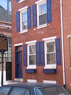
Kensington is a neighborhood in Philadelphia, Pennsylvania, United States, which straddles Lower Northeast and North Philadelphia. It is part of the River Wards. Modern Kensington is larger than the former Kensington District, and unlike the latter, the former does not include Fishtown.

Potomac Yard is a neighborhood in Northern Virginia that straddles southeastern Arlington County and northeastern Alexandria, Virginia, located principally in the area between U.S. Route 1 and the Washington Metro Blue Line /Yellow Line tracks. The area was home to what was once one of the busiest rail yards on the Eastern Seaboard of the United States. The "Potomac Yard" name is also used to refer to several developments in the area, especially the Potomac Yard Retail Center strip mall and a planned Washington Metro rail station.

Four Mile Run is a 9.4-mile-long (15.1 km) stream in Northern Virginia that starts near Interstate 66, at Gordon Avenue in Fairfax County and proceeds southeast through Falls Church to Arlington County in the U.S. state of Virginia. Most of the stretch is parkland and is paralleled by two paved non-motorized transport and recreational trails, the Washington & Old Dominion Railroad Trail and the Four Mile Run Trail.
Bella Vista, Italian for "beautiful sight", is a neighborhood in the South Philadelphia section of Philadelphia, Pennsylvania.

Fairlington is an unincorporated neighborhood in Arlington County, Virginia, United States, located adjacent to Shirlington in the southernmost part of the county on the boundary with the City of Alexandria. The main thoroughfares are Interstate 395 which divides the neighborhood into North and South Fairlington, State Route 7 and State Route 402.

The earliest electric railway, or streetcar line, in Northern Virginia opened in 1892. At their peak, when merged into a single interurban system, the successors of this and several other lines ran between downtown Washington, D.C., Rosslyn and Arlington Junction – in present-day Crystal City – and out to Mount Vernon, Fairfax City and Nauck.

Lyon Village is a neighborhood, or "urban village" located in Arlington County, Virginia, along Lee Highway. It adjoins Arlington County's government center, and is approximately one mile west of Rosslyn and less than a mile north of Clarendon, of which it is sometimes considered a sub-neighborhood, as is Cherrydale, the mostly residential district immediately west of Lyon Village.
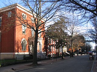
Court End is a neighborhood in Richmond, Virginia, that sits to the north of the Capitol Square and East Broad Street. It developed in the Federal era, after Virginia's capital moved from Williamsburg.

The boundary markers of the original District of Columbia are the 40 milestones that marked the four lines forming the boundaries between the states of Maryland and Virginia and the square of 100 square miles (259 km2) of federal territory that became the District of Columbia in 1801. Working under the supervision of three commissioners that President George Washington had appointed in 1790 in accordance with the federal Residence Act, a surveying team that Major Andrew Ellicott led placed these markers in 1791 and 1792. Among Ellicott's assistants were his brothers Joseph and Benjamin Ellicott, Isaac Roberdeau, George Fenwick, Isaac Briggs and an African American astronomer, Benjamin Banneker.
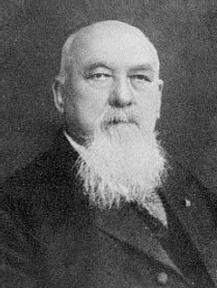
Samuel Swinfin Burdett was a U.S. Representative from Missouri.

The Ball–Sellers House, also named the John Ball House, is the oldest building in Arlington County, Virginia. It is an historic home located at 5620 Third Street, South, in the County's Glencarlyn neighborhood. The Arlington Historical Society, which owns the building, estimates that the one room log cabin was built in the 1740s.

Carlin Hall, also known as Curtis Hall, Carlin Community Hall, Glencarlyn School, Glencarlyn Recreation Center, and is a historic community center located in the Glencarlyn section of Arlington, Virginia. It was built in 1892, and is a tall one-story, frame, Late Victorian cross-plan community hall. It measures approximately 45 feet wide and 30 feet deep. The standing seam metal gable roof is topped by a four-sided wood cupola. It originally served as a meeting place for the newly formed Glencarlyn civic association and the Episcopal church congregation, provided a place for a variety of community social events. The building housed an elementary school from the 1920s to 1950. In 1953, it was returned by Arlington County as a community center.

The Glencarlyn Historic District is a national historic district located in the Glencarlyn neighborhood of Arlington County, Virginia. It contains 276 contributing buildings, two contributing sites, one contributing structure, and one contributing object in a residential neighborhood in South Arlington. The area was platted in 1887 as Carlin Springs and continued to develop throughout the 20th century as a residential subdivision. The dwelling styles include a variety of architectural styles, ranging from Craftsman-style bungalows, Colonial Revival–style, and Queen Anne style dwellings. Notable buildings and sites include the Carlin Family Cemetery, Glencarlyn Library, and St. John's Episcopal Church. Also located in the district are the separately listed Ball-Sellers House and Carlin Hall.
Alexandria, Virginia, an independent city in the Commonwealth of Virginia, is located along the western bank of the Potomac River. The city of approximately 151,000 is about six miles south of downtown Washington, D.C..
Nauck is a neighborhood in the southern part of Arlington County, Virginia, known locally as Green Valley. It is bordered by Four Mile Run and Shirlington to the south, Douglas Park to the west, I-395 to the east, and Columbia Heights and the Army-Navy Country Club to the north. The southeastern corner of the neighborhood borders the City of Alexandria.

The Arlington Public Library is a public library system located in Arlington County, Virginia. The library system includes nine locations that serve 214,373 people.


