The Battle of Lostwithiel took place over a 13-day period from 21 August to 2 September 1644, around the town of Lostwithiel and along the River Fowey valley in Cornwall during the First English Civil War. A Royalist army led by Charles I of England defeated a Parliamentarian force commanded by the Earl of Essex.
Camelford is a town and civil parish in north Cornwall, England, United Kingdom, situated in the River Camel valley northwest of Bodmin Moor. The town is approximately ten miles (16 km) north of Bodmin and is governed by Camelford Town Council. Lanteglos-by-Camelford is the ecclesiastical parish in which the town is situated. The ward population at the 2011 Census was 4,001. The town population at the same census was 865.

Fowey is a port town and civil parish at the mouth of the River Fowey in south Cornwall, England, United Kingdom. The town has been in existence since well before the Norman invasion, with the local church first established some time in the 7th century; the estuary of the River Fowey forms a natural harbour which enabled the town to become an important trading centre. Privateers also made use of the sheltered harbourage. The Lostwithiel and Fowey Railway brought China clay here for export.

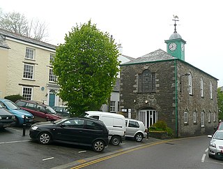
Lostwithiel is a civil parish and small town in Cornwall, England, United Kingdom at the head of the estuary of the River Fowey. According to the 2001 census it had a population of 2,739, increasing to 2,899 at the 2011 census. The Lostwithiel electoral ward had a population of 4,639 at the 2011 census. The name Lostwithiel comes from the Cornish "lostwydhyel" which means "tail of a wooded area".
Trebetherick is a village on the north coast of Cornwall. It is situated on the east side of the River Camel estuary approximately six miles (10 km) north of Wadebridge and half a mile south of Polzeath.
Blisland is a village and civil parish in Cornwall, England, United Kingdom. It is approximately five miles northeast of Bodmin. According to the 2001 census, the parish had a population of 565. This had increased to 608 at the 2011 census.

St Ervan is a rural civil parish and hamlet in Cornwall, England, United Kingdom. The hamlet is situated three miles (5 km) southwest of Padstow. St Ervan is named after St Erbyn, the original patron of the church, who is said to have been the father of St Selevan. Notable features in St Ervan are the Anglican church, the village hall and the Nonconformist cemetery. The parish population at the 2011 census was 521. In addition to the hamlet of St Ervan, also called Churchtown, the parish incorporates the hamlets of Penrose and Rumford.

Lanlivery is a village and civil parish in Cornwall, England, United Kingdom. The village is about 1+1⁄2 miles (2.4 km) west of Lostwithiel and five miles (8 km) south of Bodmin. The Saints' Way runs past Lanlivery. Helman Tor, Red Moor and Breney Common nature reserves lie within the parish.

St Sampson is a civil parish in mid-Cornwall, England, United Kingdom. The population at the 2011 census was 260.
Colan is a village and civil parish in mid-Cornwall, England, United Kingdom. It is situated approximately three miles (5 km) east of Newquay. The electoral ward is called Colan and Mawgan. The population of this ward at the 2011 census was 4,256 The hamlets of Bosoughan, Chapel, Gwills, Kestle Mill, Lane, Mountjoy, Quintrell Downs, Trebarber and Trencreek are in the parish. The Fir Hill, and Firhill Woods near Nanswhyden, contains the ruins of Fir Hill Manor. Colan Church dates back to the thirteenth century.

Helland is a civil parish and village in Cornwall, England, United Kingdom. It is situated 2+1⁄2 miles (4.0 km) north of Bodmin. The meaning of the name Helland is unclear: it is possible that the origin is in Cornish hen & lan. The original dedication of the church is unknown but St Helena is now recognised as the patron.
Nanstallon is a village in mid-Cornwall, England, United Kingdom. It is situated approximately two miles (3 km) west of Bodmin.

Withiel is a civil parish and village in mid Cornwall, England, United Kingdom. The parish of Withiel is between the parishes of St Breock, Lanivet, Roche and St Wenn. The name Withiel comes from the Cornish word Gwydhyel, meaning "wooded place". The parish contains the hamlets of Withielgoose, Retire and Tregawne; the parish had a total population of about 300 in 1824.

Cornwall played a significant role in the English Civil War, being a Royalist enclave in the generally Parliamentarian south-west.
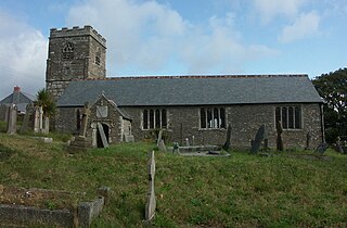
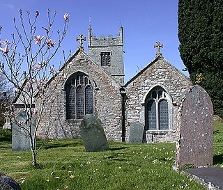
St Sampson's Church is the Church of England parish church of the village of Golant, Cornwall, England, United Kingdom; it is dedicated to St Sampson of Dol.

Lanteglos is a coastal civil parish in south Cornwall, England, United Kingdom. It is on the east side of the tidal estuary of the River Fowey which separates it from the town and civil parish of Fowey. The South West Coast Path runs along the southern coasts of the parish and much of the southern part of the parish lies in the Polruan to Polperro Site of Special Scientific Interest managed by the National Trust.
Bilberry is a village in mid Cornwall, England, United Kingdom. It is approximately five miles (8 km) north of St Austell on the A391 road in the china clay extraction area. It is in the civil parish of Roche.
Milltown is a hamlet in Cornwall, England. It lies in Lanlivery civil parish, about a mile south of Lostwithiel, in the valley of a small tributary of the River Fowey.
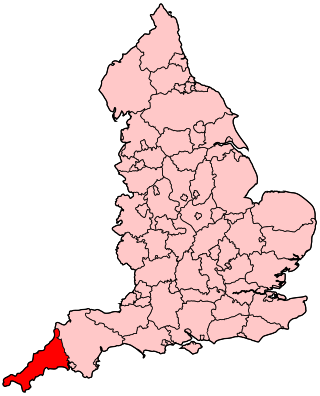
The following outline is provided as an overview of and topical guide to Cornwall: Cornwall – ceremonial county and unitary authority area of England within the United Kingdom. Cornwall is a peninsula bordered to the north and west by the Celtic Sea, to the south by the English Channel, and to the east by the county of Devon, over the River Tamar. Cornwall is also a royal duchy of the United Kingdom. It has an estimated population of half a million and it has its own distinctive history and culture.
Presented below is an alphabetical index of articles related to Cornwall:


