Goodsprings, Nevada

Last updated
Goodsprings, Nevada
Goodsprings Nevada 4.jpg
The town of Goodsprings, Nevada on November 26, 2006.
Clark County Nevada Incorporated Areas Goodsprings highlighted.svg
Location of Goodsprings in Clark County, Nevada
Coordinates: 35°49′57″N115°26′03″W / 35.83250°N 115.43417°W / 35.83250; -115.43417 [1]
Country United States
State Nevada
County Clark
Founded1900;124 years ago (1900)
Named for Joseph Good
Area
[2]
  Total0.98 sq mi (2.53 km2)
  Land0.98 sq mi (2.53 km2)
  Water0.00 sq mi (0.00 km2)
Elevation
[1]
3,707 ft (1,130 m)
Population
 (2020)
  Total162
  Density165.81/sq mi (64.03/km2)
Time zone UTC-8 (PST)
  Summer (DST) UTC-7 (PDT)
ZIP code
89019
Area code(s) 702 and 725
FIPS code 32-29500
Reference no.102

Goodsprings is an unincorporated community in Clark County, Nevada, United States. [3] The Pioneer Saloon and the Goodsprings School house were both built in 1913 and are still in use to this day. The town was once a prosperous prosperous mining town before seeing a significant decline in the population. [4] The population was 229 as of the 2010 census. [5] Due to this, the town of Goodsprings has been characterized as a ghost town. [6]

Contents

History

Goodsprings Schoolhouse was built in 1913 Goodsprings Schoolhouse.jpg
Goodsprings Schoolhouse was built in 1913

The town was named for cattle rancher Joseph Good, whose cattle frequented a spring nestled in the southeastern foothills of the Spring Mountains. [6] [7] Mormon miners discovered lead at Potosi Mountain in 1856. [8] Gold was first discovered in the region in 1893. [6] Goodsprings was once the heart of the most productive mining districts in Clark County. [9] Over the years, lead, silver, copper, zinc and gold have all been mined from this area.

Before 1900, a small cluster of tent cabins and a mill were erected, and a post office. Lincoln County established Goodsprings Township. In 1904, Salt Lake City mining interests platted the Goodsprings Township. Most early buildings in the town were constructed during the boom spurred by the railroad in 1910–1911.

After a number of moves, the current Goodsprings Schoolhouse was erected in 1913. Now on the National Register of Historic Places, it is the oldest school in Clark County that was built as a school and is still used as a school. [8] In 2009 citing costs, the school was nearly shut down. [10] [11] By 2016, the school had only around 10 students. [8]

The town boasted a population of 800 by 1918. [6] Lead mining increased during World War 1 to produce ammunition. [12] However, after World War I, mining slowed and families moved away. World War II created a second boom, but it too slowed after the war ended. [9] The town's population has dwindled to approximately 200. [11]

In the 1950's, the area was home to atomic testing. [11]

Many of the buildings that were once built no longer are standing in Goodsprings. A major cause were the several fires destroyed buildings in the city, including a 1966 fire which destroyed the local Fayle Hotel. [9] The Goodsprings Historical Society has attempted to preserve and restore local buildings by making repairs to the roofs. [13]

Pioneer Saloon

The Pioneer Saloon, built in 1913 Goodsprings Nevada Pioneer Saloon 2.jpg
The Pioneer Saloon, built in 1913

Goodsprings is the home of the Pioneer Saloon, which opened in 1913 and is considered to be one of the oldest saloons in Nevada. [4] [14] The walls of the saloon are made out of pressed tin. [6] On June 27, 1915 a dispute over a card game resulted between Paul Coski and miner Joe Armstrong resulted in Armstrong firing twice at Coski, killing him. [15] [16] Armstrong was initially exonerated of wrong doing by coroner's jury on the basis of self-defense. [15] He was subsequently put on trial and found not-guilty according to Reno Gazette-Journal on the basis that "he had never been a quarrelsome man, and had a splendid record". [17] The contemporary saloon showcases two holes in the wall that it says were bullet holes from the shooting with a local newspaper article explaining the case. [4]

The Pioneer Saloon and several other locations around Los Vegas were raided in 1924 by regulatory officers in violation of prohibition banning the sale of alcohol. [18]

In addition, the Pioneer Saloon has a small memorial to both Clark Gable and Carole Lombard. Ms. Lombard's plane TWA Flight 3 crashed into nearby Potosi Mountain on January 16, 1942. [19] The saloon and hotel were the centers of operations for the search. [20] The accident resulted in her death. It has a memorial to Clark Gable as well as Carole Lombard, whose plane crashed nearby in 1942. [21] [22] A new owner perchased the saloon in 2006, and put around 2 million dollars renovating the building. [12] The Pioneer Saloon was purchased in 2021 for 1.5 million dollars after the previous owner had owned it for 15 years. [4]

The saloon has also been used as a filming location for film productions such as Fear and Loathing in Las Vegas , and Miss Congeniality as well as the reality television series Ghost Adventures . [19] This saloon appeared in several films and TV series, such as The Twilight Zone , The Misfits , and Cherry 2000 .[ citation needed ] Two gatherings for fans of the video game Fallout: New Vegas were held in the town. In July 2022 and November 2023 at the Pioneer Saloon which organizers had hoped would become a yearly meetup. [23] [24] The saloon has a small corner dedicated to the game which is re-created accurately in the video game. [25] [19]

Energy Production

The Goodsprings Waste Heat Recovery Station opened in 2010, providing 7.5MW of energy from waste heat produced at a Kern River Pipeline compressor station. [26] The plant is owned and operated by NV Energy and is the first renewable energy plant owned by the company. [27] [28] [29] The plant which cost $22 million was constructed by Ormat Technologies construction began in March 2010 and began operations in November of that year. [27] [28] [30] [31] [26]

Geography

Goodsprings is in the Goodsprings Valley of southern Nevada. The Bird Spring Range lies to the northeast with Las Vegas beyond. The community is on Nevada State Route 161 five miles northeast of Jean and Interstate 15. [32]

According to the United States Census Bureau, the census-designated place (CDP) of Goodsprings has a total area of 1.5 square miles (3.9 km2), all of it land.

Climate

Goodsprings experiences an arid climate with long, hot summers, and mild winters.

Climate data for Goodsprings, Nevada (elevation 3,707 ft)
MonthJanFebMarAprMayJunJulAugSepOctNovDecYear
Record high °F (°C)73
(23)
75
(24)
86
(30)
95
(35)
108
(42)
112
(44)
115
(46)
113
(45)
105
(41)
95
(35)
81
(27)
68
(20)
115
(46)
Mean daily maximum °F (°C)55.2
(12.9)
58.1
(14.5)
67.0
(19.4)
74.9
(23.8)
88.8
(31.6)
98.0
(36.7)
101.8
(38.8)
99.4
(37.4)
91.9
(33.3)
77.3
(25.2)
63.7
(17.6)
53.4
(11.9)
77.4
(25.2)
Mean daily minimum °F (°C)31.8
(−0.1)
34.3
(1.3)
39.0
(3.9)
44.1
(6.7)
54.0
(12.2)
61.5
(16.4)
68.8
(20.4)
66.6
(19.2)
60.5
(15.8)
49.9
(9.9)
38.1
(3.4)
31.7
(−0.2)
48.4
(9.1)
Record low °F (°C)9
(−13)
14
(−10)
21
(−6)
25
(−4)
36
(2)
41
(5)
55
(13)
48
(9)
42
(6)
31
(−1)
16
(−9)
13
(−11)
9
(−13)
Average precipitation inches (mm)0.90
(23)
1.63
(41)
0.47
(12)
0.45
(11)
0.04
(1.0)
0.02
(0.51)
0.55
(14)
0.54
(14)
0.30
(7.6)
0.67
(17)
0.33
(8.4)
0.91
(23)
6.82
(173)
Average snowfall inches (cm)0.4
(1.0)
0.8
(2.0)
0.2
(0.51)
0
(0)
0
(0)
0
(0)
0
(0)
0
(0)
0
(0)
0
(0)
0
(0)
2.3
(5.8)
3.7
(9.4)
Source: The Western Regional Climate Center [33]

Demographics

Historical population
CensusPop.Note
2020 162
U.S. Decennial Census [34]

As of the census [35] of 2000, there were 232 people, 107 households, and 63 families residing in the CDP. The population density was 155.7 inhabitants per square mile (60.1/km2). There were 122 housing units at an average density of 81.9 per square mile (31.6/km2). The racial makeup of the CDP was 89.66% White, 1.72% African American, 0.43% Native American, 1.72% from other races, and 6.47% from two or more races. Hispanic or Latino of any race were 4.74% of the population.

There were 107 households, out of which 20.6% had children under the age of 18 living with them, 45.8% were married couples living together, 11.2% had a female householder with no husband present, and 40.2% were non-families. 35.5% of all households were made up of individuals, and 13.1% had someone living alone who was 65 years of age or older. The average household size was 2.17 and the average family size was 2.83.

In the CDP, the population was spread out, with 22.8% under the age of 18, 3.0% from 18 to 24, 22.8% from 25 to 44, 28.9% from 45 to 64, and 22.4% who were 65 years of age or older. The median age was 46 years. For every 100 females, there were 90.2 males. For every 100 females age 18 and over, there were 105.7 males.

The median income for a household in the CDP was $40,430, and the median income for a family was $58,125. Males had a median income of $35,924 versus $28,594 for females. The per capita income for the CDP was $22,282. None of the families and 9.2% of the population were living below the poverty line, including no under eighteens and 19.6% of those over 64.

Education

Goodsprings has a public library, a branch of the Las Vegas-Clark County Library District. [36]

Related Research Articles

<span class="mw-page-title-main">Nevada</span> U.S. state

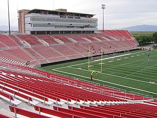
Nevada is a landlocked state in the Western region of the United States. It borders Oregon to the northwest, Idaho to the northeast, California to the west, Arizona to the southeast, and Utah to the east. Nevada is the 7th-most extensive, the 32nd-most populous, and the 9th-least densely populated of the U.S. states. Nearly three-quarters of Nevada's people live in Clark County, which contains the Las Vegas–Paradise metropolitan area, including three of the state's four largest incorporated cities. Nevada's capital is Carson City. Las Vegas is the largest city in the state.

<span class="mw-page-title-main">Clark County, Nevada</span> County in Nevada, United States

Clark County is a county located in the U.S. state of Nevada. The land area of Clark County is 8,061 square miles (20,880 km2), or roughly the size of New Jersey. As of the 2020 census, the population was 2,265,461. Most of the county population resides in the Las Vegas Census County Divisions, which has 2,196,623 people as of the 2020 Census. It is by far the most populous county in Nevada, and the 11th-most populous county in the United States. It covers 7% of the state's land area but holds 73% of the state's population, making Nevada the most centralized state in the United States.

<span class="mw-page-title-main">Bunkerville, Nevada</span> Unincorporated town in the State of Nevada, United States

Bunkerville is a census-designated place in Clark County, Nevada, United States. The population was 1,303 at the 2010 census.

<span class="mw-page-title-main">Indian Springs, Nevada</span> Unincorporated town in the State of Nevada, United States

Indian Springs is an unincorporated town and a census-designated place located on U.S. Route 95 next to Creech Air Force Base in northwestern Clark County and southern Nevada.

<span class="mw-page-title-main">Laughlin, Nevada</span> Unincorporated community in the state of Nevada, United States

Laughlin is an unincorporated community in Clark County, Nevada, United States. Laughlin lies 90 miles (140 km) south of Las Vegas, in the far southern tip of Nevada. As a resort town, it is known for its gaming and water recreation. As of the 2020 census, the population was 8,658. For statistical purposes, the United States Census Bureau has defined Laughlin as a census-designated place (CDP). It is located on the Colorado River, downstream from the Davis Dam and Lake Mohave, and directly across from the much larger Bullhead City, Arizona. The nearby communities of Bullhead City, Arizona; Needles, California; Fort Mohave, Arizona; and Mohave Valley, Arizona, bring the area's total population to about 100,000. Laughlin is also 286 miles (460 km) northeast of Los Angeles.

<span class="mw-page-title-main">Paradise, Nevada</span> Unincorporated town in Nevada, United States

Paradise is an unincorporated town and census-designated place (CDP) in Clark County, Nevada, United States, adjacent to the city of Las Vegas. It was formed on December 8, 1950. Its population was 191,238 at the 2020 census, making it the fifth-most-populous CDP in the United States; if it were an incorporated city, it would be the fifth-largest in Nevada. As an unincorporated town, it is governed by the Clark County Commission with input from the Paradise Town Advisory Board.

<span class="mw-page-title-main">Searchlight, Nevada</span> Unincorporated town in the State of Nevada, United States

Searchlight is an unincorporated town and census-designated place (CDP) in Clark County, Nevada, United States, at the topographic saddle between two mountain ranges. At the 2020 census it had a population of 445.

<span class="mw-page-title-main">Spring Valley, Nevada</span> Unincorporated town in the State of Nevada, United States

Spring Valley is an unincorporated town and census-designated place in Clark County, Nevada, United States, located 2 miles (3 km) west of the Las Vegas Strip. The population was 215,597 at the 2020 census. Spring Valley was formed in May 1981.

<span class="mw-page-title-main">Sunrise Manor, Nevada</span> Census-designated place in Clark County, Nevada, United States

Sunrise Manor is a census-designated place in Clark County, Nevada, United States, located on the western base of Frenchman Mountain, east of Las Vegas. The population was 205,618 at the 2020 census. If Sunrise Manor were to be incorporated, it would be one of the largest cities in Nevada. Sunrise Manor was formed in May 1957.

<span class="mw-page-title-main">Whitney, Nevada</span> Unincorporated town in the State of Nevada, United States

Whitney is an unincorporated town and census-designated place in Clark County, Nevada, United States. The population was 38,585 at the 2010 census.

<span class="mw-page-title-main">Winchester, Nevada</span> Unincorporated town in the State of Nevada, United States

Winchester is an unincorporated town and census-designated place (CDP) in Clark County, Nevada, United States that contains part of the Las Vegas Strip. It is one of a number of CDPs in the unincorporated urbanized area directly south of Las Vegas. The population was 36,403 at the 2020 census. It is governed by the Clark County Commission with advice from the Winchester Town Advisory Board. "Winchester, NV" does not appear in postal addresses; the United States Postal Service has assigned "Las Vegas, NV" as the place name for the ZIP codes containing Winchester.

<span class="mw-page-title-main">Beatty, Nevada</span> Unincorporated town in Nevada, United States

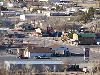
Beatty is an unincorporated town along the Amargosa River in Nye County, Nevada, United States. U.S. Route 95 runs through the town, which lies between Tonopah, about 90 miles (140 km) to the north and Las Vegas, about 120 miles (190 km) to the southeast. State Route 374 connects Beatty to Death Valley National Park, about 8 miles (13 km) to the west.

<span class="mw-page-title-main">Tonopah, Nevada</span> Unincorporated town in the state of Nevada, United States

Tonopah is an unincorporated town in, and the county seat of, Nye County, Nevada, United States. Nicknamed the Queen of the Silver Camps for its mining-rich history, it is now primarily a tourism-based resort city, notable for attractions like the Mizpah Hotel and the Clown Motel.

<span class="mw-page-title-main">Empire, Nevada</span> Place in Nevada, United States

Empire is an unincorporated community and census-designated place (CDP) in Washoe County, Nevada, with a population estimated at 65 (2021). Prior to the 2010 census it was part of the Gerlach–Empire census-designated place, it is now part of the Reno–Sparks Metropolitan Statistical Area. The nearest town, Nixon, is 60 miles (97 km) to the south on a reservation owned by the Pyramid Lake Paiute Tribe.

<span class="mw-page-title-main">Oatman, Arizona</span> Census-designated place in Mohave County, Arizona, United States

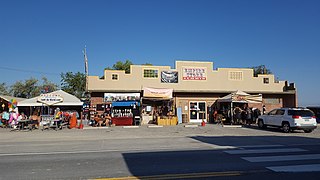
Oatman is a census-designated place (CDP) in the Black Mountains of Mohave County, Arizona, United States, at an elevation of 2,710 feet (830 m). In 1915, it began as a small mining camp when two prospectors struck US$10 million in gold, though the vicinity had already been settled for several years. Oatman's population grew to more than 3,500 in one year. As of the 2020 United States census, its population was 102.

<span class="mw-page-title-main">Jean, Nevada</span> Town in Nevada, United States

Jean is a small commercial town in Clark County, Nevada, United States, located approximately 20 miles (32 km) south of the Las Vegas hotel-casino corridor along Interstate 15, and 12 mi (19 km) north of the Nevada-California border.

<span class="mw-page-title-main">Goodsprings Cemetery (Nevada)</span> Cemetery in Clark County, Nevada, United States

The Goodsprings Cemetery consists of 1.33 acres (0.54 ha) and is an old, continuing cemetery located southwest of Las Vegas, Nevada seven miles (11 km) from Jean and just before entering the town of Goodsprings.

<span class="mw-page-title-main">Potosi Mining District</span> Historic district in Nevada, United States

The Potosi Mining District, or Potosi, was an area in Clark County of southern Nevada, U.S. It is listed on the National Register of Historic Places and includes three structures. The town was named after the famous silver-mining city of Potosi, Bolivia.

<span class="mw-page-title-main">Mizpah Hotel</span> United States historic place

The Mizpah Hotel is a historic hotel in Tonopah, Nevada, U.S. It is a member of Historic Hotels of America, the official program of the National Trust for Historic Preservation.

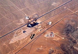
Roach is a ghost town and railroad siding in Clark County, Nevada, United States. It is located along the Union Pacific Railroad, between Jean, Nevada and Nipton, California.

References

  1. 1 2 U.S. Geological Survey Geographic Names Information System: Goodsprings, Nevada
  2. "ArcGIS REST Services Directory". United States Census Bureau. Archived from the original on January 19, 2022. Retrieved September 19, 2022.
  3. "Goodsprings Citizens Advisory Council". Clark County. Archived from the original on 2017-10-19. Retrieved 2015-12-13.
  4. 1 2 3 4 Horwath, Bryan (2021-10-30). "Showman-owner plans Old West future for rustic Nevada saloon". Arkansas Democrat Gazette . Archived from the original on 2021-11-02. Retrieved 2024-05-24.
  5. "Profile of General Population and Housing Characteristics: 2010 Demographic Profile Data (DP-1): Goodsprings CDP, Nevada". United States Census Bureau. Archived from the original on July 9, 2021. Retrieved March 12, 2012.
  6. 1 2 3 4 5 Magazine, Smithsonian. "Nevada's Living and Abandoned Ghost Towns". Smithsonian Magazine. Archived from the original on 2024-05-22. Retrieved 2024-05-24.
  7. Federal Writers' Project (1941). Origin of Place Names: Nevada (PDF). W.P.A. p. 15. Archived (PDF) from the original on 2018-04-09.
  8. 1 2 3 Hidalgo, Jason. "Goodsprings Elementary kids, some adults tested for lead exposure". Reno Gazette Journal. Archived from the original on 2024-05-24. Retrieved 2024-05-24.
  9. 1 2 3 Pesek, Margo Bartlett (April 27, 2015). "Now a ghost town, ruins recall Goodsprings' heyday". Las Vegas Review-Journal. Archived from the original on 2024-02-06. Retrieved 2024-05-24.
  10. Friess, Steve (April 12, 2009). "A Small Nevada Town Fears a Damaging Silence From Its School Bell Soon". New York Times.
  11. 1 2 3 "Good memories of Goodsprings". Las Vegas Review-Journal. 2013-11-09. Archived from the original on 2024-05-24. Retrieved 2024-05-24.
  12. 1 2 Clark, Dave (2017-05-02). "Drunk history". Nevada Public Radio | KNPR. Archived from the original on 2023-11-01. Retrieved 2024-05-24.
  13. Rosch, Denise (2020-10-29). "Ghosts of Goodsprings: residents believe the dead may not have moved on". KSNV. Archived from the original on 2020-11-01. Retrieved 2024-05-24.
  14. Thomas, Bob (July 25, 1993). "Saloon Serves History Along with Beer". Arizona Republic. Phoenix, Arizona. p. T2. Archived from the original on September 21, 2021. Retrieved September 21, 2021.
  15. 1 2 "Will probably have to Stand Trial". Carson City Daily Appeal . 1915-08-31. p. 1. Archived from the original on 2024-05-24. Retrieved 2024-05-24.
  16. "Goodsprings Pioneer Saloon Shooting". The Goldfield News and Weekly Tribune. 1915-07-03. p. 5. Archived from the original on 2024-05-24. Retrieved 2024-05-24.
  17. "Las Vegas Man Acquitted of Murder". Reno Gazette-Journal. 1915-10-22. p. 4. Archived from the original on 2024-05-24. Retrieved 2024-05-24.
  18. "Pioneer Saloon Goodsprings". Reno Gazette. 1924-11-01. p. 3. Archived from the original on 2024-05-24. Retrieved 2024-05-24.
  19. 1 2 3 "Nevada history comes alive at Pioneer Saloon, south of Las Vegas". KLAS. 2023-06-16. Archived from the original on 2023-06-24. Retrieved 2024-05-24.
  20. "Pioneer Saloon in Goodsprings celebrates 100 years of memories". Las Vegas Review-Journal. 2013-11-07. Archived from the original on 2023-06-03. Retrieved 2024-05-24.
  21. "History of the Pioneer Saloon" . Retrieved 2022-12-09.
  22. "Goodsprings Ghost Town | Goodsprings, Nevada". Archived from the original on 2023-01-29. Retrieved 2022-12-09.
  23. "Fallout fans to meet at Pioneer Saloon in Goodsprings". 8 News Now. Archived from the original on 2022-07-10. Retrieved 2022-07-21.
  24. "Fallout: New Vegas inspires a holiday in Nevada town". Archived from the original on 2023-11-23. Retrieved 2022-07-21.
  25. "Welcome to Fabulous New Vegas". KNPR . 2024-04-01. Archived from the original on 2024-05-03. Retrieved 2024-05-24.
  26. 1 2 Jennifer Robison (November 19, 2010). "NV Energy dedicates first company-owned renewable project". Las Vegas Review-Journal. Archived from the original on May 24, 2024. Retrieved November 4, 2012.
  27. 1 2 "Goodsprings Waste Heat Recovery Plant" (PDF). Nevada Power. Archived (PDF) from the original on October 19, 2012. Retrieved November 3, 2012.
  28. 1 2 "Waste Heat Recovery Gains Attention in the US" (PDF). January 12, 2011. Archived (PDF) from the original on September 5, 2012. Retrieved November 3, 2012.
  29. "Thermal Energy Recovery Project enough to Supply 4500 Homes". Solar Thermal Magazine. Archived from the original on October 30, 2012. Retrieved November 3, 2012.
  30. "Waste Heat Recovered at Goodsprings". RenewableEnergyWorld.com. November 30, 2010. Archived from the original on May 24, 2024. Retrieved November 4, 2012.
  31. Jennifer Robison (September 5, 2010). "NV Energy plant repurposes heat from natural-gas compression to yield energy". Las Vegas Review-Journal . Archived from the original on July 14, 2010. Retrieved November 4, 2012.
  32. Nevada Atlas & Gazetteer, DeLorme, 8th ed, 2012, p. 70 ISBN   0899333346
  33. "Seasonal Temperature and Precipitation Information". Western Regional Climate Center. Archived from the original on March 4, 2016. Retrieved April 12, 2013.
  34. "Census of Population and Housing". Census.gov. Archived from the original on February 28, 2022. Retrieved June 4, 2016.
  35. "U.S. Census website". United States Census Bureau. Archived from the original on 2021-07-09. Retrieved 2008-01-31.
  36. "Nevada Public Libraries". PublicLibraries.com. Archived from the original on 8 March 2019. Retrieved 14 June 2019.