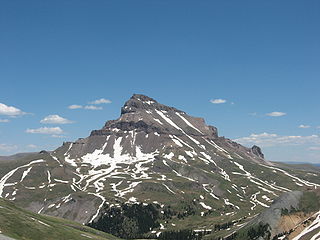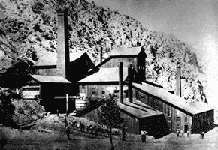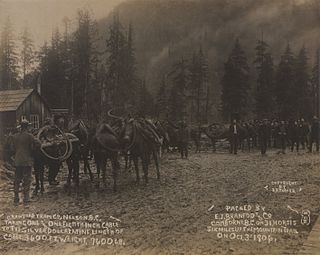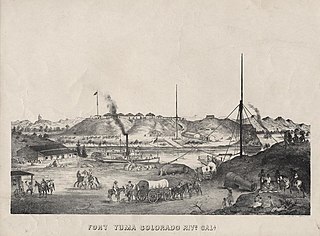
The San Juan Mountains are a high and rugged mountain range in the Rocky Mountains in southwestern Colorado and northwestern New Mexico. The area is highly mineralized and figured in the gold and silver mining industry of early Colorado. Major towns, all old mining camps, include Creede, Lake City, Silverton, Ouray, and Telluride. Large scale mining has ended in the region, although independent prospectors still work claims throughout the range. The last large scale mines were the Sunnyside Mine near Silverton, which operated until late in the 20th century and the Idarado Mine on Red Mountain Pass that closed down in the 1970s. Famous old San Juan mines include the Camp Bird and Smuggler Union mines, both located between Telluride and Ouray.

Panamint City is a ghost town in the Panamint Range, near Death Valley, in Inyo County, California, USA. It is also known by the official Board of Geographic Names as Panamint. Panamint was a boom town founded after silver and copper were found there in 1872. By 1874, the town had a population of about 2,000. Its main street was one mile (1.6 km) long. Panamint had its own newspaper, the Panamint News. Silver was the principal product mined in the area. The town is located about three miles northwest of Sentinel Peak. According to the National Geographic Names Database, NAD27 latitude and longitude for the locale are 36°07′06″N117°05′43″W, and the feature ID number is 1661185. The elevation of this location is identified as being 6,280 feet AMSL. The similar-sounding Panamint Springs, California, is located about 25.8 miles at 306.4 degrees off true north near Panamint Junction.

Galena, Washoe County, Nevada is an abandoned town in Washoe County, Nevada, south of Reno. The portion of Reno just south of Mount Rose Highway and west of Steamboat Springs is also known as Galena.39°20′59″N119°47′19″W

French Corral is an unincorporated community approximately five miles west of California State Highway 49 in Nevada County, California.

Candelaria is a ghost town in Mineral County, Nevada, approximately 121 miles southeast of Fallon. Today the site of Candelaria is dominated by the Kinross Gold Candelaria Mine on Mt. Diablo.

Castle Dome Landing, Arizona is a ghost town in the Castle Dome Mountains of Yuma County in the U.S. state of Arizona. It was first settled as a transport depot and mining camp around 1863 in what was then the Arizona Territory.
Comaplix is the name of former mining town on the Incomappleux River in the northern Arrow Lakes region of British Columbia's Kootenay Country in Canada. The name of the town and an adjacent mountain and creek are derived from that of the river, which is an Okanagan word meaning "point at the head of the lake". The location, now flooded, is on the northeast side of Beaton Arm of Upper Arrow Lake, near the sites of Beaton and Camborne.

Camborne is a locality and former galena-mining town on the east side of the Incomappleux River, northeast of the head of Beaton Arm of Upper Arrow Lake in the Kootenay Country region of British Columbia.

Aubrey Landing, Aubrey City or Aubrey is a ghost town at the mouth of the Bill Williams River in southern Mohave County, Arizona. The town was founded before 1865 and was abandoned sometime after 1886. Aubrey Landing was inundated when Lake Havasu was formed.

Rioville, Nevada was a settlement founded by Latter-day Saints in what they thought was Utah Territory in 1869, now under Lake Mead and within Clark County, Nevada.
Louisville, which is now a ghost town, was a mining camp in El Dorado Canyon near the Techatticup Mine in the Eldorado Mining District, of New Mexico Territory. The camp was probably named for Nat S. Lewis, the superintendent of the Techatticup Mine in the 1860s, and camp doctor.
El Dorado City, which is now a ghost town, was a mining camp in the Colorado Mining District at the mouth of January Wash at its confluence with El Dorado Canyon. It was located about a mile down the canyon from Huse Spring, at an elevation of 2382 feet. Its site was located nearby to the south southeast of the Techatticup Mine the primary source of the ore its mill processed.
Colorado City is now a ghost town, in Clark County, Nevada, located under Lake Mohave at the mouth of El Dorado Canyon.
Potosi or Potosi Camp, was called Crystal City in the 1870s, a mining ghost town in Clark County, Nevada. It lies at an elevation of 5705 feet.
Eureka or Eureka Landing, is a former mining town and steamboat landing, now a ghost town, on the Arizona bank of the Colorado River in what is now La Paz County, Arizona. It was originally located in Yuma County, Arizona from 1863 through the 1870s.
Williamsport is a former mining town and present day ghost town, on the bank of the Colorado River in La Paz County, Arizona.
Clip, or Clip Landing, was a steamboat landing and mill settlement in Yuma County, Arizona Territory. The site in the present day is a ghost town, on the east bank of the Colorado River in La Paz County, Arizona. The settlement was located 70 miles up river from Yuma. It lies at an elevation of 223 feet, just south of Clip Wash, and the road to the Clip Mine at the top of the wash, 8 miles southeast of the mill.


