
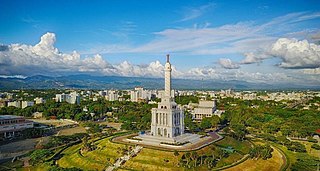
The Dominican Republic is a country in the West Indies that occupies the eastern five-eighths of Hispaniola. It has an area of 48,670 km2, including offshore islands. The land border shared with Haiti, which occupies the western three-eighths of the island, is 376 km long. The maximum length, east to west, is 390 km from Punta de Agua to Las Lajas, on the border with Haiti. The maximum width, north to south, is 265 km from Cape Isabela to Cape Beata. The capital, Santo Domingo, is located on the south coast.

Azua is a province which is collectively one of the thirty-two provinces of the Dominican Republic. It is divided into 10 municipalities and its capital city is Azua de Compostela. It is bordered by the provinces of La Vega to the north-east, San José de Ocoa and Peravia to the east, Barahona and Baoruco to the west and San Juan to the north-west. To the south, Azua has a significant coastline of the Caribbean Sea. Azua is known for its diverse geography and climate, with the southern part of the province having an arid climate that is not the typical tropical-like that is found in other parts of the Caribbean.

Elías Piña is one of the 32 provinces of the Dominican Republic, located in the westernmost part of the country, along the border with Haiti. It is divided into 6 municipalities and its capital city is Comendador. The Cordillera Central is found in the northern part of the province, and the Sierra de Neiba runs across the southern half. Between those two mountain ranges, there are several valleys formed by the Artibonite River and its tributaries.

María Trinidad Sánchez is a province of the Dominican Republic. It was split from Samaná Province in September 1959 as Julia Molina Province; in November 1961, it got its current name. The name commemorates a distinguished female soldier in the wars of independence. María Trinidad Sánchez was the first woman incarcerated and executed by Pedro Santana, a Dominican annexionist president.

Peravia is a province in the southern region of the Dominican Republic. Before January 1, 2002 it was included in what is the new San José de Ocoa province, and published statistics and maps generally relate it to the old, larger, Peravia.
Samaná is a province of the Dominican Republic in the Samaná Peninsula located in the eastern region. Its capital is Santa Bárbara de Samaná, usually known as Samaná.
Santiago is a province which currently comprises one of the 32 provinces of the Dominican Republic. It is divided into 10 municipalities and its capital city is Santiago de los Caballeros. Located in north-central Dominican Republic, in the Cibao region, it is bordered by the provinces of Valverde to the north-west, Puerto Plata to the north, Espaillat and La Vega to the east, San Juan to the south and Santiago Rodríguez to the west.

Holguín is a municipality-city in Cuba. After Havana, Santiago de Cuba, and Camagüey, it is the fourth largest city in Cuba.
Isthmus Nahuatl is a Nahuatl dialect cluster spoken by about 30,000 people in Veracruz, Mexico. According to Ethnologue 16, the Cosoleacaque dialect is 84% intelligible with Pajapan, and 83% intelligible with Mecayapan.
Vicente Noble is a municipality in Barahona province in the Dominican Republic.

Azua de Compostela, also known simply as Azua, is a city, municipality (municipio) and capital of Azua Province in the southern region of Dominican Republic. Founded in 1504, Azua is one of the oldest European settlements in the Americas. The town is located 100 kilometres west of the national capital, Santo Domingo.

Peralta is a municipality (municipio) of the Azua province in the Dominican Republic.
Estebanía is a small town about a 10-minute drive from the city of Azua de Compostela in the Azua Province of the Dominican Republic. The town is close to another municipality named Las Charcas. The municipality covers an area of 187.27 km².

Bohechío is a town in the San Juan province of the Dominican Republic. It is located northeast of the km 25 of Azua – San Juan road at a distance of 26.5 km and 43 km from San Juan Province, 205 km from Santo Domingo and 92 km of the Province Azua, nestled between mountains at the foot of the Cordillera Central. It has a land area of 428.33 km2.
Padre Las Casas is a municipality (municipio) of the Azua province in the Dominican Republic. It includes the municipal districts of La Siembra, Las Lagunas, and Los Fríos.
Altamira is a town in the Puerto Plata Province of the Dominican Republic.
San Juan is a province of the Dominican Republic. Before 1961 it was known as Benefactor. San Juan is the Republic's largest province, bearing a size of 3,569 square kilometers, and it is landlocked.

Huápoca is an archaeological site located 36 kilometers west of Ciudad Madera, in the Huápoca Canyon region, northwest of the Mexican state of Chihuahua.

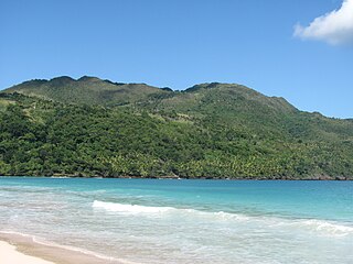
Tourism in the Dominican Republic is an important sector of the country's economy. More than 8.5 million tourists visited the Dominican Republic in 2022, making it the most popular tourist destination in the Caribbean and putting it in the top 5 overall in the Americas. The industry accounts for 11.6% of the nation's GDP and is a particularly important source of revenue in coastal areas of the country. The nation's tropical climate, white sand beaches, diverse mountainous landscape and colonial history attracts visitors from around the world.In 2022, the nation's tourism was named the best-performing nation post-pandemic with over 5% visitors more in comparison to pre-pandemic levels in 2019.

