San Juan de la Maguana

Last updated
San Juan de la Maguana
Die Kathedrale von San Juan Bautista.jpg
Cathedral of San Juan de la Maguana, Dominican Republic
Escudo del Municipio San Juan de la Maguana.png
Dominican Republic relief location map.jpg
Red pog.svg
San Juan de la Maguana
San Juan de la Maguana in the Dominican Republic
Coordinates: 18°48′36″N71°13′48″W / 18.81000°N 71.23000°W / 18.81000; -71.23000
CountryFlag of the Dominican Republic.svg  Dominican Republic
Province San Juan
Founded1503; 1733
Area
[1]
  Total1,876.21 km2 (724.41 sq mi)
Elevation
[2]
415 m (1,362 ft)
Population
 (2012) [3]
  Total169,032
  Density90/km2 (230/sq mi)
  Demonym
Sanjuanero(a)
Distance to
 Santo Domingo

200 km
Municipal Districts
9

San Juan de la Maguana is a city and municipality in the western region of the Dominican Republic and capital of the San Juan province. It was one of the first cities established on the island; founded in 1503, and was given the name of San Juan de la Maguana by San Juan Bautista and the Taino name of the valley: Maguana. The term Maguana means "the first stone, the unique stone". [4]

Contents

Geography

San Juan de la Maguana is in the center of Valley of San Juan with the Central ("Cordillera Central") mountain range to the north and east, and the Sierra de Neiba to the south. To the west there is a range of low hills. The San Juan River is the main river of the region, and the city was founded on the eastern side of this river.

History

San Juan de la Maguana is one of the oldest cities in the country . It occupies the same valley where the chiefdom seat had Maguana and the historic "Corral of the Indians". Their leader and warlord was Caonabo (which in the aboriginal language means "great lord of the earth"), he this chief led one of the most notable battles against the Spanish colonizers.

Alonso de Ojeda captured Caonabo in a ruse. Caonabo's town later became the site of San Juan de la Maguana, founded by Rodrigo Mejia Trillo. [5]

San Juan de la Maguana was founded in 1503 by Diego Velázquez. [6] However, the town experienced little growth and was largely depopulated by 1574 [7] and abandoned by 1605 as part of the Devastations of Osorio. [8]

San Juan province statue. San Juan Province Dominican Republic.jpg
San Juan province statue.

Starting in the late 17th century, the San Juan valley began to be inhabited again by colonists from other settlements in the colony and the Canary islands. In 1733, the town of San Juan was founded once more, close to the site of the original settlement. The town grew steadily during the 18th century, with a population of 1,851 according to a census done in 1777; of them, 1,223 were free and 618 were enslaved. Like many towns in the region at the time, the primary economic activity was cattle ranching. The town exported hundreds of cattle to the neighboring French colony of Saint-Domingue, surpassed in volume only by the towns of Hincha (now part of Haiti as Hinche) and El Seibo. [9]

San Juan was temporarily ruled by the French when the Spanish colony was ceded to France under the Peace of Basel in 1795. It returned to Spanish jurisdiction in 1809 following the Spanish reconquest of Santo Domingo. In 1820, president Jean-Pierre Boyer of Haiti sent Dézir Dalmassi to San Juan and other cities to amass support for the incoming annexation. In 1821, San Juan became part of the short-lived Republic of Spanish Haiti, which would later be annexed by the Republic of Haiti (1820–1849) the following year. [10] During this time, the city was known as Saint-Jean de la Maguâna and was part of the department of Ozama in the Haitian state.

The eastern part of Hispaniola declared independence as the Dominican Republic on February 27, 1844, and San Juan became part of the province of Azua. Haitian forces would attempt to recapture the east in a 12 year war; one of these battles, the Battle of Santomé, took place close to San Juan. Dominican forces prevailed and San Juan and surrounding areas remained a part of the Dominican Republic. [11]

Arco de Triunfo Triumphbogen (Arco del triunfo).jpg
Arco de Triunfo

Since its inception San Juan flourished due to its fertile lands and climate. a diverse range of fruits were grown in the town; the exploitation of sugarcane as a commercial item of importance, were the main line for the employment of labor. San Juan possessed in principle four "mills" for the exploitation of cane. The first of these mills was installed in the center of town.

Economy

The main economic activities in the province are livestock and agriculture; as it has been since the since colonial times thanks to the fertile soil and climate which is suitable for cultivation of cereals and legumes such as beans, rice, corn, peanuts, pigeon peas, and sorghum.

San Juan Dominican Republic.jpg
San Juan residential buildings panoramic view

Culture

The patron saint festivities of San Juan de la Maguana are celebrated on June 24 of each year, the day of San Juan Bautista. San Juan is known on the island for hosting a diversity of cultural traditions. It is known as "Fiesta de palos", which is a ritual done from time to time in the municipality. Figures are made to which magical powers are attributed, called Witches of San Juan.

People in carnival of San Juan de la Maguana, Dominican Republic. Dominican Republic Carnival Parade.jpg
People in carnival of San Juan de la Maguana, Dominican Republic.

In addition, evangelical Christianity has gained a significant presence in the local community, being one of the most growing religious communities in recent years composed mostly of young people. There is also the presence of Jehovah's Witnesses, members of the Church of Jesus Christ of Latter-day Saints, and other religious denominations related to Christianity.

Climate

Owing to its location in a sheltered basin, San Juan de la Maguana has a relatively dry tropical savanna climate (Köppen Aw). Maxima are hot year-round, although the city’s moderate altitude lessens humidity somewhat and cools the mornings by around 4 to 5 °C (7 to 9 °F). There is a very pronounced dry season from December to March, when only 76.9 millimetres or 3.03 inches of rain can be expected, and a moderate wet season covering the remainder of the year

Climate data for San Juan de la Maguana (1961–1990)
MonthJanFebMarAprMayJunJulAugSepOctNovDecYear
Record high °C (°F)33.9
(93.0)
35.5
(95.9)
36.8
(98.2)
36.2
(97.2)
36.2
(97.2)
37.0
(98.6)
39.0
(102.2)
37.5
(99.5)
37.5
(99.5)
36.9
(98.4)
35.0
(95.0)
33.5
(92.3)
39.0
(102.2)
Mean daily maximum °C (°F)29.6
(85.3)
30.4
(86.7)
31.4
(88.5)
31.5
(88.7)
31.0
(87.8)
31.8
(89.2)
32.7
(90.9)
32.7
(90.9)
32.2
(90.0)
31.0
(87.8)
30.1
(86.2)
29.6
(85.3)
31.2
(88.2)
Mean daily minimum °C (°F)15.3
(59.5)
16.1
(61.0)
17.4
(63.3)
18.9
(66.0)
19.9
(67.8)
20.1
(68.2)
19.6
(67.3)
19.8
(67.6)
19.8
(67.6)
19.5
(67.1)
18.1
(64.6)
15.9
(60.6)
18.4
(65.1)
Record low °C (°F)8.5
(47.3)
8.7
(47.7)
9.4
(48.9)
11.8
(53.2)
13.7
(56.7)
15.6
(60.1)
13.5
(56.3)
15.5
(59.9)
13.5
(56.3)
14.0
(57.2)
10.1
(50.2)
7.2
(45.0)
7.2
(45.0)
Average rainfall mm (inches)12.1
(0.48)
15.4
(0.61)
31.2
(1.23)
69.3
(2.73)
141.5
(5.57)
90.2
(3.55)
108.3
(4.26)
128.2
(5.05)
148.4
(5.84)
134.7
(5.30)
53.1
(2.09)
18.2
(0.72)
950.6
(37.43)
Average rainy days (≥ 1.0 mm)1.51.83.15.99.77.97.78.910.310.84.81.573.9
Average relative humidity (%)70.168.567.369.573.372.069.870.272.375.473.871.371.1
Source: NOAA [12]

Demographics

According to the 2012 Population and Housing Census, the municipality had a total population of 169,032. The urban population of the municipality was 60.10%. These population data include the populations of the municipal districts.

Notable people

Related Research Articles

<span class="mw-page-title-main">Hinche</span> Commune in Centre, Haiti

Hinche is a commune in the Centre department of Haiti. It has a population of about 50,000. It is the capital of the Centre department. Hinche is the hometown of Charlemagne Péralte, the Haitian nationalist leader who resisted the United States occupation of Haiti that lasted between 1915–1934.

<span class="mw-page-title-main">Cotuí</span> Place in Sánchez Ramírez, Dominican Republic

Cotuí is a city in the central region of the Dominican Republic and is one of the oldest cities of the New World. It is the capital of Sánchez Ramírez Province in the Cibao.

<span class="mw-page-title-main">Higüey</span> Place in La Altagracia, Dominican Republic

Higüey, or in full Salvaleón de Higüey, is the capital city of the eastern La Altagracia Province, in the Dominican Republic, and the eighth largest city of that country. The Yuma River flows through the urban areas of Higüey.

<span class="mw-page-title-main">Republic of Spanish Haiti</span> Period of Dominican statehood following the 1st independence from Spain (1821–1822)

The Republic of Spanish Haiti, also called the Independent State of Spanish Haiti was the independent state that succeeded the Captaincy General of Santo Domingo after independence was declared on November 30, 1821 by José Núñez de Cáceres. The republic lasted only from December 1, 1821 to February 9, 1822 when it was invaded by the Republic of Haiti.

<span class="mw-page-title-main">Baní</span> Municipality in Peravia, Dominican Republic

Baní is a capital town of the Peravia Province, Dominican Republic. It is the commercial and manufacturing center in the southern region of Valdesia. The town is located 65 km south of the capital city Santo Domingo.

<span class="mw-page-title-main">Bánica</span> Place in Elías Piña, Dominican Republic

San Francisco de Bánica, or simply Bánica, is a town and municipality in the northwest region of Dominican Republic in the Elías Piña province. It is located on the border with Haiti near the Artibonite river. The name Bánica comes from the Taíno name of the region, Banique.

Miches is a town located in El Seibo province in the northeast coast of the Dominican Republic. The community sits between the northern slopes of the Cordillera Oriental and the southern shore of the Samaná Bay.

<span class="mw-page-title-main">Haitian occupation of Santo Domingo</span> Haitian rule in the Dominican Republic (1822 to 1844)

The Haitian occupation of Santo Domingo was the annexation and merger of then-independent Republic of Spanish Haiti into the Republic of Haiti, that lasted twenty-two years, from February 9, 1822, to February 27, 1844. The part of Hispaniola under Spanish administration was first ceded to France and merged with the French colony of Saint Domingue as a result of the Peace of Basel in 1795. However, with the outbreak of the Haitian Revolution the French lost the western part of the island, while remaining in control of the eastern part of the island until the Spanish recaptured Santo Domingo in 1809.

Saint-Michel-de-l'Attalaye is a commune in the Marmelade Arrondissement, in the Artibonite department of Haiti. It has 95,216 inhabitants. It is the second largest city geographically after Port-au-Prince, the national capital. Located in the Central Plateau, it is home to several large Christian churches including one which has been there for over 50 years. It is a scenic locale, surrounded by rich farmland, abundant water resources and distant mountain peaks in every direction. There are excellent schools which are privately funded and a current (2011) small residential development outside of the main town area which is near completion which was originally sponsored by the central government. There is a new joint venture nearing completion with a Taiwanese partner that plans to bring bamboo crafts and goods manufacturing skills training to the local people.

Señorita República Dominicana 1962 was held on January 29, 1962, when 26 candidates competed for the national crown. The winner represented the Dominican Republic at the Miss Universe 1962. The first runner up would enter Miss International 1962. Only the 25 provinces and 1 municipality entered. The top ten contestants wore evening gowns and answered questions to get through to the top 5, where they answered more questions.

<span class="mw-page-title-main">Manuel de Jesús Troncoso de la Concha</span> President of Dominican Republic (1878–1955)

Manuel de Jesús María Ulpiano Troncoso de la Concha was an intellectual and President of the Dominican Republic from 1940 until 1942. Prior to ascending to the presidency, he was vice-president from 1938 to 1940. His term began upon the death of President Jacinto Peynado. He also served in 1911 during the reign of the Council of Secretaries.

<span class="mw-page-title-main">San Juan Province (Dominican Republic)</span> Province of the Dominican Republic

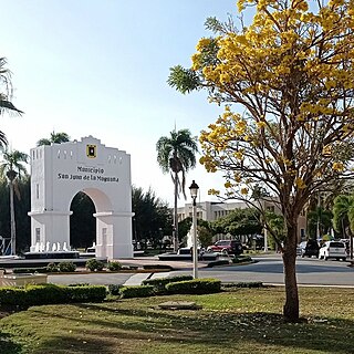
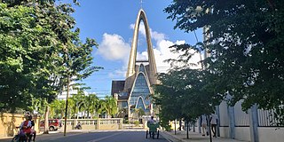
San Juan is a province of the Dominican Republic. Before 1961 it was known as Benefactor. San Juan is the Republic's largest province, bearing a size of 3,569 square kilometers, and it is landlocked.

<span class="mw-page-title-main">Manuel Jimenes</span> 2nd President of the Dominican Republic (1848–49)

Manuel José Jimenes González was one of the leaders of the Dominican War of Independence. He served as the 2nd President of the Dominican Republic from September 8, 1848, until May 29, 1849. Prior to that he served as the country's Minister of War and Marine Affairs.

<span class="mw-page-title-main">Chiefdoms of Hispaniola</span> Tainos tribes in Hispaniola

The chiefdoms of Hispaniola were the primary political units employed by the Taíno inhabitants of Hispaniola in the early historical era. At the time of European contact in 1492, the island was divided into five chiefdoms or cacicazgos, each headed by a cacique or paramount chief. Below him were lesser caciques presiding over villages or districts and nitaínos, an elite class in Taíno society.

White Dominicans are Dominican people of predominant or full European descent. They are 17.8% of the Dominican Republic's population, according to a 2021 survey by the United Nations Population Fund. The majority of white Dominicans have ancestry from the first European settlers to arrive in Hispaniola in 1492 and are descendants of the Spanish and Portuguese who settled in the island during colonial times, as well as the French who settled in the 17th and 18th centuries. Many whites in the Dominican Republic also descend from Italians, Dutchmen, Germans, Hungarians, Scandinavians, Americans and other nationalities who have migrated between the 19th and 20th centuries. About 9.2% of the Dominican population claims a European immigrant background, according to the 2021 Fondo de Población de las Naciones Unidas survey.

<span class="mw-page-title-main">José Gabriel García</span> Dominican politician and historian (1834–1910)

José Gabriel García was a Dominican army officer, historian, politician, journalist and publisher. He is regarded as a cultural pioneer as well as the "Father of Dominican History." He was the author of "Compendium of History of Santo Domingo", published in four volumes in 1867, 1887, 1900 and 1906 respectively, and made numerous contributions in the fields of culture, literature and education.

Don José de Guzmán y Meléndez, 1st Viscount of San Rafael de la Angostura, 1st Baron of San Miguel de la Atalaya, was a Dominican cattle rancher, colonizer, and a peer of the Indies.

<span class="mw-page-title-main">Campuzano-Polanco family</span> Family

Campuzano-Polanco was a prominent family from the Captaincy General of Santo Domingo with origins in Santiago de los Caballeros. During the colonial era of the Hispaniola, their members and descendants went on to occupy high political, military, and ecclesiastical positions, locally and outside the Island, as well as in the metropolis of Spain. Their merits span from the beginning until the end of the colony.

Alberto Ulloa was a painter, sculptor, and poet from Altamira, Dominican Republic. He was a student of the distinguished Latin American painter Jaime Colson, who also mentored Mario Carreño, the Cuban-Chilean master. Ulloa also studied drawing with illustrator and painter Domingo Liz.

<span class="mw-page-title-main">Mixed Dominicans</span> Dominicans of mixed racial origins

Mixed Dominicans, also referred to as mulatto, mestizo or historically quadroon, are Dominicans who are of mixed racial ancestry. Representing 73.9% of the Dominican Republic's population, they are by far the single largest racial grouping of the country.

References

  1. Superficies a nivel de municipios, Oficina Nacional de Estadistica Archived 2009-04-17 at the Wayback Machine
  2. De la Fuente, Santiago (1976). Geografía Dominicana (in Spanish). Santo Domingo, Dominican Republic: Editora Colegial Quisqueyana.
  3. Censo 2012 de Población y Vivienda, Oficina Nacional de Estadistica
  4. "ayuntamientosanjuan.gob.do/historia". ayuntamientosanjuan.gob.do.
  5. Floyd, Troy (1973). The Columbus Dynasty in the Caribbean, 1492-1526. Albuquerque: University of New Mexico Press. pp. 28–29, 63.
  6. Vidal, Pedro Luciano Vergés. Anacaona (1474–1503), p. 195
  7. Hernández González, Manuel (2005). La colonización de la frontera dominicana (1680-1795)[The colonization of the Dominican border (1680-1795)] (in Spanish). Ediciones IDEA. p. 255. ISBN   84-96505-34-0.
  8. Peguero, Valentina; de los Santos, Danilo (1983). Vision general de la historia Dominicana[Overview of Dominican History] (in Spanish). Santo Domingo, Dominican Republic: Editora Corripio, C. por A. pp. 78–79.
  9. Hernández González, Manuel (2005). La colonización de la frontera dominicana (1680-1795)[The colonization of the Dominican border (1680-1795)] (in Spanish). Ediciones IDEA. pp. 256–261. ISBN   84-96505-34-0.
  10. Peguero, Valentina; de los Santos, Danilo (1983). Vision general de la historia Dominicana[Overview of Dominican History] (in Spanish). Santo Domingo, Dominican Republic: Editora Corripio, C. por A. pp. 131–155.
  11. Peguero, Valentina; de los Santos, Danilo (1983). Vision general de la historia Dominicana[Overview of Dominican History] (in Spanish). Santo Domingo, Dominican Republic: Editora Corripio, C. por A. pp. 179–207.
  12. "San Juan Climate Normals 1961-1990". National Oceanic and Atmospheric Administration. Retrieved September 19, 2016.