Fleet Pond is a 48.3-hectare (119-acre) biological Site of Special Scientific Interest in Fleet in Hampshire. It is also a Local Nature Reserve.

The Essex Wildlife Trust (EWT) is one of 46 wildlife trusts which cover the United Kingdom. The EWT was founded in 1959, and it describes itself as Essex's leading conservation charity, which aims to protect wildlife for the future and the people of the county. As of January 2017, it has over 34,000 members and runs 87 nature reserves, 2 nature parks and 11 visitor centres.
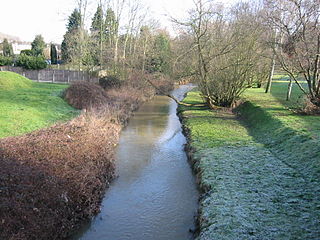
The River Ingrebourne is a tributary of the River Thames 27 miles (43.3 km) in length. It is considered a strategic waterway in London, forming part of the Blue Ribbon Network. It flows through the London Borough of Havering roughly from north to south, joining the Thames at Rainham.
Hornchurch Country Park is a 104.5-hectare park on the former site of Hornchurch Airfield, south of Hornchurch in the London Borough of Havering, east London.

The Cotswold Water Park is the United Kingdom's largest marl lake system, straddling the Wiltshire–Gloucestershire border, north-west of Cricklade and south of Cirencester. There are 180 lakes, spread over 42 square miles (110 km2).

The Thames Chase Community Forest is a community forest of 9842 hectares located in 47 sites in London and Essex, England. Established in 1990, the community forest is administered by the Thames Chase Trust, with a stated aim "to renew and regenerate the landscape at the edge of East London and South Essex by creating a varied wooded landscape for local people to influence, create, use, enjoy and cherish".

Rainham Marshes is an RSPB nature reserve in the east of London, adjacent to the Thames Estuary in Purfleet, Thurrock and the London Borough of Havering.

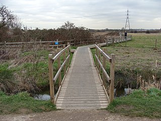
Ingrebourne Valley is a local nature reserve (LNR) in Hornchurch in the London Borough of Havering. It is owned and managed by Havering Council, and has a visitor centre managed by the Essex Wildlife Trust. Most of it is in Hornchurch Country Park west of the River Ingrebourne, but there are also areas north and south of the park which are part of the LNR. It has a wide range of habitats, including woodland, grassland, the river and marshes. It is an important site for a range of species of plants, animals and birds, including great crested newts, slow worms, the harvest mouse and the water vole.
Walthamstow Marshes, is a 36.7-hectare (91-acre) biological Site of Special Scientific Interest in Walthamstow in the London Borough of Waltham Forest. It was once an area of lammas land – common land used for growing crops and grazing cattle.

Broadmoor to Bagshot Woods and Heaths is a 1,696.3-hectare (4,192-acre) biological Site of Special Scientific Interest (SSSI) in Berkshire and Surrey that extend from a minority of the parish of Crowthorne including around Broadmoor Hospital in the west to Bagshot south-east, Bracknell north-east, and Sandhurst, south. It is part of the Thames Basin Heaths Special Protection Area. Two nature reserves which are managed by the Surrey Wildlife Trust are in the SSSI, Barossa nature reserve and Poors Allotment. Broadmoor Bottom, which is part of Wildmoor Heath, also falls within the SSSI; this reserve is managed by the Berkshire, Buckinghamshire and Oxfordshire Wildlife Trust.

The Turnford and Cheshunt Pits is a biological Site of Special Scientific Interest near Cheshunt in Hertfordshire and Essex and covers a total of 428.17 acres. It is part of the Lee Valley Special Protection Area.

Lye Valley is a 2.3-hectare (5.7-acre) biological Site of Special Scientific Interest in Headington, a suburb of Oxford in Oxfordshire. It is part of the 4.5-hectare (11-acre) Lye Valley Local Nature Reserve, which is owned and managed by Oxford City Council.

Old Park Wood is a 16.7-hectare (41-acre) Site of Special Scientific Interest in Harefield in the London Borough of Hillingdon. The south-east part is an 8-hectare (20-acre) nature reserve owned and managed by the Hertfordshire and Middlesex Wildlife Trust.

Brassey is a 2.1-hectare (5.2-acre) biological Site of Special Scientific Interest in Gloucestershire, notified in 1954 and renotified in 1983. It is situated on the north side of the Windrush Valley, midway between Naunton and Upper Slaughter. The reserve comprises sloping, unimproved limestone pasture. There is a fast-flowing stream. This site is one of the few freshwater marshes in Gloucestershire. The stream joins the River Windrush.

Hornchurch Cutting is a 0.8-hectare (2.0-acre) geological Site of Special Scientific Interest in Hornchurch in the London Borough of Havering. It is also a Geological Conservation Review site.
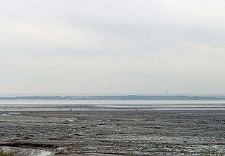
Benfleet and Southend Marshes is an 8.1-square-mile (21 km2) Site of Special Scientific Interest (SSSI) in Essex. It consists of mudflats, salt marshes, scrub and wild grassland, and includes the Southend-on-Sea foreshore. It has been so recognised for its biological value, rather than geological. A definition five percent larger forms the Benfleet and Southend Marshes Ramsar site and Special Protection Area. In the centre-west, more than ten percent of the Site is the Leigh National Nature Reserve (NNR), which has been appraised in detail in A Nature Conservation Review as a site of national importance. The SSSI and NNR include the eastern half of Two Tree Island, in Leigh on Sea which is managed by the Essex Wildlife Trust. A narrow majority of the Site is the Southend on Sea Foreshore Local Nature Reserve.

The Crouch and Roach Estuaries are a 1729 hectare biological Site of Special Scientific Interest (SSSI) at the mouth of the Crouch and Roach rivers in Essex. The Crouch part of the SSSI stretches from near Battlesbridge to Foulness Island, and the Roach from Rochford to the junction with the Crouch. Part of the site is in the Mid-Essex Coast Special Protection Area under the EC Directive on the Conservation of Wild Birds, and a Ramsar wetland site of international importance. It is also part of the Essex Estuaries Special Area of Conservation. An area of 65 hectares is managed by the Essex Wildlife Trust as the Lion Creek and Lower Raypits nature reserve and 8 hectares at Woodham Fen, both of which are managed by the Essex Wildlife Trust. A small area is also a geological SSSI, The Cliff, Burnham-on-Crouch.

Stodmarsh SSSI is a 623.2-hectare (1,540-acre) biological Site of Special Scientific Interest near Stodmarsh, north-east of Canterbury in Kent. Parts of it are a Nature Conservation Review site, Grade I, a National Nature Reserve, a Ramsar internationally important wetland site, a Special Area of Conservation and a Special Protection Area under the European Union Directive on the Conservation of Wild Birds.

Lashford Lane Fen is a 7-hectare (17-acre) nature reserve north of Dry Sandford in Oxfordshire. It is managed by the Berkshire, Buckinghamshire and Oxfordshire Wildlife Trust. It is part of Cothill Fen, which is a Site of Special Scientific Interest and Special Area of Conservation.
