Interstate 190 (New York)

Last updated

I-190 (long).svg

Interstate 190

Niagara Thruway
Interstate 190 (New York)
I-190 highlighted in red
Route information
Auxiliary route of I-90
Maintained by NYSTA, NYSDOT and the Niagara Falls Bridge Commission
Length28.34 mi [1]  (45.61 km)
Existed1959 [2] –present
Tourist
routes
Lake Erie Circle Tour.svg Lake Erie Circle Tour
NHSEntire route
Major junctions
South endI-90.svgNYS Thruway Sign.svg I-90  / New York Thruway in Cheektowaga
Major intersections
North endOntario 405 crown.svg  Highway 405 at the Canada–US border in Lewiston
Location
Country United States
State New York
Counties Erie, Niagara
Highway system
NY-189.svg NY 189 NY-190.svg NY 190
NY-90.svg NY 90 I-90N (NY 1957).svgNY-91.svg NY 91

Interstate 190 (I-190, locally known as One-Ninety) is a north–south auxiliary Interstate Highway in the United States that connects I-90 in Buffalo, New York, with the Canada–United States border at Lewiston, New York, near Niagara Falls. Officially, I-190 from I-90 north to New York State Route 384 (NY 384) is named the Niagara Thruway and is part of the New York State Thruway system. The remainder, from NY 384 to Lewiston, is known as the Niagara Expressway and is maintained by the New York State Department of Transportation (NYSDOT).

Contents

The freeway bisects downtown Buffalo before crossing Grand Island and travelling around the outskirts of Niagara Falls before crossing the Niagara River on the Lewiston–Queenston Bridge into the Canadian province of Ontario. In Canada, the freeway continues as Ontario Highway 405, a short spur connecting with the Queen Elizabeth Way (QEW), which in turn provides a freeway connection to Toronto, Canada's largest city. The 28.34-mile-long (45.61 km) route also provides access to the QEW at the Peace Bridge between Buffalo and Fort Erie, Ontario. I-190 is currently the only three-digit interstate to connect directly with Canada, and one of only two to connect to an international border, the other being I-110 in Texas, which connects to Mexico.

Parts of the highway were built along the former right-of-ways of the Lehigh Valley Railroad and the Erie Canal. The entire route was built as part of the New York State Thruway in the late 1950s and early 1960s and was completed in 1964. The cost of I-190's construction had been paid off by 1996, and, by law, the tolls along the freeway were supposed to be removed at that point; however, this did not occur until 2006. The Grand Island tollbooths remained in place for 12 more years but were taken down in 2018 and replaced with high-speed electronic toll gantries.

Route description

I-190 approaching exit 11 in Buffalo I-190 approaching NY 198.jpg
I-190 approaching exit 11 in Buffalo

I-190 begins at an interchange with the New York State Thruway (I-90) in Cheektowaga in Erie County, just north of the West Seneca town line and east of the Buffalo city line. I-190 heads west into Buffalo, passing the former location of the City Line toll barrier ahead of an interchange with South Ogden Street (exit 1). Farther west, I-190 meets NY 354 (exit 2), NY 16 (exit 3), and several local streets before entering downtown Buffalo. Within the downtown area, I-190 passes between KeyBank Center and Sahlen Field near an interchange with NY 5 (exit 7) on the shores of Lake Erie. At NY 5, I-190 turns northward to follow the path of the Niagara River. Shortly after meeting NY 266 (exit 8) immediately northwest of downtown, I-190 interchanges with Porter Avenue (exit 9), a local roadway connecting I-190 to the Peace Bridge and, thus, the QEW in Canada. [3]

North of downtown Buffalo, I-190 follows the eastern edge of the Black Rock Channel (and passes the site of the former Black Rock toll barrier) before rejoining the banks of the Niagara near an exit with the Scajaquada Expressway (NY 198, exit 11). I-190 continues north through the northern extents of Buffalo, meeting multiple streets before separating from the Niagara and interchanging with NY 266 and NY 324 (exits 15 and 16) in quick succession. At exit 16, NY 324 joins I-190 northward through western Tonawanda. The two routes then meet I-290 and NY 266 a second time prior to crossing the Niagara River on the South Grand Island Bridge. NY 324 leaves the expressway shortly after arriving on Grand Island at exit 18. [3]

Helvetica signage for exit 18A on I-190 I-190 NY north at exit 18A.jpg
Helvetica signage for exit 18A on I-190

I-190 and NY 324 follow parallel routings across Grand Island, with both roads passing on opposite sides of Niagara Amusement Park & Splash World, a local amusement park, near the center of the island. At the northern edge of the island, NY 324, as signed, terminates at exit 20; however, officially, NY 324 rejoins I-190 across the Niagara River once again via the North Grand Island Bridge. Now in Niagara Falls, Niagara County, NY 324 ends at a complex interchange featuring NY 384, the Niagara Scenic Parkway, and the LaSalle Expressway on the eastern bank of the river. Farther north, I-190 meets US Route 62 (US 62) at exit 22 and NY 182 at exit 23. [3]

Past NY 182, I-190 turns to the northwest, skirting the northeastern edge of Niagara Falls and roughly paralleling NY 265 to the east. In Lewiston, the expressway meets NY 31 at exit 24 southwest of the large Robert Moses Niagara Power Plant reservoir. I-190 continues onward, crossing the canal between the reservoir and the power plant on a small dam also used by NY 265. The freeway then interchanges with NY 265, the Niagara Scenic Parkway, and NY 104 at the expansive exit 25 before curving to the west and terminating at the approach to the Lewiston–Queenston Bridge. Across the bridge in Queenston, Ontario, the roadway becomes Highway 405. [3]

History

I-90N (NY 1957).svg

Interstate 90N

Location Buffalo Lewiston
Existed1957 [4] –1959 [2]

The portion of modern I-190 south of NY 384 in Niagara Falls was originally built by the New York State Thruway Authority (NYSTA) as part of the New York State Thruway system. Construction on two segments of the highway—from South Ogden Street to Porter Avenue in downtown Buffalo and from Beaver Island Parkway to West River Road on Grand Island—began in 1953. [5] On Grand Island, construction began to connect the two existing two lane bridges on July 16, 1954. [6] By 1955, construction had begun on the remainder of the Niagara Thruway. [7] On July 30, 1959, the thruway was opened from the Tri-Level Interchange at I-90 to Porter Avenue and from Sheridan Drive to the southern Grand Island bridge. [8] The remainder of the highway, with the exception of the twinned Grand Island bridges, was completed by 1964. [9]

On August 14, 1957, the routing of what is now I-190 (including the then-partially complete Niagara Thruway) was originally designated as I-90N, as intercity routes were assigned before auxiliary Interstate numbers were applied to the shorter intracity routes. [4] I-90N was renumbered to I-190 on February 24, 1959. [2] Construction on the portion of I-190 north of NY 384 began c.1962 [10] [11] and was completed by 1964. [12]

In 1991, maintenance of I-84 in downstate New York was transferred from NYSDOT to the NYSTA. The monies for that purpose came from tolls levied on I-190 in downtown Buffalo. [13] Under the laws authorizing the thruway construction, the tolls were to be removed once the original bonds used to pay for the construction were paid off, which occurred in 1996; however, the tolls would remain for 10 more years. Attorney Carl Paladino brought a lawsuit against the state in 2006 to force the removal of the tolls. [14] On October 30, 2006, the NYSTA voted to both begin the process of returning maintenance of I-84 to NYSDOT and to remove the tolls on I-190 in Buffalo. Collection of the tolls stopped that day. [15] Both major candidates in the 2006 New York gubernatorial election, Democrat Eliot Spitzer and Republican John Faso, had pledged to remove the tolls on I-190 if elected. [16] While the toll barriers in Buffalo were demolished, the tolls further north on the two Grand Island bridges remained for another 12 years. [17] [18] They were finally replaced with electronic tolling in 2018 and have since been demolished. [19]

Exit list

CountyLocationmi [20] kmExitDestinationsNotes
Erie Cheektowaga 0.000.00I-90.svgNYS Thruway Sign.svgAirport Sign.svg I-90  / New York Thruway  Buffalo Airport, Albany, Erie Exit 53 on I-90 / Thruway
Buffalo 0.701.131South Ogden Street
1.562.512NY-354.svgTo plate.svg
US 62.svg
NY 354 (Clinton Street) to US 62 (Bailey Avenue)
2.223.573NY-16.svg NY 16 (Seneca Street)Southbound exit and northbound entrance
3.145.054Smith Street / Fillmore Avenue
3.796.105Hamburg StreetNorthbound exit and entrance
4.136.65Louisiana StreetSouthbound exit and entrance
4.998.036Elm Street Canalside
5.108.217NY-5.svgWest plate green.svg
Lake Erie Circle Tour.svg
NY 5  / LECT west Buffalo Outer Harbor, Lackawanna
No northbound exit
5.208.37Church Street Buffalo Outer Harbor No southbound exit
5.869.438NY-266.svg NY 266 (Niagara Street)
6.5810.599Lake Erie Circle Tour.svg LECT (Porter Avenue / Niagara Street) Peace Bridge, Fort Erie, Canada To Queen Elizabeth Way and Ontario Highway 3
8.6913.9911East plate.svg
NY-198.svg
NY 198 east (Scajaquada Expressway)
Western terminus of NY 198
9.1814.7712Amherst StreetNorthbound exit and southbound entrance
9.4415.1913Austin StreetNorthbound exit and southbound entrance
9.8815.9014Ontario StreetSouthbound exit and northbound entrance
10.5016.90Vulcan StreetNorthbound exit and southbound entrance
Town of Tonawanda 12.3619.8915East plate.svg
NY-324.svg
NY 324 east / Sheridan Drive (NY 325 east) / Kenmore Avenue
Southern temrinus of NY 324 concurrency
13.3321.4516East plate blue.svg
I-290.svg
To plate blue.svg
I-90.svg
To plate blue.svg
NYS Thruway Sign.svg
I-290 east to I-90  / New York Thruway  Rochester, Tonawanda
Western terminus of I-290
14.2022.8517NY-266.svg NY 266 (River Road) North Tonawanda, Tonawanda Signed as "Tonawandas" on guide signs
Niagara River 14.50–
14.90
23.34–
23.98
South Grand Island Bridge (northbound toll)
Grand Island 15.3524.7018AWest plate.svg
NY-324.svg
NY 324 west (Grand Island Boulevard)
Northern terminus of NY 324 concurrency; northbound exit and southbound entrance
15.4624.8818B Beaver Island State Park Signed as exit 18 southbound
17.2727.7919Whitehaven Road
19.3231.0920BEast plate.svg
NY-324.svg
NY 324 east (Grand Island Boulevard) / Long Road
Signed as exit 20 northbound; southern terminus of NY 324 concurrency
19.6931.6920AWest River RoadNo northbound exit
Niagara River 20.32–
21.12
32.70–
33.99
North Grand Island Bridge (southbound toll)
Niagara Niagara Falls 21.1434.0221NY-384.svgNorth plate green.svg
Niagara Scenic Pkwy Shield.svg
NY 384 (Buffalo Avenue) / Niagara Scenic Parkway north Niagara Falls
End plate.svg
NY-324.svg
NY 324 ends
Northern terminus of NY 324 concurrency; Niagara Parkway not signed southbound
21.2434.18Transition between Niagara Thruway and Niagara Expressway
21.5334.6521AEast plate green.svg
LaSalle Expy.svg
LaSalle Expressway east North Tonawanda, Tonawanda
Signed plurally on guide signs as the "Tonawandas"
22.0835.5322US 62.svgAirport Sign.svg US 62 (Niagara Falls Boulevard) Niagara Falls International Airport
Niagara 23.7438.2123NY-182.svg NY 182 (Packard Road / Porter Road)
25.8741.6324NY-31.svg NY 31 (Witmer Road)
Town of Lewiston 27.7244.6125ANY-265.svg NY 265  Lewiston No southbound exit
27.7244.6125BNY-104.svgNiagara Scenic Pkwy Shield.svg NY 104  / Niagara Scenic Parkway  Lewiston Signed as exit 25 southbound; access via Upper Mountain Road
Niagara River 28.3445.61 Lewiston–Queenston Bridge
Canada–US border
Ontario 405 crown.svg Highway 405 west St. Catharines, Hamilton, Toronto Continuation into Ontario
1.000 mi = 1.609 km; 1.000 km = 0.621 mi

See also

Related Research Articles

<span class="mw-page-title-main">Interstate 87 (New York)</span> Interstate Highway in eastern New York

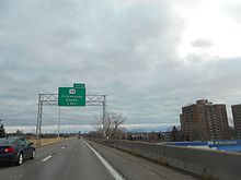
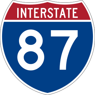
Interstate 87 (I-87) is a 333.49-mile-long (536.70 km) north–south Interstate Highway located entirely within the US state of New York. I-87 is the main highway that connects New York City and Montreal. The highway begins at exit 47 off I-278 in the New York City borough of the Bronx, just north of the Robert F. Kennedy Bridge and Grand Central Parkway. From there, the route runs northward through the Hudson Valley, the Capital District, and the easternmost part of the North Country to the Canada–United States border in the town of Champlain. At its north end, I-87 continues into Quebec as Autoroute 15 (A-15). I-87 connects with several regionally important roads: I-95 in New York City, New York State Route 17 near Harriman, I-84 near Newburgh, and I-90 in Albany. The highway is not contiguous with I-87 in North Carolina.

<span class="mw-page-title-main">New York State Thruway</span> System of controlled-access highways within the U.S. state of New York

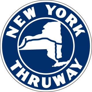
The New York State Thruway is a system of controlled-access toll roads spanning 569.83 miles (917.05 km) within the U.S. state of New York. It is operated by the New York State Thruway Authority (NYSTA), a New York State public-benefit corporation. The 496.00-mile (798.23 km) mainline is a freeway that extends from the New York City line at Yonkers to the Pennsylvania state line at Ripley by way of I-87 and I-90 through Albany, Syracuse, and Buffalo. According to the International Bridge, Tunnel and Turnpike Association, the Thruway is the fifth-busiest toll road in the United States. The toll road is also a major route for long distance travelers linking the cities of Toronto and Buffalo with Boston and New York City.

<span class="mw-page-title-main">Interstate 287</span> Interstate Highway in New Jersey and New York

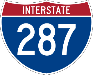
Interstate 287 (I-287) is an auxiliary Interstate Highway in the US states of New Jersey and New York. It is a partial beltway around New York City, serving northern New Jersey and the counties of Rockland and Westchester in New York. I-287, which is signed north–south in New Jersey and east–west in New York, follows a roughly horseshoe-shaped route from the New Jersey Turnpike (I-95) in Edison, New Jersey, clockwise to the New England Thruway (I-95) in Rye, New York, for 98.72 miles (158.87 km). Through New Jersey, I-287 runs west from its southern terminus in Edison through suburban areas. In Bridgewater Township, the freeway takes a more northeasterly course, paralleled by US Route 202 (US 202). The northernmost part of I-287 in New Jersey passes through mountainous surroundings. After crossing into New York at Suffern, I-287 turns east on the New York State Thruway (I-87) and runs through Rockland County. After crossing the Hudson River on the Tappan Zee Bridge, I-287 splits from I-87 near Tarrytown and continues east through Westchester County on the Cross-Westchester Expressway until it reaches the New England Thruway. Within New Jersey, I-287 is maintained by the New Jersey Department of Transportation (NJDOT), and, within New York, it is maintained by the New York State Thruway Authority (NYSTA).

The New York State Thruway Authority (NYSTA) is a public benefit corporation in New York State, United States. The NYSTA was formed in 1950 with the responsibility of constructing, maintaining, and operating the New York State Thruway, a system of limited-access highways within the state.

<span class="mw-page-title-main">Interstate 84 (Pennsylvania–Massachusetts)</span> Interstate Highway in the U.S. states of Pennsylvania, New York, Connecticut, and Massachusetts

Interstate 84 (I-84) is an Interstate Highway in the Northeastern United States that extends from Dunmore, Pennsylvania, near Scranton at an interchange with I-81 east to Sturbridge, Massachusetts, at an interchange with the Massachusetts Turnpike (I-90). Among the major cities that the road passes through is Hartford, Connecticut, and the road provides a major portion of the primary route between New York City and Boston. Another highway named I-84 is located in the Northwestern United States.

<span class="mw-page-title-main">Interstate 88 (New York)</span> Highway in New York

Interstate 88 (I-88) is an Interstate Highway located entirely within the US state of New York. Nominally signed as an east–west road as it has an even number, it extends for 117.75 miles (189.50 km) in a northeast–southwest direction from an interchange with I-81 north of the city of Binghamton to an interchange with the New York State Thruway (I-90) west of Schenectady. The freeway serves as an important connector route from the Capital District to Binghamton, Elmira, and Scranton, Pennsylvania. I-88 closely parallels NY 7, which was once the main route through the area.

<span class="mw-page-title-main">Interstate 290 (New York)</span> Highway in New York

Interstate 290 (I-290) is a 9.8-mile-long (15.8 km) auxiliary Interstate Highway in the Buffalo–Niagara Falls metropolitan area. It connects I-190 in Tonawanda with I-90 in Williamsville, via Amherst. It provides a route to Niagara Falls and Canada from the east that bypasses the city of Buffalo. I-290 also connects to I-990 and, through this connection, provides access to the Amherst campus of the University at Buffalo. Its official name is the Youngmann Memorial Highway, but, locally, it is colloquially referred to as "the 290" and "the Youngmann". The highway provides the fastest road link between Toronto and the heavily populated Northeastern US via I-90.

<span class="mw-page-title-main">Interstate 490 (New York)</span> Highway in New York

Interstate 490 (I-490) is an auxiliary Interstate Highway that serves the city of Rochester, New York, in the United States. It acts as a northerly alternate route to the New York State Thruway (I-90), leaving it at exit 47 in the town of Le Roy and rejoining the highway at exit 45 in the town of Victor 37.4 miles (60.2 km) to the east. I-490 connects with I-390 and New York State Route 390 (NY 390) on the western side of Rochester and I-590 and NY 590 on the east side of the city at an interchange known as the Can of Worms. The highway comprises the southernmost portion of the Inner Loop, a beltway around the interior of Rochester. Outside the city, I-490 serves several suburban villages, such as Churchville and Pittsford.

<span class="mw-page-title-main">New York State Route 198</span> Highway in Buffalo, New York

New York State Route 198 (NY 198) is an expressway located entirely within the city of Buffalo, New York, in the United States. It is named the Scajaquada Expressway for Scajaquada Creek, which it covers as it heads across northern Buffalo. NY 198 connects the Niagara Thruway in the Black Rock neighborhood to the Kensington Expressway (NY 33) on Buffalo's east side, dividing the city's premier public park in half.

<span class="mw-page-title-main">Interstate 95 in New York</span> Highway in New York

Interstate 95 (I-95) is part of the Interstate Highway System and runs from Miami, Florida, to the Canada–United States border near Houlton, Maine. In the US state of New York, I-95 extends 23.50 miles (37.82 km) from the George Washington Bridge in New York City to the Connecticut state line at Port Chester. The George Washington Bridge carries I-95 across the Hudson River from New Jersey into New York City. There, I-95 runs across Upper Manhattan on the Trans-Manhattan Expressway for 0.81 miles (1.30 km) through Washington Heights. It continues east across the Harlem River on the Alexander Hamilton Bridge and onto the Cross Bronx Expressway. In the Bronx, I-95 leaves the Cross Bronx at the Bruckner Interchange, joining the Bruckner Expressway to its end. North of the interchange with Pelham Parkway, it then continues northeast via the New England Thruway out of New York City into Westchester County and to the Connecticut state line, where I-95 continues on the Connecticut Turnpike.

<span class="mw-page-title-main">New York State Route 324</span> State highway in western New York, US

New York State Route 324 (NY 324) is an east–west state highway located in the western portion of New York in the United States. Officially, NY 324 begins at NY 384 in Niagara Falls and overlaps Interstate 190 south to Grand Island, where it separates from I-190 and continues southward as Grand Island Boulevard. As signed, however, NY 324 begins at the southern end of the official overlap and is contained entirely within Erie County. At the southern edge of Grand Island, NY 324 joins I-190 to cross over to the mainland, where it runs due east across three towns before reaching its eastern end at a junction with NY 5 in the town of Clarence.

<span class="mw-page-title-main">South Grand Island Bridge</span> Bridge in New York

The South Grand Island Bridge is a pair of twin two-lane truss arch bridges spanning the Niagara River between Tonawanda and Grand Island in New York, United States. Each bridge carries one direction of Interstate 190 (I-190) and New York State Route 324 (NY 324). Both crossings are operated by the New York State Thruway Authority as part of the Niagara Thruway. The southbound span was opened in 1935 and acquired by the State of New York in 1950. The northbound span was finished in 1962. A northbound-only toll is collected via Electronic Tolling.

<span class="mw-page-title-main">Niagara Scenic Parkway</span> Highway in New York, US

The Niagara Scenic Parkway is a 16.4-mile (26.39 km) north-south parkway in western Niagara County, New York, in the United States. Its southern terminus is at the LaSalle Expressway on the east bank of the Niagara River in Niagara Falls. The northern terminus is at New York State Route 18 (NY 18) at Four Mile Creek State Park in Porter near Lake Ontario. Originally, the parkway was one continuous road; however, due to low usage, a portion of the parkway near Niagara Falls was removed, separating the parkway into two sections. The length of the parkway is designated as New York State Route 957A by the New York State Department of Transportation (NYSDOT). A 1.16-mile (1.87 km) long spur connecting the Niagara Scenic Parkway to Fort Niagara State Park near Youngstown is designated as New York State Route 958A. Both reference route designations are unsigned.

<span class="mw-page-title-main">New York State Route 265</span> State highway in western New York, US

New York State Route 265 (NY 265) is a 19.75-mile (31.78 km) long state highway located in the western part of New York in the United States. NY 265 is a north–south route that roughly parallels the western parts of the Niagara River in Erie County and Niagara County. For much of its southern course, it is more frequently referred to by its longtime name, Military Road, which dates back to 1801 as a road to connect the city of Black Rock and Fort Niagara near Lake Ontario.

<span class="mw-page-title-main">New York State Route 384</span> State highway in western New York, US

New York State Route 384 (NY 384) is a state highway in Western New York in the United States. It is a north–south route extending from the city of Buffalo, Erie County to the city of Niagara Falls, Niagara County, and is one of several routes directly connecting the two cities. The southern terminus of the route is at NY 5 in downtown Buffalo. NY 384's northern terminus is at the Rainbow Bridge in downtown Niagara Falls. Through its entire course in Erie County, it is known as Delaware Avenue for the street it follows in the city. In Niagara County, NY 384 follows the Niagara River and is named River Road and Buffalo Avenue.

The LaSalle Expressway is a 2.62-mile-long (4.22 km) freeway in Niagara County, New York, in the United States. It begins near the North Grand Island Bridge at an interchange with Interstate 190 (I-190) in Niagara Falls and ends just south of the Niagara Falls International Airport at Williams Road (NY 952V) in Wheatfield. The LaSalle Expressway is part of New York State Route 951A (NY 951A), an unsigned reference route; the other, 0.42-mile (0.68 km) portion is located along Niagara Street between the Rainbow Bridge and Fifth Street in downtown Niagara Falls. Most of this portion, which is not connected to the LaSalle Expressway, is also part of the signed NY 384.

<span class="mw-page-title-main">New York State Route 266</span> State highway in Erie County, New York, US

New York State Route 266 (NY 266) is a state highway in Erie County, New York, in the United States. It runs along the Niagara River from the city of Buffalo to the city of Tonawanda. The southern terminus of the route is at the ramps leading to Interstate 190 (I-190) exit 8 in Buffalo. Its northern terminus is at an intersection with NY 265 just south of North Tonawanda in Tonawanda.

<span class="mw-page-title-main">Interstate 90 in New York</span> Section of Interstate Highway in New York, United States

Interstate 90 (I-90) is a part of the Interstate Highway System that runs from Seattle, Washington, to Boston, Massachusetts. In the US state of New York, I-90 extends 385.48 miles (620.37 km) from the Pennsylvania state line at Ripley to the Massachusetts state line at Canaan, and is the second-longest highway in the state after New York State Route 17 (NY 17). Although most of the route is part of the tolled New York State Thruway, two non-tolled sections exist along I-90. Within New York, I-90 has a complete set of auxiliary Interstates, which means that there are Interstates numbered I-190 through I-990 in the state, with no gaps in between. For most of its length in New York, I-90 runs parallel to the former Erie Canal route, NY 5, US Route 20 (US 20) and the CSX Transportation railroad mainline that traverses the state.

<span class="mw-page-title-main">Interstate 84 in New York</span> Segment of the eastern U.S. freeway in the state

Interstate 84 (I-84) is a part of the Interstate Highway System that runs from Dunmore, Pennsylvania, to Sturbridge, Massachusetts, in the eastern United States. In New York, I-84 extends 71.46 miles (115.00 km) from the Pennsylvania state line at Port Jervis to the Connecticut state line east of Brewster. As it heads east–west across the mid Hudson Valley, it goes over two mountain ranges and crosses the Hudson River at the Newburgh–Beacon Bridge.

References

  1. Starks, Edward (January 27, 2022). "Table 2: Auxiliary Routes of the Dwight D. Eisenhower National System of Interstate and Defense Highways". FHWA Route Log and Finder List. Federal Highway Administration . Retrieved November 29, 2022.
  2. 1 2 3 American Association of State Highway and Transportation Officials (2006). "Today in Interstate History: February 24" . Retrieved April 22, 2012. February 24, 1959: The American Association of State Highway Officials formally approved changing the designation for I-90N in New York to I-190.[ permanent dead link ]
  3. 1 2 3 4 Microsoft; Nokia (September 13, 2012). "overview map of Interstate 190" (Map). Bing Maps . Microsoft. Retrieved September 13, 2012.
  4. 1 2 Official Route Numbering for the National System of Interstate and Defense Highways (Map). American Association of State Highway Officials. August 14, 1957.
  5. Goldman, Mark (1990). City on the Lake: The Challenge of Change in Buffalo, New York. Prometheus Books. p. 31. ISBN   0879755792.
  6. "Niagara Thruway Begun". The New York Times. July 17, 1954. p. 11.
  7. "Thruway Spurs in North Rushed". The New York Times. August 6, 1955. p. 57.
  8. "Thruway Crosses Buffalo as Niagara Strip Opens". The New York Times. July 30, 1959. p. 10.
  9. Spieler, Cliff (May 6, 1964). "Niagara Highway Network Nears Completion". The New York Times. p. XX7.
  10. New York and Metropolitan New York (Map) (1961–62 ed.). Cartography by H.M. Gousha Company. Sunoco. 1961.
  11. New York with Sight-Seeing Guide (Map). Cartography by General Drafting. Esso. 1962.
  12. New York and Metropolitan New York (Map). Cartography by Rand McNally and Company. Sinclair Oil Corporation. 1964.
  13. Rife, Judy (September 20, 2007). "Thruway retains I-84 upkeep". Times Herald-Record . Middletown, NY . Retrieved October 30, 2007.
  14. Smerd, Jeremy (September 26, 2010). "Accidental candidate". Crain's New York Business. Retrieved September 26, 2010.
  15. "Thruway Authority Tolls Ceased At Black Rock and City Line Toll Barriers" (Press release). New York State Thruway Authority. October 30, 2006. Archived from the original on September 27, 2007. Retrieved October 30, 2007.
  16. Fink, James (October 30, 2006). "I-190 tolls in rear-view mirror". Business First of Buffalo . Retrieved October 30, 2007.
  17. "The Grand Island Bridges". Niagara Falls Info. Retrieved January 31, 2014.
  18. "The I-190 Tolls". Higgins for Congress. Archived from the original on January 24, 2014. Retrieved January 31, 2014.
  19. "Grand Island cashless tolls begin; here's what you need to know". WGRZ. Retrieved August 12, 2022.
  20. Mileage derived as follows:
Template:Attached KML/Interstate 190 (New York)
KML is from Wikidata