
Dick's Knob or Dicks Knob, with an elevation of 4,620 feet (1,408 m), is the third-highest peak in the State of Georgia if using a 200 ft. prominence rule. It is located in Rabun County, Georgia within the Southern Nantahala Wilderness and is the second-highest mountain in the county.

Double Spring Knob, with an elevation of 4,280 feet (1,305 m), is tied with Coosa Bald as the tenth-highest peak in Georgia, USA. It is located in two Georgia counties - Rabun and Towns. It is located within the boundaries of the Chattahoochee National Forest. The Appalachian Trail passes below the knob to the east. This mountain is also known as Kelly Knob.

Hightower Bald, with an elevation of 4,568 feet (1,392 m) is the fourth-highest peak in the US state of Georgia. It is located in Towns County, Georgia at the North Carolina state line and is within the boundaries of the Southern Nantahala Wilderness of the Chattahoochee National Forest.

The Southern Nantahala Wilderness was designated in 1984 and currently consists of 23,473 acres (94.99 km2). Approximately 11,770 acres (47.6 km2) are located in Georgia in the Chattahoochee National Forest and approximately 11,703 acres (47.36 km2) are located in North Carolina in the Nantahala National Forest. The Wilderness is managed by the United States Forest Service and is part of the National Wilderness Preservation System. The highest elevation in the Southern Nantahala Wilderness is the 5,499-foot peak of Standing Indian Mountain in North Carolina and the lowest elevation is approximately 2,400 feet (730 m). The Appalachian Trail passes through the Wilderness in both states.

Rich Knob, elevation 4,152 feet, is located in Towns County, Georgia. It is part of the Georgia portion of the Southern Nantahala Wilderness and is within the boundaries of the Tallulah Ranger District of the Chattahoochee National Forest. The mountain lies along the Appalachian Trail, which crosses over its eastern flank in Rabun County as it enters North Carolina.
The Hoojah Branch Site (9RA34) is an archaeological site in Rabun County, Georgia that had periods of occupation from the Archaic period to the Mississippian period. It is believed to be a platform mound similar to others across North Georgia built by peoples of the South Appalachian Mississippian culture that flourished in the Southeastern United States from approximately the years 1000 to 1600. The site is located about one mile east of Dillard, Georgia and is in the Chattahoochee National Forest and may have had a connection to the Qualla mound complexes in southwestern North Carolina. The site was listed on the National Register of Historical Places on January 24, 1973 as reference number 86003667

Young Lick is a mountain that lies in three Georgia counties, Habersham, Rabun and Towns. Its summit - Young Lick Knob, elevation 3,809 feet (1,161 m), is one of Habersham County's highest points. Young Lick Knob is crossed by the Appalachian Trail.
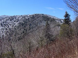
Rocky Knob is a name used to describe eight different mountain peaks located in the North Georgia mountains that are scattered among four different Georgia counties.

Coosa Bald, with an elevation of 4,280 feet (1,300 m), is tied with Double Spring Knob as the tenth-highest peak in Georgia. It is located in Union County and is the third-highest mountain in the county, behind Blood Mountain and Slaughter Mountain. Coosa Bald is located in the Chattahoochee National Forest and its peak is crossed by the Duncan Ridge Trail, a trail that connects with the Benton MacKaye Trail and the Appalachian Trail.

There are 86 trails maintained by the U.S. Forest Service in the Chattahoochee National Forest in the State of Georgia. These trails include:

Jacks Knob Trail is a hiking trail that has been designated as a National Recreation Trail in Georgia, US. The trail is 4.5 miles (7.2 km) long and is located in the Chattahoochee National Forest in the Brasstown Ranger District. The trail is managed by the U.S. Forest Service.

Waterrock Knob is a mountain peak in the U.S. state of North Carolina. It is the highest peak in the Plott Balsams and is the 16th-highest mountain in the Eastern United States.
Old Black is a mountain in the Great Smoky Mountains, located in the Southeastern United States. While often overshadowed by Mount Guyot, its higher neighbor to the south, Old Black is the 5th-highest mountain in Tennessee and the 7th-highest in the Great Smoky Mountains National Park. The Appalachian Trail crosses its western slope, connecting the Cosby-area trail system with the heart of the Eastern Smokies.

The Silurian Tuscarora Formation — also known as Tuscarora Sandstone or Tuscarora Quartzite — is a mapped bedrock unit in Pennsylvania, Maryland, West Virginia, and Virginia, USA.

Tricorner Knob is a mountain in the Great Smoky Mountains, located in the Southeastern United States. It has an elevation of 6,120 feet, with 160 feet of clean prominence. The Appalachian Trail and Balsam Mountain Trail intersect near the mountain's summit, making Tricorner Knob the great crossroads of the Eastern Smokies. The Tricorner Knob Shelter, which occupies a flat area on the mountain's southern slope, provides a key rest stop for Appalachian Trail thru-hikers.

Mount Chapman is a mountain in the Great Smoky Mountains, located in the Southeastern United States. It has an elevation of 6,417 feet above sea level. While the mountain is located deep within the Great Smokies, the Appalachian Trail crosses its eastern slope, coming to within 200 feet (61 m) of the summit. Mount Chapman is among the 10 highest mountains in the Appalachian range, if subpeaks are not included.

Marks Knob is a mountain in the Great Smoky Mountains, in the southeastern United States. It has an elevation of 6,169 feet (1,880 m), with 249 feet (76 m) of clean prominence. Its summit— located near the center of the Eastern Smokies amidst a dense stand of Southern Appalachian spruce-fir forest— is a popular bushwhacking destination and one of the most difficult-to-reach summits of the Southern Sixers.
Signal Knob is the northern peak of Massanutten Mountain in the Ridge and Valley Appalachians with an elevation of 2,106 feet (642 m). It is located in George Washington National Forest in Shenandoah County and Warren County in Virginia.

Ed Jenkins National Recreation Area, formerly proposed as Springer Mountain National Recreation Area, is a National Recreation Area in Fannin and Union counties in the U.S. state of Georgia. Located in Chattahoochee-Oconee National Forest, the national recreation area was established in 1991 by Public Law 102-458. It is administered by the U.S. Forest Service and contains approximately 23,330 acres (9,440 ha). Prior to its establishment the area was known as the proposed Springer Mountain National Recreation Area. Springer Mountain, near the center of the recreation area, is the southern terminus of the Appalachian Trail.

