Lake St. Louis, Missouri

Last updated

Lake St. Louis, Missouri
Flag of Lake St. Louis, Missouri.svg
St. Charles County Missouri Incorporated and Unincorporated areas Lake St. Louis Highlighted.svg
Location in the state of Missouri
Coordinates: 38°47′12″N90°46′48″W / 38.78667°N 90.78000°W / 38.78667; -90.78000
Country United States
State Missouri
County St. Charles
Area
[1]
  Total9.35 sq mi (24.22 km2)
  Land8.54 sq mi (22.12 km2)
  Water0.81 sq mi (2.10 km2)
Elevation
[2]
584 ft (172 m)
Population
 (2020)
  Total16,707
  Density1,956.32/sq mi (755.32/km2)
Time zone UTC-6 (CST)
  Summer (DST) UTC-5 (CDT)
ZIP code
63367
Area code 636
FIPS code 29-40043 [3]
GNIS feature ID2395600 [2]
Website http://www.lakesaintlouis.com/

The City of Lake St. Louis is a planned community, and suburb of greater St. Louis, situated around two lakes between Interstate 70 and Interstate 64 in western St. Charles County, Missouri, United States. The population was 16,707 as of the 2020 US Census. [4] Lake St. Louis, is 43 miles from the city of St. Louis.

Contents

History

In January 1961, Ellis Ellerman and Ira Nathan begin developing plans for a private resort community, a popular concept in the 1960s in the St. Louis region. The vision was for a weekend resort with a lake large enough for recreation and a location close to St. Louis. Ellerman and Nathan hired engineers to begin the initial planning of the lake and community, and Nathan named the project "Lake St. Louis" in 1961.

Ellerman and Nathan formed Trails Lake Development Corp. in 1962, and by August 31 of that year, 10 lots had already been sold in the project, which was to feature a 625 lake (PD article 8-25-63). Ellerman and Nathan lacked adequate financing and business experience, and they soon found themselves in over their heads on the project. Ellerman and Nathan were soon joined by several other investors to keep the project afloat, including R. T. Crow. The financial troubles continued for Ellerman and Nathan, and The Healey Discount Corp., owned by Crow and the three other investors, foreclosed on Ellerman and Nathan's Trails Lake Development Corp. in June 1966.

R. T. Crow felt the location of "Lake St. Louis" (indicating a change of ownership and the "planned community" concept), between two major highways, I-70 and Rt. 61, and the westward growth of St. Louis justified building a new town, rather than just the weekend community envisioned by Ellerman and Nathan. He investigated the idea of new towns, including visiting many others in the east. In the end, Crow bought out the other three investors who were part of The Healey Discount Corp., and he became the sole developer of the Lake St. Louis development. St. Charles County approved the preliminary plan for Lake St. Louis in April 1967. People who had purchased lots from the first developers were given credits for lots in the new Lake St. Louis project.

The first residents of Lake St. Louis were the Neal family, who moved to an existing home on the property in January, 1968. Gene Neal later became a vice president of one of Crow's companies, his wife Hazel managed the Lake St. Louis Country Club. Son Mike played the "boy" of various mythical families in the development's television and print advertising, and later was a founding member of the community's water ski club.

By 1969, the 85-acre (34 ha) Lake Ste. Louise, the 9-hole, 3-par golf course, tennis courts, clubhouse and pool were open. Construction on the dam for the 600-acre (2.4 km2) Lake St. Louis, the larger of the two lakes in the community, began in 1968. It was completed in 1972, and Crow filed for Chapter 11 Bankruptcy in 1974 - an action brought on in part by the energy crisis. Interstate highway speeds were reduced from 70 to 55 mph (113 to 89 km/h). Also, the I-70 bridge over the Missouri River was closed partially while the second bridge was added. The combination of events suddenly made Lake St. Louis too far away from employment and retail centers.

With Crow out of the picture, and the looming threat of annexation from O'Fallon on the East and Wentzville on the West, the residents of the Harbor Town area of the community petitioned St. Charles County Circuit Court for incorporation of the Town of Harbor Town. The Court granted the petition in June, 1975, and with the approval of the incorporation, the Circuit Court appointed a Board of Trustees: George Heidelbaugh, Charles Bailey, David Spitznagel, Betty Patton and Howard Haddock as Chairman. In December 1975, the town boundaries were expanded to include what was known as Phase A, the westernmost portion of the city. In 1976, a special census was conducted that counted 2,445 residents. Residents voted in 1977 to change the name to Lake St. Louis and become a 4th Class City under the Revised Statutes of Missouri. Howard Haddock was elected as the first mayor of the city.

Community association

The two lakes in the city of Lake St. Louis are private lakes owned by the membership of the Lake St. Louis Community Association (LSLCA). The LSLCA was formed to maintain and administer the Lake St. Louis amenities and provide services for the recreation-oriented community. The community association is funded by an assessment on all property within the LSLCA membership area. Originally all owners of property inside the city were automatically members of the LSLCA; however, as the city grew, the need to prevent lake overcrowding resulted in newer residential developments not having membership in the LSLCA. Since the lakes, as well as a country club, marinas, and several park areas, are private property of the community association, they are not available for use by non-members. This means that many residents of the city are not permitted to use the lakes, because their property is not covered by LSLCA membership. [5]

Geography

According to the United States Census Bureau, the city has a total area of 8.72 square miles (22.58 km2), of which 7.91 square miles (20.49 km2) is land and 0.81 square miles (2.10 km2) is water. [6]

Demographics

Historical population
CensusPop.Note
1980 3,843
1990 7,40092.6%
2000 10,16937.4%
2010 14,54543.0%
2020 16,70714.9%
U.S. Decennial Census [4]

2020 census

The 2020 United States census [7] counted 16,707 people, 6,557 households, and 4,819 families in Lake St. Louis. The population density was 1,956.3 per square mile (755.3/km2). There were 6,883 housing units at an average density of 806.0 per square mile (311.2/km2). The racial makeup was 85.85% (14,343) white, 4.33% (724) black or African-American, 0.37% (62) Native American, 2.43% (406) Asian, 0.04% (7) Pacific Islander, 1.07% (179) from other races, and 5.9% (986) from two or more races. Hispanic or Latino of any race was 4.3% (701) of the population.

Of the 6,557 households, 26.6% had children under the age of 18; 66.2% were married couples living together; 17.0% had a female householder with no husband present. Of all households, 19.4% consisted of individuals and 10.8% had someone living alone who was 65 years of age or older. The average household size was 2.5 and the average family size was 2.9.

19.3% of the population was under the age of 18, 7.6% from 18 to 24, 21.9% from 25 to 44, 28.6% from 45 to 64, and 20.5% who were 65 years of age or older. The median age was 45.1 years. For every 100 females, the population had 99.8 males. For every 100 females ages 18 and older, there were 100.4 males.

The 2016-2020 5-year American Community Survey [8] estimates show that the median household income was $100,122 (with a margin of error of +/- $8,120) and the median family income was $117,276 (+/- $10,025). Males had a median income of $58,692 (+/- $8,029) versus $40,932 (+/- $11,727) for females. The median income for those above 16 years old was $51,264 (+/- $2,532). Approximately, 4.7% of families and 3.9% of the population were below the poverty line, including 2.1% of those under the age of 18 and 7.2% of those ages 65 or over.

2010 census

As of the census [9] of 2010, there were 14,545 people, 5,816 households, and 4,213 families residing in the city. The population density was 1,838.8 inhabitants per square mile (710.0/km2). There were 6,197 housing units at an average density of 783.4 per square mile (302.5/km2). The racial makeup of the city was 92.2% White, 3.8% African American, 0.3% Native American, 2.1% Asian, 0.1% Pacific Islander, 0.3% from other races, and 1.1% from two or more races. Hispanic or Latino of any race were 2.1% of the population.

There were 5,816 households, of which 31.5% had children under the age of 18 living with them, 60.8% were married couples living together, 7.8% had a female householder with no husband present, 3.8% had a male householder with no wife present, and 27.6% were non-families. 22.2% of all households were made up of individuals, and 7.4% had someone living alone who was 65 years of age or older. The average household size was 2.50 and the average family size was 2.94.

The median age in the city was 41.3 years. 23.4% of residents were under the age of 18; 7.1% were between the ages of 18 and 24; 24.6% were from 25 to 44; 29% were from 45 to 64; and 16% were 65 years of age or older. The gender makeup of the city was 49.5% male and 50.5% female.

2000 census

Per the census [3] of 2000,it is estimated there were 13,708 people, 3,923 households, and 3,005 families residing in the city. The population density was 1,359.3 inhabitants per square mile (524.8/km2). There were 4,133 housing units at an average density of 552.4 per square mile (213.3/km2). The racial makeup of the city was 95.60% White, 1.84% African American, 0.25% Native American, 0.97% Asian, 0.04% Pacific Islander, 0.40% from other races, and 0.89% from two or more races. Hispanic or Latino of any race were 1.35% of the population.

There were 3,923 households, out of which 32.4% had children under the age of 18 living with them, 68.0% were married couples living together, 6.4% had a female householder with no husband present, and 23.4% were non-families. 18.5% of all households were made up of individuals, and 4.9% had someone living alone who was 65 years of age or older. The average household size was 2.59 and the average family size was 2.97.

In the city, the population was spread out, with 24.5% under the age of 18, 6.8% from 18 to 24, 27.3% from 25 to 44, 29.6% from 45 to 64, and 11.8% who were 65 years of age or older. The median age was 40 years. For every 100 females, there were 98.1 males. For every 100 females age 18 and over, there were 95.0 males.

The median income for a household in the city was $68,830, and the median income for a family was $80,700. Males had a median income of $57,201 versus $30,335 for females. The per capita income for the city was $32,064. About 2.1% of families and 3.9% of the population were below the poverty line, including 6.9% of those under age 18 and 4.5% of those age 65 or over.

Education

The residents of Lake St. Louis are part of the Wentzville R-IV School District.

Economy

Top employers

According to the Lake St. Louis Comprehensive Annual Financial Report for the Fiscal Year Ended June 30, 2018, [10] the top employers in the city were:

#Employer# of Employees
1 SSM St. Joseph Hospital West 908
2National Information Solutions Cooperative (NISC)553
3Medical Transportation Management (MTM)500
4 Walmart 353
5 Schnucks 145
6 Wentzville R-IV School District 130
7 Lowe's 115
8 Von Maur 98
9City of Lake St. Louis94
9 American Poolplayers Association (APA)63

Commercial development

When Schnucks opened a store on the city's previously undeveloped south side in 2004, at the intersection of I-64 and Lake St. Louis Boulevard, it marked the beginning of a rapid retail and commercial growth for the city. This was the first new retail development the city had seen in 17 years. In addition to the Schnucks development, the National Information Solutions Cooperative (NISC) also announced plans to build its $18 million 135,000-square-foot headquarters near the same intersection in 2004. The initial commercial development of 2004 was soon followed by the development of two large retail districts in the city: The Shoppes at Hawk Ridge and The Meadows at Lake St. Louis. Prior to this period of current retail growth, the city had very little commercial development. Residents of the lakeside community traveled to nearby Wentzville or O'Fallon for most shopping, dining, and other service needs that were not previously available in the city. [11] [12]

The Shoppes at Hawk Ridge

Bounded by I-64 to the north, South Fox Hound Drive to the east, and Hawk Ridge Trail to the South, the Shoppes at Hawk Ridge is an 800,000 sq ft (74,000 m2) retail development situated on the south side of Lake St. Louis. The development was spurred by the new $26 million Hwy N overpass completed in October 2005, which eventually became part of the Page Avenue extension. The development was the largest retail project in St. Charles County at the time of its construction, and it opened in January 2006. The Hawk Ridge development is anchored by several big box and numerous smaller retailers and restaurants. Building styles and landscaping play a vital role in the look of the development. Some businesses were forced to abandon their standard store designs and color schemes in order to comply with style elements of the development. [13]

The Meadows at Lake St. Louis

The second major retail development that anchors the Lake St. Louis retail district is The Meadows at Lake St. Louis. Opened in August 2008, the Meadows is an open-air shopping district geared toward the community's affluent residents. The Meadows was developed to meet the growing demand for specialty stores and restaurants in St. Charles County, and it was billed as the first lifestyle center in the county. It features two landscaped boulevards in a downtown street grid, surrounded by 500,000 sq ft (46,000 m2) of restaurants and a variety of specialty retail stores. The retail portion of the development is anchored by upscale specialty department store Von Maur. Kansas City-based Ferguson Properties also plans to build a 110- to 120-room Marriott or Hilton branded hotel geared toward business travelers as part of the lifestyle center. The Meadows is located on 64 acres (26 ha) on the north side of I-64 near Lake St. Louis Boulevard. [14] [15]

Notable people

Related Research Articles

<span class="mw-page-title-main">Belgrade, Minnesota</span> City in Minnesota, United States

Belgrade is a city in Stearns County, Minnesota, United States. The population was 740 at the 2010 census. It is part of the St. Cloud Metropolitan Statistical Area. Belgrade is home to the world's largest black Crow.

<span class="mw-page-title-main">Wentzville, Missouri</span> City in Missouri, United States

Wentzville is an exurb of St. Louis that is located in western St. Charles County, Missouri, United States. As of the 2022 U.S. Census Bureau estimates, the city had a total population of 47,197, making it the 15th largest city in Missouri. Wentzville has been the fastest growing city in Missouri, by percentage population increase, for two consecutive decades from 2000 to 2020. As the site of Rotary Park, Wentzville is host to the St. Charles County Fair and the St. Louis Renaissance Festival.

<span class="mw-page-title-main">Bel-Nor, Missouri</span> Village in Missouri, United States

Bel-Nor is a northwestern suburban city of St. Louis in St. Louis County, Missouri, United States. The population was 1,499 as of the 2010 census. In April 2015, the residents of Bel-Nor voted to become a city.

<span class="mw-page-title-main">Bridgeton, Missouri</span> City in Missouri, United States

Bridgeton is a second-ring suburb of Greater St. Louis in northwestern St. Louis County, Missouri, United States. Bridgeton is located at the intersection of the St. Louis outer belt and I-70. Bridgeton serves as the primary transport hub within Greater St. Louis. The population at the 2020 census was 11,445. Portions of St. Louis Lambert International Airport are within Bridgeton. The town is featured in the documentary Atomic Homefront, which covers the effects of radioactive waste stored in the nearby West Lake Landfill site.

<span class="mw-page-title-main">Crestwood, Missouri</span> City in the United States

Crestwood is a city in south St. Louis County, Missouri, United States, part of the Metropolitan Statistical Area known as Greater St. Louis. The population was 11,912 at the 2010 census.

<span class="mw-page-title-main">Creve Coeur, Missouri</span> City in Missouri, United States

Creve Coeur is a city located in mid St. Louis County, Missouri, United States, a part of Greater St. Louis. Its population was 18,834 at the 2020 census. Creve Coeur borders and shares a ZIP code (63141) with the neighboring city of Town and Country. It is home to the headquarters of Drury Hotels, and was the home of Monsanto until its acquisition by Bayer in 2018.

<span class="mw-page-title-main">Crystal Lake Park, Missouri</span> City in Missouri, United States

Crystal Lake Park is a Missouri Class 4 city in St. Louis County, Missouri, United States. The population was 508 at the 2020 census.

<span class="mw-page-title-main">Hazelwood, Missouri</span> City in Missouri, United States

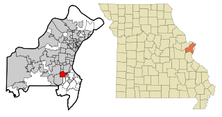
Hazelwood is a city in St. Louis County, Missouri, within Greater St. Louis. It is a second-ring northern suburb of St. Louis. Based on the 2020 United States census, the city had a total population of 25,485. It is located north of St. Louis-Lambert International Airport and is situated on Interstates 270 and 170, as well as the much-traveled Lindbergh Boulevard and Highway 370.

<span class="mw-page-title-main">Lakeshire, Missouri</span> City in Missouri, United States

Lakeshire is a city in St. Louis County, Missouri, United States. The population was 1,432 at the 2010 census.

<span class="mw-page-title-main">Maryland Heights, Missouri</span> City in Missouri, United States

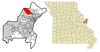
Maryland Heights is a second-ring north suburb of St. Louis, located in St. Louis County, Missouri, United States. The population was 27,472 at the 2010 census. The city was incorporated in 1985. Edwin L. Dirck was appointed the city's first mayor by then County Executive Gene McNary. Mark M. Levin served as City Administrator from August 1985 to 2015.

<span class="mw-page-title-main">Olivette, Missouri</span> City in Missouri, United States

Olivette is an inner-ring suburb of St. Louis, located in St. Louis County, Missouri, United States. The population was 8,504 at the 2020 census.

<span class="mw-page-title-main">Overland, Missouri</span> City in Missouri, United States

Overland is a city in St. Louis County, Missouri, United States. The population was 15,955 at the 2020 census.

<span class="mw-page-title-main">Wildwood, Missouri</span> City in Missouri, United States

Wildwood is a city in St. Louis County, Missouri, United States. It is located in the far western portion of the county. As of the 2020 census, the population was 35,417. Wildwood is the home of the Al Foster Trail, and numerous other trails, parks, and reserves such as Rockwoods Reservation and Babler State Park.

<span class="mw-page-title-main">Chesterfield, Missouri</span> City in Missouri, United States

Chesterfield is a city in St. Louis County, Missouri, United States. It is a western suburb of St. Louis. As of the 2020 census, the population was 49,999, making it the state's 14th most populous city. The broader valley of Chesterfield was originally referred to as "Gumbo Flats", derived from its soil, which though very rich and silty, resembled gumbo when wet.

<span class="mw-page-title-main">St. Ann, Missouri</span> City in Missouri, United States

St. Ann or Saint Ann is a city in northwest St. Louis County, Missouri, United States. The population was 13,019 at the 2020 census.

<span class="mw-page-title-main">Monett, Missouri</span> City in Missouri, United States

Monett is the most-populous city in the Barry and Lawrence counties in the U.S. state of Missouri. The city is located in the Ozarks, just south of Interstate 44 between Joplin and Springfield. According to the 2020 census, the population of the town was estimated to be 9,576 individuals.

<span class="mw-page-title-main">Foristell, Missouri</span> City in Missouri, US

Foristell is a city in St. Charles and Warren counties in the U.S. state of Missouri. It is located approximately 43 miles west of St. Louis. The population was 505 at the 2010 census.

<span class="mw-page-title-main">St. Charles County, Missouri</span> County in Missouri, United States

St. Charles County is in the central eastern part of the U.S. state of Missouri. As of the 2020 census, the population was 405,262, making it Missouri's third-most populous county. Its county seat is St. Charles. The county was organized October 1, 1812, and named for Saint Charles Borromeo, an Italian cardinal.

<span class="mw-page-title-main">O'Fallon, Missouri</span> City in Missouri, United States

O'Fallon is a city in St. Charles County, Missouri, United States. It is part of the St. Louis metropolitan statistical area, located along Interstates 64 and 70 between Lake St. Louis and St. Peters. As of the 2020 census, O'Fallon had a population of 91,316, making it the most populous suburb of St. Louis, as well as the most populous municipality in St. Charles County and the 7th most populous in Missouri. O'Fallon's namesake in St. Clair County, Illinois, is also part of the St. Louis region. The two cities are one of the few pairs of same-named municipalities to be part of the same metro area.

<span class="mw-page-title-main">Dardenne Prairie, Missouri</span> Town in Missouri, United States

Dardenne Prairie is a city in St. Charles County, Missouri, United States. The population was 12,743 at the 2020 census.

References

  1. "ArcGIS REST Services Directory". United States Census Bureau. Retrieved August 28, 2022.
  2. 1 2 U.S. Geological Survey Geographic Names Information System: Lake St. Louis, Missouri
  3. 1 2 "U.S. Census website". United States Census Bureau . Retrieved January 31, 2008.
  4. 1 2 "Census of Population and Housing". Census.gov. Retrieved June 4, 2015.
  5. "Rules and Regulations". Archived from the original on February 17, 2012. Retrieved December 12, 2011.
  6. "US Gazetteer files 2010". United States Census Bureau. Archived from the original on July 2, 2012. Retrieved July 8, 2012.
  7. "Explore Census Data". data.census.gov. Retrieved December 17, 2023.
  8. "Explore Census Data". data.census.gov. Retrieved December 17, 2023.
  9. "U.S. Census website". United States Census Bureau . Retrieved July 8, 2012.
  10. "City of Lake Saint Louis, Missouri Comprehensive Annual Financial Report for the Fiscal Year ended June 30, 2018". Lakesaintlouis.com. Retrieved August 14, 2019.
  11. Kalosc, Lou (March 13, 2005). "Lake St. Louis swimming in retail development projects". Bizjournals.com.
  12. Jackson, Margaret (January 4, 2004). "NISC to build $18 million headquarters at Lake St. Louis". Bizjournals.com.
  13. "Officials break ground for county's largest retail center". Wentzville Journal. March 2005
  14. "Archived copy". Archived from the original on April 3, 2012. Retrieved September 28, 2011.{{cite web}}: CS1 maint: archived copy as title (link)
  15. Louis, St. (January 29, 2008). "Lake St. Louis mall lands Missouri's first Von Maur store". Bizjournals.com.
  16. "Jud "Fabio" Birza Wins Survivor; Lake Saint Louis Native Earns $1 Million - St. Louis News - Daily RFT". Archived from the original on December 23, 2010. Retrieved September 28, 2011.
  17. "Cards Can Coryell; Locks Are Changed". Google News. Retrieved July 26, 2014.
  18. "A Profile of Former CIA Agent and Current Senator Jon Dolan". Mdn.org. Retrieved November 24, 2021.
  19. "Bases Loaded". Vibe. August 2002. p 100
  20. "WakeWorld provides wakeboarders with wakeboarding related services including wakeboards, bindings, wakeskates, wakesurf boards, video and boat guides, event results and news". Wakeworld.com. Retrieved November 24, 2021.
  21. "Baseball notebook: Former major-league catcher Cal Neeman dies". STLtoday.com. Retrieved November 24, 2021.
  22. Schlinkmann, Mark. "3 Republicans compete for western St. Charles County's state Senate seat". STLtoday.com. Retrieved November 24, 2021.
  23. Holtzman, Jerome (September 1, 1994). "Some Umpires Are Really Cleaning Up During The Strike". Chicago Tribune.