Troy, Missouri

Last updated

Troy, Missouri
Troy Missouri 2023.jpg
Downtown Troy Historic District, November 2023
Lincoln County Missouri Incorporated and Unincorporated areas Troy Highlighted.svg
Coordinates: 38°58′15″N90°58′17″W / 38.97083°N 90.97139°W / 38.97083; -90.97139 [1]
Country Flag of the United States.svg  United States
State Flag of Missouri.svg  Missouri
County Lincoln
Government
   Mayor Ron Sconce
Area
[2]
  Total7.76 sq mi (20.10 km2)
  Land7.72 sq mi (19.99 km2)
  Water0.04 sq mi (0.11 km2)
Elevation
[1]
515 ft (157 m)
Population
 (2020)
  Total12,686
  Density1,643.48/sq mi (634.53/km2)
Time zone UTC-6 (CST)
  Summer (DST) UTC-5 (CDT)
ZIP code
63379
Area code 636
FIPS code 29-73942 [3]
GNIS feature ID2397062 [1]
Website cityoftroymissouri.com

Troy is a city in Lincoln County, Missouri, United States. As of 2019, the estimated population was 12,820. It is the county seat of Lincoln County. [4] Troy is an exurb of St. Louis, and is part of the St. Louis Metropolitan Statistical Area.

Contents

History

Troy was platted in 1819. [5] Some say the community was named after Troy, New York, while others believe the name is a transfer from Troy, Vermont. [6] An early variant name was Woods Fort. [7] A post office called Troy has been in operation since 1823. [8]

Historic sites

Fort Cap au Gris, a War of 1812 fortification, was built near Troy in 1814. Lincoln County Medical Center was established in Troy in 1953 under the Hill-Burton Memorial Hospitals Act, as Lincoln County Memorial Hospital. Cuivre River State Park, one of the largest of Missouri's state parks, lies approximately three miles to the northeast of Troy, across the Cuivre River valley. [9]

Downtown Troy Historic District

Downtown Troy Historic District
LocationBounded by Annie Ave., 2nd, Marble & Court Sts., Troy, Missouri
Area9.3 acres (3.8 ha)
ArchitectBailey, David; Bachmann, Gustave; Pauly, P.J. & Bro.; Allison, Oscar; Downing & Luckett
Architectural styleLate Victorian, Late 19th and 20th Century Revivals, Modern Movement
NRHP reference No. 13000857 [10]
Added to NRHPOctober 30, 2013

The Downtown Troy Historic District is a national historic district in Troy. The district encompasses 39 contributing buildings, 1 contributing site, and 2 contributing structures in the central business district and surrounding residential area of Troy. It developed between about 1832 and 1966, and includes representative examples of Late Victorian style architecture. Notable buildings include the Sherman Cottle House (1832), St. Stephens Methodist Church (1900-1901), Lincoln County Jail/Jailer's House (1876), Sacred Heart Catholic Church (1954), Lincoln County Courthouse (1869-1870), Troy Post Office (c. 1925), Farmers & Merchants Bank / Masonic Lodge (1906), Universalist Church / Masonic Hall (1837/1851), Lincoln County Motor Co. (1929), and United Baptist Church (1937). [11]

It was listed on the National Register of Historic Places in 2013. [10]

Geography

Troy is located two miles west of the Cuivre River. U.S. 61 passes the east side of the city and Missouri Route 47 passes through the north side. [12]

According to the United States Census Bureau, the city has a total area of 7.34 square miles (19.01 km2), of which 7.30 square miles (18.91 km2) is land and 0.04 square miles (0.10 km2) is water. [13]

Demographics

Historical population
CensusPop.Note
1860 611
1870 70315.1%
1880 7030.0%
1890 97138.1%
1900 1,15318.7%
1910 1,120−2.9%
1920 1,116−0.4%
1930 1,41927.2%
1940 1,4935.2%
1950 1,73816.4%
1960 1,7792.4%
1970 2,53842.7%
1980 2,6243.4%
1990 3,81145.2%
2000 6,73776.8%
2010 10,54056.4%
2020 12,68620.4%
U.S. Decennial Census

2020 census

The 2020 United States census [14] counted 12,686 people, 4,151 households, and 3,086 families in Troy. The population density was 1,643.3 inhabitants per square mile (634.5/km2). There were 4,455 housing units at an average density of 577.1 per square mile (222.8/km2). The racial makeup was 87.11% (11,051) white, 2.96% (376) black or African-American, 0.46% (58) Native American or Alaska Native, 0.59% (75) Asian, 0.02% (2) Pacific Islander, 1.88% (239) from other races, and 6.98% (885) from two or more races. Hispanic or Latino of any race was 5.1% (640) of the population.

Of the 4,151 households, 39.2% had children under the age of 18; 54.1% were married couples living together; 27.6% had a female householder with no husband present. Of all households, 20.2% consisted of individuals and 9.5% had someone living alone who was 65 years of age or older. The average household size was 2.9 and the average family size was 3.2.

27.1% of the population was under the age of 18, 10.6% from 18 to 24, 28.4% from 25 to 44, 20.5% from 45 to 64, and 11.6% who were 65 years of age or older. The median age was 34.1 years. For every 100 females, the population had 98.4 males. For every 100 females ages 18 and older, there were 92.5 males.

The 2016-2020 5-year American Community Survey [15] estimates show that the median household income was $68,524 (with a margin of error of +/- $10,125) and the median family income was $73,326 (+/- $6,130). Males had a median income of $46,655 (+/- $7,043) versus $30,636 (+/- $2,944) for females. The median income for those above 16 years old was $34,958 (+/- $4,139). Approximately, 5.8% of families and 9.0% of the population were below the poverty line, including 8.4% of those under the age of 18 and 6.4% of those ages 65 or over.

2010 census

As of the census [16] of 2010, there were 10,542 people, 3,843 households, and 2,727 families living in the city. The population density was 1,443.8 inhabitants per square mile (557.5/km2). There were 4,141 housing units at an average density of 567.3 per square mile (219.0/km2). The racial makeup of the city was 92.5% White, 3.1% African American, 0.4% Native American, 0.7% Asian, 0.8% from other races, and 2.4% from two or more races. Hispanic or Latino of any race were 3.0% of the population.

There were 3,843 households, of which 43.6% had children under the age of 18 living with them, 50.5% were married couples living together, 14.8% had a female householder with no husband present, 5.6% had a male householder with no wife present, and 29.0% were non-families. 24.4% of all households were made up of individuals, and 10.1% had someone living alone who was 65 years of age or older. The average household size was 2.67 and the average family size was 3.16.

The median age in the city was 32.2 years. 30.5% of residents were under the age of 18; 7.7% were between the ages of 18 and 24; 30.4% were from 25 to 44; 19.6% were from 45 to 64; and 11.8% were 65 years of age or older. The gender makeup of the city was 47.4% male and 52.6% female.

2000 census

As of the census [3] of 2000, there were 6,737 people, 2,521 households, and 1,747 families living in the city. The population density was 1,134.5 inhabitants per square mile (438.0/km2). There were 2,661 housing units at an average density of 448.1 per square mile (173.0/km2). The racial makeup of the city was 93.87% White, 2.86% African American, 0.39% Native American, 0.13% Asian, 0.01% Pacific Islander, 0.80% from other races, and 1.93% from two or more races. Hispanic or Latino of any race were 1.71% of the population.

There were 2,521 households, out of which 39.8% had children under the age of 18 living with them, 51.6% were married couples living together, 14.6% had a female householder with no husband present, and 30.7% were non-families. 26.6% of all households were made up of individuals, and 12.5% had someone living alone who was 65 years of age or older. The average household size was 2.56 and the average family size was 3.10.

In the city, the population was spread out, with 29.8% under the age of 18, 9.2% from 18 to 24, 30.6% from 25 to 44, 16.4% from 45 to 64, and 14.0% who were 65 years of age or older. The median age was 32 years. For every 100 females, there were 87.1 males. For every 100 females age 18 and over, there were 83.7 males.

The median income for a household in the city was $40,332, and the median income for a family was $46,818. Males had a median income of $34,750 versus $24,440 for females. The per capita income for the city was $17,666. About 7.6% of families and 11.0% of the population were below the poverty line, including 13.4% of those under age 18 and 14.6% of those age 65 or over.

Education

Troy is home to Troy Buchanan High School, Troy Middle School, Troy South Middle School, Main Street Elementary, Boone Elementary School, Claude Brown Elementary, Cuivre Park Elementary, Lincoln County R-III Early Childhood Education Center, William Cappel Elementary School, and Lincoln Elementary School, all of which are part of the Lincoln County R-III School District.

Troy does not have a public library. Troy’s library, the Powell Memorial Library, is owned and operated by the Troy R-III School District. [17]

Notable people

Related Research Articles

<span class="mw-page-title-main">Lincoln County, Missouri</span> County in Missouri, United States

Lincoln County is located in the eastern part of the U.S. state of Missouri. As of the 2020 census, the population was 59,574. Its county seat is Troy. The county was founded December 14, 1818, and named for Major General Benjamin Lincoln of the American Revolutionary War.

<span class="mw-page-title-main">Troy, Illinois</span> City in Illinois, United States

Troy is a city in Madison County, Illinois, United States. The population was 10,960 at the 2020 census, up from 9,888 in 2010.

<span class="mw-page-title-main">Troy, Indiana</span> Town in Indiana, United States

Troy is a town in Troy Township, Perry County, Indiana, along the Ohio River near the mouth of the Anderson River. It is the second oldest city in Indiana. The population was 347 at the 2020 census.

<span class="mw-page-title-main">Troy, Kansas</span> City in Doniphan County, Kansas

Troy is a city in and the county seat of Doniphan County, Kansas, United States. As of the 2020 census, the population of the city was 964.

<span class="mw-page-title-main">Lincoln, Missouri</span> City in Benton County, Missouri, United States

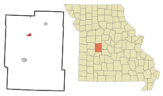
Lincoln is a city in Benton County, Missouri, United States. The population was 1,144 at the 2020 census.

<span class="mw-page-title-main">Cave, Missouri</span> City in Missouri, United States

Cave is a City in Lincoln County, Missouri, United States. The population was 5 at the 2010 census. However, As of the 2020 census, the population is 0, making it the smallest incorporated community in the U.S state of Missouri. It is the 939th largest city in Missouri and the 19481st largest city in the United States. Cave is currently declining at a rate of 0.00% annually and its population has decreased by 0.00% since the most recent census, which recorded a population of 5 in 2010.

<span class="mw-page-title-main">Chain of Rocks, Missouri</span> Village in Missouri, United States

Chain of Rocks is a village in Lincoln County, Missouri, United States. The population was 93 at the 2010 census.

<span class="mw-page-title-main">Elsberry, Missouri</span> City in Missouri, United States

Elsberry is a city in Lincoln County, Missouri, United States. The population was 1,937 at the 2020 census.

<span class="mw-page-title-main">Hawk Point, Missouri</span> City in Missouri, United States

Hawk Point is a city in Lincoln County, Missouri, United States. The population was 669 at the 2010 census.

<span class="mw-page-title-main">Old Monroe, Missouri</span> City in Lincoln County, Missouri, US

Old Monroe is a city in Lincoln County, Missouri, United States. The population was 249 at the 2020 census.

<span class="mw-page-title-main">Bellflower, Missouri</span> City in Missouri, United States

Bellflower is a city in Montgomery County, Missouri, United States. The population was 325 at the 2020 census, down from 393 in 2010.

<span class="mw-page-title-main">High Hill, Missouri</span> City in Missouri, United States

High Hill is a city in Montgomery County, Missouri, United States. The population was 186 at the 2020 census.

<span class="mw-page-title-main">Jonesburg, Missouri</span> City in Missouri, US

Jonesburg is a city in Montgomery County, Missouri, United States. The population was 726 at the 2020 census.

<span class="mw-page-title-main">Middletown, Missouri</span> City in Missouri, United States

Middletown is a city in Montgomery County, Missouri, United States. The population was 171 at the 2020 census.

<span class="mw-page-title-main">New Florence, Missouri</span> City in Missouri, United States

New Florence is a city in Montgomery County, Missouri, United States. The population was 641 at the 2020 census, down from 769 in 2010.

<span class="mw-page-title-main">Wellsville, Missouri</span> City in Missouri, United States

Wellsville is a city in Montgomery County, Missouri, United States. The population was 998 at the 2020 census, down from 1,217 in 2010.

<span class="mw-page-title-main">Farmington, Missouri</span> City in Missouri, United States

Farmington is a city in St. Francois County located about 75 miles (121 km) southwest of St. Louis in the Lead Belt region in Missouri. As of the 2020 census, the population was 18,217. It is the county seat of St. Francois County. Farmington was established in 1822 as Murphy's Settlement, named for William Murphy of Kentucky, who first visited the site in 1798. When St. Francois County was organized, the town was briefly called St. Francois Court House and later renamed to Farmington.

<span class="mw-page-title-main">Manchester, Missouri</span> City in Missouri, United States

Manchester is a city in St. Louis County, Missouri, United States. The population was 18,333 at the 2020 census.

<span class="mw-page-title-main">Moscow Mills, Missouri</span> Town in Missouri, US

Moscow Mills is a city in Lincoln County, Missouri, United States. The population was 2,509 at the 2010 census.

<span class="mw-page-title-main">Montgomery City, Missouri</span> City in Missouri, United States

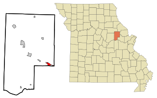
Montgomery City is a city in and the county seat of Montgomery County, Missouri, United States. The population was 2,811 at the 2020 census.

References

  1. 1 2 3 U.S. Geological Survey Geographic Names Information System: Troy, Missouri
  2. "ArcGIS REST Services Directory". United States Census Bureau. Retrieved August 28, 2022.
  3. 1 2 "U.S. Census website". United States Census Bureau . Retrieved January 31, 2008.
  4. "Find a County". National Association of Counties. Retrieved June 7, 2011.
  5. Eaton, David Wolfe (1916). How Missouri Counties, Towns and Streams Were Named. The State Historical Society of Missouri. pp.  186.
  6. "Lincoln County Place Names, 1928–1945 (archived)". The State Historical Society of Missouri. Archived from the original on June 24, 2016. Retrieved October 29, 2016.
  7. "Disappearing Missouri Names". The Kansas City Star. March 19, 1911. p. 15. Retrieved August 15, 2014 via Newspapers.com. Open Access logo PLoS transparent.svg
  8. "Post Offices". Jim Forte Postal History. Retrieved October 29, 2016.
  9. "Site of Woods Fort - Troy, MO - War of 1812 on Waymarking.com". www.waymarking.com. Retrieved January 23, 2024.
  10. 1 2 "National Register of Historic Places Listings". Weekly List of Actions Taken on Properties: 10/28/13 through 11/01/13. National Park Service. November 8, 2013.
  11. Ruth Keenoy (August 2013). "National Register of Historic Places Inventory Nomination Form: Downtown Troy Historic District" (PDF). Missouri Department of Natural Resources. Retrieved January 1, 2017. (includes 29 photographs from 2010 & 2012)
  12. Missouri Atlas & Gazetteer, DeLorme, 1998, First edition, p. 40, ISBN   0-89933-224-2
  13. "US Gazetteer files 2010". United States Census Bureau. Archived from the original on July 2, 2012. Retrieved July 8, 2012.
  14. "Explore Census Data". data.census.gov. Retrieved December 18, 2023.
  15. "Explore Census Data". data.census.gov. Retrieved December 18, 2023.
  16. "U.S. Census website". United States Census Bureau . Retrieved July 8, 2012.
  17. "Missouri Public Libraries". PublicLibraries.com. Archived from the original on June 10, 2017. Retrieved June 5, 2019.