City of Fayette, Missouri | |
---|---|
Coordinates: 39°8′44″N92°41′10″W / 39.14556°N 92.68611°W | |
Country | United States |
State | Missouri |
County | Howard |
Founded | 1823 |
Government | |
• Mayor | Kevin R. Oeth [1] |
• Administrator | Robin Triplett |
Area | |
• Total | 2.25 sq mi (5.84 km2) |
• Land | 2.22 sq mi (5.74 km2) |
• Water | 0.04 sq mi (0.09 km2) |
Elevation | 699 ft (213 m) |
Population (2020) | |
• Total | 2,803 |
• Estimate (2023) | 2,733 |
• Density | 1,264.32/sq mi (488.05/km2) |
Time zone | UTC-6 (CST) |
• Summer (DST) | UTC-5 (CDT) |
ZIP code | 65248 |
Area code | 660 |
FIPS code | 29-23842 [3] |
GNIS feature ID | 0717869 [4] |
Website | cityoffayettemo |
Fayette is a city in and the county seat of Howard County, Missouri, United States. [5] It is part of the Columbia, Missouri Metropolitan Statistical Area. The city's population was 2,803 at the 2020 census. [6]
Fayette was laid out in 1823. [7] The community was named after Gilbert du Motier, Marquis de Lafayette. [8] A post office has been in operation at Fayette since 1824. [9]
The Edwin and Nora Payne Bedford House, Central Methodist College Campus Historic District, Coleman Hall, Fayette City Park Swimming Pool, Fayette Courthouse Square Historic District, Fayette Residential Historic District, Greenwood, Prior Jackson Homeplace, Alfred W. Morrison House, Oakwood, St. Mary's Episcopal Church, South Main Street Historic District, and Dr. Uriel S. Wright Office are listed on the National Register of Historic Places. [10]
In 1899, 19-year-old, black Fayette resident Frank Embree was accused of raping a 14-year-old white girl. [11] Embree claimed to be innocent; however, after a lynch mob whipped him more than 100 times, he stated that he would "own up" to the crime if the mob agreed to shoot or hang him as an alternative to continuing to torture him. [11] Embree was then hanged, on July 21, 1899, without ever having been tried or convicted of a crime. [11]
Fayette is at 39°8′44″N92°41′10″W / 39.14556°N 92.68611°W (39.145468, -92.686126). [12] According to the United States Census Bureau, the city has a total area of 2.26 square miles (5.85 km2), of which 2.22 square miles (5.75 km2) is land and 0.04 square miles (0.10 km2) is water. [13]
Census | Pop. | Note | %± |
---|---|---|---|
1860 | 647 | — | |
1870 | 815 | 26.0% | |
1880 | 1,247 | 53.0% | |
1890 | 2,247 | 80.2% | |
1900 | 2,717 | 20.9% | |
1910 | 2,586 | −4.8% | |
1920 | 2,381 | −7.9% | |
1930 | 2,630 | 10.5% | |
1940 | 2,608 | −0.8% | |
1950 | 3,144 | 20.6% | |
1960 | 3,294 | 4.8% | |
1970 | 3,520 | 6.9% | |
1980 | 2,983 | −15.3% | |
1990 | 2,888 | −3.2% | |
2000 | 2,793 | −3.3% | |
2010 | 2,688 | −3.8% | |
2020 | 2,803 | 4.3% | |
U.S. Decennial Census [14] |
As of the census [15] of 2010, there were 2,688 people, 949 households, and 509 families living in the city. The population density was 1,210.8 inhabitants per square mile (467.5/km2). There were 1,097 housing units at an average density of 494.1 per square mile (190.8/km2). The racial makeup of the city was 83.5% White, 13.0% African American, 0.3% Native American, 0.5% Asian, 0.1% Pacific Islander, 0.6% from other races, and 2.1% from two or more races. Hispanic or Latino of any race were 2.2% of the population.
There were 949 households, of which 25.7% had children under the age of 18 living with them, 36.9% were married couples living together, 12.6% had a female householder with no husband present, 4.1% had a male householder with no wife present, and 46.4% were non-families. 37.0% of all households were made up of individuals, and 17.5% had someone living alone who was 65 years of age or older. The average household size was 2.17 and the average family size was 2.85.
The median age in the city was 26.1 years. 16.7% of residents were under the age of 18; 32% were between the ages of 18 and 24; 15.9% were from 25 to 44; 19.5% were from 45 to 64; and 15.8% were 65 years of age or older. The gender makeup of the city was 48.7% male and 51.3% female.
As of the census [3] of 2000, there were 2,793 people, 976 households, and 578 families living in the city. The population density was 1,253.6 inhabitants per square mile (484.0/km2). There were 1,133 housing units at an average density of 508.5 per square mile (196.3/km2). The racial makeup of the city was 79.16% White, 18.33% African American, 0.47% Native American, 0.21% Asian, 0.04% Pacific Islander, 0.47% from other races, and 1.32% from two or more races. Hispanic or Latino of any race were 0.93% of the population.
There were 976 households, out of which 25.0% had children under the age of 18 living with them, 41.4% were married couples living together, 14.5% had a female householder with no husband present, and 40.7% were non-families. 34.5% of all households were individuals, and 16.5% had someone living alone who was 65 years of age or older. The average household size was 2.18 and the average family size was 2.79.
In the city, the population was spread out, with 17.9% under the age of 18, 28.2% from 18 to 24, 19.5% from 25 to 44, 16.2% from 45 to 64, and 18.1% who were 65 years of age or older. The median age was 29 years. For every 100 females, there were 91.0 males. For every 100 females age 18 and over, there were 89.3 males.
The median income for a household in the city was $27,276, and the median income for a family was $35,694. Males had a median income of $27,768 versus $20,833 for females. The per capita income for the city was $13,451. About 9.1% of families and 15.6% of the population were below the poverty line, including 18.1% of those under age 18 and 20.0% of those age 65 or over.
Fayette is home to Central Methodist University, a private 4-year university, which is accredited by the Higher Learning Commission. It was also home to the now-defunct Howard-Payne Junior College.
In its public school system, Fayette has one elementary school (L. J. Daly), one middle school (W. N. Clark) and one high school (Fayette).
Fayette has a lending library, the Howard County Public Library. [16]
Fayette County is a county located in the U.S. state of Alabama. As of the 2020 census, the population was 16,321. Its county seat is Fayette. Its name is in honor of the Marquis de Lafayette, who aided General George Washington in the American Revolutionary War.
Howard County is located in the U.S. state of Missouri, with its southern border formed by the Missouri River. As of the 2020 census, the population was 10,151. Its county seat is Fayette. The county was organized January 23, 1816, and named for Benjamin Howard, the first Governor of the Missouri Territory. Settled originally by migrants from the Upper South, it is part of the region historically known as Little Dixie. It is part of the Columbia, Missouri, metropolitan area.
Farm Loop is a census-designated place (CDP) in Matanuska-Susitna Borough, Alaska, United States. It is part of the Anchorage, Alaska Metropolitan Statistical Area. At the 2020 census the population was 2,747, up from 1,028 in 2010.
Fayette is a city in Fayette County, Iowa, United States. As of the 2020 census, the city population was 1,256. It was named after the Marquis de la Fayette, French hero of the American Revolutionary War. Fayette is the home of Upper Iowa University, a small private college. The Volga River State Recreation Area is located just north of Fayette, and many other parks and natural areas are nearby.
Wheaton is a city in Wheaton Township, Barry County, Missouri, United States. The population was 696 at the 2010 census.
Smithville is a city in Clay and Platte counties in the U.S. state of Missouri and is part of the Kansas City metropolitan area, along the Little Platte River. The population was 10,406 at the 2020 United States Census.
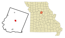
Linneus is a small city in Linn County, Missouri, United States. The population was 281 at the 2020 census. It is the county seat of Linn County.
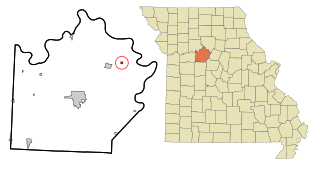
Chamois is a city in Osage County, Missouri, United States. The population was 377 at the 2020 census. It is part of the Jefferson City, Missouri Metropolitan Statistical Area.
Gilliam is a city in Saline County, Missouri, United States. The population was 197 at the 2010 census.
Miami is a city in Saline County, Missouri, United States. The population was 175 at the 2010 census.
Weldon Spring Heights is a small village in St. Charles County, Missouri, United States, approximately 30 miles west of St. Louis. According to the 2020 census, the population was 93.
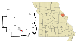
Moscow Mills is a city in Lincoln County, Missouri, United States. The population was 2,509 at the 2010 census.
South Lockport is a hamlet located in the Town of Lockport in Niagara County, New York, United States. The population was 8,234 at the 2010 census. It is part of the Buffalo–Niagara Falls Metropolitan Statistical Area.
Dunbar Township is a township in Fayette County, Pennsylvania, United States. The population was 6,671 at the 2020 census, a decline from the figure of 7,126 tabulated in 2010.
Franklin Township is a township in Fayette County, Pennsylvania, United States. The population was 2,380 at the 2020 census, a decline from the figure of 2,528 tabulated in 2010. The township is served by the Uniontown Area School District.
Georges Township is a township in Fayette County, Pennsylvania, United States. The population was 6,346 at the 2020 census, a decline from the figure of 6,612 tabulated in 2010. It is served by the Albert Gallatin Area School District.
Lower Tyrone Township is a township in Fayette County, Pennsylvania, United States. The population was 1,069 at the time of the 2020 census.
Luzerne Township is a township in Fayette County, Pennsylvania, United States. The population was 5,585 at the 2020 census, down from 5,965 at the 2010 census.
Dayton Lakes is a city in Liberty County, Texas, United States. The population was 93 at the 2010 census. Prior to 1985 Dayton Lakes city was a developed and marketed recreational subdivision named Dayton Lake Estates. In January 1985 the corporation that marketed the original subdivision held and election of residents and when the election was successful, they petitioned the District Court in Liberty County, Texas and The City of Dayton Lakes, TX, a Non Profit Corporation, was created as a city/town. The actual document was filed and recorded on January 19, 1985. Those corporate papers are the city's legal identity.
Tennyson is a village in Grant County, Wisconsin, United States, originally called Dutch Hollow. The population was 355 at the 2010 census.
{{cite web}}
: CS1 maint: bot: original URL status unknown (link)