Versailles, Missouri

Last updated

Versailles, Missouri
City Hall - Versailles, Missouri.jpg
Versailles City Hall
Morgan County Missouri Incorporated and Unincorporated areas Versailles Highlighted.svg
Location in Morgan County and the state of Missouri
Coordinates: 38°26′00″N92°50′43″W / 38.43333°N 92.84528°W / 38.43333; -92.84528
Country United States
State Missouri
County Morgan
Government
  MayorJamie K. Morrow [1]
Area
[2]
  Total2.40 sq mi (6.04 km2)
  Land2.40 sq mi (6.03 km2)
  Water0.004 sq mi (0.01 km2)
Elevation
[3]
997 ft (304 m)
Population
 (2020) [4]
  Total2,539
  Density1,090.64/sq mi (421.14/km2)
Time zone UTC-6 (Central (CST))
  Summer (DST) UTC-5 (CDT)
ZIP code
65084
Area code 573
FIPS code 29-75922 [5]
GNIS feature ID2397131 [3]
State highways MO-5.svg MO-52.svg
Website www.cityofversaillesmo.com

Versailles is a city in Morgan County, Missouri, United States. The population was 2,539 at the 2020 census. [4] It is the county seat of Morgan County. [6] Locally, the town's name is pronounced "Ver-sails", rather than the French "Ver-seye". [7]

Contents

History

A post office called Versailles, after the royal palace in France, has been in operation since 1835. [8] Versailles was not platted until 1854. [9]

The Martin Hotel, built in 1853, had such guests as the showman P. T. Barnum and outlaw robber Jesse James. Since the late 20th century, it has been operated as a museum. Both it and the Morgan County Courthouse are listed on the National Register of Historic Places. The courthouse was designed in a French style. [10]

Dixon Ticonderoga, a pencil manufacturing company, had a plant in Versailles until it closed in 2005. [11]

Geography

Versailles is in eastern Morgan County. Missouri Route 5 passes through the western and northern sides of the city, leading north 17 miles (27 km) to Tipton and south 37 miles (60 km) to Camdenton. Missouri Route 52 joins Route 5 around the north side of Versailles, but leads southeast 17 miles (27 km) to Eldon and west 8 miles (13 km) to Stover.

According to the U.S. Census Bureau, Versailles has a total area of 2.40 square miles (6.22 km2), of which 0.004 square miles (0.010 km2), or 0.17%, are water. [2] The city sits on a ridge which drains north toward the Straight Fork, part of the Moreau River watershed, and south toward Little Gravois Creek, part of the Osage River watershed.

Climate

Climate data for Versailles, Missouri (1991–2020 normals, extremes 1904–present)
MonthJanFebMarAprMayJunJulAugSepOctNovDecYear
Record high °F (°C)80
(27)
83
(28)
85
(29)
93
(34)
103
(39)
105
(41)
115
(46)
112
(44)
105
(41)
96
(36)
86
(30)
75
(24)
115
(46)
Mean daily maximum °F (°C)40.5
(4.7)
45.5
(7.5)
56.5
(13.6)
66.8
(19.3)
75.2
(24.0)
83.0
(28.3)
87.5
(30.8)
86.5
(30.3)
78.8
(26.0)
67.8
(19.9)
54.9
(12.7)
44.3
(6.8)
65.6
(18.7)
Daily mean °F (°C)31.3
(−0.4)
35.7
(2.1)
45.8
(7.7)
56.1
(13.4)
65.5
(18.6)
73.9
(23.3)
78.3
(25.7)
76.8
(24.9)
68.7
(20.4)
57.4
(14.1)
45.2
(7.3)
35.3
(1.8)
55.8
(13.2)
Mean daily minimum °F (°C)22.2
(−5.4)
25.9
(−3.4)
35.0
(1.7)
45.3
(7.4)
55.8
(13.2)
64.8
(18.2)
69.1
(20.6)
67.1
(19.5)
58.5
(14.7)
46.9
(8.3)
35.5
(1.9)
26.3
(−3.2)
46.0
(7.8)
Record low °F (°C)−18
(−28)
−22
(−30)
−15
(−26)
−2
(−19)
24
(−4)
42
(6)
45
(7)
43
(6)
30
(−1)
18
(−8)
0
(−18)
−23
(−31)
−23
(−31)
Average precipitation inches (mm)1.76
(45)
2.59
(66)
3.30
(84)
4.62
(117)
5.35
(136)
5.33
(135)
4.27
(108)
3.62
(92)
4.27
(108)
3.74
(95)
3.61
(92)
2.48
(63)
44.94
(1,141)
Average precipitation days (≥ 0.01 in)5.35.68.79.411.18.97.27.27.48.67.65.792.7
Source: NOAA [12] [13]

Demographics

Historical population
CensusPop.Note
1880 578
1890 1,211109.5%
1900 1,2402.4%
1910 1,59828.9%
1920 1,6513.3%
1930 1,6620.7%
1940 1,7817.2%
1950 1,9298.3%
1960 2,0476.1%
1970 2,2449.6%
1980 2,4067.2%
1990 2,365−1.7%
2000 2,5658.5%
2010 2,482−3.2%
2020 2,5392.3%
U.S. Decennial Census [14]

2010 census

As of the census [15] of 2010, there were 2,482 people, 1,034 households, and 590 families living in the city. The population density was 1,065.2 inhabitants per square mile (411.3/km2). There were 1,201 housing units at an average density of 515.5 per square mile (199.0/km2). The racial makeup of the city was 92.4% White, 2.8% African American, 0.8% Native American, 0.3% Asian, 1.1% from other races, and 2.6% from two or more races. Hispanic or Latino of any race were 3.1% of the population.

There were 1,034 households, of which 28.9% had children under the age of 18 living with them, 37.3% were married couples living together, 15.9% had a female householder with no husband present, 3.9% had a male householder with no wife present, and 42.9% were non-families. 38.7% of all households were made up of individuals, and 20.7% had someone living alone who was 65 years of age or older. The average household size was 2.22 and the average family size was 2.94.

The median age in the city was 40.9 years. 22.8% of residents were under the age of 18; 8.8% were between the ages of 18 and 24; 23.2% were from 25 to 44; 22.9% were from 45 to 64; and 22.4% were 65 years of age or older. The gender makeup of the city was 47.5% male and 52.5% female.

2000 census

As of the census [5] of 2000, there were 2,565 people, 1,077 households, and 636 families living in the city. The population density was 1,115.2 inhabitants per square mile (430.6/km2). There were 1,195 housing units at an average density of 519.5 per square mile (200.6/km2). The racial makeup of the city was 95.40% White, 2.14% African American, 0.66% Native American, 0.04% Asian, 0.16% from other races, and 1.60% from two or more races. Hispanic or Latino of any race were 1.05% of the population.

There were 1,077 households, out of which 29.6% had children under the age of 18 living with them, 44.3% were married couples living together, 12.3% had a female householder with no husband present, and 40.9% were non-families. 36.7% of all households were made up of individuals, and 20.7% had someone living alone who was 65 years of age or older. The average household size was 2.25 and the average family size was 2.95.

In the city, the population was spread out, with 24.7% under the age of 18, 8.4% from 18 to 24, 23.4% from 25 to 44, 18.2% from 45 to 64, and 25.3% who were 65 years of age or older. The median age was 40 years. For every 100 females, there were 77.6 males. For every 100 females age 18 and over, there were 70.9 males.

The median income for a household in the city was $23,672, and the median income for a family was $31,088. Males had a median income of $24,054 versus $18,229 for females. The per capita income for the city was $14,200. About 11.4% of families and 16.5% of the population were below the poverty line, including 21.4% of those under age 18 and 10.8% of those age 65 or over.

Education

Public education in Versailles is administered by Morgan County R-II School District. [16]

Versailles has a public library, the Morgan County Library. [17]

Notable people

See also

Related Research Articles

<span class="mw-page-title-main">Morgan County, Missouri</span> County in Missouri, United States

Morgan County is a county located in the central portion of the U.S. state of Missouri. As of the 2020 census, the population was 21,006. Its county seat is Versailles. The county was organized January 5, 1833, and named for General Daniel Morgan of the American Revolutionary War.

<span class="mw-page-title-main">Belton, Missouri</span> City in Missouri, US

Belton is a city in northwestern Cass County, Missouri, United States. The population was 23,953 at the 2020 census.

<span class="mw-page-title-main">Harrisonville, Missouri</span> City in Missouri, United States

Harrisonville is a city in Cass County, Missouri, United States. The population was 10,121 at the 2020 census. It is the county seat of Cass County. It is part of the Kansas City metropolitan area.

<span class="mw-page-title-main">Boonville, Missouri</span> City in Missouri, United States

Boonville is a city and the county seat of Cooper County, Missouri, United States. The population was 7,964 at the 2020 census. The city was the site of a skirmish early in the Civil War, on July 17, 1861. Union forces defeated the Missouri State Guard in the first Battle of Boonville. It is part of the Columbia, Missouri metropolitan area.

<span class="mw-page-title-main">Otterville, Missouri</span> City in Missouri, United States

Otterville is a city in southwest Cooper County, Missouri, United States. The population was 454 at the 2010 census.

<span class="mw-page-title-main">Lebanon, Missouri</span> City in Missouri, United States

Lebanon is a city in and the county seat of Laclede County in Missouri. The population was 14,474 at the time of the 2010 census. It is the county seat of Laclede County. The Lebanon Micropolitan Statistical Area consists of Laclede County.

<span class="mw-page-title-main">Linneus, Missouri</span> City in Missouri, United States

Linneus is a small city in Linn County, Missouri, United States. The population was 281 at the 2020 census. It is the county seat of Linn County.

<span class="mw-page-title-main">Barnett, Missouri</span> City in Missouri, United States

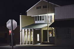
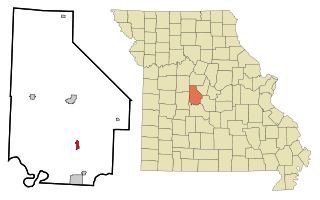
Barnett is a city in Morgan County, Missouri, United States. The population was 158 at the 2020 census, down from 203 in 2010.

<span class="mw-page-title-main">Gravois Mills, Missouri</span> Town in Missouri, United States

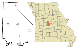
Gravois Mills is a town in Morgan County, Missouri, United States. The population was 129 at the 2020 census.

<span class="mw-page-title-main">Laurie, Missouri</span> City in Missouri, US

Laurie is a city in southern Morgan and northern Camden counties, Missouri, United States. The population was 939 at the 2020 census.

Stover is a city in Morgan County, Missouri, United States. The population was 1,006 at the 2020 census, down from 1,094 in 2010.

<span class="mw-page-title-main">Syracuse, Missouri</span> City in Missouri, United States

Syracuse is a city in Morgan County, Missouri, United States. The population was 151 at the 2020 census. In the middle of the 19th century, the city was the western terminus of the Pacific Railway that reached 108 miles from St. Louis. The current mayor of Syracuse is Duane A. Doyle.

<span class="mw-page-title-main">Alton, Missouri</span> City in Missouri, United States

Alton is a city and the county seat of Oregon County, Missouri, United States. The population was 707 at the 2020 census.

<span class="mw-page-title-main">Shelbyville, Missouri</span> City in Missouri, United States

Shelbyville is a city in Shelby County, Missouri, United States. The population was 518 at the 2020 census. It is the county seat of Shelby County.

<span class="mw-page-title-main">Manchester, Missouri</span> City in Missouri, United States

Manchester is a city in St. Louis County, Missouri, United States. The population was 18,333 at the 2020 census.

<span class="mw-page-title-main">Wildwood, Missouri</span> City in Missouri, United States

Wildwood is a city in St. Louis County, Missouri, United States. It is located in the far western portion of the county. As of the 2020 census, the population was 35,417. Wildwood is the home of the Al Foster Trail, and numerous other trails, parks, and reserves such as Rockwoods Reservation and Babler State Park.

<span class="mw-page-title-main">Moline Acres, Missouri</span> City in Missouri, United States

Moline Acres is a city in St. Louis County, Missouri, United States. The population was 2,442 at the 2010 census.

<span class="mw-page-title-main">Sunrise Beach, Missouri</span> Village in Missouri, US

Sunrise Beach is a village in Camden and Morgan counties in the U.S. state of Missouri. The population was 431 at the 2010 census.

<span class="mw-page-title-main">Argyle, Missouri</span> Town in Missouri, United States

Argyle is a town in Osage and Maries counties in the U.S. state of Missouri. The population was 144 at the 2020 census.

<span class="mw-page-title-main">Portageville, Missouri</span> City in Missouri, United States

Portageville is a city in New Madrid and Pemiscot counties in the U.S. state of Missouri. The population was 2,942 according to the 2020 Census.

References

  1. "Mayor & Board of Aldermen". City of Versailles. Retrieved August 22, 2022.
  2. 1 2 "2023 U.S. Gazetteer Files: Missouri". United States Census Bureau. Retrieved May 10, 2024.
  3. 1 2 U.S. Geological Survey Geographic Names Information System: Versailles, Missouri
  4. 1 2 "P1. Race – Versailles city, Missouri: 2020 DEC Redistricting Data (PL 94-171)". U.S. Census Bureau. Retrieved May 10, 2024.
  5. 1 2 "U.S. Census website". United States Census Bureau . Retrieved January 31, 2008.
  6. "Find a County". National Association of Counties. Archived from the original on May 31, 2011. Retrieved June 7, 2011.
  7. "Why Can't Missouri Pronounce Its Towns Right?". KBUA. September 12, 2013. Retrieved May 17, 2019.
  8. "Post Offices". Jim Forte Postal History. Retrieved November 19, 2016.
  9. "Morgan County Place Names, 1928–1945". The State Historical Society of Missouri. Archived from the original on June 24, 2016. Retrieved November 19, 2016.
  10. "National Register Information System". National Register of Historic Places . National Park Service. July 9, 2010.
  11. "Dixon Ticonderoga to close Missouri pencil plant". Orlando Sentinel. Retrieved March 27, 2022.
  12. "NowData – NOAA Online Weather Data". National Oceanic and Atmospheric Administration. Retrieved August 2, 2021.
  13. "Station: Versailles, MO". U.S. Climate Normals 2020: U.S. Monthly Climate Normals (1991–2020). National Oceanic and Atmospheric Administration. Retrieved August 2, 2021.
  14. "Census of Population and Housing". Census.gov. Retrieved June 4, 2015.
  15. "U.S. Census website". United States Census Bureau . Retrieved July 8, 2012.
  16. "Homepage". Morgan County R-Ii School District. Retrieved June 5, 2019.
  17. "Missouri Public Libraries". PublicLibraries.com. Archived from the original on June 10, 2017. Retrieved June 5, 2019.