Langhorne, Pennsylvania

Last updated

Langhorne Borough, Pennsylvania
Langhorne, Pennsylvania.jpg
The Langhorne Hotel
Bucks County Pennsylvania Incorporated and Unincorporated areas Langhorne Highlighted.svg
Location in Bucks County, Pennsylvania
USA Pennsylvania location map.svg
Red pog.svg
Langhorne
Location in Pennsylvania
Usa edcp location map.svg
Red pog.svg
Langhorne
Location in the United States
Coordinates: 40°10′39″N74°55′08″W / 40.17750°N 74.91889°W / 40.17750; -74.91889
CountryUnited States
State Pennsylvania
County Bucks
Incorporated1876
Area
[1]
  Total0.49 sq mi (1.28 km2)
  Land0.49 sq mi (1.27 km2)
  Water0.00 sq mi (0.01 km2)
Elevation
213 ft (65 m)
Population
 (2020) [2]
  Total1,643
  Density3,339.43/sq mi (1,289.42/km2)
Time zone UTC-5 (Eastern (EST))
  Summer (DST) UTC-4 (EDT)
ZIP Codes
19047
Area codes 215, 267 and 445
FIPS code 42-41392
Website www.langhorneborough.com

Langhorne Borough is a borough in Bucks County, Pennsylvania, United States. The population was 1,622 at the time of the 2010 census.

Contents

The mailing address "Langhorne" is used for Langhorne Borough, but it is also used broadly to describe the majority of surrounding Middletown Township, which for the most part uses Langhorne's ZIP code of 19047. Sesame Place, while physically located in Middletown Township, has Langhorne as its mailing address. The Langhorne post office also services the northeastern part of Lower Southampton Township, which uses the ZIP code 19053.

Langhorne Borough is approximately six miles west of the Delaware River.

Langhorne Manor is a separate borough that borders Langhorne Borough proper to the south.

History

Langhorne began in the 17th century at the intersection of older Lenni-Lenape paths. The earliest established settlers (three Dutch and two British) arrived in the early 18th century. One of the area's first notable residents was Joseph Richardson, who established a store and inn in the 1730s. [3] The road from Bristol grew into a very important transportation center between Trenton and Philadelphia in the later 18th century and 19th centuries, with trade and travelers contributing to the economic growth of the area. Langhorne eventually became the stagecoach transportation hub of Bucks County, transporting people between Trenton and Philadelphia and was then known as Four Lanes End, later known as Richardsons Corner. [3]

The first mention of Attleborough was recorded on a deed in the Recorder's Office, Deed Book 6, page 210, November 7, 1737. Isaac Hicks laid out a plan for "Washington's Square in Attleborough" in November 1783. Historian William J. Buck wrote "A resident of the place has informed me that this name is of local origin; that a William Richardson Atlee (son of Colonel Samuel Atlee of the Revolutionary Army), a lawyer and son-in-law of General Wayne, resided here about 1790 or perhaps a little earlier. A fire engine was ordered to be made, for which £50 had been raised. When it was finished, word was sent from Philadelphia inquiring what name they wanted it called. Someone suggested that, as Mr. Atlee had been one of the principal contributors, it should be called after him. When the engine arrived, it was found to have painted on its sides Atleebury, which still to be seen. Shortly afterwards a post office was established here, when it was called Attleborough, a slight change from the original." However, the post office was not established until April 1, 1806, Richard Croasdale, the first postmaster. [4]

The village became known as Attleborough until 1876, when it was incorporated and named for Jeremiah Von Langhorne, [5] an early resident of the area and former chief justice of the Supreme Court of Pennsylvania. Upon the arrival of the railroad in 1876, residents of Attleborough and Hulmeville disputed over what the name of the station should be. The president of the North Pennsylvania Railroad, Franklin A. Comly, settled the matter by name the station The Penndel Train Station, until recently changing it to Langhorne Train Station.

A school of higher learning was established in 1835 named successively Minerva Seminary, Attleborough High School, Attleboro Academy, and Bellevue Institute. Samuel J. Randall of Philadelphia, a member of the United States House of Representatives from 1875 to 1890 and speaker of the United States House of Representatives from 1876 to 1881, attended this educational institute. [4]

In the late 19th century and early 20th century, Langhorne continued to grow as wealthy Philadelphians constructed large homes and businesses along Maple and Bellevue Avenues.

The Langhorne Historic District, former Langhorne Library, Joseph Richardson House, and Tomlinson-Huddleston House are listed on the National Register of Historic Places. [6]

Langhorne was the base of eGames, the publisher of the cult classic Speedy Eggbert .

Geography

Langhorne Borough is located at 40°10′39″N74°55′8″W / 40.17750°N 74.91889°W / 40.17750; -74.91889 (40.177409, -74.918880). [7] According to the U.S. Census Bureau, the borough has a total area of 0.5 square miles (1.3 km2), all land.

The northern border of Langhorne follows the Neshaminy Creek.

Demographics

Historical population
CensusPop.Note
1880 558
1890 72730.3%
1900 80110.2%
1910 89511.7%
1920 1,06719.2%
1930 1,1477.5%
1940 1,2216.5%
1950 1,57929.3%
1960 1,461−7.5%
1970 1,67314.5%
1980 1,6971.4%
1990 1,361−19.8%
2000 1,98145.6%
2010 1,622−18.1%
2020 1,6431.3%
Sources: [8] [9] [10] [11] [2]

At the 2010 census, the borough was 86.4% White, 8.0% Black or African American, 0.1% Native American, 1.5% Asian, and 1.5% were two or more races. 2.3% of the population were of Hispanic or Latino ancestry .

At the 2000 census, [9] there were 1,981 people, 552 households and 338 families residing in the borough. The population density was 4,016.3 inhabitants per square mile (1,550.7/km2). There were 649 housing units at an average density of 1,315.8 per square mile (508.0/km2).

There were 552 households, of which 25.9% had children under the age of 18 living with them, 47.5% were married couples living together, 9.8% had a female householder with no husband present, and 38.6% were non-families. 31.7% of all households were made up of individuals, and 8.7% had someone living alone who was 65 years of age or older. The average household size was 2.40 and the average family size was 3.07.

Age distribution was 26.2% under the age of 18, 10.4% from 18 to 24, 30.8% from 25 to 44, 21.8% from 45 to 64, and 10.8% who were 65 years of age or older. The median age was 34 years. For every 100 females there were 117.5 males. For every 100 females age 18 and over, there were 107.1 males.

The median household income borough was $56,389, and the median family income was $75,429. Males had a median income of $48,125 versus $31,759 for females. The per capita income for the borough was $21,479. About 2.6% of families and 3.0% of the population were below the poverty line, including 3.0% of those under age 18 and 4.7% of those age 65 or over.

Education

Langhorne lies within the Neshaminy School District. Students living within borough boundaries attend Tawanka Elementary School for grades K-4, [12] Maple Point Middle School for grades 5-8, [13] and Neshaminy High School for grades 9-12.

Cairn University is located just south of Langhorne in Langhorne Manor and Middletown Township. [14] [15]

Transportation

PA 213 southbound in Langhorne 2022-11-02 13 26 05 View south along Pennsylvania State Route 213 (Maple Avenue) just south of Pennsylvania State Route 413 (Pine Street) in Langhorne, Bucks County, Pennsylvania.jpg
PA 213 southbound in Langhorne

As of 2007 there were 6.19 miles (9.96 km) of public roads in Langhorne, of which 3.50 miles (5.63 km) were maintained by the Pennsylvania Department of Transportation (PennDOT) and 2.69 miles (4.33 km) were maintained by the borough. [16]

Pennsylvania Route 213 and Pennsylvania Route 413 both pass through Langhorne. PA 213 follows a southwest-northeast alignment along Maple Avenue, while PA 413 follows a southeast-northwest alignment along Pine Street.

SEPTA provides bus service to Langhorne along City Bus Route 14, which runs between the Frankford Transportation Center in Northeast Philadelphia and the Oxford Valley Mall, and Suburban Bus Route 130, which runs between Frankford Avenue and Knights Road in Northeast Philadelphia and Bucks County Community College in Newtown. The Langhorne station formerly known as The Penndel station serving SEPTA Regional Rail's West Trenton Line is located south of Langhorne in Langhorne Manor. [17]

Climate

According to the Köppen climate classification system, Langhorne has a Hot-summer, Humid continental climate (Dfa). Dfa climates are characterized by at least one month having an average mean temperature ≤ 32.0 °F (0.0 °C), at least four months with an average mean temperature ≥ 50.0 °F (10.0 °C), at least one month with an average mean temperature ≥ 71.6 °F (22.0 °C) and no significant precipitation difference between seasons. Although most summer days are slightly humid in Langhorne, episodes of heat and high humidity can occur with heat index values > 107 °F (42 °C). Since 1981, the highest air temperature was 102.8 °F (39.3 °C) on July 22, 2011, and the highest daily average mean dew point was 75.4 °F (24.1 °C) on August 13, 2016. The average wettest month is July which corresponds with the annual peak in thunderstorm activity. Since 1981, the wettest calendar day was 6.65 inches (169 mm) on August 27, 2011. During the winter months, the average annual extreme minimum air temperature is 0.8 °F (−17.3 °C). [18] Since 1981, the coldest air temperature was −9.9 °F (−23.3 °C) on January 22, 1984. Episodes of extreme cold and wind can occur with wind chill values < −10 °F (−23 °C). The average annual snowfall (Nov-Apr) is between 24 inches (61 cm) and 30 inches (76 cm). Ice storms and large snowstorms depositing ≥ 12 inches (30 cm) of snow occur once every few years, particularly during nor'easters from December through February.

Climate data for Langhorne, Elevation 200 ft (61 m), 1981-2010 normals, extremes 1981-2018
MonthJanFebMarAprMayJunJulAugSepOctNovDecYear
Record high °F (°C)71.5
(21.9)
77.8
(25.4)
87.4
(30.8)
94.5
(34.7)
95.4
(35.2)
96.6
(35.9)
102.8
(39.3)
100.4
(38.0)
98.4
(36.9)
88.4
(31.3)
81.2
(27.3)
75.9
(24.4)
102.8
(39.3)
Mean daily maximum °F (°C)39.9
(4.4)
43.2
(6.2)
51.4
(10.8)
63.2
(17.3)
72.8
(22.7)
82.0
(27.8)
86.2
(30.1)
84.5
(29.2)
77.7
(25.4)
66.3
(19.1)
55.4
(13.0)
44.3
(6.8)
64.0
(17.8)
Daily mean °F (°C)31.7
(−0.2)
34.4
(1.3)
41.8
(5.4)
52.5
(11.4)
61.9
(16.6)
71.4
(21.9)
76.0
(24.4)
74.5
(23.6)
67.3
(19.6)
55.7
(13.2)
46.1
(7.8)
36.2
(2.3)
54.2
(12.3)
Mean daily minimum °F (°C)23.5
(−4.7)
25.5
(−3.6)
32.2
(0.1)
41.7
(5.4)
51.0
(10.6)
60.9
(16.1)
65.9
(18.8)
64.5
(18.1)
56.9
(13.8)
45.1
(7.3)
36.8
(2.7)
28.2
(−2.1)
44.4
(6.9)
Record low °F (°C)−9.9
(−23.3)
−2.4
(−19.1)
4.1
(−15.5)
18.1
(−7.7)
33.7
(0.9)
42.3
(5.7)
48.5
(9.2)
43.2
(6.2)
36.4
(2.4)
25.4
(−3.7)
12.5
(−10.8)
0.0
(−17.8)
−9.9
(−23.3)
Average precipitation inches (mm)3.55
(90)
2.76
(70)
4.19
(106)
3.94
(100)
4.31
(109)
4.31
(109)
5.16
(131)
4.34
(110)
4.35
(110)
3.76
(96)
3.57
(91)
4.03
(102)
48.27
(1,226)
Average relative humidity (%)66.262.558.257.762.166.166.468.869.869.367.768.165.3
Average dew point °F (°C)21.7
(−5.7)
22.9
(−5.1)
28.2
(−2.1)
38.0
(3.3)
48.8
(9.3)
59.5
(15.3)
64.0
(17.8)
63.6
(17.6)
57.1
(13.9)
45.8
(7.7)
36.0
(2.2)
26.7
(−2.9)
42.8
(6.0)
Source: PRISM [19]

Ecology

According to the A. W. Kuchler U.S. potential natural vegetation types, Langhorne would have a dominant vegetation type of Appalachian Oak (104) with a dominant vegetation form of Eastern Hardwood Forest (25). [20] The plant hardiness zone is 7a with an average annual extreme minimum air temperature of 0.8 °F (−17.3 °C). [18] The spring bloom typically begins by April 7 and fall color usually peaks by November 2.

Notable people

Related Research Articles

<span class="mw-page-title-main">Bucks County, Pennsylvania</span> County in Pennsylvania, United States

Bucks County is a county in the Commonwealth of Pennsylvania. As of the 2020 census, the population was 646,538, making it the fourth-most populous county in Pennsylvania. Its county seat is Doylestown. The county is named after the English county of Buckinghamshire.

<span class="mw-page-title-main">Bensalem Township, Pennsylvania</span> Township in Pennsylvania, United States

Bensalem Township is a township in Bucks County, Pennsylvania, United States. The township borders the northeastern section of Philadelphia and includes the communities of Andalusia, Bensalem, Bridgewater, Cornwells Heights, Eddington, Flushing, Oakford, Siles, Trappe, and Trevose. Bensalem Township has no other incorporated municipalities within its boundaries. It is located within the Delaware Valley, also known as the Philadelphia metropolitan area.

<span class="mw-page-title-main">Bristol Township, Pennsylvania</span> Township in Pennsylvania, United States

Bristol Township is a township in Bucks County, Pennsylvania, United States. The population was 54,582 at the 2010 census, making it the 13th largest municipality in the state. Bristol Township, along with Bristol Borough, is a cultural hub for Lower Bucks County, hosting celebrations of African and Latino heritage. Parts of the township consist of the neighborhoods of Fairless Hills and Levittown. It is located within the Delaware Valley.

<span class="mw-page-title-main">Chalfont, Pennsylvania</span> Home rule municipality in Pennsylvania, United States

Chalfont is a borough with home rule status in Bucks County, Pennsylvania, United States. The population was 4,009 at the 2010 census. The borough is served by SEPTA Regional Rail's Lansdale/Doylestown Line at Chalfont station.

<span class="mw-page-title-main">Doylestown Township, Pennsylvania</span> Township in Pennsylvania, United States

Doylestown Township is a township in Bucks County, Pennsylvania, United States. The population was 17,565 at the 2010 census. Adjacent to the county seat, the township hosts many county offices and the county correctional facility. Doylestown Central Park is a park in the township.

<span class="mw-page-title-main">Falls Township, Bucks County, Pennsylvania</span> Township in Pennsylvania, United States

Falls Township is a suburban Philadelphia township in Bucks County, Pennsylvania, United States. The population was 34,300 at the 2010 census. Portions of Fairless Hills and Levittown, Pennsylvania, are located in the township. Portions of Falls Township are called Morrisville and Yardley, due to the location of the Morrisville Post Office outside the Borough of Morrisville in Falls Township. As originally chartered in 1692, the villages of Morrisville and Tullytown were part of Falls Township. Morrisville was granted borough status in 1804. Tullytown was established as a borough in 1891.

<span class="mw-page-title-main">Hilltown Township, Pennsylvania</span> Township in Pennsylvania, United States

Hilltown Township is a township in Bucks County, Pennsylvania, United States. The population was 15,029 at the 2010 census. Most of Hilltown is part of Pennridge School District, while a small portion in Line Lexington is part of North Penn School District.

<span class="mw-page-title-main">Hulmeville, Pennsylvania</span> Borough in Pennsylvania, United States

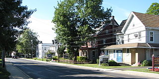
Hulmeville is a borough in Bucks County, Pennsylvania, United States. The population was 1,003 at the 2010 census.

<span class="mw-page-title-main">Langhorne Manor, Pennsylvania</span> Borough in Pennsylvania, United States

Langhorne Manor is a borough in Bucks County, Pennsylvania, United States. The population was 1,422 at the 2010 census, a 55.6% increase from the 2000 census. The mayor of Langhorne Manor is Bob Byrne.

<span class="mw-page-title-main">Lower Southampton Township, Pennsylvania</span> Township in Pennsylvania, United States

Lower Southampton Township is a township in Bucks County, Pennsylvania, United States. The population was 20,599 at the 2020 census.

<span class="mw-page-title-main">Middletown Township, Bucks County, Pennsylvania</span> Place in Pennsylvania, United States

Middletown Township is a township in Bucks County, Pennsylvania, United States. The population was 46,040 at the 2020 census. Many sections of Levittown are located in the southern end of the township. The municipality surrounds the boroughs of Langhorne, Langhorne Manor, Penndel and Hulmeville; much of the township beyond Levittown uses Langhorne as its mailing address. The township is located within the Delaware Valley, also known as the Philadelphia metropolitan area.

<span class="mw-page-title-main">Morrisville, Bucks County, Pennsylvania</span> Borough in Pennsylvania, United States

Morrisville is a borough in Bucks County, Pennsylvania, United States. It is located just below the falls of the Delaware River opposite Trenton, New Jersey. The population was 9,809 in the 2020 Census.

<span class="mw-page-title-main">New Britain Township, Pennsylvania</span> Township in Pennsylvania, United States

New Britain Township is a township in Bucks County, Pennsylvania, United States. The population was 11,070 at the 2010 census.

<span class="mw-page-title-main">Newtown, Bucks County, Pennsylvania</span> Borough in Pennsylvania, United States

Newtown is a borough in Bucks County, Pennsylvania, United States. The population was 2,268 at the 2020 census. It is located just west of the Trenton, New Jersey metropolitan area, and is part of the larger Philadelphia metropolitan area. It is entirely surrounded by Newtown Township, from which it separated in 1838. State Street is the main commercial thoroughfare with wide sidewalks, shops, taverns, and restaurants.

<span class="mw-page-title-main">Newtown Township, Bucks County, Pennsylvania</span> Township in Pennsylvania, United States

Newtown Township is a township in Bucks County, Pennsylvania, United States. The population was 19,299 at the 2010 census.

<span class="mw-page-title-main">Northampton Township, Bucks County, Pennsylvania</span> Township in Pennsylvania, United States

Northampton Township is a township in Bucks County, Pennsylvania, United States. The township is located approximately 12 miles northeast of Philadelphia. The population was 39,915 at the 2020 census.

<span class="mw-page-title-main">Penndel, Pennsylvania</span> Borough in Pennsylvania, United States

Penndel is a borough in Bucks County, Pennsylvania, United States. The population was 2,328 at the 2010 census.

<span class="mw-page-title-main">Tullytown, Pennsylvania</span> Borough in Pennsylvania, United States

Tullytown is a borough in Bucks County, Pennsylvania, United States. Originally a village in Falls Township, Tullytown was partitioned as a borough in 1891. The population was 1,872 at the 2010 census. Part of Levittown is located in Tullytown.

<span class="mw-page-title-main">Upper Southampton Township, Pennsylvania</span> Township in Pennsylvania, United States

Upper Southampton Township is a township in Bucks County, Pennsylvania, United States. The population was 15,152 at the 2010 census.

<span class="mw-page-title-main">Warrington Township, Bucks County, Pennsylvania</span> Township in Pennsylvania, United States

Warrington Township is a township in Bucks County, Pennsylvania, United States. Warrington Township is a northern suburb of Philadelphia. The population was 25,639 at the 2020 census.

References

  1. "ArcGIS REST Services Directory". United States Census Bureau. Retrieved October 12, 2022.
  2. 1 2 "Census Population API". United States Census Bureau. Retrieved October 12, 2022.
  3. 1 2 "Langhorne detailed history". www.historiclanghorne.org. Retrieved January 21, 2021.
  4. 1 2 MacReynolds, George, Place Names in Bucks County, Pennsylvania, Doylestown, Bucks County Historical Society, Doylestown, PA, 1942, Langhorne
  5. Gannett, Henry (1905). The Origin of Certain Place Names in the United States. U.S. Government Printing Office. p.  181.
  6. "National Register Information System". National Register of Historic Places . National Park Service. July 9, 2010.
  7. "US Gazetteer files: 2010, 2000, and 1990". United States Census Bureau. February 12, 2011. Retrieved April 23, 2011.
  8. "Census of Population and Housing". U.S. Census Bureau. Retrieved December 11, 2013.
  9. 1 2 "U.S. Census website". United States Census Bureau . Retrieved January 31, 2008.
  10. "Incorporated Places and Minor Civil Divisions Datasets: Subcounty Resident Population Estimates: April 1, 2010 to July 1, 2012". Population Estimates. U.S. Census Bureau. Archived from the original on June 11, 2013. Retrieved December 11, 2013.
  11. "Census 2020".
  12. Sofield, Tom (May 4, 2016). "Neshaminy Approves Elementary School Redistricting". Levittown Now. Retrieved April 5, 2021. - PDF of the school zone map (9D, which was chosen) - For detail on areas with streets, see the 2015 map: "Neshaminy School District Elementary School Zones & Elementary Student Locations March 2015" (PDF). Neshaminy School District . Retrieved April 5, 2021.
  13. "Neshaminy School District Middle School Zones & Middle Student Locations March 2015" (PDF). Neshaminy School District . Retrieved April 5, 2021.
  14. "Zoning Map". Middletown Township . Retrieved April 5, 2021.
  15. "Campus Map". Cairn University. Retrieved April 5, 2021. - Compare to township map.
  16. "Langhorne Borough map" (PDF). PennDOT. Retrieved March 11, 2023.
  17. SEPTA Official Transit & Street Map Suburban (PDF) (Map). SEPTA. Retrieved May 2, 2016.
  18. 1 2 "USDA Interactive Plant Hardiness Map". United States Department of Agriculture . Retrieved October 3, 2019.
  19. "PRISM Climate Group, Oregon State University" . Retrieved October 3, 2019.
  20. "U.S. Potential Natural Vegetation, Original Kuchler Types, v2.0 (Spatially Adjusted to Correct Geometric Distortions)" . Retrieved October 3, 2019.
  21. "NFL Recognizes Neshaminy High School Graduates Who Played In Super Bowl - LevittownNow.com". February 6, 2016. Retrieved December 30, 2017.
  22. Who Was Who in America, Historical Volume, 1607-1896. Chicago: Marquis Who's Who. 1963.
  23. "PBA.com". Professional Bowlers Association . Retrieved June 24, 2015.