Lasswade

Last updated

Lasswade
Pittendreich House, Lasswade.jpg
Pittendreich House, Lasswade by David Bryce
Midlothian UK location map.svg
Red pog.svg
Lasswade
Location within Midlothian
OS grid reference NT301661
Council area
Lieutenancy area
Country Scotland
Sovereign state United Kingdom
Post town LASSWADE
Postcode district EH18
Dialling code 0131
Police Scotland
Fire Scottish
Ambulance Scottish
UK Parliament
Scottish Parliament
List of places
UK
Scotland
55°52′59″N3°07′01″W / 55.883°N 3.117°W / 55.883; -3.117
The houses on the southern side of the river in Lasswade The houses on the southern side of the river in Lasswade.JPG
The houses on the southern side of the river in Lasswade
The Old Kirkyard, Lasswade The Old Kirkyard, Lasswade.JPG
The Old Kirkyard, Lasswade

Lasswade is a village and civil parish in Midlothian, Scotland, on the River North Esk, nine miles (14.5 kilometres) south of Edinburgh city centre, contiguous with Bonnyrigg and between Dalkeith to the east and Loanhead to the west. Melville Castle lies to the north east. The Gaelic form is Leas Bhaid, meaning the "clump at the fort."

Contents

Lasswade lies within the Edinburgh Green Belt. Most of the population is retired or commutes to Edinburgh to work. There are, however, several local businesses, including horse riding stables (Edinburgh & Lasswade Riding Centre), golf driving ranges and golf courses (Kings Acre Golf Course and Melville Golf Centre), an alpine plant nursery (Kevock Garden Plants) a pub (The Laird and Dog) and a restaurant (The Paper Mill). There is also an athletics club formed in 1981.

Etymology and name

The name Lasswade may be derived from the Brittonic [1] *lï:s meaning "a court, palace administrative centre", [1] and wï:δ, "a wood" (c.f. Welsh llys gwŷdd). [1] Also possible is an Old English derivation from the elements lǣswe, [1] "pasture", and wæd, "a ford". [1]

Although the settlement may date back to the 8th century, the first written record of "Leswade" dates to 1150. [2] On William Roy's map of 1750, it appears as Laswaid. Up until the late 18th century, all spelling was unfixed and was based upon the sound as perceived.

According to legend, the area got its name from a sturdy local girl called Jenny, who would wade across the river carrying travellers on her back before a bridge was built. [3] A short verse from the area tells the story as follows:

When there was nae Brig to cross the Esk river,
On Jenny’s braid back they a’ gaed the gither,
For Jenny was honest, stout, sober and steady
She carried the Laird, she carried his leddy,
Whin he was richt seated the doggie first gaed,
Then waving his stick he cried “Jenny Lass – Wade!”

History

The old parish church was built in the 13th century, though little of it survives today. It was abandoned in 1793, and much of its ruins collapsed in 1866. The 17th-century Scottish poet William Drummond of Hawthornden was buried within its grounds.

The first paper mill was built in Lasswade in 1750, and papermaking remained important until the start of the 20th century. [4]

Sir John Lauder, 1st Baronet of Fountainhall was born at Melville Mill, Lasswade, in 1595; and the present 18th-century Barony House was known as Lasswade Cottage when Sir Walter Scott rented it (1798–1804). He was visited here by the writer James Hogg (the 'Ettrick Shepherd') and the Wordsworths. Thomas de Quincey, author of Confessions of an English Opium Eater , also lived in nearby Polton for some years, from 1843, in the cottage now known as de Quincey Cottage. The Scottish landscape artist William McTaggart moved to Lasswade in 1889, and many of his later works depict the Moorfoot Hills.

Former 19th-century industries include paper mills, flour mills and a carpet factory. Created a police burgh in 1881, Lasswade merged with Bonnyrigg in 1929. It was a popular holiday resort in the 19th century for wealthy Edinburgh residents; yet, by the 1950s, much of the village's population had left for modern houses in Bonnyrigg.

Groome (1885) noted as chief proprietors in the parish: Lieut.-Col. Gibsone of Pentland, Viscount Melville, Drummond of Hawthornden, Sir Geo. Clerk of Penicuik, and Mrs Durham of Polton. The estates along both banks of the Esk were:

Other notable buildings

The pre-Reformation church was dedicated to St Edwin and under the control of the Dean of Restalrig. [5]

The current Lasswade Parish Church building was originally built in 1830 as a plain box chapel [6] for the former United Presbyterian Church (later United Free Church), it was remodelled by Hardy & Wight in 1894 and became part of the Church of Scotland in 1929. The parish has used this building since 1956, because of a structural fault in the Old Parish Church (subsequently demolished, built in 1793 from plans by John Clerk, Lord Eldin) discovered in the late 1940s.

St Leonard's Episcopal Church on Lower Broomieknowe dates from 1890 and is by Hippolyte Blanc.

The former board school of 1875 stands with commanding views over the village on the northern slopes next to the Old Kirkyard. It is now converted to flats. Lasswade High School moved to its current premises in the west of Bonnyrigg in 1956, being rebuilt on the same site in 2013. [7]

Parish

The parish of Lasswade is bounded on the north by the City of Edinburgh (namely the former parishes of Colinton and Liberton), on the east, by Dalkeith, Newbattle, Cockpen and Carrington, on the south by Penicuik and on the west by Glencorse. It extends about 7 miles from north to south and its greatest breadth is about 6 miles. [8] Prior to 1633 the north-east salient of the parish, around Melville Castle, formed the separate parish of Melville and Lugton. [9]

The parish lies between the Pentland Hills to the north and the Moorfoot Hills to the south and includes the easternmost part of the Pentland Hills, around the estate of Pentland. The River North Esk flows into the parish from the south-west and, after forming the western boundary, then cuts through the centre of the parish, flowing north-easterly towards the village of Lasswade. At Lasswade the river forms the boundary on the north-east side, such that the suburb of Westmill on the south-east bank lies in the parish of Cockpen. [9]

The chief antiquities within the parish are Rosslyn Chapel and the mansions of Hawthornden Castle and Melville Castle. [8]

The parish includes the villages of Lasswade, Roslin and Rosewell, and the small town of Loanhead, plus part of the town of Bonnyrigg. [10]

The Community Council areas for the parish are: [11]

A large part of the areas of Bonnyrigg/Lasswade and Poltonhall and District lies within Cockpen parish. [12]

Lasswade parish. The yellow coloured areas were under the jurisdiction of police burghs (Loanhead, Bonnyrigg and Lasswade) Lasswade Parish Map.jpg
Lasswade parish. The yellow coloured areas were under the jurisdiction of police burghs (Loanhead, Bonnyrigg and Lasswade)

Lasswade is one of the most ancient Parishes in Scotland. Burial ground evidence shows that the church was active as early as the 9th century. [13]

Before the Reformation, the present civil parish consisted of three parishes – Lasswade, Melville and Pentland – and the provostry of Roslin. [9] Melville parish comprised the baronies of Melville and Lugton. In 1633, the barony of Melville which formed the greater part of the parish of Melville was united to Lasswade, and the barony of Lugton to Dalkeith. [14] Pentland was erected into a parish before 1275. The parish of Pentland comprehended the baronies of Pentland and Falford (or Fulford) and the name Pentland appears in charters of 12th century. In 13th and 14th centuries the northern Pentland Hills were called the Moor of Pentland, implying that the hills took the name from the parish or estate and not vice versa. [15] [16] The parish was suppressed in 1647, and the northern part annexed to Lasswade, while the southern, comprising the barony of Falford, was united to the new parish of St.Catherine's, now called Glencorse. [15] However the churchyard of Pentland was still in use at least to 1907. [17]

The parish of Lasswade was divided in two, ecclesiastically, when Roslin parish was erected in 1835. The Church in Rosewell was built 1871–72 and opened for worship 1874, when Rosewell became a separate ecclesiastical parish. It was re-united with Lasswade in 2008. [13]

A Parochial Board was established under the Poor Law (Scotland) Act 1845. Within the parish of Lasswade, police burghs were created at Bonnyrigg, 1865 (main part in the parish of Cockpen); Lasswade, 1881; and Loanhead, 1884. Police burghs were communities over a certain size who were entitled to police many of their own affairs, such as cleansing, street lighting and water supply as well as public order. Police burghs were run by elected commissioners or magistrates. In 1901, police burgh functions were taken over by town or burgh councils. [18]

With the Local Government (Scotland) Act 1894 the Parish Council was established, but this only administered the “landward” part of the parish, i.e. the burghs were excluded. Under the terms of the Local Government (Scotland) Act 1929, Bonnyrigg and Lasswade were united to become the burgh of Bonnyrigg and Lasswade. Burgh or town councils were abolished in 1975. [18] The parish council ceased in 1930 when parish councils in Scotland were abolished, [19] but civil parishes persist for census and other non-administrative purposes.

The civil parish has a population of 18,126 (in 2011) [20] and an area of 10,678 acres. [21]

Famous residents

Notable persons interred in Lasswade

Related Research Articles

<span class="mw-page-title-main">Midlothian</span> Council area of Scotland

Midlothian is a historic county, registration county, lieutenancy area and one of 32 council areas of Scotland used for local government. Midlothian lies in the east-central Lowlands, bordering the City of Edinburgh council area, East Lothian and the Scottish Borders.

<span class="mw-page-title-main">Dalkeith</span> Human settlement in Scotland

Dalkeith is a town in Midlothian, Scotland, on the River Esk. It was granted a burgh of barony in 1401 and a burgh of regality in 1540. The settlement of Dalkeith grew southwestwards from its 12th-century castle . Dalkeith has a population of 12,342 people according to the 2011 census.

Bonnyrigg is a town in Midlothian, Scotland, which is eight miles southeast of Edinburgh city centre, between the Rivers North and South Esk. The town had a population of 14,663 in the 2001 census which rose to 15,677 in the 2011 census, both figures based on the 2010 definition of the locality which, as well as Bonnyrigg and the adjacent settlement of Lasswade, includes Polton village, Poltonhall housing estate and modern development at Hopefield. The estimated population for 2018 is 18,120, the highest of any town in Midlothian. Along with Lasswade, Bonnyrigg is a twin town with Saint-Cyr-l'École, France.

<span class="mw-page-title-main">River Esk, Lothian</span> River in Midlothian and East Lothian, Scotland

The River Esk, also called the Lothian Esk, is a river that flows through Midlothian and East Lothian, Scotland.

<span class="mw-page-title-main">Loanhead</span> Human settlement in Scotland

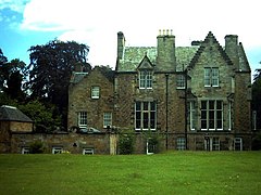
Loanhead is a town in Midlothian, Scotland, in a commuter belt to the south of Edinburgh, and close to Roslin, Bonnyrigg and Dalkeith. The town was built on coal and oil shale mining, and the paper industries.

The EH postcode area, also known as the Edinburgh postcode area, is a group of 55 postcode districts for post towns: Armadale, Balerno, Bathgate, Bo'ness, Bonnyrigg, Broxburn, Currie, Dalkeith, Dunbar, East Linton, Edinburgh, Gorebridge, Gullane, Haddington, Heriot, Humbie, Innerleithen, Juniper Green, Kirkliston, Kirknewton, Lasswade, Linlithgow, Livingston, Loanhead, Longniddry, Musselburgh, Newbridge, North Berwick, Ormiston, Pathhead, Peebles, Penicuik, Prestonpans, Rosewell, Roslin, South Queensferry, Tranent, Walkerburn, West Calder and West Linton in Scotland.

<span class="mw-page-title-main">Rosewell, Midlothian</span> Village in Midlothian, Scotland

Rosewell is a former mining village in Midlothian, Scotland, east of Roslin and south-west of Bonnyrigg. The village is in the civil parish of Lasswade and was previously a separate ecclesiastical parish, but has its own Community Council, namely Rosewell and District.

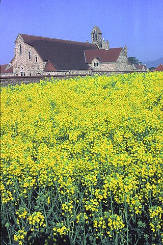
Lasswade and Rosewell Parish Church serves the communities of Lasswade, Poltonhall and Rosewell, Midlothian, Scotland. It is a congregation of the Church of Scotland.

<span class="mw-page-title-main">Cockpen and Carrington Parish Church</span> Church in Midlothian, Scotland

Cockpen and Carrington Parish Church is located to the south of the town of Bonnyrigg in Midlothian, Scotland. It is a congregation of the Church of Scotland. The parish includes the south side of the town of Bonnyrigg, plus the rural area to the south of the town.

<span class="mw-page-title-main">Carrington, Midlothian</span> Human settlement in Scotland

Carrington is a small, rural village in Midlothian, Scotland. It is located to the south of Bonnyrigg. The civil parish of the same name has a population of 316.

<span class="mw-page-title-main">Old Pentland Cemetery</span> Burial ground in Scotland

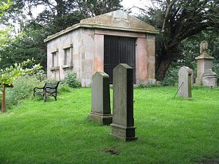
Old Pentland Cemetery is a cemetery in Old Pentland, near Loanhead in Midlothian, Scotland. A category B listed building, the cemetery dates back to the early 17th century.

The Peebles Railway was a railway company that built a line connecting the town of Peebles in Peeblesshire, Scotland, with Edinburgh. It opened on 4 July 1855, and it worked its own trains.

The Esk Valley Railway was a short branch line built to serve industry in the valley of the River North Esk, south of Edinburgh in Scotland. The terminus was Polton. The line opened on 15 April 1867

<span class="mw-page-title-main">Penicuik–Dalkeith Walkway</span> Route in Midlothian in the east of Scotland

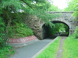
The Penicuik - Dalkeith Walkway, situated in the county of Midlothian in the east of Scotland, stretches for 9.5 miles along the former Edinburgh to Peebles railway. The route passes through many of Midlothian's historic towns and villages. The gentle gradient and nature of the route allows easy access for walkers, cyclists and horse riders to explore and enjoy the spectacular landscapes and visitor attractions of the county.

<span class="mw-page-title-main">Cockpen</span> Parish in Midlothian, Scotland

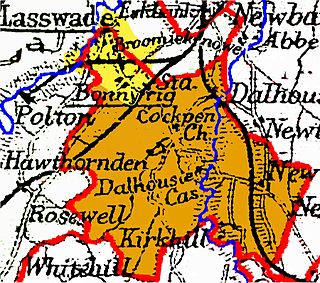
Cockpen is a parish in Midlothian, Scotland, containing at its north-west corner the town of Bonnyrigg, which lies two miles (3.2 km) south-west of Dalkeith. It is bounded on the west and north by the parish of Lasswade, on the east, by Newbattle and on the south by Carrington. It extends about three miles (4.8 km) from north to south and its greatest breadth is about 2+12 miles (4.0 km).

Glencorse is a parish of Midlothian, Scotland, lying 7 miles south of Edinburgh. It is bounded on the north-west by the former parish of Colinton now within the City of Edinburgh, to the north and west by Lasswade and to the south and west by Penicuik.

<span class="mw-page-title-main">Cranston, Midlothian</span> Human settlement in Scotland

Cranston is a parish of Midlothian, Scotland, lying 4+14 miles south-east of Dalkeith. It is bounded by the parishes of Inveresk and Ormiston on the east, by Crichton and Borthwick on the south ; and by Newbattle on the west and north. The River Tyne flows through the centre of the parish.

Old Pentland is a locality, former parish and former barony, in Midlothian, Scotland.

References

  1. 1 2 3 4 5 James, Alan. "A Guide to the Place-Name Evidence" (PDF). SPNS – The Brittonic Language in the Old North. Archived from the original (PDF) on 13 August 2017. Retrieved 25 November 2018.
  2. Undiscovered Scotland : Lasswade
  3. Whitson, Angus. "Buddleia butterfly bonanza". The Courier. Retrieved 16 March 2022.
  4. Grant's Old and New Edinburgh vol.6 p.360
  5. Fasti Ecclesiae Scoticanae; by Hew Scott
  6. Buildings of Scotland: Lothian by Colin McWilliam
  7. Lasswade Centre (Lasswade High School, Gazetteer for Scotland
  8. 1 2 Gazetteer of Scotland, 2nd edition, by W. Groome, publ. 1896. Article on Lasswade
  9. 1 2 3 The Statistical Account of Edinburghshire, by the Ministers of the Respective Parishes, publ. William Blackwood and Sons, Edinburgh, 1845. Article on Lasswade
  10. Parish of Lasswade, Gazetteer for Scotland
  11. Midlothian council web site https://midlothian.cmis.uk.com/live/CommunityCouncils.aspx – see entries for these five councils. Retrieved April 2016
  12. Ordnance Survey One-inch to the mile, 7th Series, 1952–1961, Sheet 62 – Edinburgh, Publication date: 1960
  13. 1 2 Lasswade and Rosewell Parish Church web site www.lasswadechurch.co.uk/history.html retrieved April 2016.
  14. Topographical, Statistical, and Historical Gazetteer of Scotland (article on Melville), publ. A. Fullarton & Co., Edinburgh, 1853
  15. 1 2 Topographical, Statistical, and Historical Gazetteer of Scotland (article on Pentland), publ. A. Fullarton & Co., Edinburgh, 1853
  16. Web site of Scottish Corpora, English Language, School of Critical Studies, University of Glasgow www.scottishcorpus.ac.uk/document/?documentid=1409 retrieved April 2016
  17. Historic Scotland (Royal Commission on the Ancient and Historical Monuments of Scotland) web site, entry on Pentland burial ground http://canmore.org.uk/site/51681 retrieved April 2016
  18. 1 2 Catalogue of Midlothian Burgh Council archives "Archived copy". Archived from the original on 22 April 2016. Retrieved 27 April 2016.{{cite web}}: CS1 maint: archived copy as title (link) retrieved April 2016
  19. Local Government (Scotland) Act 1929
  20. Census of Scotland 2011, Table KS101SC – Usually Resident Population, publ. by National Records of Scotland. Web site http://www.scotlandscensus.gov.uk/ retrieved March 2016. See “Standard Outputs”, Table KS101SC, Area type: Civil Parish 1930
  21. Gazetteer of Scotland, publ, by W & AK Johnston, Edinburgh, 1937. Article on Lasswade. Places are presented alphabetically