List of gaps in Interstate Highways

Last updated

Dwight D. Eisenhower National System of Interstate and Defense Highways

I-69.svg

I-70.svg

Highway shields for Interstate 69 and Interstate 70, highways with true gaps and freeway gaps
Map of current Interstates.svg
Interstate Highways in the 48 contiguous states
System information
FormedJune 29, 1956 [1]
Highway names
Interstates Interstate X (I-X)
System links
I-70 briefly follows an at-grade portion of US 30 with traffic lights in Breezewood, Pennsylvania Breezewood, Pennsylvania.jpg
I-70 briefly follows an at-grade portion of US 30 with traffic lights in Breezewood, Pennsylvania

There are gaps in the Interstate Highway system, where the roadway carrying an Interstate shield does not conform to the standards set by the Federal Highway Administration (FHWA), the body that sets the regulations for the Interstate Highway System. For the most part, the Interstate Highway System in the United States is a connected system, with most freeways completed; however, some Interstates still have gaps. These gaps can be due to unconnected segments of the same route or from failure of the road to fully conform to Interstate standards by including such characteristics as at-grade crossings, traffic lights, undivided or narrow freeways, or movable bridges (lift bridges and drawbridges).

Contents

True gaps

True gaps are where multiple disjoint sections of road have the same Interstate highway number and can reasonably be considered part of "one highway" in theory, based on the directness of connections via other highways, or based on future plans to fill in the gap in the Interstate, or simply based on the shortness of the gap. The sections are either not physically connected at all, or they are connected but the connection is not signed as part of the highway. This list does not include different highways that share the same number, such as the two different I-76s, I-84s, I-86s, I-87s, and I-88s, which despite appearances, were always intended as distinct highways and were never intended as a contiguous route.

Interstate 26

In North Carolina, Interstate 26 has a gap from Forks of Ivy to Asheville at exit 4A of Interstate 240. This is because not all of the parts in the gap were built to Interstate standards. As of November 2023, Interstate 26 is designated as Future I-26, US 19, and US 23. Construction on building this gap to Interstate Standards was scheduled to start in 2022. [2]

Interstate 49

Interstate 49 (I-49) currently has three sections: the original alignment from I-10 in Lafayette to I-20 in Shreveport, one from I-220 near Shreveport to Texarkana; and the third section from I-40 near Alma, Arkansas to I-470/I-435 south of Kansas City, Missouri. A bypass south of Bella Vista, Arkansas was completed in 2021, and existed initially as Arkansas Highway 549; the latter designation is now used on a short section southeast of Fort Smith that is several miles long. It is planned to be connected to an interstate with a project to construct a new roadway from Arkansas Highway 22 to Interstate 40 in Arkansas. I-49 from Fort Smith to Texarkana is still unbuilt. These gaps are expected to be eventually closed.

Interstate 69

I-69 currently has several disconnected sections: the original alignment travels from Indianapolis, Indiana, to Port Huron, Michigan. A second section exists from near Evansville, Indiana, to Martinsville, Indiana south of Indianapolis. In stages from 2011 to 2018, sections of the Purchase Parkway, I-24, the Wendell H. Ford Western Kentucky Parkway, and the Pennyrile Parkway from Mayfield, Kentucky, to Henderson, Kentucky, became signed as I-69. On October 2, 2006, a segment of I-69 opened in Tunica and DeSoto counties in Mississippi; this segment has since been continued (but is not signed) through Memphis, Tennessee, to an intersection with U.S. Highway 51 on the north side. Between 2012 and 2015, a portion of U.S. Highway 59 (US 59) between Rosenberg and Cleveland, Texas, extending through Houston, became part of I-69. [3] [4] [5] In South Texas, I-69's route splits into three spurs to cities on the U.S.–Mexico border, on which four segments are complete: a short segment of I-69E in Corpus Christi and another from Raymondville to the border in Brownsville; a short segment of I-69C in Edinburg and McAllen; and a very short segment of I-69W adjacent to the border in Laredo.

As of 2021, projects to connect these segments are in varying stages of development. Indiana is currently working to connect the Port Huron–Indianapolis and Martinsville–Evansville sections by extending I-69 north from Martinsville to the I-465 Indianapolis loop, with construction planned to be complete in late 2024. [6] Kentucky and Indiana expect to begin construction of the eastern bypass of Henderson and new Ohio River crossing, connecting the Mayfield–Henderson and Martinsville–Evansville sections, in 2022. [7] Kentucky has plans to upgrade the remaining section of the Purchase Parkway and work with Tennessee to reconstruct the current interchange at the south end of the Purchase Parkway in South Fulton, Tennessee to provide a free-flow connection to the existing U.S. 51 freeway to Union City, while Tennessee finished I-69 bypass of Union City. [8] It is currently designated as SR 690. A further bypass of Troy is proposed but not yet funded, which would complete a freeway-standard route from I-155 in Dyersburg to Henderson. Tennessee has deferred plans to complete the section between Dyersburg and Memphis to close the gap until the South Fulton–Dyersburg section is completed. [9] The section from Memphis to Houston is the least developed; as of 2021, Mississippi has no current plans to extend I-69 further south, and the states of Louisiana and Arkansas have not funded construction of their portion of the proposed route (via El Dorado and Shreveport) between Mississippi and Texas, other than a two-lane southern bypass of Monticello, Arkansas designed to be incorporated into I-69 at a later date. Texas has continued to fund projects to upgrade U.S. 59, U.S. 77, U.S. 281, and other routes that would eventually form parts of I-69 in South Texas and East Texas, including the I-69W/C/E spurs.

Interstate 74

I-74 currently has five sections, [10] the original segment heading northwest from Cincinnati, Ohio, to Davenport, Iowa; one from the VirginiaNorth Carolina line along I-77 south and east to a point southeast of Mount Airy, North Carolina; one traveling around High Point connecting with I-85 and reaching I-73, where the two are concurrent until Ellerbe; and from west of Laurinburg to south of Lumberton, North Carolina, at I-95. North Carolina is currently[ when? ] working on connecting all its sections of I-74.

Interstate 86

The eastern I-86 has had two sections since 2006. One travels for 197 miles (317 km) from I-90 in North East, Pennsylvania (which is a town in the northwestern part of the state) to exit 61 in Waverly, New York. The second section is a 9.9-mile (15.9 km) stretch outside of Binghamton traveling from I-81 in Kirkwood to exit 79 in Windsor. The gap is signed as Future 86. I-86 will eventually travel from North East, Pennsylvania, to the New York State Thruway (I-87) near Harriman, New York. All the designated sections and gaps in New York are part of New York State Route 17.

Interstate 99

As of 2023, I-99 has two sections: one from the Pennsylvania Turnpike to just south of I-80, concurrent with US 220, and one from the Pennsylvania–New York state line north to I-86 in Corning, New York, concurrent with US 15. Much of the intervening route, including the entire US 15 section between I-180 in Williamsport and the New York state line, has been constructed to freeway standards but as of yet is not signed as part of I-99.

The signing of the intervening route as I-99 will be completed when the route is upgraded to Interstate standards, connecting the two segments of I-99.

Freeway gaps

Freeway gaps occur where the Interstate is signed as a continuous route, but part, if not all of it, is not up to freeway standards. This includes drawbridges where traffic on the Interstate can be stopped for vessels. This does not include facilities such as tollbooths, toll plazas, agricultural inspection stations, or border stations.

At-grade intersections

Major at-grade intersections

Surface street section of I-78 in Jersey City, New Jersey I-78 Feeding Holland Tunnel jeh.jpg
Surface street section of I-78 in Jersey City, New Jersey

In urban and heavily developed areas, Interstates may travel along surface roads or have at-grade intersections with stop signs or traffic lights. This usually happens because the Interstate started construction after the land was heavily developed and buildings such as residences and businesses and other roads would have to be removed to allow a freeway to pass through. Additionally, more developed land would have to be cleared for space to build interchanges to connect the Interstate and surface streets. This situation is extremely uncommon as Interstates are usually built around cities or through them on pre- or lightly developed land.

Minor at-grade intersections

Several Interstates in rural areas of the U.S. have minor at-grade intersections (including median breaks) with farm access roads or authorized vehicle-only driveways used for highway maintenance or connection to nearby utility stations. This is usually due to the lack of an old highway, the need to provide access to property that was accessed via the road prior to its upgrade to an Interstate, and the high cost to construct an interchange for the small amount of traffic that would use such a connection or to build a frontage road parallel to the freeway to the nearest interchange.

  • I-10 in Hudspeth County, Texas has at least fifteen at-grade intersections containing median breaks with minor dirt or gravel roads.
  • I-11 in Boulder City, Nevada has an at-grade intersection with an authorized-vehicle-only service road giving access to Buchanan Boulevard and the WAPA Mead substation. An interchange replacing this has been considered. [13]
  • I-15 in Wheaton Springs, California (east of Mountain Pass) has several at-grade intersections with dirt roads, including one leading to a house.
  • I-15 west of Mesquite, Nevada has an at-grade intersection with Toquop Wash Road, a dirt road. Another access point to Toquop Wash Road passes under the I-15 southbound lanes and connects to the northbound lanes in the median.
  • I-15 southbound near Cove Fort, Utah has an at-grade intersection with Cinder Crater Road, an asphalt and gravel road that provides access for trucks to the Cinder Crater quarry.
  • I-520 in Augusta, Georgia has an at-grade intersection with a gravel and asphalt road that provides access to Lovers Lane.
  • I-40 in the mountains of western North Carolina has at-grade access to several dirt roads, as well as a partially grade-separated interchange that lacks ramps or RIROs where roads directly connect to the I-40 carriageways. (Example)
  • I-40 in western Texas has eight at-grade access points for cattle ranches with median breaks.
  • I-80 westbound in western Utah in the Great Salt Lake Desert has two gravel roads that directly connect to the freeway, one accessing the Metaphor: The Tree of Utah artwork and another towards Cobb Peak.
  • I-80 westbound in northwestern New Jersey has a RIRO providing access to Hainesburg Road at mile marker 3.4.
  • I-94 at Fort Custer west of Battle Creek, Michigan is the only instance of an Interstate freeway in Michigan to have a gated driveway (at 44th Street), which facilitates access of military vehicles. [14]

Other at-grade intersections

  • The northbound lanes of I-5 in Washington intersect with an at-level crosswalk approximately 100 feet (30 m) south of the border with Canada. This crosswalk allows pedestrians access to a monument that is part of Peace Arch Park.

Undivided and narrow freeways

Two-lane stretch of I-93 through Franconia Notch in New Hampshire I-93 Franconia Notch.jpg
Two-lane stretch of I-93 through Franconia Notch in New Hampshire
Two-lane stretch of I-81 on the Thousand Islands Bridge crossing part of the Saint Lawrence River Thousand Islands Bridge.jpg
Two-lane stretch of I-81 on the Thousand Islands Bridge crossing part of the Saint Lawrence River
The Mackinac Bridge, which carries I-75, has no hard shoulders, and has only a 4-inch-tall (10 cm) divider between the opposing directions Mackinac Bridge.JPG
The Mackinac Bridge, which carries I-75, has no hard shoulders, and has only a 4-inch-tall (10 cm) divider between the opposing directions

This section addresses two-lane freeways and other narrow or undivided freeway sections of the Interstate, excepting instances of continuing routes using one-lane ramps and merge leads. Narrow gaps between opposing directions with jersey barriers taller than four feet (1.2 m) are excluded from this section; therefore the separation criterion is really either a 4-foot-tall (1.2 m) wall, or a 100-foot-wide (30 m) median, whichever is greater.

Movable bridges

I-280 westbound approaching the movable Stickel Bridge over the Passaic River in New Jersey Interstate 280 - New Jersey westbound approaching Stickel Bridge.jpg
I-280 westbound approaching the movable Stickel Bridge over the Passaic River in New Jersey

By Interstate standard, all bridges on the Interstate system must be fixed as to not interrupt the flow of traffic. Several bridges on the system, however, are movable:

Freeway-to-freeway crosspaths without direct connection

Proposed

Connection gaps

Auxiliary Interstates (also known as three-digit Interstates) are intended to connect to their parent either directly or via a same-parented Interstate (like I-280 in California being connected to I-80 via I-680). Often, these connection gaps occur to eliminate concurrencies between other three-digit routes. Freeway gaps (signed or unsigned) that officially connect auxiliary routes to the parent are excluded.

Current examples

See also

Related Research Articles

<span class="mw-page-title-main">Interstate 99</span> Interstate Highway in Pennsylvania and New York

Interstate 99 (I-99) is an interstate highway in the United States with two segments: one located in central Pennsylvania and the other in southern New York. The southern terminus of the route is near exit 146 of the Pennsylvania Turnpike (I-70/I-76) north of Bedford, where the road continues south as U.S. Route 220 (US 220). The northern terminus of the Pennsylvania segment is at an at-grade intersection with Musser Lane just before reaching I-80 near Bellefonte. The New York segment follows US 15 from the Pennsylvania–New York border to an interchange with I-86 in Corning. Within Pennsylvania, I-99 passes through Altoona and State College—the latter home to the Pennsylvania State University—and is entirely concurrent with US 220. Long-term plans call for the two segments of I-99 to be connected using portions of I-80, US 220, and US 15 through Pennsylvania.

<span class="mw-page-title-main">Interstate 83</span> Interstate Highway in Pennsylvania and Maryland

Interstate 83 (I-83) is an Interstate Highway located in the states of Maryland and Pennsylvania in the Eastern United States. Its southern terminus is at a signalized intersection with Fayette Street in Baltimore, Maryland; its northern terminus is at I-81 near Harrisburg, Pennsylvania. I-83 runs from Downtown Baltimore north to I-695 near the northern suburb of Timonium on the Jones Falls Expressway before forming a concurrency with I-695. After splitting from I-695, the route follows the Baltimore–Harrisburg Expressway north to the border between Maryland and Pennsylvania. Upon crossing the state line, I-83 becomes the Veterans of Foreign Wars of the United States Memorial Highway and continues north through York toward the Harrisburg area. The route runs along the southern and eastern portion of the Capital Beltway that encircles Harrisburg before reaching its northern terminus.

<span class="mw-page-title-main">Interstate 49</span> Interstate Highway in Louisiana, Arkansas, and Missouri

Interstate 49 (I-49) is a north–south Interstate Highway that exists in multiple segments: the original portion entirely within the state of Louisiana with an additional signed portion extending from I-220 in Shreveport to the Arkansas state line, three newer sections in Arkansas, and a new section that opened in Missouri. Its southern terminus is in Lafayette, Louisiana, at I-10 while its northern terminus is in Kansas City, Missouri, at I-435 and I-470. Portions of the remaining roadway in Louisiana, Arkansas, and Texas, which will link Kansas City with New Orleans, are in various stages of planning or construction.

<span class="mw-page-title-main">New Jersey Route 42</span> Highway in New Jersey

Route 42 is a state highway in the U.S. state of New Jersey within the Camden area. It runs 14.28 mi (22.98 km) from an intersection with U.S. Route 322 and County Route 536 Spur in Monroe Township, Gloucester County, to an intersection with Interstate 76 (I-76) and I-295 in Bellmawr, Camden County. The southern portion of Route 42 is an four-lane divided highway and one of several highways comprising the Black Horse Pike, a road that runs from Camden to Atlantic City. The northern portion is part of a six- to eight-lane freeway referred to locally as the North–South Freeway that connects the Atlantic City Expressway to the Benjamin Franklin Bridge. Major junctions along the route include the Atlantic City Expressway and the southern terminus of Route 168 in Turnersville, Route 168 in Blackwood, and Route 41 and Route 55 in Deptford Township.

<span class="mw-page-title-main">U.S. Route 46</span> Highway in New Jersey

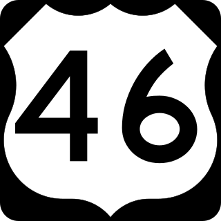
U.S. Route 46 (US 46) is an east–west U.S. Highway completely within the state of New Jersey, running for 75.34 mi (121.25 km), making it the shortest signed, non-spur U.S. Highway. The west end is at an interchange with Interstate 80 (I-80) and Route 94 in Columbia, Warren County, on the Delaware River. The east end is in the middle of the George Washington Bridge over the Hudson River in Fort Lee, Bergen County, while the route is concurrent with I-95 and US 1-9. Throughout much of its length, US 46 is closely paralleled by I-80. US 46 is a major local and suburban route, with some sections built to or near freeway standards and many other sections arterials with jughandles. The route runs through several communities in the northern part of New Jersey, including Hackettstown, Netcong, Dover, Parsippany-Troy Hills, Wayne, Clifton, Ridgefield Park, Palisades Park, and Fort Lee. It crosses over the Upper Passaic River at several points. The road has been ceremonially named the United Spanish–American War Veterans Memorial Highway.

<span class="mw-page-title-main">New Jersey Route 440</span> State highway in Hudson and Middlesex counties in New Jersey, United States

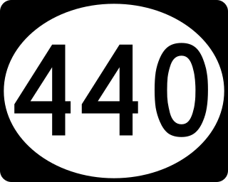
Route 440 is a state highway in New Jersey, United States. It comprises two segments, a 5.15-mile (8.29 km) freeway in Middlesex County linking Interstate 287 (I-287) and the New Jersey Turnpike (I-95), in Edison to the Outerbridge Crossing in Perth Amboy and an 8.18-mile (13.16 km) four-lane divided highway in Hudson County running from the Bayonne Bridge in Bayonne to U.S. Route 1/9 Truck in Jersey City. These two segments are connected by New York State Route 440 (NY 440), which runs across Staten Island. The freeway portion in Middlesex County is six lanes wide and interchanges with the Garden State Parkway and US 9 in Woodbridge.

<span class="mw-page-title-main">Frontage road</span> Type of road

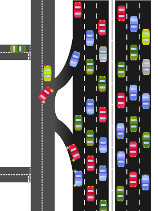
A frontage road is a local road running parallel to a higher-speed, limited-access road. A frontage road is often used to provide access to private driveways, shops, houses, industries or farms. Where parallel high-speed roads are provided as part of a major highway, these are also known as local lanes. Sometimes a similar arrangement is used for city roads; for example, the collector portion of Commonwealth Avenue in Boston, Massachusetts, is known as a carriage road.

<span class="mw-page-title-main">U.S. Route 202</span> Highway in the United States

U.S. Route 202 (US 202) is a spur route of US 2. It follows a northeasterly and southwesterly direction stretching from Delaware in the south to Maine in the north and traveling through the states of Pennsylvania, New Jersey, New York, Connecticut, Massachusetts, and New Hampshire. The highway has borne the number 202 since at least 1936. Before this, sections of the highway were designated U.S. Route 122, as it intersected US 22 in New Jersey. Its current designation is based on its intersection with I-395 and SR 15 near US 2 in Maine, but it does not have a direct connection with US 2.

<span class="mw-page-title-main">Interstate 530</span> Highway in Arkansas

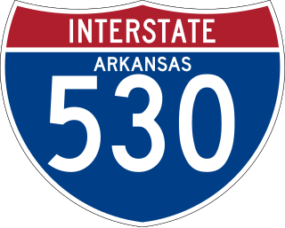
Interstate 530 (I-530) in Arkansas is a spur route of the Interstate highway system, traveling 46.65 miles (75.08 km) from Pine Bluff north-northwest to Little Rock at an interchange of I-30/I-440/U.S. Highway 65 (US 65)/US 67/US 167. The highway also travels through the cities of Redfield and White Hall. In the future, I-530 will be extended to I-69 west of Monticello. A short section near the future I-69 alignment has been signed as Highway 530 (AR 530).

<span class="mw-page-title-main">Interstate 465</span> Interstate Highway loop in Indiana, United States

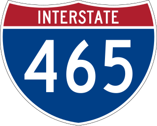
Interstate 465 (I-465), also known as the USS Indianapolis Memorial Highway, is the beltway circling Indianapolis, Indiana, United States. It is roughly rectangular in shape and has a perimeter of approximately 53 miles (85 km). It lies almost completely within the boundaries of Marion County, except for two short sections on the north leg in Boone and Hamilton counties. It intersects with I-65, I-69, I-70, and I-74 and provides additional access to I-65 via I-865.

<span class="mw-page-title-main">Interstate 295 (Delaware–Pennsylvania)</span> Interstate Highway in the US states of Delaware, New Jersey, and Pennsylvania

Interstate 295 (I-295) in Delaware, New Jersey, and Pennsylvania is an auxiliary Interstate Highway, designated as a bypass around Philadelphia, Pennsylvania, and a partial beltway of Trenton, New Jersey.

<span class="mw-page-title-main">Interstate 676</span> Highway in New Jersey and Pennsylvania

Interstate 676 (I-676) is an Interstate Highway that serves as a major thoroughfare through Center City Philadelphia, where it is known as the Vine Street Expressway, and Camden, New Jersey, where it is known as the northern segment of the North–South Freeway, as well as the Martin Luther King Jr. Memorial Highway in honor of civil rights leader Martin Luther King Jr. Its western terminus is at I-76 in Philadelphia near the Philadelphia Museum of Art and Fairmount Park. From there, it heads east and is then routed on surface streets near Franklin Square and Independence National Historical Park, home of the Liberty Bell, before crossing the Delaware River on the Benjamin Franklin Bridge. On the New Jersey side of the bridge, the highway heads south to its southern terminus at I-76 in Gloucester City near the Walt Whitman Bridge. Between the western terminus and downtown Camden, I-676 is concurrent with U.S. Route 30 (US 30).

<span class="mw-page-title-main">California State Route 65</span> Highway in California

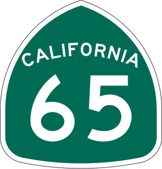
State Route 65 is a north-south state highway in the U.S. state of California. It is composed of two segments in the Central Valley. The southern segment begins at SR 99, near Bakersfield and terminates at SR 198 near Exeter. It also serves the communities of Oildale, Ducor, Terra Bella, Porterville, Strathmore, and Lindsay. The northern segment begins at Interstate 80 in Roseville and terminates at SR 70 at Olivehurst. It also serves the communities of Rocklin, Lincoln, and Wheatland.

<span class="mw-page-title-main">Interstate 80 in New Jersey</span> Highway in New Jersey

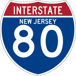
Interstate 80 (I-80) is a major Interstate Highway in the United States, running from San Francisco, California, eastward to the New York metropolitan area. In New Jersey, I-80 runs for 68.35 miles (110.00 km) from the Delaware Water Gap Toll Bridge at the Pennsylvania state line to its eastern terminus at I-95 in Teaneck, Bergen County. I-95 continues from the end of I-80 to the George Washington Bridge for access to New York City. The highway runs parallel to U.S. Route 46 (US 46) through rural areas of Warren and Sussex counties before heading into more suburban surroundings in Morris County. As the road continues into Passaic and Bergen counties, it heads into more urban areas. The New Jersey Department of Transportation (NJDOT) identifies I-80 within the state as the Christopher Columbus Highway.

<span class="mw-page-title-main">Interstate 78 in New Jersey</span> Highway in New Jersey

Interstate 78 (I-78) is an east–west route stretching from Union Township, Lebanon County, Pennsylvania, to New York City. In New Jersey, I-78 is called the Phillipsburg–Newark Expressway and the Newark Bay–Hudson County Extension of the New Jersey Turnpike. The highway runs for 67.83 miles (109.16 km) in the northern part of the state of New Jersey from the I-78 Toll Bridge over the Delaware River at the Pennsylvania state line in Phillipsburg, Warren County, east to the Holland Tunnel under the Hudson River at the New York state line in Jersey City, Hudson County. The Phillipsburg–Newark Expressway portion of I-78, formally called the Lightning Division Memorial Highway, runs from the Phillipsburg area east across rural areas of western New Jersey before entering suburban areas in Somerset County. The road crosses the Watchung Mountains, widening into a local–express lane configuration at Route 24 as it continues through urban areas to Newark. Here, I-78 intersects the mainline of the New Jersey Turnpike (I-95) and becomes the Newark Bay Extension, crossing the Newark Bay Bridge and continuing to Jersey City. The route, along with Route 139, follows a one-way pair of surface streets to the Holland Tunnel.

<span class="mw-page-title-main">Interstate 70 in Pennsylvania</span> Section of Interstate highway in Pennsylvania, United States

Interstate 70 (I-70) is a state highway that is located in the Commonwealth of Pennsylvania in the United States. It runs east to west across the southwest part of Pennsylvania and serves the southern fringe of the Pittsburgh metropolitan area.

<span class="mw-page-title-main">Interstate 95 in Pennsylvania</span> Section of Interstate Highway in United States

Interstate 95 (I-95) is a major north–south Interstate Highway that runs along the East Coast of the United States from Miami, Florida, north to the Canada–United States border at Houlton, Maine. In the state of Pennsylvania, it runs 51.00 miles (82.08 km) from the Delaware state line near Marcus Hook in Delaware County in the southeastern part of the state northeast to the Delaware River–Turnpike Toll Bridge at the New Jersey state line near Bristol in Bucks County, closely paralleling the New Jersey state line for its entire length through Pennsylvania.

<span class="mw-page-title-main">Two-lane expressway</span> Expressway or freeway with only one lane in each direction

A two-lane expressway or two-lane freeway is an expressway or freeway with only one lane in each direction, and usually no median barrier. It may be built that way because of constraints, or may be intended for expansion once traffic volumes rise. The term super two is often used by roadgeeks for this type of road, but traffic engineers use that term for a high-quality surface road. Most of these roads are not tolled.

<span class="mw-page-title-main">U.S. Route 1 in New Jersey</span> Highway in New Jersey

U.S. Route 1 (US 1) is a U.S. Route which parallels the East Coast of the United States, running from Key West, Florida, in the south to Fort Kent, Maine, at the Canadian border in the north. Of the entire length of the route, 66.06 miles (106.31 km) of it runs through New Jersey. It enters the state from Pennsylvania on the Trenton–Morrisville Toll Bridge over the Delaware River in the state capital of Trenton, running through the city on the Trenton Freeway. From here, US 1 continues northeast as a surface divided highway through suburban areas, heading into Middlesex County and passing through New Brunswick and Edison. US 1 merges with US 9 in Woodbridge, and the two routes continue through northern New Jersey as US 1/9 to the George Washington Bridge over the Hudson River in Fort Lee. At this point, the road continues into New York City along with I-95.

<span class="mw-page-title-main">U.S. Route 24 in Indiana</span> Section of U.S. Highway in Indiana, United States

U.S. Route 24 (US 24) in Indiana runs east from the Illinois state line to Huntington. At Huntington, US 24 turns northeast and runs to Fort Wayne; it then runs concurrently with Interstate 69 (I-69) and I-469 to bypass the city before entering Ohio at the state line east of Fort Wayne. The segment of US 24 between Logansport and Toledo, Ohio, is part of the Hoosier Heartland Industrial Corridor project of the Intermodal Surface Transportation Efficiency Act.

References

  1. Weingroff, Richard F. (Summer 1996). "Federal-Aid Highway Act of 1956, Creating the Interstate System". Public Roads. 60 (1). Washington, DC: Federal Highway Administration . Retrieved March 16, 2012.
  2. "NCDOT: Asheville I-26 Connector". North Carolina Department of Transportation. Retrieved January 19, 2022.
  3. Special Committee on U.S. Route Numbering (May 19, 2012). "Report to SCOH" (PDF) (Report). Washington, DC: American Association of State Highway and Transportation Officials. Archived from the original (PDF) on June 3, 2019.
  4. "Alliance for I-69 Texas: More Houston Areas Freeway Added to Interstate 69". Alliance for I-69 Texas. February 28, 2013.
  5. "Texas Transportation Commission Minute Order" (PDF). Texas Transportation Commission. March 26, 2015.
  6. "I-69 in Martinsville opens to through traffic in both directions". I-69 Finish Line. December 23, 2021. Retrieved December 31, 2021.
  7. "Ohio River Crossing: ORX Section 1". I-69 Ohio River Crossing. Indiana Department of Transportation and Kentucky Transportation Cabinet . Retrieved December 30, 2021.
  8. Latham, Angele (July 15, 2021). "Interstate 69 Bypass, part of 'last great American highway,' kicks off paving in Obion County". The Jackson Sun. Retrieved December 31, 2021.
  9. Irel, Jeff (January 19, 2021). "Updates on Interstate 69, Highway 14, an east-west corridor and the Megasite". The Leader. Covington, Tennessee. Retrieved December 31, 2021.
  10. Malme, Bob. "I-74 North Carolina Progress Page". Archived from the original on July 25, 2010. Retrieved August 28, 2009.[ self-published source ]
  11. Roig-Franzia, Manuel (November 22, 2001). "The Town That Stops Traffic: Travelers Encounter Way Station as Way of Life in Breezewood" . The Washington Post . p. B1.
  12. Google (August 28, 2009). "Intersection of 14th St (ostensibly 78 West) and Erie St" (Map). Google Maps . Google. Retrieved August 28, 2009.
  13. "Buchanan or bust. Proposal seems to lack supporters". Boulder City Review . May 24, 2017. Retrieved December 16, 2020.
  14. Michigan Department of Transportation (n.d.). "Road & Highway Facts". Michigan Department of Transportation. Retrieved October 28, 2014.
  15. "Interstate 55 Crump Boulevard Interchange". Tennessee Department of Transportation. Retrieved June 7, 2021.
  16. Google (April 15, 2021). "North America to 870 I-70" (Map). Google Maps . Google. Retrieved April 15, 2021.
  17. Weingroff, Richard (April 7, 2011). "Interstate System Conditions and Performance". Highway History. Federal Highway Administration. Retrieved August 20, 2012.
  18. Koziol, John (May 23, 2019). "Hikers warned not to park along Franconia Notch Parkway in multi-agency crackdown". UnionLeader.com. Retrieved April 15, 2021.
  19. Project staff. "Home". Columbia River Crossing. Oregon Department of Transportation and Washington State Department of Transportation . Retrieved August 28, 2009.
  20. Read, Richard (July 5, 2013). "Bridge Funds to Nowhere: Some of the $175 million in work for the now-defunct Columbia River Crossing might be useful someday, but much of it is just gone". The Oregonian . Portland. p. A1. Retrieved July 5, 2013.
  21. Theen, Andrew (September 24, 2019). "Oregon and Washington: We'll start building a new Interstate Bridge by 2025". The Oregonian. Retrieved May 11, 2023.
  22. "Groundbreaking on I-64 widening, High Rise Bridge project". January 12, 2018. Retrieved December 31, 2019.
  23. "I-64 High-Rise Bridge project could raise economic opportunities". December 4, 2018.
  24. "Chesapeake's new High Rise Bridge opens Saturday". 13newsnow.com. July 15, 2022. Retrieved December 17, 2023.
  25. Highway Information Services Division (December 31, 2007). Highway Location Reference. Maryland State Highway Administration . Retrieved April 15, 2009.
  26. Highway Services Division (2010). "Movable Bridges on State Maintained Highways" (PDF). Maryland State Highway Administration. Retrieved October 18, 2010.
  27. Federal Highway Administration. National Highway System: Los Angeles, CA (PDF) (Map). Scale not given. Federal Highway Administration. Retrieved February 5, 2012.
  28. Cooper, Casey. "Indigestion 238". Casey's Roads and Highways Page. Retrieved January 26, 2013.[ unreliable source ]
  29. New York City (Map). Rand McNally and Company. 1960. Retrieved April 15, 2010.
  30. A Report on Airport Requirements and Sites in the Metropolitan New Jersey–New York Region. Port of New York Authority. 1961. p. 73. OCLC   2551801.
  31. West Side Hwy Project, New York: Environmental Impact Statement. New York State Department of Transportation; Federal Highway Administration. 1977. Retrieved March 19, 2018.
  32. Roberts, Sam (October 7, 1985). "The Legacy of Westway: Lessons from Its Demise". The New York Times. Retrieved March 22, 2018.
    • Union County Sheet 1 (Map). New Jersey Department of Transportation. 1967. Retrieved February 13, 2010.
    • Union County Sheet 2 (Map). New Jersey Department of Transportation. 1967. Retrieved February 13, 2010.
  33. "Greenville Spartanburg Metro 2018" (PDF). SCDOT. April 2021. Retrieved May 30, 2021.