List of onshore wind farms in the United Kingdom

Last updated

This is a list of some onshore wind farms (more than 1 turbine) in the UK. This information is gathered from multiple Internet sources, primarily the UK Wind Energy Database from RenewableUK (formerly BWEA) [1] and The Wind Power's database. There are many operational wind farms missing from the list, such as Scotland's 522 MW Clyde Wind Farm and the 68 MW Keadby Wind Farm in North Lincolnshire, England's largest onshore wind farm. The name of the wind farm is the name used by the energy company when referring to the farm and is usually related to the name of the physical location, e.g. hill, moor, fell, down etc. or the name of the agricultural farm for the smaller installations on property owned by farmers. The "wind farm" part is implied and hence removed for clarity in most cases. Listings here are restricted to wind farms with 12 turbines or more; for a more comprehensive list, please see the individual country articles.

Contents

North Steads Wind Farm from Druridge Bay North Steads Wind Farm from Druridge Bay.jpg
North Steads Wind Farm from Druridge Bay

England

Onshore wind farms in England
Wind farm County CoordinatesModelPower per
turbine
(MW)
No. Cap. (MW)OnlineDeveloperOperatorOwnerWebsite
Red Tile Cambridgeshire 52°27′02″N00°00′27″W / 52.45056°N 0.00750°W / 52.45056; -0.00750 (Red Tile) REpower MM822.001224.002007Wind Prospect Cumbria Wind Farms EDF EN
Frodsham Cheshire 53°17′46″N02°45′28″W / 53.29611°N 2.75778°W / 53.29611; -2.75778 (Frodsham Marsh) 2.651950.352017 Peel Wind Power Ltd -
Bears Down Cornwall 50°28′23″N04°57′11″W / 50.47306°N 4.95306°W / 50.47306; -4.95306 (Bears Down) Bonus B6000.60169.602001 npower renewables Innogy Innogy
Cold Northcott Cornwall 50°38′14″N04°31′07″W / 50.63722°N 4.51861°W / 50.63722; -4.51861 (Cold Northcott) WEG MS3-3000.30226.801993First Windfarm Holdings Ltd Cumbria Wind Farms First Wind Farm Holdings
Four Burrows Cornwall 50°17′30″N05°08′44″W / 50.29167°N 5.14556°W / 50.29167; -5.14556 (Four Burrows) Bonus B3000.30154.501998Ecogen Ltd RES RES
West Durham County Durham 54°46′05″N01°49′18″W / 54.76806°N 1.82167°W / 54.76806; -1.82167 (West Durham) REpower MM822.001224.002009 Banks Developments - ESB Group
Kirkby Moor Cumbria 54°14′46″N03°09′08″W / 54.24611°N 3.15222°W / 54.24611; -3.15222 (Kirkby Moor) Vestas WD340.40124.801993 npower renewables Innogy Beaufort Wind Limited
Goole Fields 1 East Riding of Yorkshire 53°40′58″N00°47′41″W / 53.68278°N 0.79472°W / 53.68278; -0.79472 (Goole Fields 1) Senvion MM922.051632.82014RWERWERWE
Goole Fields 2 East Riding of Yorkshire 53°40′58″N00°47′41″W / 53.68278°N 0.79472°W / 53.68278; -0.79472 (Goole Fields 1) Senvion MM922.051734.852017RWERWERWE
Hall Farm East Riding of Yorkshire 53°52′1.8″N00°22′15.8″W / 53.867167°N 0.371056°W / 53.867167; -0.371056 (Hall Farm) REpower MM822.051224.62013Blue Energy-John Laing Investments
Lissett Airfield East Riding of Yorkshire 54°00′35″N00°15′15″W / 54.00972°N 0.25417°W / 54.00972; -0.25417 (Lissett Airfield) Nordex N902.501230.002009 Novera -- [ permanent dead link ]
Little Cheyne Court Kent 50°57′45″N00°49′13″E / 50.96250°N 0.82028°E / 50.96250; 0.82028 (Little Cheyne Court) Nordex N902.302659.802009 npower renewables --
Coal Clough Lancashire 53°44′55″N02°10′03″W / 53.74861°N 2.16750°W / 53.74861; -2.16750 (Coal Clough) Vestas WD340.40249.601992 RES B9 Energy ScottishPower, SWEB, RES
Scout Moor Greater Manchester & Lancashire 53°40′01″N02°16′26″W / 53.66694°N 2.27389°W / 53.66694; -2.27389 (Scout Moor) Nordex N802.502665.002008Peel Wind Power Ltd- Peel Wind Power Ltd
Hyndburn Lancashire 53°42′52″N02°23′10″W / 53.71444°N 2.38611°W / 53.71444; -2.38611 (Hyndburn) REpower MM822.051224.62012 Energiekontor --
Bicker Fen Lincolnshire 52°55′34″N00°12′59″W / 52.92611°N 0.21639°W / 52.92611; -0.21639 (Bicker Fen) REpower MM822.001326.002008Wind Prospect Cumbria Wind Farms EDF EN
Conisholme Fen Resubmission Lincolnshire 53°25′32″N00°04′48″W / 53.42556°N 0.08000°W / 53.42556; -0.08000 (Conisholme Fen) Enercon E480.802016.002008 Ecotricity Ecotricity Ecotricity
Rusholme North Yorkshire 53°43′32″N00°55′15″W / 53.72556°N 0.92083°W / 53.72556; -0.92083 (Rusholme) REpower MM822.001224.002010Wind Prospect EDF EN EDF EN
Green Rigg Northumberland 55°05′56″N02°11′55″W / 55.09889°N 2.19861°W / 55.09889; -2.19861 (Green Rigg) Vestas V80218362012 EdF EDF EN EDF Energy
Royd Moor South Yorkshire 53°31′55″N01°40′10″W / 53.53194°N 1.66944°W / 53.53194; -1.66944 (Royd Moor) Bonus M1500-5000.50136.501993 E.ON UK Renewables B9 Energy E.ON Renewables

Northern Ireland

Onshore wind farms in Northern Ireland
Wind farm County CoordinatesModelPower per turbine (MW)No. Cap. (MW)OnlineDeveloperOperatorOwnerWebsite
Garves Mountain/Dunloy Antrim 55°15′58″N6°26′35.6″W / 55.26611°N 6.443222°W / 55.26611; -6.443222 (Garves) Vestas V903.00515.002009Your Energy Engineering Renewables Garves Wind Farm Ltd [ permanent dead link ]
Corkey County Antrim 55°02′00″N06°15′24″W / 55.03333°N 6.25667°W / 55.03333; -6.25667 (Corkey) Nordtank NTK5000.50105.001994 RES Ltd and B9 Energy B9 Energy ScottishPower ;
Elliot's Hill County Antrim 54°51′00″N06°03′36″W / 54.85000°N 6.06000°W / 54.85000; -6.06000 (Elliot’s Hill) Vestas V390.50105.001995 RES Ltd and B9 Energy B9 Energy ScottishPower ;
Gruig County Antrim 55°01′32″N06°14′58″W / 55.02556°N 6.24944°W / 55.02556; -6.24944 (Gruig) Nordex N802.501025.002009 RES UK & Ireland Ltd --
Wolf Bog County Antrim 54°48′11″N06°05′39″W / 54.80306°N 6.09417°W / 54.80306; -6.09417 (Wolf Bog) Vestas V802.00510.002007RES UK & Ireland Ltd B9 Energy ScottishPower ;
Callagheen County Fermanagh 54°26′18″N08°00′30″W / 54.43833°N 8.00833°W / 54.43833; -8.00833 (Callagheen) Siemens SWT-1.31.301316.902005 RES Ltd and B9 Energy B9 Energy ScottishPower ;
Slieve Rushen Repowering County Fermanagh 54°09′36″N07°37′12″W / 54.16000°N 7.62000°W / 54.16000; -7.62000 (Slieve Rushen) Vestas V903.001854.002008Sean Quinn Group --
Tappaghan Mountain County Fermanagh 54°32′53″N07°33′14″W / 54.54806°N 7.55389°W / 54.54806; -7.55389 (Tappaghan Mountain) GE 1.5s1.501319.502005 Airtricity GE Wind Airtricity [ permanent dead link ]
Tappaghan Mountain Extension County Fermanagh 54°32′53″N07°33′14″W / 54.54806°N 7.55389°W / 54.54806; -7.55389 (Tappaghan Mountain Extension) GE 1.5s1.5069.002009 SSE Renewables --
Altahullion Phase I County Londonderry 54°57′36″N07°01′54″W / 54.96000°N 7.03167°W / 54.96000; -7.03167 (Altahullion Phase I) Bonus B13001.302026.002003 RES Ltd and B9 Energy B9 Energy RES-GEN
Altahullion Phase II County Londonderry 54°57′38″N07°01′58″W / 54.96056°N 7.03278°W / 54.96056; -7.03278 (Altahullion Phase II) Siemens SWT-1.31.30911.702007 RES UK & Ireland Ltd B9 Energy RES-GEN
Rigged Hill County Londonderry 55°01′18″N06°49′13″W / 55.02167°N 6.82028°W / 55.02167; -6.82028 (Rigged Hill) Nordtank NTK5000.50105.001995 RES Ltd and B9 Energy B9 Energy ScottishPower ;
Bessy Bell County Tyrone 54°40′48″N07°24′12″W / 54.68000°N 7.40333°W / 54.68000; -7.40333 (Bessy Bell) Vestas V390.50105.001995Column Energy B9 Energy E.ON Renewables
Bessy Bell Extension County Tyrone 54°43′21″N07°22′29″W / 54.72250°N 7.37472°W / 54.72250; -7.37472 (Bessy Bell Extension) GE 1.5s1.5069.002008 Airtricity - Airtricity
Bin Mountain County Tyrone 54°42′18″N07°35′28″W / 54.70500°N 7.59111°W / 54.70500; -7.59111 (Bin Mountain) GE 1.5s1.5069.002007 Airtricity Airtricity Airtricity [ permanent dead link ]
Hunter's Hill County Tyrone 54°27′01″N07°18′25″W / 54.45028°N 7.30694°W / 54.45028; -7.30694 (Hunter's Hill) Nordex N802.50820.002010 RES UK & Ireland Ltd B9 Energy ESB Group
Lendrum's Bridge Phase I County Tyrone 54°26′12″N07°20′42″W / 54.43667°N 7.34500°W / 54.43667; -7.34500 (Lendrum’s Bridge Phase I) Vestas V470.6695.942000 RES Ltd and B9 Energy B9 Energy RES
Lendrum's Bridge Phase II County Tyrone 54°26′12″N07°20′42″W / 54.43667°N 7.34500°W / 54.43667; -7.34500 (Lendrum’s Bridge Phase II) Vestas V470.66117.302002 RES Ltd and B9 Energy B9 Energy RES [ permanent dead link ]
Lough Hill Resubmission County Tyrone 54°37′37″N07°36′21″W / 54.62694°N 7.60583°W / 54.62694; -7.60583 (Lough Hill) Siemens SWT-1.31.3067.802007 RES Ltd and B9 Energy - RES-GEN
Owenreagh County Tyrone 54°48′30″N07°19′54″W / 54.80833°N 7.33167°W / 54.80833; -7.33167 (Owenreagh) Zond Z400.50105.001997 EF Energy South Western Services South Western Services [ permanent dead link ]
Owenreagh Extension County Tyrone 54°48′30″N07°19′54″W / 54.80833°N 7.33167°W / 54.80833; -7.33167 (Owenreagh Extension) Vestas V520.8565.102008 EF Energy South Western Services South Western Services [ permanent dead link ]
Slieve Divena 1 County Tyrone 54°30′27″N07°06′19″W / 54.50750°N 7.10528°W / 54.50750; -7.10528 (Slieve Divena 1) Nordex N802.501230.002009 RES UK & Ireland Ltd SSE Renewables SSE Renewables

Scotland

Onshore wind farms in Scotland
Wind farm County CoordinatesModelPower per turbine (MW)No. Cap. (MW)OnlineDeveloperOperatorOwnerWebsite
Aikengall East Lothian 55°55′36″N02°27′28″W / 55.92667°N 2.45778°W / 55.92667; -2.45778 (Aikengall) Vestas V903.001648.002009Community WindpowerCommunity Windpower Community Windpower
Dalry North Ayrshire 55°42′38″N04°43′24″W / 55.71056°N 4.72333°W / 55.71056; -4.72333 (Dalry) Vestas V903.00618.002006Community WindpowerCommunity Windpower Community Windpower
Millour Hill Extension North Ayrshire 55°44′29″N004°46′56″W / 55.74139°N 4.78222°W / 55.74139; -4.78222 (Millour Hill Extension) Siemens Direct Drive3.226.42016Community WindpowerCommunity Windpower Community Windpower
Millour Hill North Ayrshire 55°44′29″N004°46′56″W / 55.74139°N 4.78222°W / 55.74139; -4.78222 (Millour Hill) Siemens Direct Drive36182012Community WindpowerCommunity Windpower Community Windpower
Calder Water South Lanarkshire 55°38′40″N004°12′33″W / 55.64444°N 4.20917°W / 55.64444; -4.20917 (Calder Water) Siemens Direct Drive313392013Community WindpowerCommunity Windpower Community Windpower
Aikengall IIa East Lothian and Scottish Borders 55°53′57″N002°27′43″W / 55.89917°N 2.46194°W / 55.89917; -2.46194 (Aikengall IIa) Siemens Gamesa SWT-DD-1204.31981.72021Community WindpowerCommunity Windpower Community Windpower
Aikengall II East Lothian 55°53′57″N002°27′43″W / 55.89917°N 2.46194°W / 55.89917; -2.46194 (Aikengall II) Siemens Direct Drive3.21960.82017Community WindpowerCommunity Windpower Community Windpower
Sanquhar Dumfries and Galloway 55°20′40″N004°02′25″W / 55.34444°N 4.04028°W / 55.34444; -4.04028 (Sanquhar) Vestas V1123.6931.052018Community WindpowerCommunity Windpower Community Windpower
Boyndie Airfield Aberdeenshire 57°38′47″N02°36′17″W / 57.64639°N 2.60472°W / 57.64639; -2.60472 (Boyndie Airfield) Enercon E822.00714.002006RDC Falck Renewables Falck Renewables
Cairnmore Aberdeenshire 57°18′30″N02°49′30″W / 57.30833°N 2.82500°W / 57.30833; -2.82500 (Cairnmore) Vestas V520.8532.552010 Greenspan Electric Cairnmore Ltd --
Dummuie Aberdeenshire 57°24′46″N02°43′42″W / 57.41278°N 2.72833°W / 57.41278; -2.72833 (Dummuie) Vestas V661.75710.402007Eco2Eco2Englefield Renewable Energy Fund ;
Glens of Foudland Aberdeenshire 57°25′28″N02°38′34″W / 57.42444°N 2.64278°W / 57.42444; -2.64278 (Glens of Foudland) Bonus B13001.302026.002005 RES - Centrica Renewable Energy Ltd
Hill of Balquhindachy (Extension) Aberdeenshire 57°28′23″N02°14′19″W / 57.47306°N 2.23861°W / 57.47306; -2.23861 (Hill of Balquhindachy) Vestas V520.8521.702009 Grant Mackie - Greenspan Energy
Hill of Eastertown Aberdeenshire 57°22′21″N02°24′7″W / 57.37250°N 2.40194°W / 57.37250; -2.40194 (Hill of Eastertown) Vestas V520.8532.552007-- Mackies Icecream Factories
Hill of Fiddes Aberdeenshire 57°18′56″N02°06′52″W / 57.31556°N 2.11444°W / 57.31556; -2.11444 (Hill of Fiddes) Enercon E702.3036.902010Broadview Energy--
Hill of Skelmonae Aberdeenshire 57°26′56″N02°11′21″W / 57.44889°N 2.18917°W / 57.44889; -2.18917 (Hill of Skelmonae) Enercon E480.8043.202009---
House O Hill Aberdeenshire 57°37′02″N02°02′27″W / 57.61722°N 2.04083°W / 57.61722; -2.04083 (House O Hill) Enercon E480.8032.402010---
North Redbog Aberdeenshire 57°35′09″N02°00′21″W / 57.58583°N 2.00583°W / 57.58583; -2.00583 (North Redbog) Enercon E480.8021.602008Redbog Renewables Ltd. Enercon Redbog Renewables Ltd
St John's Wells Aberdeenshire 57°25′22″N02°20′04″W / 57.42278°N 2.33444°W / 57.42278; -2.33444 (St John's Wells) Enercon E480.8032.402009St John's Wells Wind Farm Limited--
Strath of Brydock Aberdeenshire 57°37′45″N02°35′07″W / 57.62917°N 2.58528°W / 57.62917; -2.58528 (Strath of Brydock) Enercon E702.3024.602009A.J. Duncan--
Tullo Aberdeenshire 56°50′07″N02°23′59″W / 56.83528°N 2.39972°W / 56.83528; -2.39972 (Tullo) Nordex N802.50717.502010- Eneco Eneco
Twinshiels Aberdeenshire

56°50′36″N2°23′54″W / 56.843242°N 2.398279°W / 56.843242; -2.398279

Nordex N802.501025.002014- Eneco Eneco
Upper Ardgrain Aberdeenshire 57°24′02″N02°04′03″W / 57.40056°N 2.06750°W / 57.40056; -2.06750 (Upper Ardgrain) Enercon E480.8032.402010---
Ardkinglas/ Clachan Flats Argyll and Bute 56°17′16″N04°56′55″W / 56.28778°N 4.94861°W / 56.28778; -4.94861 (Ardkinglas) Ecotecnia 741.67915.032009 ScottishPower - Iberdrola
Beinn an Tuirc Argyll and Bute 55°33′56″N05°34′12″W / 55.56556°N 5.57000°W / 55.56556; -5.57000 (Beinn an Tuirc) Vestas V470.664630.002001 ScottishPower B9 Energy ScottishPower
Beinn Ghlas Argyll and Bute 56°22′59″N05°16′20″W / 56.38306°N 5.27222°W / 56.38306; -5.27222 (Beinn Ghlas) Bonus B6000.60148.401999 npower renewables Innogy Beaufort Wind Limited
Cruach Mhor Argyll and Bute 56°02′24″N05°09′22″W / 56.04000°N 5.15611°W / 56.04000; -5.15611 (Cruach Mhor) Vestas V520.853529.752004 ScottishPower B9 Energy ScottishPower
Deucheran Hill Argyll and Bute 55°37′44″N05°33′35″W / 55.62889°N 5.55972°W / 55.62889; -5.55972 (Deucheran Hill) Vestas V661.75915.752001 E.ON UK Renewables B9 Energy E.ON Renewables
Tangy Argyll and Bute 55°29′38″N05°40′45″W / 55.49389°N 5.67917°W / 55.49389; -5.67917 (Tangy) Vestas V520.852218.652002 SSE plc SSE plc SSE plc
Artfield Fell Dumfries and Galloway 54°57′58″N04°45′59″W / 54.96611°N 4.76639°W / 54.96611; -4.76639 (Artfield Fell) Siemens SWT-1.31.301519.502005 SSE plc SSE plc SSE plc
Craig Wind Farm Dumfries and Galloway 55°12′46″N03°06′34″W / 55.21278°N 3.10944°W / 55.21278; -3.10944 (Craig Wind Farm) Nordex N802.50410.002007Craig Wind Farm Co Craig Wind Farm Company Craig Wind Farm Company
Dalswinton, Pennyland Moor Dumfries and Galloway 55°10′13″N03°40′25″W / 55.17028°N 3.67361°W / 55.17028; -3.67361 (Dalswinton) REpower MM822.001530.002008 Airtricity - Airtricity
Minsca Dumfries and Galloway 55°06′46″N03°12′59″W / 55.11278°N 3.21639°W / 55.11278; -3.21639 (Minsca) Siemens SWT-2.32.301636.802008 Airtricity - Airtricity
North Rhins Dumfries and Galloway 54°52′55″N05°05′00″W / 54.88194°N 5.08333°W / 54.88194; -5.08333 (North Rhins) Vestas V802.001122.002010Wind Energy (North Rhins) Ltd- AES Wind Generation
Wether Hill Dumfries and Galloway 55°13′20″N04°02′30″W / 55.22222°N 4.04167°W / 55.22222; -4.04167 (Wether Hill) Siemens SWT-1.31.301418.202007 ScottishPower - ScottishPower
Windy Standard Dumfries and Galloway 55°17′31″N04°12′18″W / 55.29194°N 4.20500°W / 55.29194; -4.20500 (Windy Standard) Nordtank NTK6000.603621.601996 npower renewables Innogy Innogy
Michelin Tyre Factory Dundee City 56°28′59″N02°53′32″W / 56.48306°N 2.89222°W / 56.48306; -2.89222 (Michelin Tyre Factory) Enercon E702.0024.002006 Ecotricity Ecotricity Ecotricity
Hare Hill East Ayrshire 55°21′06″N04°07′04″W / 55.35167°N 4.11778°W / 55.35167; -4.11778 (Hare Hill) Vestas V470.662013.202000 ScottishPower B9 Energy ScottishPower ;
Myres Hill East Renfrewshire 55°41′30″N04°16′42″W / 55.69167°N 4.27833°W / 55.69167; -4.27833 (Myres Hill) NEG Micon NM520.9521.902001 Vestas NEG Micon UK -
Whitelee, [2] Eaglesham Moor East Renfrewshire 55°41′14″N04°13′43″W / 55.68722°N 4.22861°W / 55.68722; -4.22861 (Whitelee) Siemens SWT-2.32.30215539.002009 ScottishPower - ScottishPower
Achairn Farm, Stirkoke Highland 58°26′14″N03°11′31″W / 58.43722°N 3.19194°W / 58.43722; -3.19194 (Achairn Farm) REpower MM822.0536.152009Innes (James & Ronald)--
Achany Estate Highland 58°00′16″N04°31′54″W / 58.00444°N 4.53167°W / 58.00444; -4.53167 (Achany Estate) REpower MM822.001938.002010 SSE Renewables --
Beinn Tharsuinn Highland 57°48′06″N04°19′56″W / 57.80167°N 4.33222°W / 57.80167; -4.33222 (Beinn Tharsuinn) Vestas V661.751729.752006 ScottishPower - ScottishPower
Beinn Tharsuinn Extension Highland 57°48′06″N04°19′56″W / 57.80167°N 4.33222°W / 57.80167; -4.33222 (Beinn Tharsuinn Extension) Enercon E702.3024.602009RockBySea & Midfern Renewables-- [ permanent dead link ]
Ben Aketil Highland 57°25′45″N06°27′18″W / 57.42917°N 6.45500°W / 57.42917; -6.45500 (Ben Aketil) Enercon E702.301023.002007RDC Falck Renewables Falck Renewables
Ben Aketil Extension Highland 57°25′38″N06°26′55″W / 57.42722°N 6.44861°W / 57.42722; -6.44861 (Ben Aketil Extension) Enercon E702.3024.602010 Falck Renewables Falck Renewables
Bilbster (Watten) Highland 58°28′19″N03°18′48″W / 58.47194°N 3.31333°W / 58.47194; -3.31333 (Bilbster) Nordex N601.3033.902008 npower renewables Innogy Innogy
Boulfruich Highland 58°18′0″N03°26′00″W / 58.30000°N 3.43333°W / 58.30000; -3.43333 (Buolfruich) Vestas V520.851513.002005Anthony & Kathryn Hall- Anthony & Kathryn Hall
Causeymire Highland 58°25′46″N03°30′31″W / 58.42944°N 3.50861°W / 58.42944; -3.50861 (Causeymire) Bonus B23002.302148.302004 npower renewables Innogy Innogy
Edinbane Highland 57°25′45″N06°25′18″W / 57.42917°N 6.42167°W / 57.42917; -6.42167 (Edinbane) Enercon E702.301841.402009 Vattenfall --
Fairburn Estate Highland 57°31′47″N04°38′47″W / 57.52972°N 4.64639°W / 57.52972; -4.64639 (Fairburn Estate) REpower MM822.002040.002010 SSE Renewables -- [ permanent dead link ]
Farr Wind Farm Highland 57°19′30″N04°05′39″W / 57.32500°N 4.09417°W / 57.32500; -4.09417 (Farr) Bonus B23002.304092.002006 npower renewables Innogy Innogy
Forss Extension Highland 58°36′28″N03°40′11″W / 58.60778°N 3.66972°W / 58.60778; -3.66972 (Forss Extension) Siemens SWT-1.31.3045.202007 RES --
Forss, Hill of Lybster Highland 58°36′28″N03°40′03″W / 58.60778°N 3.66750°W / 58.60778; -3.66750 (Forss 1) Bonus1.0022.002003 RES RES -
Gordonbush Highland 58°06′31″N03°55′45″W / 58.10861°N 3.92917°W / 58.10861; -3.92917 (Gordonbush) REpower MM822.053571.752012 SSE Renewables SSE plc SSE plc
Gigha Community Highland 55°40′05″N05°45′16″W / 55.66806°N 5.75444°W / 55.66806; -5.75444 (Gigha Community) Vestas V270.22530.682004Gigha Renewable Energy Company Gigha Renewable Energy Ltd Isle of Gigha Heritage Trust
Kilbraur (Strathbrora) Highland 58°02′52″N04°07′40″W / 58.04778°N 4.12778°W / 58.04778; -4.12778 (Kilbraur) Nordex N902.501947.502008RDC Falck Renewables Falck Renewables
Millennium (Glenmoriston) Highland 57°08′04″N04°49′56″W / 57.13444°N 4.83222°W / 57.13444; -4.83222 (Millennium) Nordex N902.501640.002008RDC Falck Renewables Falck Renewables
Millennium Extension (Glenmoriston) Highland 57°08′04″N04°49′56″W / 57.13444°N 4.83222°W / 57.13444; -4.83222 (Millennium Extension) Nordex N902.50410.002008WCE Falck Renewables Falck Renewables
Novar Highland 57°42′52″N04°26′03″W / 57.71444°N 4.43417°W / 57.71444; -4.43417 (Novar) Bonus B5000.503417.001997 npower renewables Innogy Beaufort Wind Limited
Findhorn Foundation Extension Moray 57°39′26″N03°34′48″W / 57.65722°N 3.58000°W / 57.65722; -3.58000 (Findhorn_Ecovillage) Vestas V290.22530.752006 Findhorn Foundation --
Paul's Hill Moray 57°26′46″N03°28′34″W / 57.44611°N 3.47611°W / 57.44611; -3.47611 (Paul’s Hill) Bonus B23002.302864.402006 Fred Olsen Renewables Natural Power/Fred Olsen Fred Olsen Renewables Ltd
Rothes (Cairn Uish) Moray 57°32′14″N03°22′17″W / 57.53722°N 3.37139°W / 57.53722; -3.37139 (Rothes) Bonus B23002.302250.602005 Fred Olsen Renewables Natural Power/Fred Olsen Fred Olsen Renewables Ltd
Ardrossan North Ayrshire 55°41′09″N04°48′26″W / 55.68583°N 4.80722°W / 55.68583; -4.80722 (Ardrossan) Vestas V802.001224.002004 Airtricity InfinisInfinis
Ardrossan Extension North Ayrshire 55°41′09″N04°48′26″W / 55.68583°N 4.80722°W / 55.68583; -4.80722 (Ardrossan Extension) Vestas V802.0036.002004InfinisInfinis-
Hagshaw Hill Extension North Lanarkshire 55°33′22″N03°54′03″W / 55.55611°N 3.90083°W / 55.55611; -3.90083 (Hagshaw Hill Extension) Siemens SWT-1.31.302026.002008 ScottishPower - ScottishPower
Bu Farm Orkney 59°04′59″N02°39′53″W / 59.08306°N 2.66472°W / 59.08306; -2.66472 (Bu Farm) GE Wind 900S0.9032.702002Farm Energy I & H Brown I & H Brown
Burgar Hill Orkney 59°07′13″N03°08′45″W / 59.12028°N 3.14583°W / 59.12028; -3.14583 (Burgar Hill) Nordex N802.5025.002007 npower renewables Innogy Innogy
Hammars Hill Orkney 59°05′41″N03°04′31″W / 59.09472°N 3.07528°W / 59.09472; -3.07528 (Hammars Hill) Enercon E440.9054.502010Hammars Hill Energy Ltd--
Spurness Wind Farm Orkney 59°11′10″N02°41′22″W / 59.18611°N 2.68944°W / 59.18611; -2.68944 (Spurness) NEG Micon NM802.7538.252005Your Energy- SSE plc
Drumderg Perth and Kinross 56°40′46″N03°21′23″W / 56.67944°N 3.35639°W / 56.67944; -3.35639 (Drumderg) Siemens SWT-2.32.301636.802008 SSE plc --
Green Knowes Perth and Kinross 56°14′56″N03°40′01″W / 56.24889°N 3.66694°W / 56.24889; -3.66694 (Green Knowes) Acciona AW15001.501827.002008 ScottishPower - ScottishPower
Toddleburn Scottish Borders 55°46′20″N02°48′24″W / 55.77222°N 2.80667°W / 55.77222; -2.80667 (Toddleburn) Siemens SWT-2.32.301227.602010 SSE Renewables - SSE Renewables [ permanent dead link ]
Black Hill Scottish Borders 55°47′54″N02°26′02″W / 55.79833°N 2.43389°W / 55.79833; -2.43389 (Black Hill) Siemens SWT-1.31.302228.602007 RES - RES
Bowbeat Scottish Borders 55°42′56″N03°08′23″W / 55.71556°N 3.13972°W / 55.71556; -3.13972 (Bowbeat) Nordex N601.302431.202002 E.ON UK Renewables E.ON Renewables E.ON Renewables
Carcant Scottish Borders 55°45′42″N03°00′49″W / 55.76167°N 3.01361°W / 55.76167; -3.01361 (Carcant) Siemens2.0036.002010 AMEC Wind SSE Renewables SSE Renewables [ permanent dead link ]
Crystal Rig Scottish Borders 55°53′42″N02°30′47″W / 55.89500°N 2.51306°W / 55.89500; -2.51306 (Crystal Rig) Nordex N802.502050.002004 Fred Olsen Renewables Natural Power/Fred Olsen Fred Olsen Renewables Ltd
Crystal Rig1a Scottish Borders 55°53′42″N02°30′47″W / 55.89500°N 2.51306°W / 55.89500; -2.51306 (Crystal Rig 1a) Nordex N802.50512.502007 Fred Olsen Renewables - Fred Olsen Renewables Ltd
Crystal Rig2 & 2a Scottish Borders 55°54′20″N02°33′00″W / 55.90556°N 2.55000°W / 55.90556; -2.55000 (Crystal Rig 2 & 2a) Siemens SWT-2.32.3060138.002010 Fred Olsen Renewables Natural Power/Fred Olsen Fred Olsen Renewables Ltd
Dun Law Scottish Borders 55°48′27″N02°51′37″W / 55.80750°N 2.86028°W / 55.80750; -2.86028 (Dun Law) Vestas V470.662617.602000 ScottishPower B9 Energy ScottishPower ;
Dun Law Extension Scottish Borders 55°48′27″N02°51′37″W / 55.80750°N 2.86028°W / 55.80750; -2.86028 (Dun Law Extension) Vestas V520.853529.752009 RES - ScottishPower
Longpark Scottish Borders 55°40′23″N02°50′11″W / 55.67306°N 2.83639°W / 55.67306; -2.83639 (Longpark) REpower MM822.001938.002009 Wind Prospect Cumbria Wind Farms EDF EN
Burradale Phase 1 Shetland Islands 60°09′53″N01°14′10″W / 60.16472°N 1.23611°W / 60.16472; -1.23611 (Burradale Phase 1) Vestas V470.6631.982000Shetland Aerogenerators Shetland Aerogenerators Ltd Shetland Aerogenerators
Burradale Phase 2 Shetland Islands 60°09′53″N01°14′10″W / 60.16472°N 1.23611°W / 60.16472; -1.23611 (Burradale Phase 2) Vestas V520.8521.702003Shetland Aerogenerators Shetland Aerogenerators Ltd Shetland Aerogenerators
Arecleoch South Ayrshire 55°03′12″N04°52′56″W / 55.05333°N 4.88222°W / 55.05333; -4.88222 (Arecleoch) Gamesa G802.0060120.002011 ScottishPower ScottishPower Renewables
Hadyard Hill, Barr South Ayrshire 55°14′45″N04°43′23″W / 55.24583°N 4.72306°W / 55.24583; -4.72306 (Hadyard Hill) Bonus B23002.3052120.002006 SSE plc SSE plc SSE plc
Black Law Phase I South Lanarkshire 55°46′01″N03°44′20″W / 55.76694°N 3.73889°W / 55.76694; -3.73889 (Black Law Phase I) Siemens SWT-2.32.304497.002005 ScottishPower - ScottishPower
Black Law Phase II South Lanarkshire 55°46′01″N03°44′20″W / 55.76694°N 3.73889°W / 55.76694; -3.73889 (Black Law Phase II) Siemens SWT-2.32.301227.602006 ScottishPower - ScottishPower
Greendykeside Wind Farm South Lanarkshire 55°54′30″N03°54′07″W / 55.90833°N 3.90194°W / 55.90833; -3.90194 (Greendykeside) REpower MM822.0024.002007A7 Energy Ltd Wind Prospect -
Hagshaw Hill South Lanarkshire 55°33′02″N03°55′06″W / 55.55056°N 3.91833°W / 55.55056; -3.91833 (Hagshaw Hill) Bonus B6000.602615.601995Eurus Energy/Ecogen Ltd Ingenco ScottishPower
Lochhead Farm South Lanarkshire 55°42′17″N03°56′46″W / 55.70472°N 3.94611°W / 55.70472; -3.94611 (Lochhead Farm) REpower MM822.0536.152009 A7 Energy Ltd --
Braes of Doune Stirling 56°16′34″N04°03′45″W / 56.27611°N 4.06250°W / 56.27611; -4.06250 (Braes of Doune) Vestas V802.003672.002007 Airtricity - Airtricity/Centrica
Burnfoot Hill Stirling 56°12′41″N03°46′01″W / 56.21139°N 3.76694°W / 56.21139; -3.76694 (Burnfoot Hill) REpower MM822.001326.002010 Wind Prospect EDF EN -
Craigengelt Stirling 56°03′07″N04°02′23″W / 56.05194°N 4.03972°W / 56.05194; -4.03972 (Craigengelt Hill) Nordex N802.50820.002010GDF SUEZ Energy UK--
Earlsburn Stirling 56°05′00″N04°05′00″W / 56.08333°N 4.08333°W / 56.08333; -4.08333 (Earlsburn) Nordex N802.501537.502007RDC Falck Renewables Falck Renewables
Rhodders Stirling 56°09′14″N03°44′24″W / 56.15389°N 3.74000°W / 56.15389; -3.74000 (Burnfoot Hill) Senvion MM822.05612.32016 EDF EN EDF EN-
Pates Hill West Lothian 55°48′32″N03°35′57″W / 55.80889°N 3.59917°W / 55.80889; -3.59917 (Pates Hill) Vestas V802.00714.002010Your Energy Engineering Renewables Winscales Moor Wind Farm Ltd
Arnish Moor Western Isles 58°10′42″N06°25′39″W / 58.17833°N 6.42750°W / 58.17833; -6.42750 (Arnish Moor) Nordex N601.3033.902007Farm Energy Farm Energy John Moulton ,

Wales

Onshore wind farms in Wales
Wind farm County CoordinatesModelPower per turbine (MW)No. Cap. (MW)OnlineDeveloperOperatorOwnerWebsite
Llyn Alaw Anglesey 53°21′48″N04°26′59″W / 53.36333°N 4.44972°W / 53.36333; -4.44972 (Llyn Alaw) Bonus B6000.603420.401997 npower renewables Innogy Beaufort Wind Limited
Alltwalis (formerly Blaengwen) Carmarthenshire 51°58′42″N04°15′03″W / 51.97833°N 4.25083°W / 51.97833; -4.25083 (Alltwalis) Siemens SWT-2.32.301023.002009Statkraft Wind UK Ltd--
Blaen Bowi Carmarthenshire 51°59′17″N04°26′43″W / 51.98806°N 4.44528°W / 51.98806; -4.44528 (Blaen Bowi) Nordex N601.3033.902002Windjen Power Ltd Windjen Power Ltd Windjen Power Ltd
Parc Cynog Carmarthenshire 51°45′33″N04°32′40″W / 51.75917°N 4.54444°W / 51.75917; -4.54444 (Parc Cynog) NEG Micon0.7253.602001 Nuon Renewables Nuon Renewables Nuon Renewables
Pendine (Parc Cynog Extension I) Carmarthenshire 51°45′33″N04°32′40″W / 51.75917°N 4.54444°W / 51.75917; -4.54444 (Parc Cynog Extension I) Enercon E480.8064.802009 Nuon Renewables Nuon Renewables Nuon Renewables
Cefn Croes Ceredigion 52°24′18″N03°45′03″W / 52.40500°N 3.75083°W / 52.40500; -3.75083 (Cefn Croes) GE 1.5se1.503958.502005 Falck Renewables RDC / Falck Renewables Falck Renewables
Dyffryn Brodyn Ceredigion 51°52′09″N04°33′25″W / 51.86917°N 4.55694°W / 51.86917; -4.55694 (Dyffryn Brodyn) Nordtank NTK5000.50115.501994New World Power RES RES
Llangwyryfon Ceredigion 52°18′26″N04°01′43″W / 52.30722°N 4.02861°W / 52.30722; -4.02861 (Llangwyryfon) Vestas V520.85119.352004First Windfarm Holdings Ltd Cumbria Wind Farms First Wind Farm Holdings
Mynydd Gorddu Ceredigion 52°27′18″N03°58′20″W / 52.45500°N 3.97222°W / 52.45500; -3.97222 (Mynydd Gorddu) NEG Micon M1500-5000.501910.201998 Amgen Innogy Beaufort Wind Limited
Rheidol Ceredigion 52°24′12″N03°52′56″W / 52.40333°N 3.88222°W / 52.40333; -3.88222 (Rheidol) Bonus B3000.3082.401997 E.ON UK Renewables RES E.ON Renewables ;
Rhyd-y-Groes Anglesey 53°24′46″N04°25′54″W / 53.41278°N 4.43167°W / 53.41278; -4.43167 (Rhyd-y-Groes) Bonus B3000.30247.201992 E.ON UK Renewables B9 Energy E.ON Renewables
Moel Maelogen Conwy 53°08′08″N03°43′24″W / 53.13556°N 3.72333°W / 53.13556; -3.72333 (Moel Maelogen) Bonus B13001.3032.602002Cwmni Gwynt Teg Cyf GT O+M Cwmni Gwynt Teg Cyf
Moel Maelogen Extension Conwy 53°08′08″N03°43′24″W / 53.13556°N 3.72333°W / 53.13556; -3.72333 (Moel Maelogen Extension) Siemens SWT-1.31.30911.702008Ail Wynt Cyf--
Tir Mostyn & Foel Goch Denbighshire 53°06′52″N03°29′17″W / 53.11444°N 3.48806°W / 53.11444; -3.48806 (Tir Mostyn & Foel Goch) Gamesa G520.852521.252005Windjen Power Ltd- HgCapital
Wern Ddu (Craig Lelo) Denbighshire 53°00′28″N03°22′48″W / 53.00778°N 3.38000°W / 53.00778; -3.38000 (Wern Ddu) Enercon E702.3049.202010Tegni--
Braich Ddu Farm Gwynedd 52°57′42″N03°28′04″W / 52.96167°N 3.46778°W / 52.96167; -3.46778 (Braich Ddu Farm) Nordex N601.3033.902008 REG Windpower --
Hafoty Ucha 2 Extension Gwynedd 52°54′01″N03°35′18″W / 52.90028°N 3.58833°W / 52.90028; -3.58833 (Hafoty Ucha 2 Extension) Vestas V520.8521.702002 Tegni Tegni Tegni
Trysglwyn Anglesey 53°22′28″N04°20′43″W / 53.37444°N 4.34528°W / 53.37444; -4.34528 (Trysglwyn) Bonus0.40145.601996 npower renewables Innogy Beaufort Wind Limited
Ffynnon Oer Neath Port Talbot 51°54′00″N03°10′00″W / 51.90000°N 3.16667°W / 51.90000; -3.16667 (Ffynnon Oer) REpower MM702.001632.002006 npower renewables Innogy Innogy
Castle Pill Farm Repowering Pembrokeshire 52°03′39″N03°39′25″W / 52.06083°N 3.65694°W / 52.06083; -3.65694 (Castle Pill Farm) EWT 9000.9043.202009Infinergy--
Solutia UK Ltd Pembrokeshire 51°33′53″N02°57′34″W / 51.56472°N 2.95944°W / 51.56472; -2.95944 (Solutia UK Ltd) Nordex N902.5025.002009Wind Direct- Wind Direct Ltd
Bryn Titli Powys 52°22′03″N03°33′51″W / 52.36750°N 3.56417°W / 52.36750; -3.56417 (Bryn Titli) Bonus B4500.45229.901994 npower renewables Innogy Beaufort Wind Limited
Carno ’A’ & ’B’ Powys 52°33′02″N03°36′01″W / 52.55056°N 3.60028°W / 52.55056; -3.60028 (Carno ’A’ & ’B’) Bonus B6000.605633.601996 npower renewables Innogy Beaufort Wind Limited
Carno Extension Powys 52°33′02″N03°36′01″W / 52.55056°N 3.60028°W / 52.55056; -3.60028 (Carno Extension) Siemens SWT-1.31.301215.602009 Amegni --
Cemmaes Powys 52°38′38″N03°40′45″W / 52.64389°N 3.67917°W / 52.64389; -3.67917 (Cemmaes) Vestas V520.851815.302002First Windfarm Holdings Ltd Cumbria Wind Farms First Wind Farm Holdings
Llandinam P&L Powys 52°26′11″N03°24′49″W / 52.43639°N 3.41361°W / 52.43639; -3.41361 (Llandinam P&L) Mitsubishi0.3010330.901992 ScottishPower/Eurus Energy SKM ScottishPower/Eurus Energy
Mynydd Clogau Powys 52°34′49″N03°25′59″W / 52.58028°N 3.43306°W / 52.58028; -3.43306 (Mynydd Clogau) Vestas V520.851714.452006Novera SKM Novera Energy plc
Taff Ely Rhondda Cynon Taff 51°33′46″N03°29′09″W / 51.56278°N 3.48583°W / 51.56278; -3.48583 (Taff Ely) Nordtank NTK450/5000.45209.001993Perma Energy Innogy Beaufort Wind Limited
Totals
Country No. of
turbines
Total
capacity
(GW)
England 1,9992.93
Northern Ireland 1,3021.33
Scotland 4,4648.56
Wales 9981.25
Whole of UK 8,76314.07

See also

Related Research Articles

<span class="mw-page-title-main">Wind farm</span> Group of wind turbines

A wind farm or wind park, also called a wind power station or wind power plant, is a group of wind turbines in the same location used to produce electricity. Wind farms vary in size from a small number of turbines to several hundred wind turbines covering an extensive area. Wind farms can be either onshore or offshore.

<span class="mw-page-title-main">Wind power in the United Kingdom</span>

The United Kingdom is the best location for wind power in Europe and one of the best in the world. The combination of long coastline, shallow water and strong winds make offshore wind unusually effective.

<span class="mw-page-title-main">Renewable energy in the United Kingdom</span> Overview of renewable energy in the United Kingdom

Renewable energy in the United Kingdom contributes to production for electricity, heat, and transport.

<span class="mw-page-title-main">Whitelee Wind Farm</span> Wind farm in East Ayrshire, Scotland

Whitelee Wind Farm is a windfarm on the Eaglesham moor in Scotland. The main visitor centre is located in East Renfrewshire, but the majority of turbines are located in East Ayrshire and South Lanarkshire. It is the largest on-shore wind farm in the United Kingdom with 215 Siemens and Alstom wind turbines and a total capacity of 539 megawatts (MW), with the average of 2.5 MW per turbine. Whitelee was developed and is operated by ScottishPower Renewables, which is part of the Spanish company Iberdrola.

<span class="mw-page-title-main">Wind power in France</span>

In 2021 France reached a total of 18,676 megawatts (MW) installed wind power capacity placing France at that time as the world's seventh largest wind power nation by installed capacity, behind the United Kingdom and Brazil and ahead of Canada and Italy. According to the IEA the yearly wind production was 20.2 TWh in 2015, representing almost 23% of the 88.4 TWh from renewable sources in France during that year. Wind provided 4.3% of the country's electricity demand in 2015.

<span class="mw-page-title-main">Clyde Wind Farm</span> Wind farm in South Lanarkshire, Scotland, UK

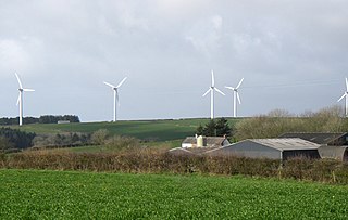
The Clyde Wind Farm is a 522 megawatt (MW) wind farm near Abington in South Lanarkshire, Scotland.

Wind power in Indiana was limited to a few small water-pumping windmills on farms until 2008 with construction of Indiana's first utility-scale wind power facility, Goodland with a nameplate capacity of 130 MW. As of March of 2024, Indiana had a total of 2,743 MW of wind power capacity installed, ranking it 12th among U.S. states. Wind power was responsible for 4.8% of in-state electricity production in 2016.

<span class="mw-page-title-main">Coal Clough Wind Farm</span> Onshore wind farms in Lancaster, England

Coal Clough Wind Farm is one of the oldest onshore wind farms in England. The wind farm, which was built for ScottishPower, produced electricity from originally 24 Vestas WD34 wind turbines. It had a total nameplate capacity of 9.6 MW of electricity, enough to serve the average needs of 5,500 homes. It is situated near Burnley, Lancashire in the parish of Cliviger, near Coal Clough Farm, on the edge of Stiperden Moor in the South Pennines. For a few weeks it was the largest wind farm in the UK, until the much larger Penrhyddlan and Llidiartywaun wind farms in Powys, Wales overtook it. It narrowly remained the largest in England until Coldham opened in Cambridgeshire in November 2005. The record was then taken yet again by Scout Moor Wind Farm 7 miles (11 km) to the south west until May 2009 where Whitelee Wind Farm took and now holds it with 215 units with a total output capacity of 539 Mw. In 2009 ScottishPower announced plans to replace the existing turbines with eight 2 MW units with an estimated maximum height 110 metres (361 ft).

<span class="mw-page-title-main">Westermost Rough Wind Farm</span>

Westermost Rough Wind Farm is an offshore wind farm 8 kilometres (5 mi) north east of Withernsea off the Holderness coast, in the North Sea, England. The farm covers an area of approximately 35 km2 (14 sq mi) with a generation capacity of approximately 210 MW. It became operational in May 2015.

<span class="mw-page-title-main">Walney Wind Farm</span> Offshore wind farm off the coast of Cumbria, England

Walney Wind Farms are a group of offshore wind farms 9 miles (14 km) west of Walney Island off the coast of Cumbria, England, in the Irish Sea. The group, operated by Ørsted, consists of Walney Phase 1, Phase 2 and the Walney Extension. The extension has a capacity of 659 MW and it was the world's second largest offshore wind farm in 2018.

References

  1. "RenewableUK | UK Wind Energy Database (UKWED)". Archived from the original on 26 November 2015. Retrieved 28 May 2015.
  2. Largest wind farm in the UK