Los Lunas, New Mexico

Last updated

Los Lunas, New Mexico
Village of Los Lunas
Los Lunas New Mexico Public Library.jpg
Los Lunas Public Library
Nickname(s): 
The Moon, Looneyville
Valencia County New Mexico Incorporated and Unincorporated areas Los Lunas Highlighted.svg
Location of Los Lunas, New Mexico
Usa edcp location map.svg
Red pog.svg
Los Lunas, New Mexico
Location in the United States
Coordinates: 34°48′34″N106°44′7″W / 34.80944°N 106.73528°W / 34.80944; -106.73528
CountryUnited States
State New Mexico
County Valencia
Area
[1]
  Total20.37 sq mi (52.75 km2)
  Land20.36 sq mi (52.74 km2)
  Water0.00 sq mi (0.01 km2)
Elevation
4,856 ft (1,480 m)
Population
 (2020) [2]
  Total17,242
  Density846.73/sq mi (326.93/km2)
Time zone UTC−7 (Mountain (MST))
  Summer (DST) UTC−6 (MDT)
ZIP code
87031
Area code 505
FIPS code 35-43370
GNIS feature ID0891361
Website www.loslunasnm.gov

Los Lunas is a village in Valencia County, New Mexico, United States. As of the 2010 census, the village population is 14,835 inside the village limits due to the new housing developments at El Cerro de Los Lunas (Huning Ranch). It is the county seat of Valencia County. [3] Los Lunas is part of the Albuquerque Metropolitan Statistical Area.

Contents

History

The original land grant was made to Don Adrian Luna Candelaria in 1716, but within two years it was given to the Luna family. Some Civil War battles were fought near the village. Los Lunas became the county seat in 1876 and became an incorporated village in 1928. The Los Lunas Decalogue Stone is located nearby.

A United States Army Air Forces bombing range, used by elements of the 509th Bomb Wing out of Kirtland Army Air Field, later Kirtland Air Force Base, was located here during and after World War II.[ citation needed ]

Geography

According to the United States Census Bureau, the village has a total area of 10.1 square miles (26.0 km2), all land. The village lies in the Rio Grande Valley of the Albuquerque Basin on the west bank of the Rio Grande, and is on State Highway 6, east of Interstate 25. El Cerro de Los Lunas, a volcano related to the Rio Grande rift, forms a prominent landmark at the western edge of the village.

Climate

According to the Köppen Climate Classification system, Los Lunas has a cold semi-arid climate, abbreviated "BSk" on climate maps. The hottest temperature recorded in Los Lunas was 108 °F (42.2 °C) on June 28, 2013, while the coldest temperature recorded was −25 °F (−31.7 °C) on January 7, 1971. [4]

Climate data for Los Lunas, New Mexico, 1991–2020 normals, extremes 1923–present
MonthJanFebMarAprMayJunJulAugSepOctNovDecYear
Record high °F (°C)75
(24)
81
(27)
87
(31)
93
(34)
102
(39)
108
(42)
106
(41)
103
(39)
100
(38)
93
(34)
84
(29)
74
(23)
108
(42)
Mean maximum °F (°C)65.8
(18.8)
72.3
(22.4)
81.2
(27.3)
86.4
(30.2)
94.3
(34.6)
101.7
(38.7)
102.3
(39.1)
99.1
(37.3)
95.4
(35.2)
87.9
(31.1)
76.0
(24.4)
65.9
(18.8)
103.3
(39.6)
Mean daily maximum °F (°C)51.4
(10.8)
57.7
(14.3)
65.7
(18.7)
73.1
(22.8)
81.7
(27.6)
91.8
(33.2)
93.3
(34.1)
91.1
(32.8)
85.0
(29.4)
74.3
(23.5)
60.9
(16.1)
50.2
(10.1)
73.0
(22.8)
Daily mean °F (°C)35.2
(1.8)
40.5
(4.7)
47.9
(8.8)
55.1
(12.8)
64.1
(17.8)
73.7
(23.2)
77.7
(25.4)
75.7
(24.3)
68.3
(20.2)
56.4
(13.6)
43.7
(6.5)
35.0
(1.7)
56.1
(13.4)
Mean daily minimum °F (°C)19.0
(−7.2)
23.4
(−4.8)
30.1
(−1.1)
37.2
(2.9)
46.4
(8.0)
55.5
(13.1)
62.2
(16.8)
60.3
(15.7)
51.7
(10.9)
38.4
(3.6)
26.6
(−3.0)
19.7
(−6.8)
39.2
(4.0)
Mean minimum °F (°C)7.4
(−13.7)
10.5
(−11.9)
16.5
(−8.6)
24.9
(−3.9)
33.4
(0.8)
44.3
(6.8)
53.3
(11.8)
51.7
(10.9)
39.3
(4.1)
25.5
(−3.6)
12.6
(−10.8)
7.0
(−13.9)
3.8
(−15.7)
Record low °F (°C)−25
(−32)
−15
(−26)
4
(−16)
16
(−9)
20
(−7)
35
(2)
39
(4)
41
(5)
31
(−1)
14
(−10)
−15
(−26)
−5
(−21)
−25
(−32)
Average precipitation inches (mm)0.45
(11)
0.42
(11)
0.54
(14)
0.55
(14)
0.49
(12)
0.52
(13)
1.55
(39)
1.53
(39)
1.15
(29)
0.92
(23)
0.57
(14)
0.54
(14)
9.23
(233)
Average snowfall inches (cm)1.5
(3.8)
0.7
(1.8)
0.3
(0.76)
0.0
(0.0)
0.0
(0.0)
0.0
(0.0)
0.0
(0.0)
0.0
(0.0)
0.0
(0.0)
0.4
(1.0)
0.6
(1.5)
1.6
(4.1)
5.1
(12.96)
Average precipitation days (≥ 0.01 in)3.33.23.43.03.03.38.37.85.64.33.13.351.6
Average snowy days (≥ 0.1 in)0.90.50.20.00.00.00.00.00.00.20.40.62.8
Source 1: NOAA [5]
Source 2: National Weather Service [4]

Demographics

Historical population
CensusPop.Note
1880 876
1930 513
1940 68633.7%
1950 88929.6%
1960 1,18633.4%
1970 973−18.0%
1980 3,525262.3%
1990 6,01370.6%
2000 10,03466.9%
2010 14,83547.8%
2020 17,24216.2%
U.S. Decennial Census [6] [2]

2010

Whereas according to the 2010 U.S. Census Bureau:

2000

As of the census [7] of 2000, there were 10,034 people, 3,601 households, and 2,689 families residing in the village. The population density was 998.8 inhabitants per square mile (385.6/km2). There were 3,845 housing units at an average density of 382.7 units per square mile (147.8 units/km2). The racial makeup of the village was 64.14% White, 1.16% African American, 2.62% Native American, 0.50% Asian, 0.06% Pacific Islander, 27.63% from other races, and 3.90% from two or more races. Hispanic or Latino of any race were 58.74% of the population.

There were 3,601 households, out of which 41.9% had children under the age of 18 living with them, 51.8% were married couples living together, 16.8% had a female householder with no husband present, and 25.3% were non-families. 20.7% of all households were made up of individuals, and 5.8% had someone living alone who was 65 years of age or older. The average household size was 2.75 and the average family size was 3.16.

In the village, the population was spread out, with 31.1% under the age of 18, 9.6% from 18 to 24, 30.1% from 25 to 44, 20.2% from 45 to 64, and 8.9% who were 65 years of age or older. The median age was 32 years. For every 100 females, there were 95.0 males. For every 100 females age 18 and over, there were 90.1 males.

The median income for a household in the village was $36,240, and the median income for a family was $37,255. Males had a median income of $30,664 versus $22,437 for females. The per capita income for the village was $14,692. About 11.6% of families and 13.5% of the population were below the poverty line, including 18.3% of those under age 18 and 7.3% of those age 65 or over.

Economy

On September 14, 2016, Facebook announced their plans to open a data center in Los Lunas. [8] The construction would start in October 2016, and it will be equipped with the latest in the Open Compute Project hardware designs, protected from the frequent dust storms that occur in New Mexico, and powered by 100% clean and renewable energy through solar and wind plants. This data center will support 300 new construction jobs and 50 permanent jobs. [9] The data center opened on February 7, 2019. [10]

The village is served by the New Mexico Rail Runner Express at Los Lunas station. It is also served by Interstate 25 in New Mexico, New Mexico State Road 314, and New Mexico State Road 6. [11]

Arts and culture

The village offers a variety of events to go to. Among them are annual events such as: the St. Patrick's Day Balloon Rally; Fourth of July Parade, celebration and fireworks display at Daniel Fernandez Park; and the Holiday Electric Light Parade down Main Street (NM Highway 6).

Education

Los Lunas' public schools are operated by Los Lunas Public Schools, [12] which includes three high schools, two middle schools, one intermediate school, and ten elementary schools. [13] Another school entitled Family School is a program that allows the combination of public school and homeschooling, found on the Daniel Fernandez Elementary Campus. [14]

Growth was rapid for Los Lunas in the 1990s and early 2000s, with the enrollment of Los Lunas High School reaching nearly 2,500 students around 2004. In fact, Valencia High School opened in 2006 as a relief valve for that enrollment, but due in part to the recession of the late 2000s, the two schools had a similar enrollment by the end of the decade.

Media

The town has been the site of two episodes of Breaking Bad .

Notable people

Related Research Articles

<span class="mw-page-title-main">Valencia County, New Mexico</span> County in New Mexico, United States

Valencia County is a county in the U.S. state of New Mexico. As of the 2020 census, the population was 76,205. The county seat is Los Lunas.

<span class="mw-page-title-main">Sierra County, New Mexico</span> County in New Mexico, United States

Sierra County is a county located in the U.S. state of New Mexico. As of the 2020 Census, the population was 11,576. Its county seat is Truth or Consequences.

<span class="mw-page-title-main">Sandoval County, New Mexico</span> County in New Mexico, United States

Sandoval County is located in the U.S. state of New Mexico. As of the 2020 census, the population was 148,834, making it the fourth-most populous county in New Mexico. The county seat is Bernalillo.

<span class="mw-page-title-main">Luna County, New Mexico</span> County in New Mexico, United States

Luna County is a county located in the U.S. state of New Mexico. As of the 2020 census, the population was 25,427. Its county seat is Deming. This county abuts the Mexican border. Luna County comprises the Deming, NM Micropolitan Statistical Area.

<span class="mw-page-title-main">Bernalillo County, New Mexico</span> County in New Mexico, United States

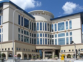
Bernalillo County is the most populous county in the U.S. state of New Mexico. As of the 2020 census, the population was 676,444. The county seat, Albuquerque, is the most populous city in New Mexico.

<span class="mw-page-title-main">Isleta Village Proper, New Mexico</span> Census-designated place in New Mexico, United States

Isleta Village Proper is a census-designated place (CDP) in Bernalillo County, New Mexico, United States. The population was 491 at the 2010 census. It is part of the Albuquerque Metropolitan Statistical Area.

<span class="mw-page-title-main">Los Ranchos de Albuquerque, New Mexico</span> Village in New Mexico, United States

Los Ranchos de Albuquerque, known locally simply as "Los Ranchos" or "The Village," is a village in Bernalillo County, New Mexico. The population was 6,024 at the time of the 2010 Census.

<span class="mw-page-title-main">Reserve, New Mexico</span> Village in New Mexico, United States

Reserve is a village in Catron County, New Mexico, United States. The population was 289 as of the 2010 census, down from 387 in 2000. It is the county seat of Catron County. Currently the village has two grocery stores, a hardware store, a bar, fairgrounds, and a health clinic. It is the site where Elfego Baca held off a gang of Texan cowboys who wanted to kill him for arresting cowboy Charles McCarty.

<span class="mw-page-title-main">Laguna, New Mexico</span> Census-designated place in New Mexico, United States

Laguna is a census-designated place (CDP) on the Laguna Pueblo in Cibola County, New Mexico, United States. The population was 1,241 at the 2010 census. It is located approximately 47 miles west of Albuquerque.

<span class="mw-page-title-main">Eagle Nest, New Mexico</span> Village in New Mexico, United States

Eagle Nest is a village in Colfax County, New Mexico. The population was 290 at the time of the 2010 census. Located along the Enchanted Circle Scenic Byway, Eagle Nest is a small summer-home and resort destination. Originally named Therma, the village was renamed Eagle Nest in the 1930s. The town is located in the Sangre de Cristo Mountains in northern New Mexico near the Colorado border.

<span class="mw-page-title-main">Santa Rosa, New Mexico</span> City in New Mexico, United States

Santa Rosa is a city in and the county seat of Guadalupe County, New Mexico, United States. The population was 2,848 at the 2010 census. It lies between Albuquerque and Tucumcari, situated on the Pecos River at the intersection of Interstate 40 and U.S. Route 54 and 84. The city is located on the western edge of the Llano Estacado or "staked plains" of eastern New Mexico and west Texas.

<span class="mw-page-title-main">Alcalde, New Mexico</span> CDP in New Mexico, United States

Alcalde is a census-designated place (CDP) in Rio Arriba County, New Mexico, United States. The population was 285 at the 2010 census.

<span class="mw-page-title-main">Bernalillo, New Mexico</span> Town in New Mexico, United States

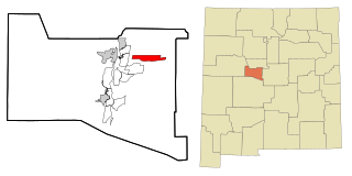
Bernalillo is a town in and the county seat of Sandoval County, New Mexico, United States. As of the 2020 census, the town population was 8,977.

<span class="mw-page-title-main">Jemez Springs, New Mexico</span> Village in Sandoval County, New Mexico, United States

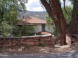
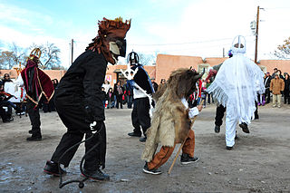
Jemez Springs is a village in Sandoval County, New Mexico, United States. The population was 250 at the 2010 census. Named for the nearby Pueblo of Jemez, the village is the site of Jemez State Monument and the headquarters of the Jemez Ranger District. The village and nearby locations in the Jemez Valley are the site of hot springs and several religious retreats.

<span class="mw-page-title-main">Bosque Farms, New Mexico</span> Village in Valencia County, New Mexico, United States

Bosque Farms is a village in Valencia County, New Mexico, United States. The population was 3,904 at the 2010 census. It is part of the Albuquerque Metropolitan Statistical Area.

<span class="mw-page-title-main">Los Chavez, New Mexico</span> CDP in New Mexico, United States

Los Chavez is a census-designated place (CDP) in Valencia County, New Mexico. The population was 5,033 at the time of the 2000 census. It is part of the Albuquerque Metropolitan Statistical Area.

<span class="mw-page-title-main">Meadow Lake, New Mexico</span> CDP in New Mexico, United States

Meadow Lake is a census-designated place (CDP) in Valencia County, New Mexico, United States. The population was 4,491 at the 2000 census. It is part of the Albuquerque Metropolitan Statistical Area.

<span class="mw-page-title-main">Peralta, New Mexico</span> Town in New Mexico, United States

Peralta is a town in Valencia County, New Mexico, United States. Prior to its incorporation on July 1, 2007, it was a census-designated place (CDP). The population was 3,660 as of the 2010 census. Peralta is part of the Albuquerque metropolitan area.

<span class="mw-page-title-main">Valencia, Valencia County, New Mexico</span> CDP in New Mexico, United States

Valencia is a census-designated place (CDP) in Valencia County, New Mexico, United States. The population was 2,192 at the 2010 census. It is part of the Albuquerque Metropolitan Statistical Area.

<span class="mw-page-title-main">Albuquerque metropolitan area</span> Metropolitan area in central New Mexico

The Albuquerque Metropolitan Statistical Area, sometimes referred to as Tiguex, is a metropolitan area in central New Mexico centered on the city of Albuquerque. The metro comprises four counties: Bernalillo, Sandoval, Torrance, and Valencia. As of the 2010 United States Census, the MSA had a population of 887,077. The population is estimated to be 923,630 as of July 1, 2020, making Greater Albuquerque the 61st-largest MSA in the nation. The Albuquerque MSA forms a part of the larger Albuquerque–Santa Fe–Las Vegas combined statistical area with a 2020 estimated population of 1,165,181, ranked 49th-largest in the country.

References

  1. "ArcGIS REST Services Directory". United States Census Bureau. Retrieved October 12, 2022.
  2. 1 2 "Census Population API". United States Census Bureau. Retrieved October 12, 2022.
  3. "Find a County". National Association of Counties. Archived from the original on May 31, 2011. Retrieved June 7, 2011.
  4. 1 2 "NOAA Online Weather Data – NWS Albuquerque". National Weather Service. Retrieved August 8, 2023.
  5. "U.S. Climate Normals Quick Access – Station: Los Lunas 3 SSW, NM". National Oceanic and Atmospheric Administration. Retrieved August 8, 2023.
  6. "Census of Population and Housing". Census.gov. Retrieved June 4, 2015.
  7. "U.S. Census website". United States Census Bureau . Retrieved January 31, 2008.
  8. "Hello, Los Lunas!". Facebook. September 14, 2016. Retrieved September 16, 2016.
  9. Associated Press (September 14, 2016). "Facebook chooses New Mexico over Utah for its newest data center". The Guardian. Retrieved September 16, 2016.
  10. "Opening our newest data center in Los Lunas, New Mexico". Engineering at Meta. February 7, 2019. Retrieved May 21, 2024.
  11. "Los Lunas · New Mexico 87031". Google Maps. Retrieved May 21, 2024.
  12. "2020 CENSUS - SCHOOL DISTRICT REFERENCE MAP: Valencia County, NM" (PDF). U.S. Census Bureau . Retrieved September 4, 2022.
  13. Los Lunas Schools - Home. Llschools.net (July 22, 2013). Retrieved August 15, 2013.
  14. Los Lunas Schools [ dead link ]
  15. "Guide to General Vertical Files" (PDF). unm.edu. Retrieved December 9, 2023.
  16. "Rosie leaves spirit of "Angel Baby" as pop queen enters heaven's gate at age 71". April 12, 2017.
  17. Keleher and Chant. The Padre of Isleta. Sunstone Press, 2009,chap.4- p. 30.36.