
Masaka District is a district in Buganda Kingdom in Uganda. Its main town is Masaka City, whose estimated population in 2011 was 74,100.

Sembabule District is a district in the Central Region of Uganda. The town of Sembabule is the site of the district headquarters. Other urban centers in the district include Lwemiyaga and Ntuusi.
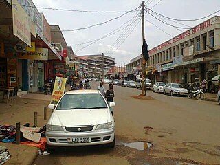
Masaka is a district and a city in the Buganda Region in southern Uganda, west of Lake Victoria. The city is the headquarters of Masaka District.
Kyotera is a town in the southern part of the Central Region of Uganda. It is a municipality in Kyotera District. However, the district headquarters are located at Kasaali.
Kalisizo is a town in the southern part of the Central Region of Uganda. Although it is the leading commercial center in Kyotera District, the administrative headquarters of the district are in Kasaali.
Lukaya is a town in the Kalungu District of the Central Region of Uganda.
Nsangi is a town in the Central Region of Uganda. It is one of the urban centers in Wakiso District.
Kyazanga is a town council in the Lwengo District of the Central Region of Uganda.
Sheema, also Sheema Municipality, is an urban centre in the Western Region of Uganda. It is the largest municipality in Sheema District.

Kajjansi is a town in Central Uganda. It is one of the urban centers in Wakiso District.
Ishaka is a town in the Western Region of Uganda. It is one of the municipalities in Bushenyi District.

Bukomansimbi District is a district in Central Uganda. The district is named after its main municipal center, Bukomansimbi, the location of the district headquarters.

Lwengo District is a district in the Central Region of Uganda. Lwengo is the largest town in the district and the location of the district headquarters.
Kako Senior Secondary School is a government aided, mixed boarding middle and high school in Uganda.
Nyakahita is a sparsely populated settlement in the Western Region of Uganda.
Letshego Microfinance Uganda,, whose official name is Letshego Uganda Limited, is a Tier IV microfinance institution in Uganda.
EFC Uganda Limited (EFCUL), also known as EFC Uganda, is a microfinance deposit-taking institution (MDI) in Uganda whose license was withdrawn and liquidated by Bank of Uganda on 19 January 2024.
Kyotera District is a district in the Central Region of Uganda. Kyotera is the largest town in the district but the district headquarters are located at Kasaali, a suburb of Kyotera.
Mbiriizi is a town in the southern part of the Central Region of Uganda. It is the administrative center of Lwengo District.
Lwensinga is a town in the Buganda Region of Uganda.

