Masaka

Last updated
Masaka
Masaka
Wikipedia masaka town.jpg
Masaka in 2014
Uganda location map.svg
Red pog.svg
Masaka
Location in Uganda
Coordinates: 00°20′28″S31°44′10″E / 0.34111°S 31.73611°E / -0.34111; 31.73611
Country Flag of Uganda.svg Uganda
Region Buganda Region
District Masaka District
Elevation
1,288 m (4,226 ft)
Population
 (2014 Census)
  Total103,829 [1]

Masaka is a district and a city in the Buganda Region in southern Uganda, west of Lake Victoria. [2] The city is the headquarters of Masaka District. [3]

Contents

Location

Masaka is approximately 132 kilometres (82 mi) to the south-west of Kampala on the highway to Mbarara. [4] The city is close to the Equator. The coordinates of Masaka are 0°20'28.0"S, 31°44'10.0"E (Latitude:-0.341111; Longitude:31.736111). [5] Masaka lies at an average elevation of 1,288 metres (4,226 ft) above sea level. [6]

History

Masaka was founded as a township in 1953. It became a town council in 1958 and a municipality in 1968. [7]

Masaka was a strategically important location during the Uganda–Tanzania War (1978–79), and was accordingly garrisoned by Uganda Army troops. These soldiers terrorized the local civilians, and most fled the town. On 23–24 February 1979, the Tanzania People's Defence Force and allied Ugandan rebels attacked the settlement, resulting in the Battle of Masaka. The town was bombarded with artillery, and fell to the Tanzanian-led forces after light resistance. The Tanzanians subsequently levelled much of the town to take revenge for atrocities committed by the Uganda Army during its previous invasion of northwestern Tanzania. [8]

In course of the Ugandan Bush War, Masaka again suffered from fighting. The town was garrisoned by the Uganda National Liberation Army which served as Uganda's national army at the time. In late 1985, National Resistance Army rebels laid siege to the town. After heavy combat, Masaka's garrison surrendered on 10 December 1985. [9]

In 2019 the Cabinet of Uganda, resolved to award Masaka, city status effective July 2023. [2] [10] In November of the same year, Cabinet revised the date of city status to 1 July 2020. [11]

As of June 2021, the city of Masaka occupied a total area in excess of 100 square kilometres (25,000 acres). Masaka City Council, with assistance from the Central Ugandan government and the World Bank is in the process of implementing major road and street improvements, as part of the Municipal Infrastructure Development (USMID) program. The city has a working budget of USh73 billion (approx. US$21 million), in the 2020/2021 financial year. [12]

Population

According to the 2002 national census, the population of Masaka was about 67,800. In 2010, the Uganda Bureau of Statistics (UBOS) estimated the population at 73,300. In 2011, UBOS estimated the mid-year population at 74,100. [13] In August 2014, the national population census put the population at 103,829. [1]

In 2020, UBOS estimated the mid-year population of Masaka City at 116,600 people. The population agency calculated the population growth rate of the town to average 2.11 percent, between 2014 and 2020. [14]

Historical population
YearPop.±%
196912,987    
198029,123+124.2%
199149,585+70.3%
200267,768+36.7%
2014103,227+52.3%
2020116,600+13.0%
source: [14]

Overview

Maize plantation in Masaka Jolly images1.jpg
Maize plantation in Masaka
Villa Maria Catholic parish in Masaka Villa Maria Catholic parish Masaka.jpg
Villa Maria Catholic parish in Masaka

In 2016, before the metropolis attained city status, Masaka occupied 58 square kilometres (22 sq mi). It was divided into three administrative divisions, (a) Katwe-Butego (b) Kimaanya-Kyabakuza and (c) Nyendo-Ssenyange. It is further subdivided into 54 zones. [7]

The annual Uganda Marathon event takes place in June, the race route loops twice through the town and the funds generated support local employment and community development.[ citation needed ]

Points of interest

The following points of interest are located in Masaka or close to its borders: (a) the offices of Masaka City Council (b) Masaka central market (c) the headquarters of the Mechanized Brigade of the Uganda People's Defense Force [15] (d) the main campus of Muteesa I Royal University [16] (d) Western Campus of Kampala University (e) St. Henry's College Kitovu. [17]

Other points of interest include (f) the headquarters of the Roman Catholic Diocese of Masaka [18] (g) Lake Nabugabo, 20 kilometres (12 mi) to the east of downtown Masaka. [19] (h) Bukakkata, on the shores of Lake Victoria, about 36 kilometres (22 mi) east of Masaka. [20] (i) Masaka Regional Referral Hospital (j) Masaka Currency Center, a currency storage and processing facility owned and operated by the Bank of Uganda, Uganda's central bank. [21] (k) A branch of the National Social Security Fund.

Hamda Vocational and Social Institute

Hamda Vocational and Social Institute is a institute, Emirati women philanthropist Hamda Taryam was a well-known philanthropist in Masaka Uganda who initiated this charitable projects aims to qualify students professionally for the labour market. The foundation provides free training to orphan students, ensuring they qualify for the market, with proceeds going towards humanitarian and charitable projects sponsored by the Foundation [22] [23] [24]

Notable people

See also

Photos

Related Research Articles

<span class="mw-page-title-main">Rakai District</span> District in Central Region of Uganda, Uganda

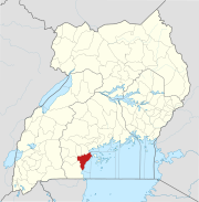
Rakai District is a district in the Central Region of Uganda. The town of Rakai is the site of the district's headquarters.

<span class="mw-page-title-main">Lira, Uganda</span> Place in Northern Region of Uganda, Uganda

Lira is a city in the Northern Region of Uganda. It is the main municipal, administrative, and commercial centre of Lira District.

<span class="mw-page-title-main">Soroti</span> Ugandan town

Soroti is a city in Eastern Region of Uganda. It is the main city, commercial, and administrative center in Soroti District, one of the nine administrative districts in the Teso sub-region. Soroti city was immediately approved for operationalization ahead of schedule by the Parliament of Uganda in the Financial Year 2020/2021.

<span class="mw-page-title-main">Tororo</span> Place in Eastern Region of Uganda, Uganda

Tororo is a town in the Eastern Region of Uganda. It is the main municipal, administrative, and commercial center of Tororo District.

<span class="mw-page-title-main">Mbale</span> Place in Eastern Uganda, Uganda

Mbale is a city in the Eastern Region of Uganda. It is the main municipal, administrative, and commercial center of Mbale District and the surrounding sub-region.

<span class="mw-page-title-main">Masindi</span> Place in Western Region of Uganda, Uganda

Masindi is a town in the Western Region of Uganda. It is on the road between Kampala and the Murchison Falls National Park. It is the site of the headquarters of the Masindi District.

<span class="mw-page-title-main">Mbarara</span> Place in Western Region, Uganda

Mbarara City is a city in the Western Region of Uganda and the second largest city in Uganda after Kampala.The city is divided into 6 boroughs of Kakoba Division, Kamukuzi Division, Nyamitanga Division, Biharwe Division, Kakiika Division, Nyakayojo Division. It is the main commercial centre of most of south western districts of Uganda and the site of the district headquarters. In May 2019, the Uganda's cabinet granted Mbarara a city status, which started on 1 July 2020.

Hoima is a city in the Western Region of Uganda. It is the main municipal, administrative, and commercial center of Hoima District. It is also the location of the palace of the Omukama of Bunyoro.

Mayuge is a town in the Eastern Region of Uganda. It is the location of the headquarters of Mayuge District.

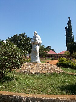
Rakai is a town in the Central Region of Uganda. It is the site of the headquarters of Rakai District. Other towns in the district include Kalisizo, Kyotera Kakuuto and Mutukula.

Kayunga is a town in the Central Region of Uganda. It is the main municipal, administrative, and commercial center of Kayunga District.

Mpigi is a town in Mawokota County, Mpigi District, in Central Uganda. Mpigi is the municipal, administrative and commercial headquarters of Mpigi District. The district is named after the town.

Moyo, is the main municipal, administrative, and commercial center of Moyo District in the Northern Region of Uganda. The district headquarters are located here.

<span class="mw-page-title-main">Mubende</span> Place in Central Region of Uganda, Uganda

Mubende is a town in the Central Region of Uganda. It is the main municipal, administrative, and commercial center of Mubende District and is the location of the district headquarters.

Nebbi is a town in the Nebbi District of the Northern Region of Uganda. It is the site of the district headquarters.

<span class="mw-page-title-main">Mukono Town</span> Urban centre in Uganda

Mukono Town is a municipality in Mukono District in the Central Region of Uganda. The town is administered by the Mukono Town Council. The district headquarters are located in this town.

Lyantonde is a town in the southern part of the Central Region of Uganda. It is the main municipal, administrative, and commercial center of Lyantonde District.

Kalisizo is a town in the southern part of the Central Region of Uganda. Although it is the leading commercial center in Kyotera District, the administrative headquarters of the district are in Kasaali.

Sanga, is an urban center in the Kiruhura District, Ankole sub-region, in the Western Region of Uganda.

Namayumba is a settlement in the Wakiso District in the Buganda Region of Uganda. The name also refers to "Namayumba sub-county", the location of Namayumba settlement.

References

  1. 1 2 UBOS (27 August 2014). "The Population of The Regions of the Republic of Uganda And All Cities And Towns of More Than 15,000 Inhabitants". Citypopulation.de Quoting Uganda Bureau of Statistics (UBOS). Retrieved 22 February 2015.
  2. 1 2 Franklin Draku (22 May 2019). "Cabinet Elevates 15 Municipalities To Cities". Daily Monitor . Kampala. Retrieved 1 June 2019.
  3. Fields, Megan (December 2009). "Masaka: Big Shoes, Small Feet". Wordpress.com (Megan Fields Blog). Archived from the original on 18 April 2014. Retrieved 17 April 2014.
  4. Google (28 April 2021). "Road Distance Between Kampala, Uganda And Masaka, Uganda" (Map). Google Maps . Google. Retrieved 28 April 2021.
  5. Google (1 June 2019). "Location of Masaka City At Google Maps" (Map). Google Maps . Google. Retrieved 1 June 2019.
  6. Floodmap (2018). "Elevation of Masaka, Uganda". Floodmap.net. Retrieved 3 June 2019.
  7. 1 2 Martins Ssekweyama (15 June 2016). "Masaka Town Expands To Get City Status". Daily Monitor . Kampala. Retrieved 1 June 2019.
  8. Cooper & Fontanellaz 2015, pp. 30–31.
  9. Cooper & Fontanellaz 2015, pp. 49–50.
  10. Isa Aliga, and Al-Mahdi Ssenkabirwa (10 June 2019). "Kabaka Faults Government On Delayed Masaka City Status". Daily Monitor . Kampala. Retrieved 11 June 2019.
  11. Kungu Al-Mahadi Adam (5 November 2019). "Cabinet Includes Masaka, Mbale Among New Cities To Be Operational In 2020". Kampala: SoftPower Uganda. Retrieved 6 November 2019.
  12. Wilson Kutamba (17 June 2021). "Masaka USMID roads construction starts". Daily Monitor . Kampala. Retrieved 19 June 2021.
  13. "Estimated Population of Masaka In 2002, 2010 & 2011" (PDF). Uganda Bureau of Statistics. Archived from the original (PDF) on 7 July 2014. Retrieved 17 April 2014.
  14. 1 2 Uganda Bureau of Statistics (14 June 2020). "Masaka Population Statistics" (Citypopulation.de Quoting Uganda Bureau of Statistics). Kampala: Citypopulation.de. Retrieved 29 April 2021.
  15. Google (1 June 2019). "Location of UPDF Mechanized Brigade Barracks" (Map). Google Maps . Google. Retrieved 1 June 2019.
  16. Campus Times Reporter (15 January 2014). "Courses offered at Muteesa I Royal University". Kampala: Campus Times Uganda. Retrieved 1 June 2019.
  17. Google (1 June 2019). "Location of St. Henry's College Kitovu, Masaka, Uganda" (Map). Google Maps . Google. Retrieved 1 June 2019.
  18. David M. Cheney (June 2019). "About the Roman Catholic Diocese of Masaka". Kansas City: Catholic-Hierarchy.org . Retrieved 1 June 2019.
  19. Lake Nabugabo Terrace View Beach (2014). "Location of Lake Nabugabo". Lake Nabugabo Terrace View Beach. Retrieved 1 June 2019.
  20. Globefeed.com (1 June 2019). "Distance between Masaka, Uganda and Bukakata, Uganda". Globefeed.com. Retrieved 1 June 2019.
  21. "Bank of Uganda Maintains A Currency Center In Masaka". Bank of Uganda. Archived from the original on 19 April 2014. Retrieved 17 April 2014.
  22. "Emirati racer dies: Sharjah Ruler grants Dh1 million for Hamda Taryam's unfinished charity projects".
  23. "Sharjah ruler allocates Rs 2 cr to complete Hamda Taryam's charitable projects". 29 January 2024.
  24. "Tributes pour in for young Emirati drag racer Hamda Taryam". 30 January 2024.

Works cited

00°20′28″S31°44′10″E / 0.34111°S 31.73611°E / -0.34111; 31.73611