North Florida | |
---|---|
Country | United States |
State | Florida |
Largest city | Jacksonville |
Population (2010) | |
• Total | 3,753,144 (approximate area) [1] |
North Florida is a region of the U.S. state of Florida comprising the northernmost part of the state. Along with South Florida and Central Florida, it is one of Florida's three most common "directional" regions. It includes Jacksonville and nearby localities in Northeast Florida, an interior region known as North Central Florida, and the Florida Panhandle.
As with many vernacular regions, North Florida does not have any officially designated boundaries or status, and is defined differently in different sources. A 2007 study of Florida's regions by geographers Ary Lamme and Raymond K. Oldakowski found that Floridians surveyed identified "North Florida" as comprising the northernmost areas of the state, including both the peninsula and the Florida Panhandle. Additionally, two localized "directional" regions had emerged: North East Florida, also known as the "First Coast", representing the area around Jacksonville on the Atlantic coast, and North Central Florida, comprising the central area. [2] North Florida is one of Florida's three most common directional regions, along with Central Florida and South Florida. [3] The region includes smaller vernacular regions, particularly along the coast, including the Emerald Coast and the Big Bend on the Gulf Coast and the First Coast and Halifax area on the Atlantic. [2] Lamme and Oldakowski note that the directional region is more commonly used in the interior areas than on the coast. [3]
Enterprise Florida, the state's economic development agency, divides the state into three economic regions, used within the agency and other state and outside entities, including the Florida Department of Transportation. They identify three regions within the area identified as "North Florida" by Enterprise Florida: Northeast Florida, North Central Florida, and Northwest Florida (representing most of the Panhandle). [4]
The following regions are entirely or partly within Northern Florida:
Directional regions:
Metropolitan areas:
Vernacular regions:
Average High and Low temperatures for various North Florida Cities (°F) | ||||||||||||
City | Jan | Feb | Mar | Apr | May | Jun | Jul | Aug | Sep | Oct | Nov | Dec |
Jacksonville [5] | 65/42 | 66/45 | 73/50 | 79/55 | 86/63 | 90/70 | 92/73 | 91/73 | 87/69 | 80/61 | 74/45 | 67/44 |
Pensacola [6] | 61/43 | 64/46 | 70/51 | 76/58 | 84/66 | 89/72 | 90/74 | 90/74 | 87/70 | 80/60 | 70/50 | 63/45 |
Tallahassee [7] | 64/39 | 68/40 | 72/47 | 80/52 | 87/62 | 91/70 | 92/72 | 92/72 | 89/68 | 82/57 | 73/48 | 66/41 |
Jacksonville is the largest metropolitan area in North Florida. Its cities include St. Augustine, Orange Park, and Fernandina Beach, this area is sometimes referred to as the First Coast. Other metropolitan areas include Pensacola-Ferry Pass-Brent, Tallahassee, Gainesville, Crestview-Fort Walton Beach-Destin, Panama City-Lynn Haven, and Palm Coast. Important cities considered micropolitan areas include Lake City and Palatka.
City | 2020 population | 2010 population [8] | County |
---|---|---|---|
Jacksonville | 949,611 | 821,784 | Duval |
Tallahassee | 196,169 | 181,376 | Leon |
Gainesville | 141,085 | 124,354 | Alachua |
Palm Coast | 89,258 | 75,180 | Flagler |
Ocala | 63,591 | 56,707 | Marion |
Pensacola | 54,312 | 51,923 | Escambia |
Panama City | 32,939 | 36,484 | Bay |
Jacksonville Beach | 23,830 | 21,362 | Duval |
St. Augustine | 14,329 | 12,975 | St. Johns |
Lamme and Oldakowski's survey identifies several demographic, political, and cultural elements that characterize North Florida and distinguish it from other areas of the state. North Floridians considered their area to be part of the South and "Dixie"; while Floridians from all parts of the state considered their area to be part of the South, people in more southern areas typically did not identify with Dixie. Additionally, residents of some parts of North Florida considered their area to be in the Bible Belt, while residents of other parts of the state did not. [2] A popular expression of people in this region of the state goes "In Florida, the farther north you go, the farther South you are."
Politically, in contrast to Central Florida, where a majority considered their part of the state moderate, and South Florida, which was more liberal, residents of North Florida overwhelmingly (76%) considered their part of the state conservative; 16% considered it moderate and 8% considered it liberal. [9] Lamme and Oldakowski's findings track with Barney Warf and Cynthia Waddell's studies of Florida's political geography during the 2000 Presidential election. [9] [10]
Lamme and Oldakowski's survey also found some cultural indicators that characterize North Florida. In general, North Florida was similar to Central Florida and differed from South Florida in these measures. In North and Central Florida, American cuisine was the most popular food, in contrast to South Florida, where ethnic foods were equally popular. [11] Additionally, while there was little geographical variation for most styles of music, there was regional variation for both country and Latin music. Country was popular in North and Central Florida, and less so in South Florida, while Latin was less popular in North and Central Florida, and more so in South Florida. [11]
Lamme and Oldakowski noted that North Florida's economy was much more diversified than Central and South Florida, where tourism was by far the most significant industry. While tourism was a significant factor in North Florida's economy, particularly in the Emerald Coast, other important industries included agriculture in rural areas, education in Tallahassee and Gainesville, and military and finance in Jacksonville. [12]
Major military bases in the region include the Pensacola Naval Air Station, Jacksonville Naval Air Station, Camp Blanding, Naval Station Mayport, Corry Station Naval Technical Training Center, Naval Support Activity Panama City, Blount Island Command, Eglin Air Force Base and Hurlburt Field.
Major attractions include the Big Kahuna's, Marineland of Florida, Florida State Capitol, World Golf Village, Historic Pensacola Village, and historic sites in St. Augustine. North Florida also has a wide variety of natural attractions including the Ravine Gardens State Park, Big Lagoon State Park, Osceola National Forest, and Timucuan Ecological and Historic Preserve. North Florida also has three major zoos, the Jacksonville Zoo and Gardens, St. Augustine Alligator Farm Zoological Park and Gulf Breeze Zoo.
Major malls and shopping districts include The Avenues, Butler Plaza, Five Points, Gateway Town Center, Governor's Square, Jacksonville Landing, The Oaks Mall, Orange Park Mall, Paddock Mall, Pier Park, Regency Square, River City Marketplace, St. Johns Town Center and University Town Plaza.
The following are major central business districts:
Thousands of companies are headquartered in North Florida. Among those, the following 4 are in the Fortune 1000:
Additional notable companies headquartered (or with a significant presence) in North Florida include (some defunct or subsumed):
Areas under federal protection include Castillo de San Marcos National Monument, Fort Matanzas National Monument, Fort Caroline National Memorial, Gulf Islands National Seashore, and Timucuan Ecological and Historic Preserve. National forests occupy large sections of North Florida, including the Apalachicola National Forest, Choctawhatchee National Forest and Osceola National Forest.
State University System
State College System
(Partial list)
(Partial list)
TransportationAirportsThe following airports currently have regularly scheduled commercial service:
Rail
Transit organizationsFerriesRoadwaysInterstates:
U.S. Routes: Notes
Related Research ArticlesU.S. Route 90 or U.S. Highway 90 (US 90) is an east–west major United States highway in the Southern United States. Despite the "0" in its route number, US 90 never was a full coast-to-coast route. It generally travels near Interstate 10 (I-10) and passes through the southern states of Texas, Louisiana, Mississippi, Alabama, and Florida. US 90 also includes part of the DeSoto Trail between Tallahassee and Lake City, Florida. Florida's First Coast, or simply the First Coast, is a region of the U.S. state of Florida, located on the Atlantic coast of North Florida. The First Coast refers to the same general area as the directional region of Northeast Florida. It consists roughly of the counties abutting Jacksonville—Duval, Baker, Clay, Nassau, and St. Johns—and nearby Flagler County and Putnam County. The name originated in a marketing campaign in the 1980s, and has become part of Florida's regional vernacular. Area codes 850 and 448 are telephone area codes in the North American Numbering Plan for the Florida Panhandle, including Pensacola, Tallahassee and Panama City. Area code 850 was created in 1997 in a split from 904, and area code 448 was assigned as a second code to the same area in an overlay plan in 2019, and mandatory ten-digit local calling began in May 2021. The Florida panhandle is the northwestern part of the U.S. state of Florida. It is a salient roughly 200 miles (320 km) long, bordered by Alabama on the north and the west, Georgia on the north, and the Gulf of Mexico to the south. Its eastern boundary is arbitrarily defined. It is defined by its southern culture and rural geography relative to the rest of Florida, as well as closer cultural links to French-influenced Louisiana, Mississippi, and Alabama. Its major communities include Pensacola, Navarre, Destin, Panama City Beach, and Tallahassee. South Florida, sometimes colloquially shortened to SoFlo, is the southernmost region of the U.S. state of Florida. It is one of Florida's three most commonly referred to directional regions; the two others are Central Florida and North Florida. South Florida is the southernmost part of the continental United States and the only region of the continental U.S. that includes some areas with a tropical climate. 
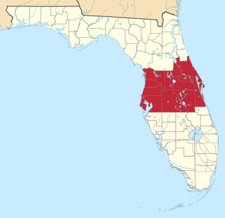
Central Florida is a region of the U.S. state of Florida. Different sources give different definitions for the region, but as its name implies it is usually said to comprise the central part of the state, including the Tampa Bay area and the Greater Orlando area, though in recent times the Tampa Bay area has often been described as its own region, with "central Florida" becoming more synonymous with the Orlando area. 
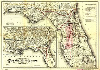
The Florida Central and Peninsular Railroad was the final name of a system of railroads throughout Florida, becoming part of the Seaboard Air Line Railway in 1900. The system, including some of the first railroads in Florida, stretched from Jacksonville west through Tallahassee and south to Tampa. Much of the FC&P network is still in service under the ownership of CSX Transportation. North central Florida is a region of the U.S. state of Florida which comprises the north-central part of the state and encompasses the north Florida counties of Alachua, Marion, Putnam, Bradford, Columbia, Dixie, Gilchrist, Hamilton, Lafayette, Levy, Madison, Suwannee, Taylor, and Union. The region's largest city is Gainesville, home of the University of Florida and center of the Gainesville metropolitan area, which is the largest metro area of the region. As of 2020, the region had a population of 575,622 people. The Florida Trail is one of eleven National Scenic Trails in the United States. It currently runs 1,500 miles (2,400 km), from Big Cypress National Preserve to Fort Pickens at Gulf Islands National Seashore, Pensacola Beach. Also known as the Florida National Scenic Trail, the Florida Trail provides permanent non-motorized recreation opportunity for hiking and other compatible activities and is within an hour of most Floridians. The Florida National Scenic Trail is designated as a National Scenic Trail by the National Trails System Act of 1968. The Big Bend of Florida, United States, is an informally named geographic region of North Florida where the Florida Panhandle transitions to the Florida Peninsula south and east of Tallahassee. The region is known for its vast woodlands and marshlands and its low population density relative to much of the state. The area is home to the largest single spring in the United States, the Alapaha Rise, and the longest surveyed underwater cave in the United States, the 32-mile (51 km) Wakulla-Leon Sinks cave system. The history of Pensacola, Florida, begins long before the Spanish claimed founding of the modern city in 1698. The area around present-day Pensacola was inhabited by Native American peoples thousands of years before the historical era. It is very rare for snow to fall in the U.S. state of Florida, especially in the central and southern portions of the state. With the exception of the far northern areas of the state, most of the major cities in Florida have never recorded measurable snowfall, though trace amounts have been recorded, or flurries in the air observed few times each century. According to the National Weather Service, in the Florida Keys and Key West there is no known occurrence of snow flurries since the European colonization of the region more than 300 years ago. In Miami, Fort Lauderdale, and Palm Beach there has been only one known report of snow flurries observed in the air in more than 200 years; this occurred in January 1977. In any event, Miami, Fort Lauderdale, and Palm Beach have not seen snow flurries before or since this 1977 event. 
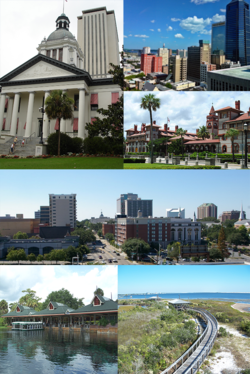
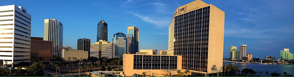
The following is an alphabetical list of articles related to the U.S. state of Florida. The Halifax area or simply Daytona is a region of the U.S. state of Florida, comprising the area around Daytona Beach. It is roughly coextensive with the Daytona Beach metropolitan area and Volusia County. There have been a number of attempts to establish a regional identity for Daytona, including dubbing it the "Surf Coast" and "Fun Coast". The name "Halifax area" refers to the Halifax River, which runs through Daytona Beach and other nearby municipalities. References
|