
Hanover is a town located along the Connecticut River in Grafton County, New Hampshire, United States. As of the 2020 census, its population was 11,870. The town is home to the Ivy League university Dartmouth College, the U.S. Army Corps of Engineers Cold Regions Research and Engineering Laboratory, and Hanover High School. The Appalachian Trail crosses the town, connecting with a number of trails and nature preserves.

Grafton County is a county in the U.S. state of New Hampshire. As of the 2020 census, the population was 91,118. Its county seat is the town of Haverhill. In 1972, the county courthouse and other offices were moved from Woodsville, a larger village within the town of Haverhill, to North Haverhill.

Bath is a town in Grafton County, New Hampshire, United States. The population was 1,077 at the 2020 census, unchanged from the 2010 census. Now a tourist destination and commuter town for Littleton, the town is noted for its historic architecture, including the Brick Store and three covered bridges. Bath includes the village of Swiftwater and part of the district known as Mountain Lakes.

Bethlehem is a hillside town in Grafton County, New Hampshire, United States. The population was 2,484 at the 2020 census. It is home to Cushman and Strawberry Hill state forests. The eastern half of the town is within the White Mountain National Forest. The Appalachian Trail crosses a small portion of the town in the south.

Haverhill is a town and the seat of Grafton County, New Hampshire, United States. The population was 4,585 at the 2020 census. Haverhill includes the villages of Woodsville, Pike, and North Haverhill, the historic town center at Haverhill Corner, and the district of Mountain Lakes. Located here are Bedell Bridge State Park, Black Mountain State Forest, Kinder Memorial Forest, and Oliverian Valley Wildlife Preserve. It is home to the annual North Haverhill Fair, and to a branch of the New Hampshire Community Technical Colleges.

Piermont is a town in Grafton County, New Hampshire, United States. The population was 769 at the 2020 census. It is home to Camp Walt Whitman and Kingswood Camp for Boys.

Woodsville is a census-designated place (CDP) and the largest village in the town of Haverhill in Grafton County, New Hampshire, United States, along the Connecticut River at the mouth of the Ammonoosuc River. The population was 1,431 at the 2020 census. Although North Haverhill is now the county seat of Grafton County, the village of Woodsville has traditionally been considered the county seat, as the county courthouse was originally located there. The county buildings are now located halfway between Woodsville and the village of North Haverhill to the south.

Lancaster is a town located along the Connecticut River in Coös County, New Hampshire, United States. The town is named after the city of Lancaster in England. As of the 2020 census, the town population was 3,218, the second largest in the county after Berlin. It is the county seat of Coos County and gateway to the Great North Woods Region of the state. Lancaster, which includes the villages of Grange and South Lancaster, is home to Weeks State Park and the Lancaster Fair. Part of the White Mountain National Forest is in the eastern portion. The town is part of the Berlin, NH−VT Micropolitan Statistical Area.
Lisbon is a census-designated place (CDP) and the main village in the town of Lisbon in Grafton County, New Hampshire, United States. The population of the CDP was 965 at the 2020 census, out of 1,621 in the entire town.
Littleton is a census-designated place (CDP) and the main village in the town of Littleton in Grafton County, New Hampshire, United States. The population of the CDP was 4,467 at the 2020 census, out of 6,005 in the entire town.

Littleton is a town in Grafton County, New Hampshire, United States. The population was 6,005 at the 2020 census. Situated at the northern edge of the White Mountains, Littleton is bounded on the northwest by the Connecticut River.

Plymouth is a census-designated place (CDP) and the main village in the town of Plymouth in Grafton County, New Hampshire, United States. Its population was 4,730 at the 2020 census, out of 6,682 in the entire town. The CDP includes the campus of Plymouth State University.

U.S. Route 302 is an east–west spur of U.S. Route 2 in northern New England in the United States. It currently runs 171 miles (275 km) from Montpelier, Vermont, beginning at US 2, to Portland, Maine, at U.S. Route 1. It passes through the states of Vermont, New Hampshire and Maine.

New Hampshire Route 10 is a 122.25-mile-long (196.74 km) north–south state highway in western New Hampshire, United States. Its southern terminus is in Winchester at the Massachusetts state line, where it continues south as Massachusetts Route 10. Administratively, the northern terminus is at a junction with U.S. Route 302 in Haverhill.

New Hampshire Route 25 is a 96.62-mile (155.49 km) long east–west state highway in New Hampshire. It runs completely across the state from Vermont to Maine.

New Hampshire Route 116 is a 48.605-mile-long (78.222 km) north-south state highway in northern New Hampshire, United States. NH 116 is a scenic rural highway stretching from Haverhill, which lies along the Connecticut River, to Jefferson, in the White Mountains Region. The southern terminus is at NH 10 in the village of North Haverhill and the northern terminus is at U.S. Route 2, near the Santa's Village amusement park. Major intersections include Interstate 93, U.S. Route 3, and U.S. Route 302.
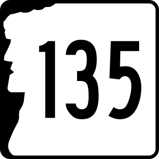
New Hampshire Route 135 is a 46.677-mile-long (75.119 km) north–south state highway in New Hampshire. The highway runs along the Connecticut River from Woodsville in the town of Haverhill to Lancaster.

The Ammonoosuc River is a 55-mile-long (89 km) river in northwestern New Hampshire in the United States. It is a tributary of the Connecticut River, which flows to Long Island Sound. Ammonoosuc is Abnaki for "small, narrow fishing place".

North Woodstock is a census-designated place (CDP) and the primary village in the town of Woodstock in Grafton County, New Hampshire, United States. It had a population of 739 at the 2020 census.
Mountain Lakes is a census-designated place (CDP) in the towns of Haverhill and Bath in Grafton County, New Hampshire, United States. It had a population of 504 at the 2020 census.


