Otsego, New York

Last updated

Otsego, New York
Otsego County outline map Otsego red.png
Otsego County map with the Town of Otsego in Red
Coordinates: 42°44′5″N74°57′32″W / 42.73472°N 74.95889°W / 42.73472; -74.95889 [1]
Country United States
State New York
County Otsego
Government
  Town SupervisorMeg Kiernan
  Town Clerk/Tax CollectorPam Deane
Area
[2]
  Total59.05 sq mi (152.94 km2)
  Land53.89 sq mi (139.57 km2)
  Water5.16 sq mi (13.37 km2)
Elevation
[1]
1,381 ft (421 m)
Population
 (2020)
  Total3,641
  Density69.10/sq mi (26.68/km2)
Time zone UTC-5 (Eastern (EST))
  Summer (DST) UTC-4 (EDT)
ZIP code
13337
Area code 607
FIPS code 36-55695
GNIS feature ID0979329
Website Town website

Otsego is a town in the north-central part of Otsego County, New York, United States. The population was 3,641 at the 2020 census. [3] The town is named after Lake Otsego, which forms part of the town's eastern border.

Contents

History

Gideon Hawley, a missionary, arrived in this area in 1753. William Cooper purchased land (Cooper Patent) that now is marked, in part, by Cooperstown. Major settlement began around 1788.

The Town of Otsego was organized while still in Montgomery County in 1788 and is the oldest town in the county.

People of note

Geography

According to the United States Census Bureau, the town has a total area of 57.8 square miles (150 km2), of which 54.2 square miles (140 km2) is land and 3.6 square miles (9.3 km2) (6.18%) is water.

Otsego Lake forms most of the eastern boundary, and Canadarago Lake forms part of the western boundary.

New York State Route 80 is a highway along the western shore of Otsego Lake. New York State Route 28 comes into Cooperstown from the south. At Cooperstown, NY-80 joins NY-28 and they run concurrently towards Fly Creek. Past Fly Creek the NY-28/NY-80 concurrency ends at New York State Route 205 in the western part of Otsego. NY-80 joins NY-205 and continues concurrently toward the west. NY-28 continues on northward out of the town.

Demographics

Historical population
CensusPop.Note
1820 4,186
1830 4,3634.2%
1840 4,120−5.6%
1850 3,901−5.3%
1860 4,30310.3%
1870 4,5906.7%
1880 4,6902.2%
1890 4,9174.8%
1900 4,497−8.5%
1910 4,287−4.7%
1920 4,223−1.5%
1930 4,3452.9%
1940 4,074−6.2%
1950 4,3045.6%
1960 4,121−4.3%
1970 3,998−3.0%
1980 4,0120.4%
1990 3,932−2.0%
2000 3,904−0.7%
2010 3,900−0.1%
2020 3,641−6.6%
U.S. Decennial Census [5]

As of the census [6] of 2000, there were 3,904 people, 1,701 households, and 1,029 families residing in the town. The population density was 72.0 inhabitants per square mile (27.8/km2). There were 2,193 housing units at an average density of 40.5 per square mile (15.6/km2). The racial makeup of the town was 97.75% White, 0.64% African American, 0.08% Native American, 0.69% Asian, 0.26% from other races, and 0.59% from two or more races. Hispanic or Latino of any race were 1.54% of the population.

There were 1,701 households, out of which 25.5% had children under the age of 18 living with them, 49.1% were married couples living together, 8.3% had a female householder with no husband present, and 39.5% were non-families. 33.6% of all households were made up of individuals, and 15.2% had someone living alone who was 65 years of age or older. The average household size was 2.22 and the average family size was 2.85.

In the town, the population was spread out, with 22.0% under the age of 18, 5.4% from 18 to 24, 23.8% from 25 to 44, 27.7% from 45 to 64, and 21.1% who were 65 years of age or older. The median age was 44 years. For every 100 females, there were 89.0 males. For every 100 females age 18 and over, there were 84.6 males.

The median income for a household in the town was $40,036, and the median income for a family was $48,320. Males had a median income of $33,684 versus $22,868 for females. The per capita income for the town was $26,305. About 4.5% of families and 7.5% of the population were below the poverty line, including 6.7% of those under age 18 and 6.0% of those age 65 or over.

Communities and locations in the Town of Otsego, New York

Related Research Articles

<span class="mw-page-title-main">Otsego County, New York</span> County in New York, United States

Otsego County is a county in the U.S. state of New York located within the Mohawk Valley Region. As of the 2020 census, the population was 58,524. The county seat is Cooperstown. The county's population center is Oneonta. The name Otsego is from a Mohawk or Oneida word meaning "place of the rock." The county is part of the Mohawk Valley region of the state.

<span class="mw-page-title-main">Warren, New York</span> Town in Herkimer County, New York, US

Warren is a town in Herkimer County, New York, United States. The population was 1,143 at the 2010 census. The town is named after General Joseph Warren, who was killed at the Battle of Bunker Hill. Warren is in the south part of Herkimer County. US 20 passes across the town.

<span class="mw-page-title-main">Burlington, New York</span> Town in New York, United States

Burlington is a town in Otsego County, New York, United States. The population was 1,140 at the 2010 census.

<span class="mw-page-title-main">Butternuts, New York</span> Town in New York, United States

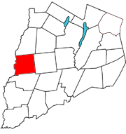
Butternuts is a town located in Otsego County, New York, United States. As of the 2010 census, the town had a population of 1,786. The Town of Butternuts is located in the southwestern part of the county, and is west of Oneonta.

<span class="mw-page-title-main">Cooperstown, New York</span> Village in New York, United States

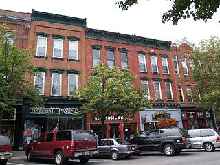
Cooperstown is a village in and the county seat of Otsego County, New York, United States. Most of the village lies within the town of Otsego, but some of the eastern part is in the town of Middlefield. Located at the foot of Otsego Lake in the Central New York Region, Cooperstown is approximately 60 miles west of Albany, 67 mi (108 km) southeast of Syracuse and 145 mi (233 km) northwest of New York City. The population of the village was 1,794 as of the 2020 census.

<span class="mw-page-title-main">Exeter, New York</span> Town in New York, United States

Exeter is a town in Otsego County, New York, United States. The town is located in the northern part of the county. The population was 987 at the 2010 census. It is named after the county town and cathedral city of Exeter in England.

<span class="mw-page-title-main">Hartwick, New York</span> Town in New York, United States

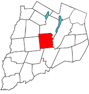
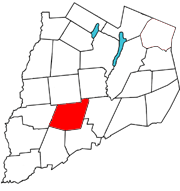
Hartwick is a town located in Otsego County, New York, United States. As of the 2010 census, the town had a population of 2,110. The Town of Hartwick is located in the middle of the county, southwest of the Village of Cooperstown.

<span class="mw-page-title-main">Maryland, New York</span> Town in New York, United States

Maryland is a town in Otsego County, New York, United States. The population was 1,897 at the 2010 census. It was named for the U.S. state of the same name. The Town of Maryland is on the county's southern border. It is northeast of the City of Oneonta.

<span class="mw-page-title-main">Middlefield, New York</span> Town in New York, United States

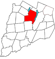
Middlefield is a town in Otsego County, New York, United States. The population was 2,114 at the 2010 census.

<span class="mw-page-title-main">Pittsfield, New York</span> Town in New York, United States

Pittsfield is a town in Otsego County, New York, United States. The population was 1,366 at the 2010 census.

<span class="mw-page-title-main">Richfield, New York</span> Town in Otsego County, New York, US

Richfield is a town located in Otsego County, New York, United States. As of the 2010 census, the town had a population of 2,388. The Town of Richfield is located at the northern border of the county.

<span class="mw-page-title-main">Roseboom, New York</span> Town in New York, United States

Roseboom is a town in Otsego County, New York, United States. The population was 711 at the 2010 census. The name of the town is taken from those of early landowners and settlers Abram and John Roseboom.

<span class="mw-page-title-main">Springfield, New York</span> Town in New York, United States

Springfield is a town in Otsego County, New York, United States. The population was 1,358 at the 2010 census.

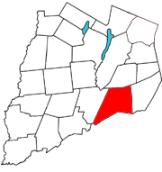
Worcester is a town in Otsego County, New York, United States. The population was 2,220 at the 2010 census. Worcester is on the southeastern border of the county and is northeast of Oneonta. The Worcester Central School District presently has 369 students enrolled in grades K-12.

<span class="mw-page-title-main">Laurens, New York</span> Town in New York, United States

Laurens is a town in Otsego County, New York, United States. The population was 2,424 at the 2010 census.

<span class="mw-page-title-main">Milford, New York</span> Town in New York, United States

Milford is a town in Otsego County, New York, United States. The population was 3,044 at the 2010 census. Within town is the village of Milford. The town is northeast of the City of Oneonta.

<span class="mw-page-title-main">Unadilla, New York</span> Town in New York, United States

Unadilla is a town in Otsego County, New York, United States. As of the 2010 census, the town had a population of 4,392. The name is derived from an Iroquois word for "meeting place". Unadilla is located in the southwestern corner of the county, southwest of Oneonta. The village of Unadilla is located in the southern part of the town. The mayor of Unadilla is Jason Cotten.

<span class="mw-page-title-main">Canadarago Lake</span> Lake in Otsego County, New York, U.S.

Canadarago Lake is a 1,917-acre (7.76 km2) lake located in Otsego County, New York and is the source of Oaks Creek. The Village of Richfield Springs is located at the lake's northern end. It is the second largest lake in Otsego County, lying to the west of and parallel to the larger Otsego Lake. The lake's name is also spelled "Candajarago Lake" or "Caniadaraga Lake".

<span class="mw-page-title-main">New York State Route 205</span> State highway in Otsego County, New York, US

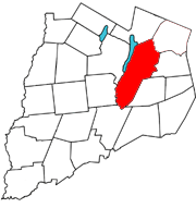
New York State Route 205 (NY 205) is a 23.24-mile-long (37.40 km) north–south state highway in central Otsego County, New York, in the United States. It extends from Interstate 88 (I-88) at exit 13 near the city of Oneonta to a junction with NY 28 and NY 80 in the town of Otsego. The latter junction also marks the east end of a 2.1-mile (3.4 km) overlap between NY 205 and NY 80, from where NY 80 heads southeast to follow NY 28 to Cooperstown. NY 205 is a two-lane highway for its entire length and passes through the towns of Oneonta, Laurens and Hartwick.

<span class="mw-page-title-main">Oaks Creek</span> River in New York State

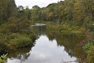
Oaks Creek is a river that drains Canadarago Lake, which is situated in the north central region of Otsego County, New York. The creek begins by the Hamlet of Schuyler Lake and flows southeast approximately 9.32 miles (15.00 km), dropping only 105 feet (32 m) in elevation, before converging with the Susquehanna River south of the Village of Cooperstown, by the Hamlet of Index. From the source to Oaksville the creek flows along Panther Mountain. Fly Creek is a main tributary, that converges with Oaks Creek south of the Hamlet of Fly Creek.

References

  1. 1 2 "Town of Otsego". Geographic Names Information System . United States Geological Survey, United States Department of the Interior . Retrieved December 29, 2017.
  2. "2016 U.S. Gazetteer Files". United States Census Bureau. Retrieved July 5, 2017.
  3. "2020 Census Data". United States Census Bureau. Retrieved October 2, 2023.
  4. young, holice (2001). "Otsego town". usgennet.org. usgennet. Retrieved April 16, 2017. data
  5. "Census of Population and Housing". United States Census Bureau. Retrieved June 4, 2015.
  6. "U.S. Census website". United States Census Bureau . Retrieved January 31, 2008.
  7. "National Register Information System". National Register of Historic Places . National Park Service. March 13, 2009.