
Kitgum is a municipality in Kitgum District in the Northern Region of Uganda. The town is administered by Kitgum Town Council, an urban local government. It is the largest metropolitan area in the district and the site of the district headquarters.
Bombo is a town in Luweero District in the Central Region of Uganda.
Pabbo, sometimes spelled as Pabo, is a municipality in Amuru District of the Northern Region of Uganda.
Anaka is a town in the Northern Region of Uganda. It is the site of the Nwoya District headquarters.
Kigumba is a town in Kiryandongo District, northwestern Uganda. It is one of the urban centers in the district. The other urban centres in Kiryandongo District include: (a) Karuma b) Kiryandongo (c) Bweyale and (d) Masindi Port.
Karuma Falls is a town in Uganda.

Nwoya District is a district in Northern Uganda. Like most districts in Uganda, it is named after its main municipal, administrative and commercial center, Nwoya, the location of the district headquarters.
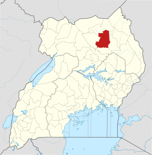
Agago District is a district in Northern Uganda.
Agago is a town in the Northern Region of Uganda. It is the chief political, administrative, and commercial center of the Agago District.
Kiryandongo is a town in the Western Region of Uganda. It is the main municipal, administrative, and commercial center of Kiryandongo District.
Bibia is a municipality in the Amuru District of the Northern Region of Uganda.
Rwekunye–Apac–Aduku–Lira–Kitgum–Musingo Road is a road in the Northern Region of Uganda, connecting the towns of Masindi Port in Kiryandongo District to Apac in Apac District, Lira in Lira District, Acholibur in Pader District, Kitgum in Kitgum District, and Musingo in Lamwo District at the international border with South Sudan.
Rwekunye is a settlement in Kiryandongo District in the Western Region of Uganda.
The Kamdini–Gulu Road, also known as the Gulu–Kamdini Road, is a road in the Northern Region of Uganda, connecting the town of Kamdini with Gulu, the largest city in the Northern Region.
Bobi is a town in the Northern Region of Uganda.
Kiryandongo General Hospital, is a hospital in the Western Region of Uganda.
Palenga is a town in the Omoro District in the Northern Region of Uganda. It is the site of the district headquarters.
The Wabigalo–Nakasongola–Sasira Road is a road in the Central Region of Uganda, connecting the town of Nakasongola with the towns of Wabigalo and Sasira on the Kampala–Gulu Highway. An extension from Nakasongola links to Nakasongola Air Force Base.
The Kampala–Gulu Highway, also Kampala–Gulu Road, is a road connecting the capital city of Kampala, in the Buganda Region, with the city of Gulu, the largest urban centre in the Northern Region of Uganda.
The New Karuma Bridge, also referred to as the Second Karuma Bridge, is a proposed bridge in Uganda. It will replace the current Karuma Bridge, which was built in 1963.

