
St Davids or St David's is a city and a community with a cathedral in Pembrokeshire, Wales, lying on the River Alun. It is the resting place of Saint David, Wales's patron saint, and named after him. St Davids is the United Kingdom's smallest city in population and urban area. St Davids was given city status in the 12th century. This does not derive automatically from criteria, but in England and Wales it was traditionally given to cathedral towns under a practice laid down in the early 1540s, when Henry VIII founded dioceses. City status was withdrawn in 1886. It was restored in 1994 at the request of Queen Elizabeth II.

Strumble Head is a rocky headland in the community of Pencaer in Pembrokeshire, Wales, within the Pembrokeshire Coast National Park. It marks the southern limit of Cardigan Bay. Three islands lie off the head: Ynys Meicel – 112 feet (34 m) – Ynys Onnen and Carreg Onnen.

Amroth is both a village, a parish and a community 7 miles (11 km) northeast of Tenby, Pembrokeshire, Wales. Located on Carmarthen Bay, Amroth is noted for its long sandy beach which stretches the length of the village. It regularly earns a Blue Flag award. and is the south-to-north start of the Pembrokeshire Coast Path. Amroth is within the Pembrokeshire Coast National Park.

Dinas Cross is both a village, a community and a former parish in Pembrokeshire, Wales. Located between Fishguard and Newport in the Pembrokeshire Coast National Park, it is a popular holiday destination on the A487 road. The two hamlets, Cwm-yr-Eglwys and Pwllgwaelod, are in the community. The community has an elected community council and gives its name to an electoral ward of Pembrokeshire County Council which covers the communities of Dinas Cross, Cwm Gwaun and Puncheston.

Saundersfoot is a large village, community and electoral ward in Pembrokeshire, Wales. It is near Tenby, both being holiday destinations. Saundersfoot lies in the Pembrokeshire Coast National Park and on the Pembrokeshire Coast Path. The village population was 3,361 in 2011.

Penally is a coastal village, parish and community 1 mile (1.6 km) southwest of Tenby in Pembrokeshire, Wales. The village is known for its Celtic Cross, Penally Abbey, the neighbouring St. Deiniol's Well, WWI Practice trenches, and Penally Training Camp. In the community, though nearer to St Florence than Penally, is Carswell Medieval House, a Grade II* listed building.

Camrose is a village, parish and community in the historic cantref of Roose in Pembrokeshire, Wales. The community includes the villages of Keeston and Wolfsdale. Since 1987 the parish has been expanded to include the whole historic parish of Lambston and parts of Haverfordwest St Martins.
Llanwnda is a rural village and parish to the north of the Welsh county of Pembrokeshire and part of the community of Pencaer. It lies some two miles northwest of the port of Fishguard and is inside the boundaries of the Pembrokeshire Coast National Park.
Castlemartin is a village and parish in the community of Stackpole and Castlemartin, Pembrokeshire, Wales, in the Pembrokeshire Coast National Park.
Clydau is a community and parish in Pembrokeshire, Wales.

Nolton and Roch is a community in the Hundred of Roose, Pembrokeshire, Wales. The community consists essentially of the villages of Nolton and Roch and a number of hamlets including Cuffern and Druidston. The western part of the community is in the Pembrokeshire Coast National Park. Its population (2001) was 746, increasing to 825 at the 2011 census.

Brawdy is a village and community in Pembrokeshire, Wales.

Kilgetty/Begelly is a community in southeast Pembrokeshire, Wales. It includes the settlements of Begelly, Broom, Kilgetty, Reynalton, Shipping and Thomas Chapel. The community touches Amroth, East Williamston, Jeffreyston, Lampeter Velfrey, Saundersfoot and Templeton. It has a community council and community association.

Ceibwr Bay is a bay opening into the Irish Sea in Pembrokeshire, west Wales. It is about 7 km west of Cardigan, and 3 km south of the headland of Cemaes Head. It is owned by the National Trust, within the Pembrokeshire Coast National Park and on the Pembrokeshire Coast Path.

Cwm Gwaun is a community and valley in north Pembrokeshire, Wales. The community is centred around Pontfaen, a parish and hamlet 4 miles (6.4 km) southeast of Fishguard, and includes the ancient parish of Llanychaer. In 2011, the population was 313. The valley is known for its unspoilt nature and old-world pub, and there are numerous other listed buildings.

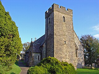
Rudbaxton is a village, parish and a local government community in the county of Pembrokeshire, Wales. It is 81 miles (130 km) from Cardiff and 208 miles (335 km) from London.

Scleddau is a village and a community in the county of Pembrokeshire, Wales, and is 2 miles (3.2 km) south of Fishguard on the main A40 road. The Western Cleddau river which lends its name to the village flows under the main road. There are several springs in the village.
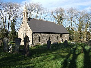
Granston is a hamlet and parish in Pembrokeshire, Wales. The parish was in the Hundred of Dewisland and includes the settlements of Llangloffan and Tregwynt, with Tregwynt woollen mill. Granston is in the community of Pencaer.


