Port of Cleveland

Last updated
Port of Cleveland
Cleveland Ohio aerial view.jpg
Oblique aerial view of Port of Cleveland, Cuyahoga County, Ohio.
Location
Country United States
Location Cleveland, Ohio, Cuyahoga River, Lake Erie, Great Lakes
Coordinates 41°31′10″N81°41′19″W / 41.51944°N 81.68861°W / 41.51944; -81.68861 Coordinates: 41°31′10″N81°41′19″W / 41.51944°N 81.68861°W / 41.51944; -81.68861
UN/LOCODE US CLE
Details
Opened1825 (1825)
Owned by Cleveland-Cuyahoga County Port Authority
Size144 sq mi (370 km2) [C] [1]
Draft depth 27 ft (8.2 m) [2]
CEO and President William D. Friedman [3]
Statistics
Vessel arrivals959 (2006) [4]
Annual cargo tonnage 15,186,819 (2006) [5]
Value of cargo $1 billion [6]
Website
www.portofcleveland.com

The Port of Cleveland is a bulk freight and container shipping port at the mouth of the Cuyahoga River on Lake Erie in Cleveland, Ohio, United States. It is the third-largest port in the Great Lakes and the fourth-largest Great Lakes port by annual tonnage. Over 20,000 jobs and $3.5 billion in annual economic activity are tied to the roughly 13 million tons of cargo that move through Cleveland Harbor each year. [E] [5] [6]

Contents

The Port of Cleveland is the only container port on the Great Lakes, with bi-weekly service between Cleveland and Antwerp on a service called the Cleveland-Europe Express. [7]

Cargo

The Port of Cleveland handles the bulk of raw material shipments for regional manufacturing, as well as exporting some local resources (salt mined from under Lake Erie, materials quarried locally, Ohio farm surpluses).

Primary Cargoes

Overall Annual Tonnage

Tonnage for Port of Cleveland
Year
U.S.
Rank
Total
Tons
Domestic
Tons
Foreign
Total
Tons
Foreign
Imports
Tons
Foreign
Exports
Tons
Reference
20064415,186,81911,467,1313,719,6883,598,998120,690 [5]
20054713,640,96610,225,3603,415,6063,137,262278,344 [8]
20044415,774,61111,855,2823,919,3293,567,866351,463 [9]
20034712,620,7949,508,5423,112,2522,708,093404,159 [10]
20024811,411,7659,083,9652,327,8002,270,80057,000 [11]
20014811,937,8159,203,5872,734,2282,430,028304,200 [12]
20004414,390,80211,914,4372,476,3652,262,104214,261 [13]
Break- and Dry- Bulk Tonnage for Port of Cleveland
Year
Dry [D] Bulk
short Tons [2]
Break [B] Bulk
short Tons [2]
20001,028,500949,552
1999934,306721,369
19981,239,5511,182,792
19971,521,7291,045,377
19961,809,0001,158,056
19951,531,985779,314
19941,899,989869,669
19932,069,184764,743
19922,700,842435,286
19912,852,675913,670
19903,038,535773,922

Connections

Rail

Connections to:
(2) Class I railroads: [14] [15]

and several regional/short-line railroads:

Truck

Port has truck access to four major Interstate highways: [15] [16]

as well as local bypasses/connectors:

and Ohio State Routes, such as:

Facilities

A warehouse at the Port of Cleveland. North Coast Harbor.JPG
A warehouse at the Port of Cleveland.

Eight international cargo berths and docks consist of 110 acres (0.45 km2) of land alongside Lake Erie on the east side of the Cuyahoga River, while the Cleveland Bulk Terminal transshipment facility occupies 44 acres (0.18 km2) just west of the river. [1]

Geography

The Port of Cleveland spans across the Cleveland Harbor on Lake Erie and up the Cuyahoga River to the turning basin.

Port of Cleveland
Name
USGS
GNIS
Feature
ID #
and
Link
Coordinates
Elevation
Cleveland Harbor 1072326 41°31′10″N81°41′19″W / 41.51944°N 81.68861°W / 41.51944; -81.68861 (Cleveland Harbor (Cuyahoga)) 571 feet (174 m)
Cuyahoga River 1072205 41°30′13″N81°42′44″W / 41.50361°N 81.71222°W / 41.50361; -81.71222 (Port of Cleveland (Cuyahoga River/Lake Erie)) 571 feet (174 m)
Turning Basin 1047220 41°28′36″N81°40′20″W / 41.47667°N 81.67222°W / 41.47667; -81.67222 (Turning Basin (Cuyahoga)) 581 feet (177 m)

Maritime

Docks are maintained at a full Great Lakes seaway depth, which is 27 feet (8.2 m). [15]

Operators

Four terminal operators use port facilities: [15]

Cleveland Bulk Terminal

Cleveland Bulk Terminal (CBT), located at 5500 Whiskey Island Drive, on Whiskey Island, is port-owned but operated by Carmeuse NA which handles iron ore transfers. The lakefront facility can accommodate 1,000 feet (300 m) vessels used to discharge and reload rail cars. [17] The automated CBT iron ore loader system on Whiskey Island [18] on the west side of the Cuyahoga River loads materials onto boats from the terminal and transfers materials at a rate of 5,200 tons per hour. Limited handling of materials greatly improves the quality of pellets delivered to the mill.
The ore loader operation benefits three Cleveland companies: [15]

  • Cleveland-Cliffs — supplier of iron ore pellets, uses iron ore pellets at its steel mills, and coke plants
  • Carmeuse NA — CBT operator and materials transporter

Terminals

These facilities are: [17]

  • Nine berths and docks in either open dock or two-berth facilities
  • Capacity for lifting up to 150 net tons
  • Firect rail access and warehousing ability
  • Over 6,500 feet (2,000 m) of linear dock space,
  • 420,000 square feet (39,000 m2) of warehouse space and
  • 12 acres (0.049 km2) of open storage for general cargo operations.
Port of Cleveland Terminals
Dock [15]
Coordinates [G]
Berth
Length [15]
Warehouse
Storage [15]
Facilities [15]
Tenants [15]
20 41°30′6.91″N81°42′35.70″W / 41.5019194°N 81.7099167°W / 41.5019194; -81.7099167 (Dock 20) 1,200 feet (370 m)dry bulk, outside storage, cementEssroc (Italcementi Group) and Kenmore Construction
22 41°30′14.95″N81°42′27.41″W / 41.5041528°N 81.7076139°W / 41.5041528; -81.7076139 (Dock 22) 760 feet (230 m) Federal Marine Terminals, Inc.
2424: 41°30′17.80″N81°42′19.25″W / 41.5049444°N 81.7053472°W / 41.5049444; -81.7053472 (Dock 24-Warehouse)
A: 41°30′12.01″N81°42′13.80″W / 41.5033361°N 81.7038333°W / 41.5033361; -81.7038333 (Dock 24-Warehouse A)
1,900 feet (580 m)24: 79,000 square feet (7,300 m2)
A: 144,000 square feet (13,400 m2) [A]
30-ton overhead cranes Federal Marine Terminals, Inc.
26 41°30′22.44″N81°42′14.39″W / 41.5062333°N 81.7039972°W / 41.5062333; -81.7039972 (Dock 26-Warehouse) 1,677 feet (511 m)26: 76,000 square feet (7,100 m2) Federal Marine Terminals, Inc.
28 41°30′23.81″N81°42′10.22″W / 41.5066139°N 81.7028389°W / 41.5066139; -81.7028389 (Dock 28-Buckeye Booster) 1,243 feet (379 m)Buckeye Booster: heavy 150-ton capacity lift crane Federal Marine Terminals, Inc.
30 41°30′30.55″N81°42′3.23″W / 41.5084861°N 81.7008972°W / 41.5084861; -81.7008972 (Dock 30-Warehouse) 500 feet (150 m)54,000 square feet (5,000 m2) Federal Marine Terminals, Inc.
32 41°30′32.65″N81°41′59.53″W / 41.5090694°N 81.6998694°W / 41.5090694; -81.6998694 (Dock 32-Warehouse) City of Cleveland, Ohio used for non-Maritime development including the new Lake Shore Electric Railway interurban museum (since 2006). [19]
CBT 41°29′50.24″N81°43′16.73″W / 41.4972889°N 81.7213139°W / 41.4972889; -81.7213139 (Cleveland Bulk Terminal) 1,850 feet (560 m) [2] Outside storage:
46 acres (2,000,000 sq ft) [2]
Carmeuse NA
Totals9,130 feet (2,780 m)353,000 square feet (32,800 m2)

Foreign Trade Zones

Cleveland-Cuyahoga County Port Authority, Grantee #40, operates-owns several General Purpose Zone Foreign Trade Zones in Cuyahoga County, Ashtabula County and Lorain County. [C] [20]

Port of Cleveland

Port of Cleveland complex located on Lake Erie at the mouth of the Cuyahoga River includes five general cargo facilities operated by port-approved stevedoring contractors. [17]

Tow Path Valley Business Park

Tow Path Valley Business Park is located on both sides of the east and west bank of the Cuyahoga River bordered by Jennings Road on the south, Upper Campbell Road on the east, I-490/I-77/Dille Road on the north and West 14th Street to the west. [17]

See also

Notes

^  A: Warehouse A has heated storage; and inside rail loading [15]
^  B: Break Bulk (packaged materials): 500,000 tons [1]
^  C:  Cleveland-Cuyahoga County Port Authority operates-owns several General Purpose Zone Foreign Trade Zones NOT included in the cited Port of Cleveland dock-terminal acreage. [20]
^  D: Dry Bulk (loose materials such as limestone and grain): 12 million tons [1]
^  E: Port of Duluth, Minnesota-Superior, Wisconsin, and Port of Chicago, and Port of Detroit, Michigan are Great Lakes ports ranked higher than Cleveland, Ohio by annual tonnage. [5]
^  F: Notes:
^  G: Dock and Warehouse coordinates manually plotted in Google Earth from map in [2]

Related Research Articles

<span class="mw-page-title-main">Lake freighter</span> Ship type

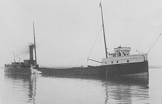
Lake freighters, or lakers, are bulk carrier vessels that operate on the Great Lakes of North America. These vessels are traditionally called boats, although classified as ships.

<span class="mw-page-title-main">Port of Anchorage</span> Port in United States

The Port of Alaska (POA) is a deep-water port located in Anchorage, Alaska with 3 bulk carrier berths, two petroleum berths, and one barge berth. It is an enterprise department of the Municipality of Anchorage. The name was changed from "Port of Anchorage" to the "Port of Alaska" in 2017. As such, the Port is distinguished from other types of municipal departments largely because it generates enough revenue to support its operations without being a burden to Anchorage property tax payers, and it also pays a fee-in-lieu of taxes to help run city government.

<span class="mw-page-title-main">Irishtown Bend</span> Archaeological site in Ohio, United States

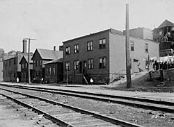
Irishtown Bend is the name given to both a former Irish American neighborhood and a landform located on the Flats of the west bank of the Cuyahoga River in the city of Cleveland in the U.S. state of Ohio in the United States. The landform consists of a tight meander in the Cuyahoga River, and the steep hillside above this meander.

<span class="mw-page-title-main">Tulsa Ports</span> Port in United States

The primary facility of the Tulsa Ports, known as the Tulsa Port of Catoosa, is near the city of Catoosa in Rogers County, just inside the municipal fenceline of Tulsa, Oklahoma, United States. Located at the head of navigation for the McClellan-Kerr Arkansas River Navigation System (MKARNS), it handles shipping loads through its waterway access to the Arkansas River via the Verdigris River. TPOC offers year-round, ice-free barge service with river flow levels controlled by the U.S. Army Corps of Engineers. It encompasses an area of 2,500 acres (10 km2) and employs over 4,000 people at over 70 companies in its industrial park. The port ships manufactured goods and agricultural products from Oklahoma to the rest of the world. Designated a foreign trade zone, it is a major economic engine for the region with over 2.7 million tons of cargo shipped through the Port in 2013 alone.

<span class="mw-page-title-main">Port of Mobile</span> Sea port in Alabama

The Port of Mobile is a deep-water port in Mobile, Alabama, United States. It is the only deep-water port in Alabama. It was ranked by the United States Army Corps of Engineers as the 9th largest port by tonnage in the nation during 2014, with a trade volume of 64.3 million tons. This ranking had increased from 12th largest during 2010, with a trade volume of 55,713,273 tons, an increase of 19.1%.

<span class="mw-page-title-main">Pennsylvania and Ohio Canal</span>

The Pennsylvania and Ohio Canal, also known as the P & O Canal, the Cross Cut Canal and the Mahoning Canal was a shipping canal which operated from 1840 until 1877. It was unique in that it served to connect canals in two states and was funded by private interests.

<span class="mw-page-title-main">Ore dock</span> Transportation construction

An ore dock is a large structure used for loading ore onto ships, which then carry the ore to steelworks or to transshipment points. Most known ore docks were constructed near iron mines on the upper Great Lakes and served the lower Great Lakes. Ore docks still in existence are typically about 60 feet (18 m) wide, 80 feet (24 m) high, and vary from 900 feet (270 m) to 2,400 feet (730 m) in length. They are commonly constructed from wood, steel, reinforced concrete, or combinations of these materials.

SS <i>Marquette</i> (1881) Wooden-hulled, American Great Lakes freighter

The SS Marquette was a wooden-hulled, American Great Lakes freighter built in 1881, that sank on Lake Superior, five miles east of Michigan Island, Ashland County, Wisconsin, Apostle Islands, United States on October 15, 1903. On the day of February 13, 2008 the remains of the Marquette were listed on the National Register of Historic Places.

<span class="mw-page-title-main">Whiskey Island (Cleveland)</span> Peninsula in Cleveland, Ohio, United States

Whiskey Island is a peninsula at the mouth of the Cuyahoga River at Lake Erie in Cleveland, Ohio. Its current configuration was created in 1827 when the river's mouth was moved to its present location. Part of the city's Cuyahoga Valley neighborhood, the peninsula is 1 mile (1.6 km) long and 0.3 miles (0.48 km) at its widest, bounded by Lake Erie to the north, West 54th Street on the west (roughly), and the Cuyahoga River to the south and east.

<span class="mw-page-title-main">Port of Pittsburgh</span> Inland port in Pennsylvania, USA

The Port of Pittsburgh is a vast river traffic region in southwestern Pennsylvania. It spans a twelve-county area including Allegheny, Armstrong, Beaver, Blair, Butler, Clarion, Fayette, Greene, Indiana, Lawrence, Washington, and Westmoreland Counties. It encompasses essentially all 200 miles of commercially navigable waterways in southwestern Pennsylvania, including the three major rivers in this region: the Allegheny, the Monongahela, and the Ohio. These waterways are made navigable by a system of seventeen locks and dams. The Port of Pittsburgh supports over 200 river terminals and barge industry service suppliers, including privately owned public river terminals. The port complex is served by the CSX and Norfolk Southern railroads and by four interstate highways. The Port of Pittsburgh Commission acts as a comprehensive service for shippers and industries seeking information on the river system.

<span class="mw-page-title-main">Port of Huntington Tri-State</span> Port in  United States

The Port of Huntington Tri-State, centered on the Ohio River in Huntington, West Virginia, is the second-largest inland port in the United States, and was formerly the largest. It is the largest river port in the state of West Virginia and the 15th-largest in the United States as of 2012. Included in the port's area is 100 miles of the Ohio River from the mouth of the Scioto River in Portsmouth, Ohio to the northern border of Gallia County, Ohio, 9 miles of the Big Sandy River, and 90 miles of the Kanawha River. The United States Army Corps of Engineers' 1953 Ohio River Navigation Modernization Program sited the Greenup Locks and Dam project as an early priority so that its pool could serve the Port of Huntington Tri-State. It exceeded Pittsburgh in 1953 as the busiest port on the waterway. In 2014, it was exceeded by the Port of Cincinnati-Northern Kentucky in annual cargo tonnage, making it the second-largest inland port in the United States.

The Type L6 ship is a United States Maritime Administration (MARAD) designation for World War II as a Great Lakes dry break bulk cargo ship. The L-Type Great Lakes Dry Bulk Cargo Ships were built in 1943 to carry much-needed iron ore from the upper Great Lakes to the steel and iron production facilities on Lakes Erie and Ontario in support of the war effort. The ships have a 15,675 tonne deadweight tonnage. The L6 ships were built by two companies: American Ship Building Company, in the case of the type L6-S-A1 models, of which 6 were built; and Great Lakes Engineering Works, Ashtabula, Ohio/ Great Lakes Engineering Works, River Rouge, Ohio, in the case of the type L6-S-B1, which produced 10 ships. Steel supply needed for World War was great. To supply iron ore from Lake Superior to steel foundries, the United States Commission had a series of L6 Lakers ship built. The Maritime Commission ordered ten Great Lakes Bulk Carriers of the L6-S-B1 type. The L6-S-B1 was design with a 3-cylinder triple expansion steam engines. The L6-S-A1 used a lentz 4-cylinder compound engine. All L6 ships were coal burning and delivered between May and November 1943. L6-S-B1 was built for the US Maritime Commission under USMC contract MCc-1834 in 1943 at the River Rouge yard. Each L6 ship cost $2.265 million. The first L6-S-B1 was the SS Adirondack/Richard J. Reiss, hull 290, keel was laid on March 9, 1942 and launched on September 19, 1942. The ships are often called the Class Lake Bulk Freighter now.

<span class="mw-page-title-main">Cleveland Foundation Centennial Lake Link Trail</span>

The Cleveland Foundation Centennial Lake Link Trail, originally known as the Lake Link Trail, is a cycling, hiking, and walking trail located in the city of Cleveland, Ohio, in the United States. Owned by the city of Cleveland and maintained by Cleveland Metroparks, the trail runs along the former track bed of the Cleveland and Mahoning Valley Railroad. The trail is named for The Cleveland Foundation, a local community foundation which donated $5 million toward the trail's construction. The southern leg of the 1.3-mile (2.1 km) trail opened in August 2015, and the northern leg in August 2017. The middle leg will begin construction once the Irishtown Bend hillside is stabilized. A bridge connecting the trail to Whiskey Island will begin construction in Spring 2019 and will be completed in early Summer 2020.

<span class="mw-page-title-main">Redcar Bulk Terminal</span> Deep sea East Coast port in Redcar and Cleveland, Northern England

Redcar Bulk Terminal (RBT), also known as Redcar Ore Terminal, is a privately run dock at the mouth of the Tees Estuary in North Yorkshire, England. The port is used for the transhipment of coal and coke and for many years was the import dock for iron ore destined for Redcar Steelworks under British Steel Corporation, British Steel plc, Corus, Tata Steel Europe and Sahaviriya Steel Industries.

SS <i>Selah Chamberlain</i> Great Lakes freighter that sank on Lake Michigan in 1886

SS Selah Chamberlain was a wooden hulled Great Lakes freighter that sank in Lake Michigan in 1886, 6 miles (10 km) off the coast of Sheboygan, Sheboygan County, Wisconsin, United States after being rammed by the steamer John Pridgeon Jr. with the loss of five lives. On January 7, 2019, the wreck of Selah Chamberlain was listed on the National Register of Historic Places, and was given the reference number 100003288. She was the first shipwreck listed on the National Register of Historic Places in 2019.

<span class="mw-page-title-main">Transportation in Cleveland</span>

The transportation system of Cleveland is a network that includes several modes of transportation including sidewalks, roads, public transit, bicycle paths and regional and international airports.

SS <i>S.R. Kirby</i> Great Lakes freighter sunk in a 1916 storm on Lake Superior

SS S.R. Kirby was a composite-hulled bulk carrier that served on the Great Lakes of North America from her construction in 1890 to her sinking in 1916. On May 8, 1916, while heading across Lake Superior with a cargo of iron ore and the steel barge George E. Hartnell in tow, she ran into a storm and sank with the loss of all but two of her 22-man crew off Eagle Harbor, Michigan. For over 102 years the location of S.R. Kirby's wreck remained unknown, until June 2018, when her wreck was discovered by the Great Lakes Shipwreck Historical Society (GLSHS) in 825 feet (251 m) of water, completely broken up.

SS <i>John Mitchell</i> (1906) American lake freighter ship

SS John Mitchell was a steel-hulled, American lake freighter in service between 1907 and 1911. She was built in 1906 by the Great Lakes Engineering Works in St. Clair, Michigan, for the Cornell Steamship Company of Chicago, Illinois, which was managed by C.W. Elphicke. She entered service in 1907, and had a sister ship named William B. Davock. Throughout her career, John Mitchell carried iron ore and coal. On October 4, 1908, she ran aground at Indiana Harbor, Indiana, while loaded with iron ore.

Overlakes Freight Corporation was shipping agent company founded in New York City on April 21, 1932, by William M. Nicholson. Overlakes Freight Corporation operated Liberty Ships during and for post World War II efforts. Most of Overlakes Freight Corporation ships were purchased by the War Shipping Administration for the war. Nicholson also owned the Nicholson Universal Steamship Company, Nicholson, Erie, Dover, Ferry Line, Nicholson Terminal & Dock Company, Aqua Terminal & Dock Corporation and the Nicholson Transit Company.

References

  1. 1 2 3 4 5 6 7 8 "Maritime - Overview". Cleveland-Cuyahoga County.
  2. 1 2 3 4 5 6 "Facility and Capacity Assessment" (PDF). February 2003.
  3. "Our Staff : Port of Cleveland". Cleveland-Cuyahoga County Port Authority.
  4. 1 2 "About the Port - Frequently Asked Questions". Cleveland-Cuyahoga County.
  5. 1 2 3 4 5 "Tonnage for Selected U.S. Ports in 2006, Sorted by Port Name". Waterborne Commerce Statistics Center, Navigation Data Center, United States Army Corps of Engineers.
  6. 1 2 3 "About the Port - History". Cleveland-Cuyahoga County.
  7. "Cleveland-Europe Express – Port of Cleveland".
  8. 1 2 "Tonnage for Selected U.S. Ports in 2005, Sorted by Port Name". Waterborne Commerce Statistics Center, Navigation Data Center, United States Army Corps of Engineers.
  9. 1 2 "Tonnage for Selected U.S. Ports in 2004, Sorted by Port Name". Waterborne Commerce Statistics Center, Navigation Data Center, United States Army Corps of Engineers. Archived from the original on 2006-11-17.
  10. 1 2 "Tonnage for Selected U.S. Ports in 2003, Sorted by Port Name". Waterborne Commerce Statistics Center, Navigation Data Center, United States Army Corps of Engineers.
  11. 1 2 "Tonnage for Selected U.S. Ports in 2002, Sorted by Port Name". Waterborne Commerce Statistics Center, Navigation Data Center, United States Army Corps of Engineers.
  12. 1 2 "Tonnage for Selected U.S. Ports in 2001, Sorted by Port Name". Waterborne Commerce Statistics Center, Navigation Data Center, United States Army Corps of Engineers.
  13. 1 2 "Tonnage for Selected U.S. Ports in 2000, Sorted by Port Name". Waterborne Commerce Statistics Center, Navigation Data Center, United States Army Corps of Engineers.
  14. "Maritime - Rail facilities". Cleveland-Cuyahoga County [Port Authority].
  15. 1 2 3 4 5 6 7 8 9 10 11 "Maritime - Terminals". Cleveland-Cuyahoga County [Port Authority].
  16. "Maritime - Highway-Truck access facilities". Cleveland-Cuyahoga County [Port Authority].
  17. 1 2 3 4 "FTZ Sites at the Port of Cleveland". Cleveland-Cuyahoga County [Port Authority].
  18. "Terminal Operators". Cleveland-Cuyahoga County Port Authority. Archived from the original on May 13, 2008.
  19. "LSERy - Home Page". Archived from the original on 2008-05-21. Retrieved 2008-12-21.
  20. 1 2 "Foreign Trade Zone - Sites". Cleveland-Cuyahoga County [Port Authority].

Other sources