Scranton, Kansas

Last updated

Scranton, Kansas
Scranton kansas post office 2009.jpg
U.S Post Office in Scranton (2009)
Osage County Kansas Incorporated and Unincorporated areas Scranton Highlighted.svg
Location within Osage County and Kansas
Map of Osage Co, Ks, USA.png
Coordinates: 38°46′46″N95°44′17″W / 38.77944°N 95.73806°W / 38.77944; -95.73806 [1]
Country United States
State Kansas
County Osage
Founded1871
Incorporated 1872
Named for Scranton, Pennsylvania
Area
[2]
  Total1.08 sq mi (2.80 km2)
  Land1.08 sq mi (2.79 km2)
  Water0.00 sq mi (0.01 km2)
Elevation
[1]
1,122 ft (342 m)
Population
 (2020) [3]
  Total653
  Density600/sq mi (230/km2)
Time zone UTC-6 (CST)
  Summer (DST) UTC-5 (CDT)
ZIP code
66537
Area code 785
FIPS code 20-63675 [1]
GNIS ID 479457 [1]
Website scrantonks.com

Scranton is a city in Osage County, Kansas, United States. [1] As of the 2020 census, the population of the city was 653. [3] It was named after the city of Scranton, Pennsylvania due to its coal mining in the 19th century.

Contents

History

Scranton was founded in 1871 as a coal town. [4] It was named after Scranton, Pennsylvania. [5] [6]

The first post office in Scranton was established in September 1872. [7]

As of 1890, Scranton was reported to be one of many Kansas coal mining towns that were sundown towns, meaning that African Americans were not allowed to live there. [8]

Geography

Scranton is located at 38°46′46″N95°44′17″W / 38.77944°N 95.73806°W / 38.77944; -95.73806 (38.779307, -95.737918). [9] According to the United States Census Bureau, the city has a total area of 1.07 square miles (2.77 km2), all of it land. [10]

Climate

The climate in this area is characterized by hot, humid summers and generally mild to cool winters. According to the Köppen Climate Classification system, Scranton has a humid subtropical climate, abbreviated "Cfa" on climate maps. [11]

Demographics

Historical population
CensusPop.Note
1880 835
1890 1,57288.3%
1900 1,099−30.1%
1910 770−29.9%
1920 622−19.2%
1930 538−13.5%
1940 500−7.1%
1950 487−2.6%
1960 57618.3%
1970 575−0.2%
1980 66415.5%
1990 6741.5%
2000 7247.4%
2010 710−1.9%
2020 653−8.0%
U.S. Decennial Census
Scranton (1974) Kansas.little town1974.0024.jpg
Scranton (1974)

Scranton is part of the Topeka, Kansas Metropolitan Statistical Area.

2010 census

As of the census [12] of 2010, there were 710 people, 265 households, and 189 families residing in the city. The population density was 663.6 inhabitants per square mile (256.2/km2). There were 297 housing units at an average density of 277.6 per square mile (107.2/km2). The racial makeup of the city was 97.6% White, 0.4% Native American, 0.6% Asian, 0.8% from other races, and 0.6% from two or more races. Hispanic or Latino of any race were 2.4% of the population.

There were 265 households, of which 37.0% had children under the age of 18 living with them, 54.7% were married couples living together, 10.6% had a female householder with no husband present, 6.0% had a male householder with no wife present, and 28.7% were non-families. 24.2% of all households were made up of individuals, and 11.3% had someone living alone who was 65 years of age or older. The average household size was 2.68 and the average family size was 3.19.

The median age in the city was 36.8 years. 30.3% of residents were under the age of 18; 7.7% were between the ages of 18 and 24; 23.2% were from 25 to 44; 24.2% were from 45 to 64; and 14.5% were 65 years of age or older. The gender makeup of the city was 48.7% male and 51.3% female.

2000 census

As of the census [13] of 2000, there were 724 people, 263 households, and 181 families residing in the city. The population density was 675.3 inhabitants per square mile (260.7/km2). There were 289 housing units at an average density of 269.6 per square mile (104.1/km2). The racial makeup of the city was 95.44% White, 0.83% African American, 0.69% Native American, 0.14% Asian, and 2.90% from two or more races. Hispanic or Latino of any race were 1.52% of the population.

There were 263 households, out of which 35.7% had children under the age of 18 living with them, 53.2% were married couples living together, 10.3% had a female householder with no husband present, and 30.8% were non-families. 25.1% of all households were made up of individuals, and 12.9% had someone living alone who was 65 years of age or older. The average household size was 2.75 and the average family size was 3.34.

In the city, the population was spread out, with 31.9% under the age of 18, 7.3% from 18 to 24, 29.7% from 25 to 44, 19.5% from 45 to 64, and 11.6% who were 65 years of age or older. The median age was 33 years. For every 100 females, there were 90.0 males. For every 100 females age 18 and over, there were 94.1 males.

The median income for a household in the city was $37,794, and the median income for a family was $40,521. Males had a median income of $31,364 versus $22,083 for females. The per capita income for the city was $15,210. About 8.3% of families and 11.9% of the population were below the poverty line, including 18.6% of those under age 18 and 6.8% of those age 65 or over.

Education

The community is served by Santa Fe Trail USD 434 public school district, which includes Carbondale, Overbrook and Scranton. The district high school is Santa Fe Trail High School. [14]

The Santa Fe Trail Chargers won the Kansas State High School boys class 4A basketball championship in 1997 and the girls class 4A basketball championship in 1998. [15]

See also

Related Research Articles

<span class="mw-page-title-main">Ellinwood, Kansas</span> City in Barton County, Kansas

Ellinwood is a city in the southeast corner of Barton County, Kansas, United States. As of the 2020 census, the population of the city was 2,011.

<span class="mw-page-title-main">Elmdale, Kansas</span> City in Chase County, Kansas

Elmdale is a city in Chase County, Kansas, United States. As of the 2020 census, the population of the city was 40. It is located along U.S. Route 50 highway.

<span class="mw-page-title-main">Walnut, Kansas</span> City in Crawford County, Kansas

Walnut is a city in Crawford County, Kansas, United States. As of the 2020 census, the population of the city was 187.

<span class="mw-page-title-main">Baldwin City, Kansas</span> City in Kansas, United States

Baldwin City is a city in Douglas County, Kansas, United States, about 12 miles (19 km) south of Lawrence. As of the 2020 census, the population of the city was 4,826. The city is home to Baker University, the state's oldest four-year university.

<span class="mw-page-title-main">Kinsley, Kansas</span> City in Edwards County, Kansas

Kinsley is a city in and the county seat of Edwards County, Kansas, United States. As of the 2020 census, the population of the city was 1,456. It is located along Highway 50.

<span class="mw-page-title-main">Holcomb, Kansas</span> City in Finney County, Kansas

Holcomb is a city in Finney County, Kansas, United States. As of the 2020 census, the population of the city was 2,245. It is located south of Highway 50.

<span class="mw-page-title-main">Montezuma, Kansas</span> City in Gray County, Kansas

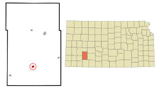
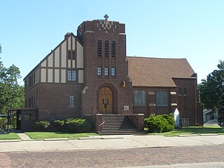
Montezuma is a city in Gray County, Kansas, United States. As of the 2020 census, the population of the city was 975.

<span class="mw-page-title-main">Hamilton, Kansas</span> City in Greenwood County, Kansas

Hamilton is a city in Greenwood County, Kansas, United States. As of the 2020 census, the population of the city was 182.

<span class="mw-page-title-main">Coolidge, Kansas</span> City in Hamilton County, Kansas

Coolidge is a city in Hamilton County, Kansas, United States. As of the 2020 census, the population of the city was 80. It is located along Highway 50 about 1 miles east of the Colorado-Kansas border.

<span class="mw-page-title-main">Deerfield, Kansas</span> City in Kearny County, Kansas

Deerfield is a city in Kearny County, Kansas, United States. As of the 2020 census, the population of the city was 711. It is located along Highway 50.

<span class="mw-page-title-main">Barnard, Kansas</span> City in Lincoln County, Kansas

Barnard is a city in Lincoln County, Kansas, United States. As of the 2020 census, the population of the city was 64.

<span class="mw-page-title-main">Windom, Kansas</span> City in McPherson County, Kansas

Windom is a city in McPherson County, Kansas, United States. As of the 2020 census, the population of the city was 85.

<span class="mw-page-title-main">Council Grove, Kansas</span> City in Morris County, Kansas

Council Grove is a city and county seat in Morris County, Kansas, United States. As of the 2020 census, the population of the city was 2,140. It was named after an agreement between American settlers and the Osage Nation allowing settlers' wagon trains to pass westward through the area on the Santa Fe Trail. Pioneers gathered at a grove of trees so that wagons could band together for their trip west.

<span class="mw-page-title-main">Wilsey, Kansas</span> City in Morris County, Kansas

Wilsey is a city in Morris County, Kansas, United States. As of the 2020 census, the population of the city was 139.

<span class="mw-page-title-main">Elkhart, Kansas</span> City in Morton County, Kansas

Elkhart is a city in and the county seat of Morton County, Kansas, United States. As of the 2020 census, the population of the city was 1,888. The south edge of the city is the Kansas-Oklahoma state border, and the city is 8.5 miles (13.7 km) from the Kansas-Colorado border.

<span class="mw-page-title-main">Burlingame, Kansas</span> City in Osage County, Kansas

Burlingame is a city in Osage County, Kansas, United States. As of the 2020 census, the population of the city was 971.

<span class="mw-page-title-main">Carbondale, Kansas</span> City in Osage County, Kansas

Carbondale is a city in Osage County, Kansas, United States. As of the 2020 census, the population of the city was 1,352. It is located south of Topeka along U.S. Route 75 four lane freeway.

<span class="mw-page-title-main">Overbrook, Kansas</span> City in Osage County, Kansas

Overbrook is a city in Osage County, Kansas, United States. As of the 2020 census, the population of the city was 1,005.

<span class="mw-page-title-main">Larned, Kansas</span> City in Pawnee County, Kansas

Larned is a city in and the county seat of Pawnee County, Kansas, United States. As of the 2020 census, the population of the city was 3,769.

<span class="mw-page-title-main">Chase, Kansas</span> City in Rice County, Kansas

Chase is a city in Rice County, Kansas, United States. As of the 2020 census, the population of the city was 396.

References

  1. 1 2 3 4 5 "Scranton, Kansas", Geographic Names Information System , United States Geological Survey, United States Department of the Interior
  2. "2019 U.S. Gazetteer Files". United States Census Bureau. Retrieved July 24, 2020.
  3. 1 2 "Profile of Scranton, Kansas in 2020". United States Census Bureau. Archived from the original on June 5, 2022. Retrieved June 5, 2022.
  4. Blackmar, Frank Wilson (1912). Kansas: A Cyclopedia of State History, Volume 2. Standard Publishing Company. pp.  657.
  5. Kansas State Historical Society (1916). Biennial Report of the Board of Directors of the Kansas State Historical Society. Kansas State Printing Plant. pp.  256.
  6. "Profile for Scranton, Kansas". ePodunk . Retrieved June 22, 2014.
  7. "Kansas Post Offices, 1828-1961". Kansas Historical Society. Archived from the original on October 9, 2013. Retrieved June 22, 2014.
  8. "Letter From Kansas: A North Carolinian Notes the Political Drift in the Mining Towns of The Banner Republican State They Don't Allow a Negro to Live—Kansas Agriculture and Kansas People". Daily State Chronicle. Raleigh, North Carolina. September 30, 1890. p. 1 via Chronicling America.
  9. "US Gazetteer files: 2010, 2000, and 1990". United States Census Bureau. February 12, 2011. Retrieved April 23, 2011.
  10. "US Gazetteer files 2010". United States Census Bureau. Archived from the original on January 25, 2012. Retrieved July 6, 2012.
  11. Climate Summary for Scranton, Kansas
  12. "U.S. Census website". United States Census Bureau . Retrieved July 6, 2012.
  13. "U.S. Census website". United States Census Bureau . Retrieved January 31, 2008.
  14. "Santa Fe Trail USD 434". USD 434. Retrieved January 5, 2010.
  15. "Basketball". KSHSAA. Retrieved January 3, 2017.

Further reading