Hancock is a town in Berkshire County, Massachusetts, United States. It is part of the Pittsfield, Massachusetts Metropolitan Statistical Area. The population was 757 at the 2020 census.
Savoy is a town in Berkshire County, Massachusetts, United States. It is part of the Pittsfield, Massachusetts Metropolitan Statistical Area. The population was 645 at the 2020 census.
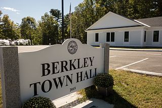
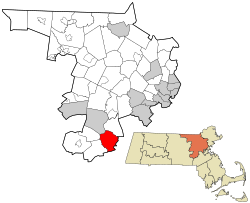
Berkley is a town in Bristol County, Massachusetts, United States, located south of Boston and east of Providence, Rhode Island. The population was 6,764 according to the 2020 census, making it the least populated town in the county.
Erving is a town in Franklin County, Massachusetts, United States. The population was 1,665 at the 2020 census. It is part of the Springfield, Massachusetts metropolitan statistical area.

Gill is a town in Franklin County, Massachusetts, United States. The population was 1,551 at the 2020 census. It is part of the Springfield, Massachusetts Metropolitan Statistical Area. The campus of Northfield Mount Hermon School is located in the Mount Hermon section of the town.

Monroe is a town in Franklin County, Massachusetts, United States. The population was 118 at the 2020 census. By area, population, and population density, it is the smallest town in the county; and is the second-smallest town by population in the Commonwealth, with only Gosnold having fewer residents.

Montague is a town in Franklin County, Massachusetts, United States. The population was 8,580 at the 2020 census. It is part of the Springfield, Massachusetts metropolitan statistical area.

Whately is a town in Franklin County, Massachusetts, United States. The population was 1,607 at the 2020 census. It is part of the Springfield, Massachusetts Metropolitan Statistical Area.

Tolland is a town in Hampden County, Massachusetts, United States. It is part of the Springfield, Massachusetts Metropolitan Statistical Area. The population was 471 at the 2020 census, making it the smallest town in Hampden County by population.

Blackstone is a town in Worcester County, Massachusetts, United States. The population was 9,208 at the 2020 census. It is a part of the Providence metropolitan area.

Douglas is a town in Southern Worcester County, Massachusetts, United States. The population was 8,983 at the 2020 census. It includes the sizable Douglas State Forest, managed by the Department of Conservation and Recreation (DCR).

Holden is a town in Worcester County, Massachusetts, United States. The town was founded in 1741, and the Town Square was donated by John Hancock, former Governor of Massachusetts. The population was 19,905 at the 2020 census.

Hubbardston is a town in Worcester County, Massachusetts, United States. As of the 2020 U.S. census, the town population was 4,328. It is situated 18 miles north of Worcester and 53 miles west of Boston; it is distinguished in Massachusetts by being unusually high, at 1015 feet above sea level.

Millbury, officially the Town of Millbury, is a town in Worcester County, Massachusetts, United States. Located within Blackstone Valley, the population in Millbury was 13,831 at the 2020 United States Census.
Oakham is a town in Worcester County, Massachusetts, United States. The population was 1,851 at the 2020 census.

Phillipston is a town in Worcester County, Massachusetts, United States. The population was 1,724 at the 2020 census.

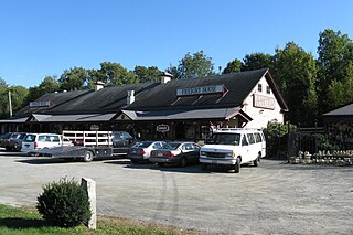
Templeton is a town in Worcester County, Massachusetts, United States. The population was 8,149 at the 2020 census. The town comprises four main villages: Templeton Center, East Templeton, Baldwinville, and Otter River.

Dover is a town in Norfolk County, Massachusetts, United States. The population was 5,923 at the time of the 2020 United States Census. With a median income of more than $250,000, Dover is the wealthiest town in Massachusetts.

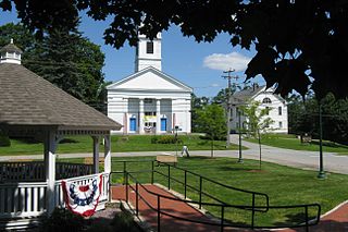
Shirley is a town in Middlesex County, Massachusetts, United States. It is approximately thirty miles west-northwest of Boston. The population was 7,431 at the 2020 census. The town has a well-preserved historic New England town center.

Townsend is a town in Middlesex County, Massachusetts, United States. The population was 9,127 at the 2020 census.