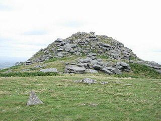
Callington is a civil parish and town in east Cornwall, England, United Kingdom about 7 miles (11 km) north of Saltash and 9 miles (14 km) south of Launceston.

Kelly Bray is a village in east Cornwall, England, United Kingdom. It is situated one mile (1.6 km) north of Callington, immediately west of Kit Hill in a former mining area. Kelly Bray is in the parish of Callington and lies within the St Dominick, Harrowbarrow and Kelly Bray division on Cornwall Council. The population was 3,949 at the 2011 census. Kelly Bray is first recorded ca. 1286 as Kellibregh.

Gwinear–Gwithian is a coastal civil parish in west Cornwall, England, United Kingdom. It includes the villages of Connor Downs, Gwinear, Gwithian, Reawla and Rosewarne. The parish is situated approximately two miles (3 km) east of Hayle two miles (3 km) west of Camborne.

Advent is a civil parish on the north-western edge of Bodmin Moor in north Cornwall, England, United Kingdom. The English name St Adwenna derives from the Cornish Adhwynn and lies in the Registration District of Camelford.

Boyton is a civil parish and village in Cornwall, England, United Kingdom. It is situated close to the River Tamar and the border with Devon about six miles (10 km) north of Launceston. According to the 2001 census it had a population of 378.This increased to 457 at the 2011 census.
Jacobstow is a civil parish and village in north Cornwall, England, United Kingdom. The village is located east of the A39 road approximately seven miles (11 km) south of Bude.

Manaccan is a civil parish and village on the Lizard peninsula in south Cornwall, England, United Kingdom. The village is about five miles (8 km) south-southwest of Falmouth.

St Goran is a coastal civil parish in Cornwall, England, UK, six miles (10 km) south-southwest of St Austell. The largest settlement in the parish is the coastal village of Gorran Haven, a mile to the east with a further cluster of homes at Trevarrick. The population at the 2011 census was 1,411.

Perranzabuloe is a coastal civil parish and a hamlet in Cornwall, England, United Kingdom. Perranzabuloe parish is bordered to the west by the Atlantic coast and St Agnes parish, to the north by Cubert parish, to the east by St Newlyn East and St Allen parishes and to the south by Kenwyn parish. The hamlet is situated just over a mile (2 km) south of the principal settlement of the parish, Perranporth; the hamlet is also seven miles (11 km) south-southwest of Newquay. Other settlements in the parish include Perrancoombe, Goonhavern, Mount and Callestick. The parish population was 5,382 in the 2001 census, increasing to 5,486 at the 2011 census.

Ruan Lanihorne is a civil parish and village in south Cornwall, England, United Kingdom. The village is situated approximately four miles (6.5 km) east-southeast of Truro between the River Fal and its tributary the Ruan River.

Germoe is a village and civil parish in Cornwall, England, United Kingdom. Germoe village, the parish's main settlement and church town, is about five miles (8 km) west of Helston and seven miles (11.3 km) east of Penzance. The A394 Penzance to Helston road runs along the southern border of the parish. Other settlements in the parish include Balwest, Boscreege and Tresowes Green.

St Anthony-in-Meneage is a coastal civil parish and village in Cornwall, England, United Kingdom. The parish is in the Meneage district of the Lizard peninsula. In the 2001 census the parish had a population of 171, decreasing to 168 at the 2011 census.

Linkinhorne is a civil parish and village in southeast Cornwall, England, United Kingdom. The village itself is situated at grid reference SX 320 736 and is approximately four miles (6.5 km) northwest of Callington and seven miles (11 km) south of Launceston. The parish population at the 2011 census including Downgate was 1,541

South Hill is a civil parish and hamlet in east Cornwall, England, United Kingdom. The parish population at the 2011 census was 489.

St Gennys is a coastal civil parish and small settlement in north Cornwall, England, United Kingdom.

North Tamerton is a village and civil parish in east Cornwall, England, UK. The village is situated approximately eight miles (13 km) southeast of Bude and eight miles (13 km) north of Launceston.

St Mellion is a village and rural civil parish in east Cornwall, England, United Kingdom. The parish is about 3 miles (5 km) south of Callington and is in the St Germans Registration District. To the north, the parish is bordered by Callington and St Dominick parishes, to the east and south by Pillaton parish, and to the west by St Ive parish.


